(date: 2024-02-17 00:15:15)
date: 2024-02-16, from: NOAA tornado/severe thunderstorm watches, mesoscale discussions, convective outlooks, fire weather outlooks

Day 1 Convective Outlook
NWS Storm Prediction Center Norman OK
1024 AM CST Fri Feb 16 2024

Valid 161630Z - 171200Z

...THERE IS A MARGINAL RISK OF SEVERE THUNDERSTORMS THIS AFTERNOON
AND EVENING OVER PORTIONS OF ARKANSAS AND WEST TENNESSEE....

...SUMMARY...
Isolated strong storms capable of hail are possible this afternoon
and early evening over parts of Arkansas and west Tennessee.

...AR/TN...
Morning water vapor imagery shows a fast-moving upper trough over
KS, that will overspread the MS/TN valleys later today.  A surface
low currently over northwest AR will deepen and build eastward
today, with strengthening convergence near the low/cold front.  This
will result in scattered afternoon thunderstorm development across
central AR into west/middle TN.  Forecast soundings in this zone
show cold mid level temperatures (-20C or colder at 500mb), steep
mid-level lapse rates, and CAPE values of 500-800 J/kg.  This,
combined with sufficient deep-layer shear for updraft rotation will
pose a risk of a few hail-producing storms through the early
evening.  The threat should wane a couple of hours after sunset due
to weakening instability.

..Hart/Squitieri.. 02/16/2024
https://www.spc.noaa.gov/products/outlook/day1otlk_1630.html Save to Pocket
date: 2024-02-16, from: NOAA tornado/severe thunderstorm watches, mesoscale discussions, convective outlooks, fire weather outlooks

Day 1 Convective Outlook
NWS Storm Prediction Center Norman OK
0633 AM CST Fri Feb 16 2024

Valid 161300Z - 171200Z

...NO SEVERE THUNDERSTORM AREAS FORECAST...

...SUMMARY...
No areas of organized severe thunderstorms are forecast over the
conterminous U.S.

...Synopsis...
A highly amplified mid/upper-level pattern will persist over the
CONUS today, as an initial high-latitude omega configuration over
western Canada evolves into a full-latitude, open-wave, synoptic
ridge.  That ridge will extend southward over the western U.S. as
well.  The eastern portion of a shortwave trough -- initially over
the northern Rockies -- will break away from the remainder of the
height weakness footing the omega pattern and reach parts of
southwestern WY, southern ID and northern UT by 00Z.  The trough
then should dig southeastward to parts of CO/UT by the end of the
period.  As that occurs, a weaker, downstream perturbation --
evident in moisture-channel imagery near an axis from HLC-AMA-INK --
will weaken gradually as it moves eastward across OK and AR,
reaching the lower Ohio Valley and western TN by 00Z.  What is left
of this feature should accelerate eastward over the central
Appalachians by 12Z tomorrow.

At the surface, 11Z analysis showed a frontal-wave low near FDR,
with wavy warm front across central parts of OK/AR to northern MS.
An initial/weak cold front was drawn from the low southwestward over
southern NM and an Arctic front across the southeastern TX Panhandle
to northeastern NM.  These fronts should merge through the day,
while the low ripples rapidly east-northeastward along the warm
front.  The low should reach south-central/southeastern KY by 00Z,
with trailing cold front across middle TN, northern MS, the Arklatex
region, and south-central TX.  By 12Z, the low should move offshore
from Hampton Roads, with cold front over central NC, north-central
GA, south-central AL, to parts of the north-central/northwestern
Gulf.

...AR/Mid-South...
Scattered thunderstorms are expected to form this afternoon into
evening over AR, along/ahead of the surface cold front, then shift
eastward while backbuilding southward.  A resultant band of
thunderstorms should cross parts of western TN, northern MS and
northern LA before weakening substantially late this evening.  The
strongest cells within the band -- especially early in the
convective cycle when discrete storms still are possible -- may
produce hail approaching severe limits and strong gusts.  Severe
potential still appears too low and conditional for a categorical
risk area; however, an isolated, marginally severe hail report or
damaging subsevere gust cannot be ruled out.

Surface dewpoints in the 50s F already extend from the Gulf into the
warm sector across parts of this region, and should remain in place
as moist advection offsets any diurnal mixing.  The return-flow
regime will remain incompletely modified, so that the convective
plume will outrun already modest moisture this evening while
diabatic cooling takes hold.  Time series of forecast soundings
depict two simultaneous processes:
1.  Effective-inflow parcels becoming surface-based this afternoon,
in a narrow prefrontal corridor, due to warm advection and
cloud-slowed diurnal surface warming.  This should contribute to
peak preconvective MLCAPE in the 300-800 J/kg range.
2.  Veering of surface winds with time, reducing hodograph size,
low-level SRH and low-level bulk shear.  Deep shear will be marginal
to favorable, even with veering of low-level flow.  0-6-km shear
magnitudes in the 45-55-kt range are expected.  However, effective-
shear magnitudes are only around 1/2-2/3 that range, because the
low-topped/compressed nature of the buoyant layer shunts the upper
reaches of the calculation to below the strongest mid/upper winds.

With the favorable kinematic and thermodynamic factors trending
oppositely through the afternoon, and the regime already being
somewhat moisture/buoyancy-starved, unconditional probabilities will
be held below MRGL categorical levels for the time being.

..Edwards.. 02/16/2024
https://www.spc.noaa.gov/products/outlook/day1otlk_1300.html Save to Pocket
date: 2024-02-15, from: NOAA tornado/severe thunderstorm watches, mesoscale discussions, convective outlooks, fire weather outlooks

Day 2 Convective Outlook
NWS Storm Prediction Center Norman OK
1122 AM CST Thu Feb 15 2024

Valid 161200Z - 171200Z

...NO SEVERE THUNDERSTORM AREAS FORECAST...

...SUMMARY...
Organized severe thunderstorms appear unlikely on Friday.

...Synopsis and Discussion...
Within broadly cyclonic flow over the central/eastern states, a
subtle mid-level impulse will advance eastward from the
southern/central Plains across the lower MS Valley and Mid-South on
Friday. A weak surface low is likewise expected to develop from the
Ozarks vicinity towards the southern/central Appalachians by Friday
evening. Modest low-level moisture, with surface dewpoints generally
in the mid to upper 50s, should be present ahead of a front from the
ArkLaTex into the Mid-South. As this front moves east-southeastward
through the day, isolated to scattered thunderstorms may develop
along its length. With mid-level flow largely paralleling the front,
there should be a tendency for convection to be undercut and become
elevated. Still, some chance for strong/gusty winds and small hail
may exist with any near-surface-based thunderstorms across the
Mid-South Friday afternoon, as weak instability and sufficient
deep-layer shear may support modest updraft organization. But,
overall severe potential still appears too limited to add low
hail/wind probabilities at this time.

..Gleason.. 02/15/2024
https://www.spc.noaa.gov/products/outlook/day2otlk_1730.html Save to Pocket
date: 2024-02-14, from: NOAA Weather Forecasts

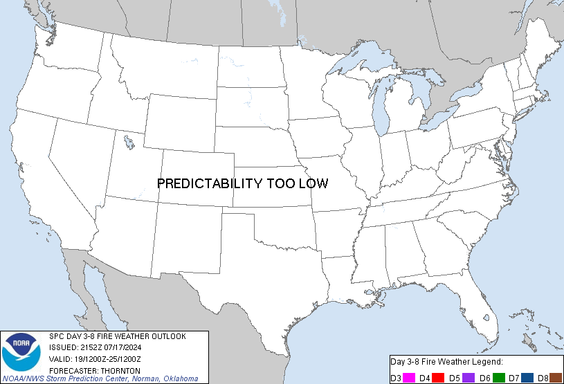
Day 3-8 Fire Weather Outlook
NWS Storm Prediction Center Norman OK
0326 PM CST Wed Feb 14 2024

Valid 161200Z - 221200Z

From D3/Friday through D5/Sunday, an expansive post-frontal air mass
will encompass much of the central CONUS, with cold surface
temperatures generally limiting fire-weather potential. Thereafter,
westerly midlevel flow will strengthen across the Rockies, with
multiple embedded shortwave troughs encouraging weak lee troughing
and the potential for dry/breezy conditions across the
southern/central High Plains. This will especially be the case on
D7-D8/Tuesday-Wednesday over the southern High Plains, though
confidence in the development of critical conditions is low owing to
continued model disagreement and marginal fuels across the area.

..Weinman.. 02/14/2024

...Please see www.spc.noaa.gov/fire for graphic product...
https://www.spc.noaa.gov/products/exper/fire_wx/ Save to Pocket
date: 2024-02-12, from: NOAA tornado/severe thunderstorm watches, mesoscale discussions, convective outlooks, fire weather outlooks

STATUS FOR WATCH 0024 HAS NOT BEEN ISSUED YET
https://www.spc.noaa.gov/products/watch/ws0024.html Save to Pocket
date: 2024-02-12, from: NOAA tornado/severe thunderstorm watches, mesoscale discussions, convective outlooks, fire weather outlooks

URGENT - IMMEDIATE BROADCAST REQUESTED
Tornado Watch Number 24
NWS Storm Prediction Center Norman OK
1000 AM EST Mon Feb 12 2024

The NWS Storm Prediction Center has issued a

* Tornado Watch for portions of
  Eastern Florida Panhandle
  Extreme southwest Georgia
  Coastal Waters

* Effective this Monday morning and afternoon from 1000 AM until
  300 PM EST.

* Primary threats include...
  A couple tornadoes possible
  Isolated damaging wind gusts to 60 mph possible

SUMMARY...A band of storms with some embedded bowing/rotating
structures will pose the threat for isolated damaging winds near 60
mph and a tornado or two for the next few hours.

The tornado watch area is approximately along and 50 statute miles
east and west of a line from 35 miles west northwest of Moultrie GA
to 25 miles south southeast of Apalachicola FL. For a complete
depiction of the watch see the associated watch outline update
(WOUS64 KWNS WOU4).

PRECAUTIONARY/PREPAREDNESS ACTIONS...

REMEMBER...A Tornado Watch means conditions are favorable for
tornadoes and severe thunderstorms in and close to the watch
area. Persons in these areas should be on the lookout for
threatening weather conditions and listen for later statements
and possible warnings.

&&

OTHER WATCH INFORMATION...CONTINUE...WW 22...

AVIATION...Tornadoes and a few severe thunderstorms with hail
surface and aloft to 0.5 inches. Extreme turbulence and surface wind
gusts to 50 knots. A few cumulonimbi with maximum tops to 450. Mean
storm motion vector 25035.

...Thompson
https://www.spc.noaa.gov/products/watch/ww0024.html Save to Pocket
date: 2024-02-12, from: NOAA tornado/severe thunderstorm watches, mesoscale discussions, convective outlooks, fire weather outlooks

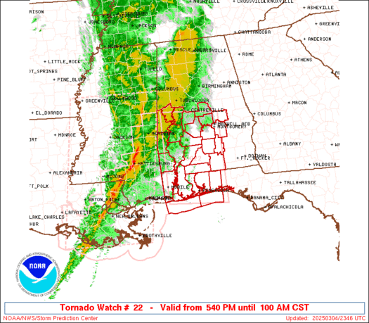
STATUS REPORT ON WW 22

SEVERE WEATHER THREAT CONTINUES RIGHT OF A LINE FROM 10 S CEW TO
30 SSW TOI TO 30 N DHN.

..KERR..02/12/24

ATTN...WFO...BMX...MOB...TAE...


STATUS REPORT FOR WT 22

SEVERE WEATHER THREAT CONTINUES FOR THE FOLLOWING AREAS

ALC005-031-045-061-121440-

AL
.    ALABAMA COUNTIES INCLUDED ARE

BARBOUR              COFFEE              DALE
GENEVA


FLC059-091-131-121440-

FL
.    FLORIDA COUNTIES INCLUDED ARE

HOLMES               OKALOOSA            WALTON


GMZ634-635-636-655-121440-

CW

.    ADJACENT COASTAL WATERS INCLUDED ARE

PENSACOLA BAY AREA INCLUDING SANTA ROSA SOUND
https://www.spc.noaa.gov/products/watch/ws0022.html Save to Pocket
date: 2024-02-12, from: NOAA tornado/severe thunderstorm watches, mesoscale discussions, convective outlooks, fire weather outlooks

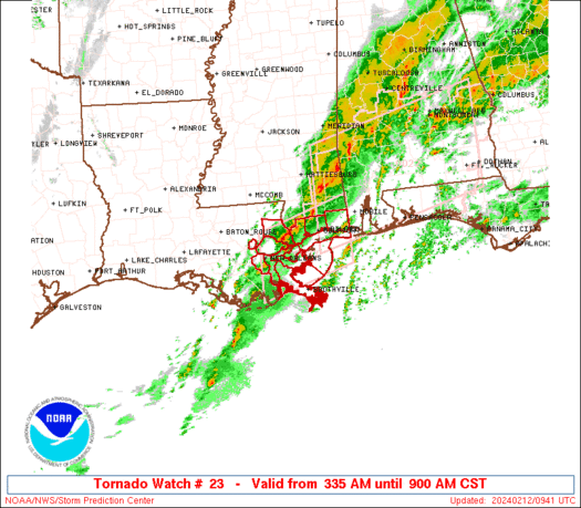
STATUS REPORT ON WW 23

SEVERE WEATHER THREAT CONTINUES RIGHT OF A LINE FROM 45 ENE BVE
TO 50 S MOB.

..KERR..02/12/24

ATTN...WFO...LIX...


STATUS REPORT FOR WT 23

SEVERE WEATHER THREAT CONTINUES FOR THE FOLLOWING AREAS

GMZ536-121340-

CW

.    ADJACENT COASTAL WATERS INCLUDED ARE

THE WATCH STATUS MESSAGE IS FOR GUIDANCE PURPOSES ONLY.  PLEASE
REFER TO WATCH COUNTY NOTIFICATION STATEMENTS FOR OFFICIAL
INFORMATION ON COUNTIES...INDEPENDENT CITIES AND MARINE ZONES
CLEARED FROM SEVERE THUNDERSTORM AND TORNADO WATCHES.
https://www.spc.noaa.gov/products/watch/ws0023.html Save to Pocket