(date: 2024-03-08 07:50:14)
date: 2024-03-08, from: NOAA tornado/severe thunderstorm watches, mesoscale discussions, convective outlooks, fire weather outlooks
No watches are valid as of Fri Mar 8 15:22:02 UTC 2024.
https://www.spc.noaa.gov/products/watch/ Save to Pocket
date: 2024-03-08, from: NOAA tornado/severe thunderstorm watches, mesoscale discussions, convective outlooks, fire weather outlooks

Mesoscale Discussion 0204
NWS Storm Prediction Center Norman OK
0920 AM CST Fri Mar 08 2024

Areas affected...East TX into central/southern LA and southwest MS

Concerning...Severe potential...Watch possible

Valid 081520Z - 081715Z

Probability of Watch Issuance...40 percent

SUMMARY...Some uptick in severe potential is possible through the
morning. Hail, damaging gusts, and a tornado or two will become
possible with time. Eventual watch issuance is possible, though
timing is uncertain.

DISCUSSION...Extensive convection is ongoing this morning from parts
of east TX into LA. A convectively reinforced surface front is
draped from northeast TX into northern LA and west-central MS. To
the south of the front, rich low-level moisture is in place, with
dewpoints in the upper 60s/low 70s F. Widespread cloudiness will
tend to limit diurnal heating through the morning, but modestly
steep midlevel lapse rates atop the moist boundary layer will
support MLCAPE of 1000-1500 J/kg through the morning, helping to
maintain convection as it generally spreads eastward.

Deep-layer shear is favorable for organized convection across the
region, though storms may struggle to mature due to the lack of
stronger heating and generally weak low-level lapse rates.
Eventually, a couple supercells may become established from east TX
into LA and perhaps southwest MS, posing a threat of hail and
locally damaging gusts. If supercells can be sustained, a tornado or
two will also be possible, especially from central/eastern LA into
southwest MS, where some airmass recovery is expected in the wake of
an earlier storm cluster, and 0-1 km SRH of 100-200 m2/s2 is
expected to persist through much of the day.

Watch issuance will become possible if the threat for maturing
supercells appears imminent, though the onset of a greater threat
and potential watch timing remain uncertain.

..Dean/Smith.. 03/08/2024

...Please see www.spc.noaa.gov for graphic product...

ATTN...WFO...JAN...LIX...LCH...SHV...HGX...FWD...

LAT...LON   30909589 32129550 32229415 32179289 31939137 31629037
            31359017 30689035 30469123 30259235 30169287 30359446
            30469504 30689574 30909589
https://www.spc.noaa.gov/products/md/md0204.html Save to Pocket
date: 2024-03-08, from: NOAA tornado/severe thunderstorm watches, mesoscale discussions, convective outlooks, fire weather outlooks

Day 1 Convective Outlook
NWS Storm Prediction Center Norman OK
0655 AM CST Fri Mar 08 2024

Valid 081300Z - 091200Z

...THERE IS A SLIGHT RISK OF SEVERE THUNDERSTORMS FROM EAST TEXAS TO
SOUTHERN ALABAMA...

...SUMMARY...
A tornado threat exists today into tonight from parts of Louisiana
to southern/eastern Alabama.  Large hail or strong-severe gusts are
possible over the same areas and westward into parts of north and
east Texas and southeastern Oklahoma.

...Synopsis...
Broadly cyclonic flow, astride increasingly phased northern- and
southern-stream troughing -- will shift eastward across the central
CONUS through day-1.  Through this period, the southern-stream
component -- with a series of vorticity maxima initially extending
from the Desert Southwest to the southern Plains -- will remain more
influential.  The associated trough should reach central KS, the TX
South Plains, and northern Chihuahua by 00Z.  By 12Z, the northern
part of the trough will reach the Ozarks and begin phasing with a
northern-stream shortwave trough digging southeastward across the
upper Mississippi Valley.  The southern trough will extend from the
Ozarks southwestward over central/southwest TX to the Big Bend
region.  Several meso-alpha- and smaller-scale vorticity lobes (some
convectively generated/augmented) should traverse the foregoing
southwesterly flow aloft.

At the surface, 11Z analysis showed weak lows near ACT and ABI,
which should consolidate toward the eastern low in the next few
hours.  A cold front extended south-southwestward to just downstream
from DRT on the Rio Grande.  A diffuse warm-frontal zone was drawn
east-southeastward across east TX, central/southeastern LA, and the
Gulf offshore from AL and the FL Panhandle.  The cold front should
reach to near a JAN-GLS-MFE line by 00Z, then from central AL
southwestward across southeastern LA to the northwestern Gulf by 12Z
tomorrow.  The warm front will remain diffuse while shifting
northeastward over southern parts of MS/AL and the western FL
Panhandle, ahead of a convective plume discussed below.

...TX/OK to Gulf Coast States...
Multiple episodes of thunderstorms are expected across the outlook
corridor today, with the greatest potential for well-organized,
surface-based convection from parts of east TX eastward to near the
GA/AL line, in and near the "slight risk" area.  Severe gusts,
isolated large hail and a few tornadoes are all possible.  Potential
appears to be tied primarily to three regimes, with isolated
warm-sector supercell(s) possible south and southeast of them:

1.  An initially elevated corridor of precip and embedded
thunderstorms -- now apparent in composited radar imagery over
portions of western/central MS and northern LA.  This activity
should persist and expand lengthwise somewhat as the foregoing
airmass destabilizes today -- with sustained low-level warm
advection in its inflow layer lowering the elevation of effective-
inflow parcels to surface-based with time over the Gulf Coastal
Plain.  Modest lapse rates aloft will be offset to some extent by
increasing low-level theta-e with time and with southwestward
extent, as mid/upper 60s F surface dewpoints spread east-
northeastward through the day to meet the convective plume.
Diabatic heating will be steady and modest, owing to persistent
cloud cover, but MLCINH should decrease with time across much of the
area south of about I-20.  Favorable deep shear is expected
(effective-shear magnitudes around 45-60 kt) along with variably
large hodographs and 150-300 J/kg SRH in the lowest km.  This will
yield a favorable supercell/tornado environment, but dominant
messy/training convective modes may limit overall organization of
severe potential somewhat.

2.  Thunderstorms initially in a band from north-central to south-
central/southwest TX, near the I-35 corridor and the low/cold front,
may increase severe potential as they shift eastward into the
western fringes of the environment discussed above, through the
remainder of the morning.  Some of this activity may merge with the
southwestern part of the initially separate first regime to create a
very long swath of strong-severe thunderstorms by mid/late afternoon
from southern AL to southeast TX.  The combined swath of convection
should shift slowly eastward/southeastward over the remainder of the
outlook area into tonight, maintaining potential for damaging gusts
and a few embedded tornadic mesocirculations.

3.  An afternoon area of thunderstorms rooted in or just above the
boundary layer poleward of the low and frontal zone, across parts of
OK and north TX, and spreading southeastward with mainly large-hail/
isolated-gust potential before weakening this evening.  Despite the
cool surface conditions, some convection may be rooted at or near
the surface, with cold midlevel temperatures nearest the trough
aloft contributing to steep low/middle-level lapse rates and MUCAPE
potentially reaching the 1000-1500 J/kg range.  Strong mid/upper
flow will contribute to effective-shear magnitudes of 40-50 kt,
supporting organized convective potential.

..Edwards/Jewell.. 03/08/2024
https://www.spc.noaa.gov/products/outlook/day1otlk_1300.html Save to Pocket
date: 2024-03-08, from: NOAA Weather Forecasts

Day 2 Fire Weather Outlook
NWS Storm Prediction Center Norman OK
0144 AM CST Fri Mar 08 2024

Valid 091200Z - 101200Z

...NO CRITICAL AREAS...

...Synopsis...
A dry cold frontal passage Friday will bring a much cooler
continental air mass as far south as the southern Plains on
Saturday, with mild temperatures and afternoon relative humidity
largely above 30-35 percent. In addition, surface high pressure will
keep winds generally light where fuels are the driest across
southern Texas. As such, fire weather concerns are expected to be
low across the CONUS on Saturday.

..Thornton.. 03/08/2024

...Please see www.spc.noaa.gov/fire for graphic product...
https://www.spc.noaa.gov/products/fire_wx/fwdy2.html Save to Pocket
date: 2024-03-07, from: NOAA tornado/severe thunderstorm watches, mesoscale discussions, convective outlooks, fire weather outlooks
No Mesoscale Discussions are in effect as of Thu Mar 7 14:51:02 UTC 2024.
https://www.spc.noaa.gov/products/md/ Save to Pocket
date: 2024-03-06, from: NOAA tornado/severe thunderstorm watches, mesoscale discussions, convective outlooks, fire weather outlooks

Day 1 Fire Weather Outlook
NWS Storm Prediction Center Norman OK
1020 AM CST Wed Mar 06 2024

Valid 061700Z - 071200Z

The previous forecast remains largely on track. The only appreciable
change made to the Day 1 Fire Weather Outlook was to expand Elevated
highlights eastward into central Minnesota and northern Iowa. Here,
the latest guidance consensus shows 25-30 percent RH coinciding with
15-20 mph sustained southerly surface winds for at least a few hours
this afternoon.

..Squitieri.. 03/06/2024

.PREV DISCUSSION... /ISSUED 0150 AM CST Wed Mar 06 2024/

...Synopsis...
A northern-stream midlevel shortwave trough will track eastward
across the northern Plains, while an attendant surface cyclone and
trailing cold front move east-northeastward across the Dakotas early
in the period. Along/ahead of the front, a tightening surface
pressure gradient, coupled with boundary-layer mixing into a 45-50
kt low-level jet, will yield 20-25 mph sustained southerly surface
winds (with gusts upwards of 45 mph) across parts of eastern SD,
western MN, northeast NE, and far northwest IA. Here, 25-35 percent
minimum RH will support an elevated to near-critical fire-weather
risk, given the strong/gusty surface winds atop modestly receptive
fuels.

Farther south, midlevel westerly flow will strengthen across the
southern Rockies -- ahead of an approaching midlevel trough/low
moving ashore over southern CA. The strengthening downslope flow off
the southern Rockies, and related lee cyclogenesis over eastern CO,
will favor 15-20 mph sustained southwesterly surface winds (with
higher gusts) amid 15-20 percent afternoon RH across the southern
High Plains. As a result, elevated to spotty critical fire-weather
conditions are expected.

...Please see www.spc.noaa.gov/fire for graphic product...
https://www.spc.noaa.gov/products/fire_wx/fwdy1.html Save to Pocket
date: 2024-03-06, from: NOAA tornado/severe thunderstorm watches, mesoscale discussions, convective outlooks, fire weather outlooks

Day 1 Convective Outlook
NWS Storm Prediction Center Norman OK
1006 AM CST Wed Mar 06 2024

Valid 061630Z - 071200Z

...THERE IS A MARGINAL RISK OF SEVERE THUNDERSTORMS OVER PARTS OF
THE FLORIDA PENINSULA...SOUTH CAROLINA...AND PARTS OF WEST-CENTRAL
TO NORTH TEXAS....

...SUMMARY...
Isolated severe thunderstorms are possible this afternoon over parts
of the Florida Peninsula and South Carolina, and late afternoon into
tonight over parts of west-central to north Texas.

...FL...
A warm/moist air mass is present across the central/southeast
portions of the FL Peninsula today, where pockets of daytime heating
will yield afternoon moderate MLCAPE values around 2000 J/kg.  At
least isolated thunderstorms are expected to form across this area
during the afternoon, tracking slowly eastward toward the coast.
Forecast soundings suggest low/deep layer shear is not particularly
strong, but given the favorable thermodynamics, a few strong to
briefly severe storms capable of hail and damaging winds will be
possible - especially near the east coast.  The severe threat should
diminish after sunset.

...SC...
Multiple weak shortwave troughs are rotating across the Carolinas
today.  One feature is currently over western GA, accompanied by a
cluster of showers.  This activity will move into SC this afternoon,
where daytime heating will help to steepen low level lapse rates and
lead to at least marginal CAPE values.  Low level winds will be
quite veered and relatively weak.  However, a storm or two may be
briefly intense with gusty winds or hail.

...TX...
Clear skies will lead of strong heating and steepening lapse rates
across west-central TX today.  Most CAM solutions suggest one or two
storms could form in the well-mixed zone near San Angelo late this
afternoon.  Steep mid-level lapse rates would support a risk of hail
or damaging wind gusts in these storms.  After dark, a strengthening
southerly low-level jet would likely allow this activity to become
more numerous and spread northeastward toward the Red River.  The
overall severe threat would likely weaken after dark, but could
still pose a risk of occasional hail or gusty winds.

..Hart/Moore.. 03/06/2024
https://www.spc.noaa.gov/products/outlook/day1otlk_1630.html Save to Pocket
date: 2024-03-05, from: NOAA tornado/severe thunderstorm watches, mesoscale discussions, convective outlooks, fire weather outlooks

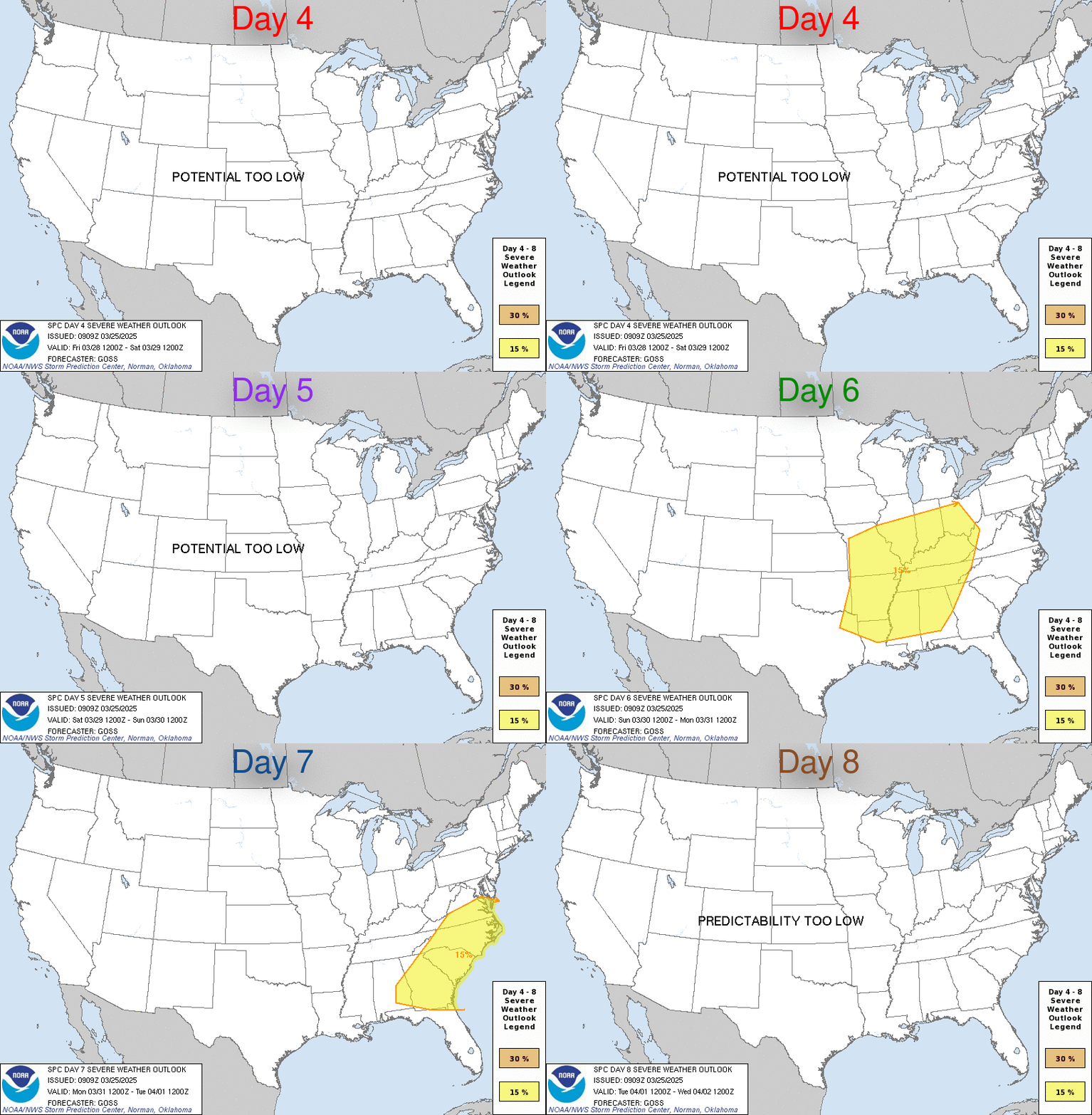
Day 4-8 Convective Outlook
NWS Storm Prediction Center Norman OK
0352 AM CST Tue Mar 05 2024

Valid 081200Z - 131200Z

...DISCUSSION...
Enhanced mid/upper-level flow associated with an upper trough will
overspread much of the southern Plains into the lower MS Valley and
central Gulf Coast States on Day 4/Friday. Thunderstorms should be
ongoing Friday morning across parts of central/east TX. Strong
deep-layer shear should continue to support updraft organization,
with enough MUCAPE present for robust convection. The severe threat
on Friday should shift from TX into the lower MS Valley in tandem
with a northward-developing warm sector and low-level moisture
return. Latest guidance has trended slightly later with the upper
trough ejection, and depicts a somewhat weaker surface low.
Accordingly, it appears that the rich low-level moisture may not
advance as far northward as indicated previously across the central
Gulf Coast States. Have therefore trimmed the northern extent of the
15% severe area for Friday across central MS/AL. There will still be
a severe risk for areas closer to the coast, where a favorable
thermodynamic and kinematic environment should support a threat for
tornadoes, damaging winds, and hail with surface-based convection
through Friday night.

The upper trough and related mid/upper-level jet should continue
moving eastward across the Southeast and Mid-Atlantic regions on Day
5/Saturday. Some severe threat should persist across these areas
through Saturday night. However, there may be a tendency for
convection to outpace the low-level moisture return and gradually
become more elevated with eastward extent across the Southeast.
Still, parts of southern AL into the FL Panhandle/north FL and
GA/SC/NC will be closely monitored for possible inclusion in a 15%
severe area if confidence increases that sufficient instability will
exist to support surface-based thunderstorms and a corresponding
risk for tornadoes and damaging winds. Once the surface cold front
associated with the upper cyclone clears the East Coast on Day
6/Sunday, severe potential should remain minimal across the CONUS
through early next week.
https://www.spc.noaa.gov/products/exper/day4-8/ Save to Pocket
date: 2024-03-04, from: NOAA tornado/severe thunderstorm watches, mesoscale discussions, convective outlooks, fire weather outlooks

Day 1 Convective Outlook
NWS Storm Prediction Center Norman OK
0656 PM CST Sun Mar 03 2024

Valid 040100Z - 041200Z

...NO SEVERE THUNDERSTORM AREAS FORECAST...

...SUMMARY...
Severe thunderstorms are unlikely for the remainder of tonight.

...Northern WI into Upper MI...
Thunderstorms are ongoing early this evening across northwest WI,
along and ahead of a cold front attendant to a deep surface cyclone
centered near the ND/MN/MB border. Strong ascent in combination with
steep low/midlevel lapse rates across the region has compensated for
generally limited low-level moisture, though buoyancy remains weak,
with MUCAPE generally less than 500 J/kg. Small hail and gusty winds
will remain possible with these storms as they move across northern
WI into Upper MI and over Lake Superior through the evening. See MCD
187 for more information.

...Florida...
A downward trend in storm coverage/intensity has been noted over
Florida this evening, though an ongoing storm cluster west of Lake
Okeechobee could pose a threat for small hail and gusty winds for as
long as it persists. Substantial earlier convective overturning over
much of the Peninsula and the loss of diurnal heating should
contribute to a continued overall weakening trend with time tonight.

..Dean.. 03/04/2024
https://www.spc.noaa.gov/products/outlook/day1otlk_0100.html Save to Pocket
date: 2024-03-03, from: NOAA Weather Forecasts

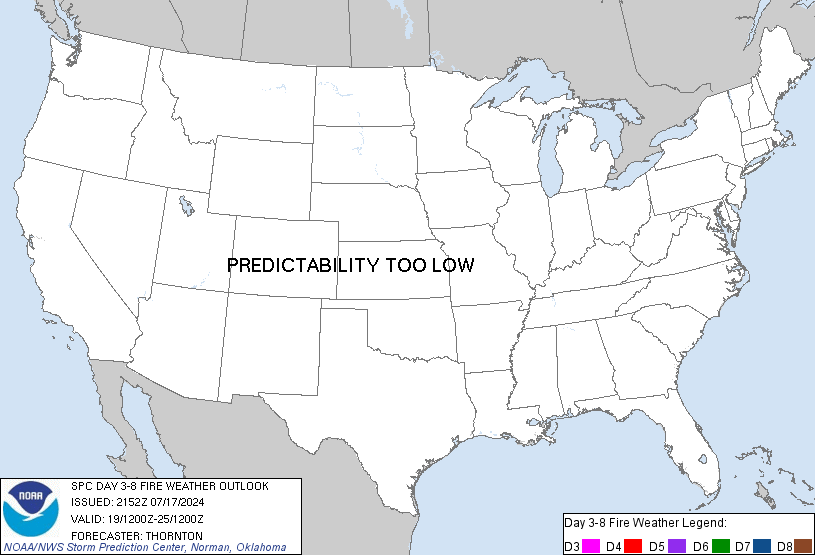
Day 3-8 Fire Weather Outlook
NWS Storm Prediction Center Norman OK
0333 PM CST Sun Mar 03 2024

Valid 051200Z - 111200Z

A relatively zonal upper pattern will encourage locally dry and
windy conditions across the Plains states Tuesday-Wednesday, before
dry and windy conditions increase across the southern High Plains
later this week in advance of an approaching mid-level trough.
Medium range guidance members show some potential for Critical
overlapping winds/RH somewhere from the Texas/New Mexico border to
the Rio Grande during the Thursday-Saturday period. However, the
medium range members vary too much in placement and timing of the
aforementioned Critical winds/RH for Critical probabilities to be
introduced at this time. Nonetheless, prolonged dry conditions are
expected to continue through the week across the southern High
Plains, with no appreciable precipitation accumulations expected. As
such, Critical probabilities or fire weather highlights will likely
be introduced at some point later this week across the southern High
Plains once guidance members show better agreement in the placement
and timing of conditions favorable for wildfire spread.

..Squitieri.. 03/03/2024

...Please see www.spc.noaa.gov/fire for graphic product...
https://www.spc.noaa.gov/products/exper/fire_wx/ Save to Pocket