(date: 2024-03-17 14:40:58)
date: 2024-03-17, from: NOAA tornado/severe thunderstorm watches, mesoscale discussions, convective outlooks, fire weather outlooks
No watches are valid as of Sun Mar 17 21:37:02 UTC 2024.
https://www.spc.noaa.gov/products/watch/
date: 2024-03-17, from: NOAA tornado/severe thunderstorm watches, mesoscale discussions, convective outlooks, fire weather outlooks
No Mesoscale Discussions are in effect as of Sun Mar 17 21:37:02 UTC 2024.
https://www.spc.noaa.gov/products/md/
date: 2024-03-17, from: NOAA tornado/severe thunderstorm watches, mesoscale discussions, convective outlooks, fire weather outlooks

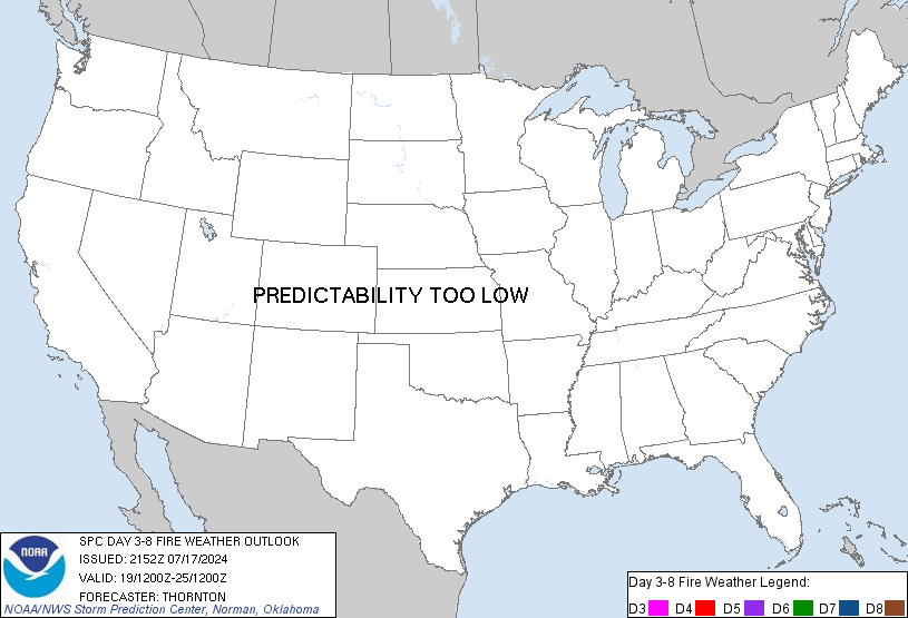
Day 3-8 Fire Weather Outlook
NWS Storm Prediction Center Norman OK
0337 PM CDT Sun Mar 17 2024

Valid 191200Z - 251200Z

A persistent cut-off low across the Southwest will start to advance
east toward the middle of this week. As this occurs, some light to
moderate rain is expected across portions of the southern High
Plains which will further wet fuels which are already mostly moist.
Next weekend, troughing and strong mid-level flow will resume across
the Southwest which will lead to warmer temperatures, drying and
gusty winds across the southern High Plains. There is moderate
consensus for the jet to eject across the Plains next Sunday which
will likely bring dry and breezy conditions to the southern High
Plains. This pattern will likely support critical meteorological
conditions, but fuels will be questionable. If sufficient drying
occurs late this week and over the weekend, critical probabilities
may need to be added later, but at this time it appears fuels will
likely remain too moist to support a large-fire threat by next
weekend.

..Bentley.. 03/17/2024

...Please see www.spc.noaa.gov/fire for graphic product...
https://www.spc.noaa.gov/products/exper/fire_wx/
date: 2024-03-17, from: NOAA tornado/severe thunderstorm watches, mesoscale discussions, convective outlooks, fire weather outlooks

Day 1 Convective Outlook
NWS Storm Prediction Center Norman OK
0249 PM CDT Sun Mar 17 2024

Valid 172000Z - 181200Z

...THERE IS A MARGINAL RISK OF SEVERE THUNDERSTORMS ACROSS PORTIONS
OF THE FLORIDA PANHANDLE AND FLORIDA BIG BEND THROUGH EARLY
EVENING...

...SUMMARY...
Local/isolated risk for gusty/damaging winds remains possible the
remainder of the afternoon/early evening across the Florida
Panhandle/Big Bend area.

...20z Update...

The main change with the 20z update was to trim marginal severe
probabilities across far southeast LA and the coastal waters south
of southern MS/AL behind the ongoing clusters of storms over the
northern Gulf. Stronger heating has occurred downstream from this
cluster across parts of the FL Panhandle and FL Big Bend vicinity.
While instability remain low (less than 500 J/kg MLCAPE), some
potential for a few strong gusts will continue the remainder of the
afternoon/early evening. Otherwise, the only other changes were to
trim portions of the general thunderstorm probability over TX into
LA/MS/AL.

..Leitman.. 03/17/2024

.PREV DISCUSSION... /ISSUED 1122 AM CDT Sun Mar 17 2024/

...Gulf Coastal area from southeastern Louisiana to the Florida Big
Bend...
A well-defined MCS with embedded MCV is moving eastward across the
southeastern Louisiana vicinity late this morning, along the
west-to-east synoptic cold front lying roughly across the Gulf Coast
region.

West of this convective complex, weak quasi-geostrophic ascent
across Texas -- within a zone of modest low-level warm advection
beneath minor mid-level disturbances moving through fast
west-southwesterly flow aloft southeast of the Desert Southwest
upper low -- will support occasional deep convection.  However,
aside from a couple of sporadic stronger storms and possibly
brief/marginally severe hail/wind risk locally, risk appears too low
to require inclusion of probabilities in the current outlook.

East of the MCS, limited severe risk remains apparent across coastal
areas, though the strongest storms should remain over the northern
Gulf.  Still, gusty/locally damaging winds may occur, warranting
continuation of 5% wind probability as far east as the Florida Big
Bend region through tonight.
https://www.spc.noaa.gov/products/outlook/day1otlk_2000.html
date: 2024-03-17, from: NOAA tornado/severe thunderstorm watches, mesoscale discussions, convective outlooks, fire weather outlooks

Day 2 Fire Weather Outlook
NWS Storm Prediction Center Norman OK
0251 PM CDT Sun Mar 17 2024

Valid 181200Z - 191200Z

...NO CRITICAL AREAS...

No changes. See previous discussion below.

..Bentley.. 03/17/2024

.PREV DISCUSSION... /ISSUED 0116 AM CDT Sun Mar 17 2024/

...Synopsis...
Through the day on Monday, the mid-level pattern is expected to be a
longwave trough across the eastern US with a decaying cutoff low
over the southwest US. This is expected to result in northwesterly
flow across the central US. Perhaps some locally Elevated fire
weather conditions are possible across parts of Kansas and Oklahoma,
but fuels do not appear particularly receptive across much of this
area. Therefore, no risk areas are outlined at this time.

...Please see www.spc.noaa.gov/fire for graphic product...
https://www.spc.noaa.gov/products/fire_wx/fwdy2.html
date: 2024-03-17, from: NOAA tornado/severe thunderstorm watches, mesoscale discussions, convective outlooks, fire weather outlooks

Day 2 Convective Outlook
NWS Storm Prediction Center Norman OK
1204 PM CDT Sun Mar 17 2024

Valid 181200Z - 191200Z

...THERE IS A MARGINAL RISK OF SEVERE THUNDERSTORMS ACROSS PORTIONS
OF THE FLORIDA PENINSULA...

...SUMMARY...
Strong thunderstorms may move inland off the Gulf of Mexico into
portions of the northern and central Florida peninsula early Monday.
Additional thunderstorms may develop during the afternoon along the
east-central and southeast Florida coast. Strong gusts and hail may
accompany this activity.

...FL Peninsula...

An upper trough over the Great Lakes and MS Valley will pivot
east/southeast across the eastern U.S. on Monday. Forecast guidance
depicts a shortwave perturbation in the base of the trough over the
northern Gulf of Mexico shifting east across northern/north-central
FL Monday morning. Deep-layer westerly flow will increase with
southward extent across the FL Panhandle through the afternoon, with
30-40 kt 850-700 mb flow common ahead of southward-sagging surface
boundary.

Showers and thunderstorms may be ongoing across parts of
north-central FL Monday morning. Gusty winds may accompany this
activity as it spreads east the first few hours of the forecast
period. A more conditional severe thunderstorm risk may develop
during the afternoon further south across parts of the
east-central/southeast coast.

The NAM appears to be an outlier with the strength of an EML,
maintaining capping through the period. The RAP/HRRR/GFS show weaker
capping around 700 mb with full erosion of the cap by afternoon.
Given favorable vertical shear (0-6 effective shear around 40 kt),
steep midlevel lapse rates (around 7-7.5 C/km) and MLCAPE around
1500-2000 J/kg, at least a conditional risk for a couple of severe
storms appears plausible. Large-scale ascent will remain weak over
the area, and veered low-level flow will limit low-level convergence
along the southward-developing surface front. If a well-defined sea
breeze develops along the southeast Peninsula, this could allow for
a few storms to develop during the afternoon/early evening, posing a
conditional risk for large hail and strong gusts. For this reason,
have expanded the Marginal risk (level 1 of 5) to encompass the
southeast Peninsula.

..Leitman.. 03/17/2024
https://www.spc.noaa.gov/products/outlook/day2otlk_1730.html
date: 2024-03-17, from: NOAA tornado/severe thunderstorm watches, mesoscale discussions, convective outlooks, fire weather outlooks

Day 1 Fire Weather Outlook
NWS Storm Prediction Center Norman OK
1135 AM CDT Sun Mar 17 2024

Valid 171700Z - 181200Z

...NO CRITICAL AREAS...

No changes. See previous discussion below.

..Bentley.. 03/17/2024

.PREV DISCUSSION... /ISSUED 0115 AM CDT Sun Mar 17 2024/

...Synopsis...
During the day on Sunday, mid-level pattern will be characterized by
a digging longwave trough over the central and eastern US with a
cutoff low in the southwest US. This will promote cool, northerly
surface flow across much of the central US and precipitation across
parts of the southern High Plains. As such, aside from perhaps some
locally Elevated fire risk in parts of southwest Kansas and
northwest Oklahoma, fire concerns are expected to be minimal.

...Please see www.spc.noaa.gov/fire for graphic product...
https://www.spc.noaa.gov/products/fire_wx/fwdy1.html
date: 2024-03-17, from: NOAA tornado/severe thunderstorm watches, mesoscale discussions, convective outlooks, fire weather outlooks

Day 1 Convective Outlook
NWS Storm Prediction Center Norman OK
1122 AM CDT Sun Mar 17 2024

Valid 171630Z - 181200Z

...THERE IS A MARGINAL RISK OF SEVERE THUNDERSTORMS FROM THE MOUTH
OF THE MISSISSIPPI TO THE FLORIDA BIG BEND...

...SUMMARY...
Local/isolated risk for gusty/damaging winds remains possible today
from southeastern Louisiana to the Florida Panhandle/Big Bend area.

...Gulf Coastal area from southeastern Louisiana to the Florida Big
Bend...
A well-defined MCS with embedded MCV is moving eastward across the
southeastern Louisiana vicinity late this morning, along the
west-to-east synoptic cold front lying roughly across the Gulf Coast
region.

West of this convective complex, weak quasi-geostrophic ascent
across Texas -- within a zone of modest low-level warm advection
beneath minor mid-level disturbances moving through fast
west-southwesterly flow aloft southeast of the Desert Southwest
upper low -- will support occasional deep convection.  However,
aside from a couple of sporadic stronger storms and possibly
brief/marginally severe hail/wind risk locally, risk appears too low
to require inclusion of probabilities in the current outlook.

East of the MCS, limited severe risk remains apparent across coastal
areas, though the strongest storms should remain over the northern
Gulf.  Still, gusty/locally damaging winds may occur, warranting
continuation of 5% wind probability as far east as the Florida Big
Bend region through tonight.

..Goss/Weinman.. 03/17/2024
https://www.spc.noaa.gov/products/outlook/day1otlk_1630.html