(date: 2024-03-28 08:13:08)
date: 2024-03-28, from: NOAA tornado/severe thunderstorm watches, mesoscale discussions, convective outlooks, fire weather outlooks
No watches are valid as of Thu Mar 28 14:03:02 UTC 2024.
https://www.spc.noaa.gov/products/watch/
date: 2024-03-28, from: NOAA tornado/severe thunderstorm watches, mesoscale discussions, convective outlooks, fire weather outlooks
No Mesoscale Discussions are in effect as of Thu Mar 28 14:03:02 UTC 2024.
https://www.spc.noaa.gov/products/md/
date: 2024-03-28, from: NOAA tornado/severe thunderstorm watches, mesoscale discussions, convective outlooks, fire weather outlooks

Day 1 Convective Outlook
NWS Storm Prediction Center Norman OK
0747 AM CDT Thu Mar 28 2024

Valid 281300Z - 291200Z

...NO SEVERE THUNDERSTORM AREAS FORECAST...

...SUMMARY...
Severe thunderstorms are not expected.

...Synopsis/Discussion...
The mid/upper-level pattern will remain progressive, but deamplify
temporarily, through the end of the period.  This will occur as a
strong synoptic-scale trough -- initially extending from northern ON
across the Ohio/Tennessee Valleys to the central Gulf -- pivots
preferentially faster eastward in its southern parts.  By 12Z
tomorrow, the synoptic trough will become negatively tilted from a
low over James bay across the NYC area, then to a basal shortwave
trough offshore from the Atlantic Coast farther south.  That
shortwave -- now apparent in moisture-channel imagery over the
central Gulf Coast -- will follow a cold front offshore.  Before
that, however, a few more hours of general thunder potential are
possible over coastal NC, including the sounds and Outer Banks.
Isolated thunderstorms also are possible over much of the FL
Peninsula amid favorable moisture along/ahead of the front, but with
coverage limited by modest lift.  Mid/upper-level winds and deep
shear remain strong across the region, and a few cells moving
through a diurnally destabilizing thermodynamic profile inland may
produce strong gusts or small hail.

Elsewhere, a large mid/upper-level cyclone was centered about 300 nm
west of HQM, with synoptic trough extending south-southeastward
offshore from the West Coast.  As a strengthening shortwave trough
south of the Gulf of Alaska digs southeastward to west of north-
central CA through the period, the cyclone will weaken, but the
larger-scale trough will be maintained.  Several variably sized/
shaped shortwave perturbations were noted in downstream southwest
flow over the Pacific Coast States and Intermountain West.  Related
large-scale ascent and steep midlevel lapse rates, with patches of
weak but adequate low/middle-level moisture, will combine to support
isolated general-thunder potential over parts of the West. This
includes the Northwest Coast, where the cool but moist Pacific
marine layer will underlie coldest air aloft.

..Edwards/Leitman.. 03/28/2024
https://www.spc.noaa.gov/products/outlook/day1otlk_1300.html
date: 2024-03-28, from: NOAA Weather Forecasts

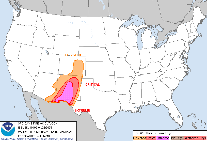
Day 2 Fire Weather Outlook
NWS Storm Prediction Center Norman OK
0154 AM CDT Thu Mar 28 2024

Valid 291200Z - 301200Z

...Synopsis...
Surface cyclone development is expected across the southern High
Plains as a mid-level trough amplifies across the Southwest tomorrow
(Friday). Downslope flow will increase in the process, with much of
the southern High Plains experiencing widespread 10-15 percent RH
and 15-20 mph sustained westerly surface winds by afternoon peak
heating. Given multiple days of dry and windy conditions, fine fuels
will continue to cure further, supporting at least widespread
"high-end" Elevated conditions, especially over eastern New Mexico
into western Texas. If fuel receptiveness increases at a greater
rate than currently anticipated, Critical highlights may be needed
in future outlooks.

..Squitieri.. 03/28/2024

...Please see www.spc.noaa.gov/fire for graphic product...