(date: 2024-04-12 17:34:03)
date: 2024-04-12, from: NOAA tornado/severe thunderstorm watches, mesoscale discussions, convective outlooks, fire weather outlooks
No watches are valid as of Fri Apr 12 23:46:02 UTC 2024.
https://www.spc.noaa.gov/products/watch/
date: 2024-04-12, from: NOAA tornado/severe thunderstorm watches, mesoscale discussions, convective outlooks, fire weather outlooks

Mesoscale Discussion 0432
NWS Storm Prediction Center Norman OK
0556 PM CDT Fri Apr 12 2024

Areas affected...Southeast North Carolina

Concerning...Severe potential...Watch unlikely

Valid 122256Z - 130100Z

Probability of Watch Issuance...5 percent

SUMMARY...Weak convection will pose a damaging wind risk over the
next 1-2 hours as storms approach the southeastern North Carolina
coast. Watch issuance is not expected.

DISCUSSION...Weak, shallow convection migrating eastward across
southern NC has persisted over the past 1-2 hours despite a very
marginal thermodynamic environment (MLCAPE generally near 250 J/kg
or less per recent mesoanalyses and forecast soundings). This
persistence is likely attributable to lift ahead of a subtle
vorticity maximum. Despite the poor buoyancy, low-level warming has
resulted in steep boundary-layer lapse rates up to 7-8 C/km, which
is facilitating downward transfer of stronger mid-level flow.
Surface observations have reported isolated severe winds (59 mph was
recently measured at KFAY), with more frequent gusts around 35-50
mph. While severe winds will likely be confined to very narrow
swaths, the relatively more widespread 35-50 mph winds will pose a
wind damage risk. The onset of nocturnal cooling in the coming hours
will further limit convective intensity and should hinder efficient
mixing, but favorable forcing for ascent may maintain poorly
organized convection (and associated damaging wind threat) to the NC
coast.

..Moore/Thompson.. 04/12/2024

...Please see www.spc.noaa.gov for graphic product...

ATTN...WFO...MHX...RAH...ILM...

LAT...LON   34377914 34667927 34977919 35247862 35497776 35557718
            35517645 35307620 35117641 34847676 34567724 34347762
            34147791 34107814 34287895 34377914
https://www.spc.noaa.gov/products/md/md0432.html
date: 2024-04-12, from: NOAA tornado/severe thunderstorm watches, mesoscale discussions, convective outlooks, fire weather outlooks
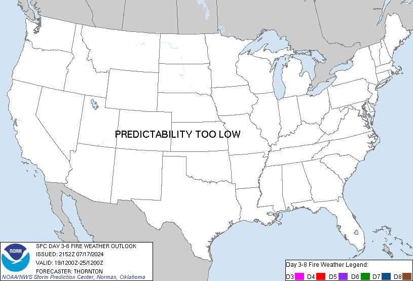
Day 3-8 Fire Weather Outlook
NWS Storm Prediction Center Norman OK
0323 PM CDT Fri Apr 12 2024

Valid 141200Z - 201200Z

A potent upper-level low will continue to move eastward out of the
Great Basin into the Southwest and southern Plains early next week.
A deep lee cyclone is expected to form Monday afternoon along the
CO/KS border. The shortwave trough will lift into the Midwest/Great
Lakes by midweek with the surface low following a similar track.
Fire weather concerns are expected to focus within the southern High
Plains during the extended period.

...Southern High Plains...
Critical fire weather potential will increase as the trough begins
to the eject into the region on Monday. Strong mid-level winds will
overlap with a deepening surface cyclone to the north to produce
areas of 20-30 mph winds along with RH that could fall to near 10%
behind the dryline. Some areas have observed rainfall in the past
few days which has helped reduce fuel receptiveness. Critical
probabilities have been kept lower in those areas.

As the surface low departs, strong westerly winds will remain across
the region on Tuesday. As winds will be on a gradual decrease into
the afternoon, potential for critical fire weather should remain
lower than on Monday. The eastern/northern extent of potential fire
weather concerns will be determined by where and how much
precipitation occurs Monday afternoon/evening.

With the upper-level pattern beginning to become rapidly less
predictable by Wednesday, confidence in potential critical fire
weather is quite low through the remainder of the extended period.
There is a low probability that elevated fire weather continues into
Wednesday across parts of the region. Trends in model guidance will
continue to be monitored.

..Wendt.. 04/12/2024

...Please see www.spc.noaa.gov/fire for graphic product...
https://www.spc.noaa.gov/products/exper/fire_wx/
date: 2024-04-12, from: NOAA tornado/severe thunderstorm watches, mesoscale discussions, convective outlooks, fire weather outlooks

Day 1 Convective Outlook
NWS Storm Prediction Center Norman OK
0243 PM CDT Fri Apr 12 2024

Valid 122000Z - 131200Z

...THERE IS A MARGINAL RISK OF SEVERE THUNDERSTORMS ACROSS PARTS OF
EASTERN NEW YORK/WESTERN NEW ENGLAND AND FROM NORTHERN NEVADA TO
WESTERN MONTANA...

...SUMMARY...
Isolated severe wind gusts and hail may occur with thunderstorms
over northern Nevada, eastern Oregon, Idaho, and far western Montana
into early evening. A severe storm or two also remains possible
across portions of western New England the next few hours.

...20z Update...

The previous outlook remains on track and no changes have been made
with the 20z update. For details regarding short term severe
potential across portions of the Northwest states, refer to MCD 430.

..Leitman.. 04/12/2024

.PREV DISCUSSION... /ISSUED 1143 AM CDT Fri Apr 12 2024/

...Champlain/Hudson Valleys of New York into western New England...
Showers appear to be increasing at this time across the
Hudson/Champlain Valleys, ahead of an occluded front moving eastward
across eastern portions of Upstate New York early this afternoon.  A
lobe of vorticity will continue rotating northeastward across the
region this afternoon, on the eastern fringe of the upper low
crossing the Great Lakes.  Cold air aloft combined with weak
insolation through breaks in the cloud cover evident in visible
satellite imagery will permit additional/modest destabilization.  As
a result, low-topped thunderstorms are expected to develop across
this area.

With deep-layer flow somewhat unidirectional/meridional, but
strengthening with height, shear will support organized storms and
potentially a few rotating updrafts.  As a result, a brief/weak
tornado or two will be possible, along with gusty winds that may
approach severe levels locally, with a few stronger cells and/or
line segments.  As such, a MRGL risk is being introduced across a
portion of eastern New York and into parts of western New England.
For additional short-term information, please refer to SWOMCD #429.

...Parts of northern Nevada to western Montana...
Ahead of the advancing upper low, daytime heating beneath steep
mid-level lapse rates will result in modest destabilization, with
degree of CAPE hindered due to scant moisture availability across
this region.  Still, with a few hundred J/kg mixed-layer CAPE likely
by late afternoon, widely scattered thunderstorms are expected to
develop.

With favorably strong flow aloft across this area, a few
stronger/sustained updrafts appear likely.  With a very deep
well-mixed boundary layer expected across the region, gusty
downdraft winds -- enhanced due to evaporative cooling in the
sub-cloud layer -- may reach severe levels in a few instances.  This
warrants continuation of the MRGL risk across into early evening.

...Ohio Valley to the Mid-Atlantic region...
Scattered showers should diurnally increase from parts of the OH
Valley across the central Appalachians to the Virginia/North
Carolina area, with eventual/embedded low-topped thunderstorms
expected to develop within the broader area of precipitation this
afternoon.

The convection will be associated with cold mid-level temperatures
accompanying a shortwave trough, that is embedded within the broader
cyclonic circulation across the eastern CONUS. With generally
west-northwesterly flow behind the cold front, instability should
remain very weak.  Still, enhanced low-level winds may reach the
surface given the anticipated well-mixed boundary layer, resulting
in occasional strong/gusty winds with a few of the stronger
convective elements.
https://www.spc.noaa.gov/products/outlook/day1otlk_2000.html
date: 2024-04-12, from: NOAA tornado/severe thunderstorm watches, mesoscale discussions, convective outlooks, fire weather outlooks
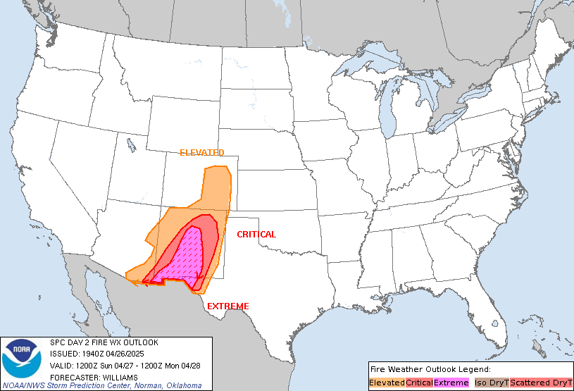
Day 2 Fire Weather Outlook
NWS Storm Prediction Center Norman OK
0234 PM CDT Fri Apr 12 2024

Valid 131200Z - 141200Z

No changes to the ongoing forecast. Critical meteorological
conditions appear most likely to occur in parts of the Texas
Panhandle/South Plains. Given recent rainfall and reports of some
greening grasses, a categorical upgrade to Critical does not seem
warranted at this time. Critical conditions also appear possible
near the KS/CO border. Deterministic and ensemble guidance generally
depict these conditions occurring only briefly, however.

..Wendt.. 04/12/2024

.PREV DISCUSSION... /ISSUED 0202 AM CDT Fri Apr 12 2024/

...Synopsis...
Across the western US, southwesterly flow aloft is forecast to
intensify Saturday as a broad upper low moves onshore over the West
Coast and begins to phase with the sub tropical jet. The strong flow
aloft from the intensifying upper low will deepen a lee trough into
a surface low over the northern Plains. The low will bolster surface
winds across the Great Basin and Southwest, while gusty surface
winds will extend eastward to the lee of the Rockies and over much
of the Great Plains. With gusty winds overlapping areas of dry fuels
and warm temperatures, elevated fire-weather conditions are likely.

...High Plains...
To the west of the deepening lee trough, gusty west/southwest winds
are expected to increase through the afternoon over parts of eastern
CO, eastern NM, western KS, and the far western TX Panhandle.
Widespread gusts of 20-25 mph are likely, overlapping with minimum
humidity values of 10-20%. Elevated to locally critical fire-weather
concerns are likely, especially over parts of southeastern CO,
western KS and eastern NM, where fuels are driest. Less confidence
exists over part of the TX panhandle and northwest OK. Here, recent
rainfall has likely tempered fuels somewhat. Still, several days of
drying may result in some potential for elevated and critical
fire-weather conditions Saturday afternoon.

...Central Plains...
As the lee trough continues to deepen into a broad lee low over the
northern Plains, strong southerly winds are expected across much of
the southern and central Plains. Ahead of the returning moisture,
sustained winds of 20-25 mph are expected Saturday. While RH values
may not reach nominal diurnal minimums, widespread RH below 30% is
still likely. In combination with increasingly warm temperatures and
very dry fuels, the gusty winds and marginally dry surface
conditions should support at least a few hours of elevated
fire-weather potential across parts of central/eastern KS into
southern NE. Localized fire-weather concerns are also possible
farther east into portions of MO, though lesser confidence in
sustained winds and fuels exists here.

...Please see www.spc.noaa.gov/fire for graphic product...
https://www.spc.noaa.gov/products/fire_wx/fwdy2.html
date: 2024-04-12, from: NOAA tornado/severe thunderstorm watches, mesoscale discussions, convective outlooks, fire weather outlooks

Day 1 Fire Weather Outlook
NWS Storm Prediction Center Norman OK
1032 AM CDT Fri Apr 12 2024

Valid 121700Z - 131200Z

No changes to the ongoing forecast.

..Wendt.. 04/12/2024

.PREV DISCUSSION... /ISSUED 0200 AM CDT Fri Apr 12 2024/

...Synopsis...
In the wake of the upper-level cyclone departing to the east,
transient ridging aloft will give way to increasingly strong
southwest flow over the southern Rockies. An embedded perturbation
passing overhead will aid in deepening a lee trough over parts of
the southern High Plains Friday. Downslope surface winds are
forecast to increase through afternoon over part of eastern NM and
southeastern CO. Dry southerly return flow is also possible across
parts of the TX Rio Grande Valley. The gusty winds and low humidity
will likely support elevated to locally critical fire-weather
conditions.

...Northeast New Mexico and southern Colorado...
As flow aloft begins to strengthen ahead of the approaching
shortwave trough, a deepening lee trough will bolster westerly
surface flow over northeastern NM and southern CO. Dry downslope
trajectories and daytime heating should support widespread minimum
RH values of 10-15%. Overlapping with sustained surface winds of
15-25 mph, and dry fuels devoid of recent rainfall, several hours of
elevated to locally critical fire-weather conditions are likely over
parts of NM and southern CO.

...Texas Rio Grande Valley...
To the east of the deepening lee trough, southerly winds are forest
to increase through much of the day with the approach of the
upper-level shortwave trough. With limited surface moisture in place
behind the previous frontal passage, dry return flow is expected
over parts of South TX and the central Rio Grande Valley. Periodic
surface wind gusts of 15-20 mph and diurnal RH minimums of 15-20%
may support a few hours of elevated fire-weather conditions.

...Please see www.spc.noaa.gov/fire for graphic product...
https://www.spc.noaa.gov/products/fire_wx/fwdy1.html
date: 2024-04-12, from: NOAA tornado/severe thunderstorm watches, mesoscale discussions, convective outlooks, fire weather outlooks
No Mesoscale Discussions are in effect as of Fri Apr 12 15:35:02 UTC 2024.
https://www.spc.noaa.gov/products/md/
date: 2024-04-12, from: NOAA tornado/severe thunderstorm watches, mesoscale discussions, convective outlooks, fire weather outlooks

Day 1 Convective Outlook
NWS Storm Prediction Center Norman OK
0748 AM CDT Fri Apr 12 2024

Valid 121300Z - 131200Z

...THERE IS A MARGINAL RISK OF SEVERE THUNDERSTORMS ACROSS PARTS OF
NORTHERN NEVADA...EASTERN OREGON...IDAHO...AND FAR WESTERN
MONTANA...

...SUMMARY...
Isolated severe wind gusts and hail may occur with thunderstorms
over northern Nevada, eastern Oregon, Idaho, and far western Montana
late this afternoon and early evening.

...Northern Nevada into Eastern Oregon, Idaho, and Far Western
Montana...
An upper low over the eastern Pacific will dig southward towards the
northern/central CA Coast through tonight, with a belt of moderately
enhanced flow extending over parts of the Northwest. Low-level
moisture across the northern Great Basin into the northern Rockies
is expected to remain quite meager, with PW values generally around
0.7 inch or less. Even so, daytime heating should encourage a very
well-mixed boundary layer to develop by later this afternoon as a
surface low consolidates over northern NV. Isolated to scattered
thunderstorms should develop this afternoon from parts of northern
NV and eastern OR into ID and eventually western MT. With up to 500
J/kg of MLCAPE present amid sufficient deep-layer for some updraft
organization, some of this activity could become strong to severe.
Isolated severe wind gusts may occur with any convective downdrafts,
as low/mid-level lapse rates will likely be quite steep. Occasional
hail also appears possible with the more robust cores. Convection
should weaken this evening with eastward extent into ID/western MT
with the loss of daytime heating.

...Ohio Valley into the Mid-Atlantic and Northeast...
Low-topped thunderstorms should develop along a cold front this
morning into the afternoon across parts of the Northeast. Poor lapse
rates, weak buoyancy, and generally meridional flow at low/mid
levels across eastern NY into parts of southern New England will
likely hinder an organized severe threat from developing.

A separate area of convection may develop this afternoon across
parts of the OH Valley into the central Appalachians and perhaps
Carolinas. This activity will be tied to cold mid-level temperatures
associated with a shortwave trough embedded within a broad upper
trough/low over the eastern CONUS. With generally west-northwesterly
flow behind a front, instability should remain very weak. Still,
enhanced low-level winds may reach the surface with a well-mixed
boundary layer, and occasional strong/gusty winds could occur this
afternoon.

..Gleason/Grams.. 04/12/2024
https://www.spc.noaa.gov/products/outlook/day1otlk_1300.html
date: 2024-04-11, from: NOAA tornado/severe thunderstorm watches, mesoscale discussions, convective outlooks, fire weather outlooks

Mesoscale Discussion 0420
NWS Storm Prediction Center Norman OK
0933 AM CDT Thu Apr 11 2024

Areas affected...northern and central Florida

Concerning...Tornado Watch 104...

Valid 111433Z - 111630Z

The severe weather threat for Tornado Watch 104 continues.

SUMMARY...A broken band of thunderstorms continues moving eastward
across northern Florida, where local severe-weather risk continues.

DISCUSSION...Latest radar loop shows a loosely organized band of
thunderstorms extending from the southeastern Georgia coast
southwestward to the eastern Gulf of Mexico west of Tampa.  Storms
have remained largely sub-severe despite very favorable deep-layer
shear, due to an overall lack of appreciable buoyancy.  The 12Z TBW
RAOB shows a deeply moist airmass, but very weak lapse rates, with
several warm layers that hint at subdued updraft acceleration,
confirming the character of convection at this time per radar
reflectivity.

With that said, filtered heating through high cirrus ahead of the
convection has allowed heating to commence, with surface
temperatures having risen a few degrees over the past 1 to 2 hours.
Continued insolation/heating will allow destabilization eventually
permit more unimpeded updrafts, and a corresponding increase in
convective intensity/organization, aided by the favorable background
kinematic environment.  As such, local severe risk -- including
isolated tornado potential -- should gradually increase over the
next couple of hours.

..Goss.. 04/11/2024

...Please see www.spc.noaa.gov for graphic product...

ATTN...WFO...MLB...TBW...JAX...

LAT...LON   27768404 28948331 29978264 31038152 31068090 29788094
            27888228 27568338 27768404
https://www.spc.noaa.gov/products/md/md0420.html
date: 2024-04-11, from: NOAA tornado/severe thunderstorm watches, mesoscale discussions, convective outlooks, fire weather outlooks

URGENT - IMMEDIATE BROADCAST REQUESTED
Tornado Watch Number 104
NWS Storm Prediction Center Norman OK
730 AM EDT Thu Apr 11 2024

The NWS Storm Prediction Center has issued a

* Tornado Watch for portions of
  North and Central Florida
  Southern Georgia
  Coastal Waters

* Effective this Thursday morning and afternoon from 730 AM until
  300 PM EDT.

* Primary threats include...
  A couple tornadoes possible
  Scattered damaging wind gusts to 70 mph possible

SUMMARY...A pre-frontal broken band of storms will gradually shift
east across the watch area through the morning and into the early
afternoon.  A few supercells and line segments will probably pose
some risk for a few tornadoes and damaging gusts.

The tornado watch area is approximately along and 75 statute miles
east and west of a line from 15 miles west northwest of Brunswick GA
to 20 miles south southwest of Saint Petersburg FL. For a complete
depiction of the watch see the associated watch outline update
(WOUS64 KWNS WOU4).

PRECAUTIONARY/PREPAREDNESS ACTIONS...

REMEMBER...A Tornado Watch means conditions are favorable for
tornadoes and severe thunderstorms in and close to the watch
area. Persons in these areas should be on the lookout for
threatening weather conditions and listen for later statements
and possible warnings.

&&

AVIATION...Tornadoes and a few severe thunderstorms with hail
surface and aloft to 1 inch. Extreme turbulence and surface wind
gusts to 60 knots. A few cumulonimbi with maximum tops to 500. Mean
storm motion vector 23035.

...Smith
https://www.spc.noaa.gov/products/watch/ww0104.html
date: 2024-04-11, from: NOAA tornado/severe thunderstorm watches, mesoscale discussions, convective outlooks, fire weather outlooks

STATUS REPORT ON WW 104

SEVERE WEATHER THREAT CONTINUES RIGHT OF A LINE FROM 80 WSW PIE
TO 40 WSW JAX TO 15 NE SSI.

..GOSS..04/11/24

ATTN...WFO...JAX...TBW...TAE...MLB...


STATUS REPORT FOR WT 104

SEVERE WEATHER THREAT CONTINUES FOR THE FOLLOWING AREAS

FLC001-003-007-017-019-031-035-041-053-057-069-075-083-101-103-
105-107-109-119-125-127-111540-

FL
.    FLORIDA COUNTIES INCLUDED ARE

ALACHUA              BAKER               BRADFORD
CITRUS               CLAY                DUVAL
FLAGLER              GILCHRIST           HERNANDO
HILLSBOROUGH         LAKE                LEVY
MARION               PASCO               PINELLAS
POLK                 PUTNAM              ST. JOHNS
SUMTER               UNION               VOLUSIA


AMZ450-452-454-550-GMZ830-850-853-111540-

CW

.    ADJACENT COASTAL WATERS INCLUDED ARE

COASTAL WATERS FROM ALTAMAHA SOUND TO FERNANDINA BEACH FL OUT 20
NM

COASTAL WATERS FROM FERNANDINA BEACH TO ST. AUGUSTINE FL OUT 20
https://www.spc.noaa.gov/products/watch/ws0104.html
date: 2024-04-10, from: NOAA tornado/severe thunderstorm watches, mesoscale discussions, convective outlooks, fire weather outlooks
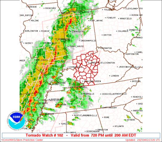
URGENT - IMMEDIATE BROADCAST REQUESTED
Tornado Watch Number 102
NWS Storm Prediction Center Norman OK
955 AM CDT Wed Apr 10 2024

The NWS Storm Prediction Center has issued a

* Tornado Watch for portions of
  Southern Alabama
  Florida Panhandle
  Coastal Waters

* Effective this Wednesday morning and afternoon from 955 AM
  until 500 PM CDT.

* Primary threats include...
  A few tornadoes likely with a couple intense tornadoes possible
  Widespread damaging winds likely with isolated significant gusts
    to 80 mph possible

SUMMARY...Conditions will become increasingly favorable for severe
storms as tornadoes as additional moistening and destabilization
occurs, with storms increasing ahead of a squall line, potentially
leading to multiple rounds of severe storms in some areas through
mid into late afternoon.

The tornado watch area is approximately along and 85 statute miles
north and south of a line from 35 miles north northwest of Mobile AL
to 35 miles east of Evergreen AL. For a complete depiction of the
watch see the associated watch outline update (WOUS64 KWNS WOU2).

PRECAUTIONARY/PREPAREDNESS ACTIONS...

REMEMBER...A Tornado Watch means conditions are favorable for
tornadoes and severe thunderstorms in and close to the watch
area. Persons in these areas should be on the lookout for
threatening weather conditions and listen for later statements
and possible warnings.

&&

OTHER WATCH INFORMATION...CONTINUE...WW 101...

AVIATION...Tornadoes and a few severe thunderstorms with hail
surface and aloft to 1.5 inches. Extreme turbulence and surface wind
gusts to 70 knots. A few cumulonimbi with maximum tops to 500. Mean
storm motion vector 24040.

...Guyer
https://www.spc.noaa.gov/products/watch/ww0102.html
date: 2024-04-10, from: NOAA tornado/severe thunderstorm watches, mesoscale discussions, convective outlooks, fire weather outlooks

STATUS REPORT ON WW 102

THE SEVERE WEATHER THREAT CONTINUES ACROSS THE ENTIRE WATCH AREA.

..LEITMAN..04/10/24

ATTN...WFO...MOB...BMX...


STATUS REPORT FOR WT 102

SEVERE WEATHER THREAT CONTINUES FOR THE FOLLOWING AREAS

ALC003-013-023-025-035-039-041-047-053-085-091-097-099-119-129-
131-101640-

AL
.    ALABAMA COUNTIES INCLUDED ARE

BALDWIN              BUTLER              CHOCTAW
CLARKE               CONECUH             COVINGTON
CRENSHAW             DALLAS              ESCAMBIA
LOWNDES              MARENGO             MOBILE
MONROE               SUMTER              WASHINGTON
WILCOX


FLC033-091-113-101640-

FL
.    FLORIDA COUNTIES INCLUDED ARE

ESCAMBIA             OKALOOSA            SANTA ROSA


GMZ630-631-632-633-634-635-636-650-655-101640-

CW
https://www.spc.noaa.gov/products/watch/ws0102.html
date: 2024-04-10, from: NOAA tornado/severe thunderstorm watches, mesoscale discussions, convective outlooks, fire weather outlooks
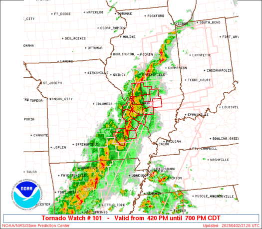
URGENT - IMMEDIATE BROADCAST REQUESTED
Tornado Watch Number 101
NWS Storm Prediction Center Norman OK
600 AM CDT Wed Apr 10 2024

The NWS Storm Prediction Center has issued a

* Tornado Watch for portions of
  Southeast Louisiana
  Central and Southern Mississippi
  Coastal Waters

* Effective this Wednesday morning and afternoon from 600 AM
  until 100 PM CDT.

* Primary threats include...
  A few tornadoes likely with a couple intense tornadoes possible
  Widespread damaging winds and isolated significant gusts to 80
    mph likely
  Scattered large hail events to 1.5 inches in diameter possible

SUMMARY...A destabilizing airmass across the central Gulf Coast will
support an increasing severe thunderstorm and tornado risk this
morning into the midday.  The tornado risk will likely maximize with
any supercells that develop within the warm sector as the marine
warm front advances northward.  A squall line will move west to east
across the area with a risk for damaging gusts and the tornado risk
will likely focus with any sustained mesovortex or embedded
supercell.

The tornado watch area is approximately along and 85 statute miles
east and west of a line from 95 miles northwest of Meridian MS to 45
miles west southwest of Boothville LA. For a complete depiction of
the watch see the associated watch outline update (WOUS64 KWNS
WOU1).

PRECAUTIONARY/PREPAREDNESS ACTIONS...

REMEMBER...A Tornado Watch means conditions are favorable for
tornadoes and severe thunderstorms in and close to the watch
area. Persons in these areas should be on the lookout for
threatening weather conditions and listen for later statements
and possible warnings.

&&

OTHER WATCH INFORMATION...CONTINUE...WW 99...WW 100...

AVIATION...Tornadoes and a few severe thunderstorms with hail
surface and aloft to 1.5 inches. Extreme turbulence and surface wind
gusts to 70 knots. A few cumulonimbi with maximum tops to 500. Mean
storm motion vector 25040.

...Smith
https://www.spc.noaa.gov/products/watch/ww0101.html
date: 2024-04-10, from: NOAA tornado/severe thunderstorm watches, mesoscale discussions, convective outlooks, fire weather outlooks

STATUS REPORT ON WW 102

THE SEVERE WEATHER THREAT CONTINUES ACROSS THE ENTIRE WATCH AREA.

..LEITMAN..04/10/24

ATTN...WFO...MOB...BMX...


STATUS REPORT FOR WT 102

SEVERE WEATHER THREAT CONTINUES FOR THE FOLLOWING AREAS

ALC003-013-023-025-035-039-041-047-053-085-091-097-099-119-129-
131-101640-

AL
.    ALABAMA COUNTIES INCLUDED ARE

BALDWIN              BUTLER              CHOCTAW
CLARKE               CONECUH             COVINGTON
CRENSHAW             DALLAS              ESCAMBIA
LOWNDES              MARENGO             MOBILE
MONROE               SUMTER              WASHINGTON
WILCOX


FLC033-091-113-101640-

FL
.    FLORIDA COUNTIES INCLUDED ARE

ESCAMBIA             OKALOOSA            SANTA ROSA


GMZ630-631-632-633-634-635-636-650-655-101640-

CW
https://www.spc.noaa.gov/products/watch/ws0101.html
date: 2024-04-10, from: NOAA tornado/severe thunderstorm watches, mesoscale discussions, convective outlooks, fire weather outlooks
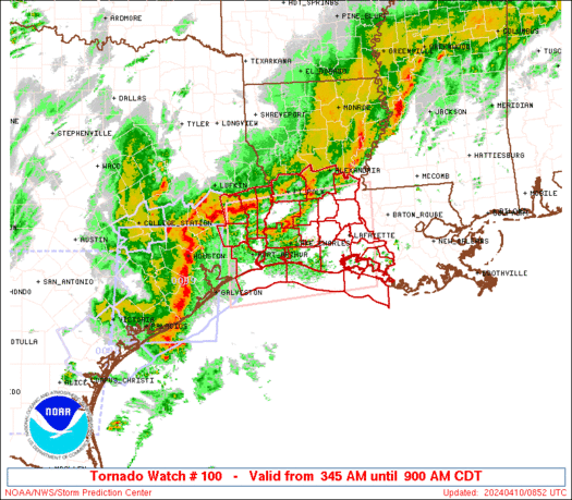
STATUS REPORT ON WW 100

SEVERE WEATHER THREAT CONTINUES RIGHT OF A LINE FROM 55 SW 7R4 TO
15 NW LFT TO 35 NNE LFT TO 15 ENE ESF.

..LEITMAN..04/10/24

ATTN...WFO...LCH...


STATUS REPORT FOR WT 100

SEVERE WEATHER THREAT CONTINUES FOR THE FOLLOWING AREAS

LAC045-055-099-101-113-101440-

LA
.    LOUISIANA PARISHES INCLUDED ARE

IBERIA               LAFAYETTE           ST. MARTIN
ST. MARY             VERMILION


GMZ435-436-452-455-101440-

CW

.    ADJACENT COASTAL WATERS INCLUDED ARE

VERMILION BAY


COASTAL WATERS FROM INTRACOASTAL CITY TO CAMERON LA OUT 20 NM

COASTAL WATERS FROM LOWER ATCHAFALAYA RIVER TO INTRACOASTAL CITY
LA OUT 20 NM

THE WATCH STATUS MESSAGE IS FOR GUIDANCE PURPOSES ONLY.  PLEASE
https://www.spc.noaa.gov/products/watch/ws0100.html
date: 2024-04-09, from: NOAA tornado/severe thunderstorm watches, mesoscale discussions, convective outlooks, fire weather outlooks
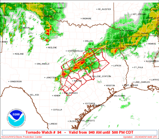
STATUS REPORT ON WW 94

THE SEVERE WEATHER THREAT CONTINUES ACROSS THE ENTIRE WATCH AREA.

..GLEASON..04/09/24

ATTN...WFO...FWD...EWX...HGX...


STATUS REPORT FOR WT 94

SEVERE WEATHER THREAT CONTINUES FOR THE FOLLOWING AREAS

TXC001-021-027-031-041-051-053-055-091-099-145-161-187-209-213-
225-281-287-289-293-309-313-331-349-395-453-491-091640-

TX
.    TEXAS COUNTIES INCLUDED ARE

ANDERSON             BASTROP             BELL
BLANCO               BRAZOS              BURLESON
BURNET               CALDWELL            COMAL
CORYELL              FALLS               FREESTONE
GUADALUPE            HAYS                HENDERSON
HOUSTON              LAMPASAS            LEE
LEON                 LIMESTONE           MCLENNAN
MADISON              MILAM               NAVARRO
ROBERTSON            TRAVIS              WILLIAMSON


THE WATCH STATUS MESSAGE IS FOR GUIDANCE PURPOSES ONLY.  PLEASE
REFER TO WATCH COUNTY NOTIFICATION STATEMENTS FOR OFFICIAL
INFORMATION ON COUNTIES...INDEPENDENT CITIES AND MARINE ZONES
CLEARED FROM SEVERE THUNDERSTORM AND TORNADO WATCHES.
https://www.spc.noaa.gov/products/watch/ws0094.html
date: 2024-04-09, from: NOAA tornado/severe thunderstorm watches, mesoscale discussions, convective outlooks, fire weather outlooks
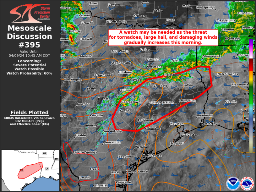
Mesoscale Discussion 0395
NWS Storm Prediction Center Norman OK
0848 AM CDT Tue Apr 09 2024

Areas affected...Portions of central/east TX into northwestern LA

Concerning...Severe potential...Watch possible

Valid 091348Z - 091545Z

Probability of Watch Issuance...60 percent

SUMMARY...A watch may be needed as the threat for tornadoes, large
hail, and damaging winds gradually increases this morning.

DISCUSSION...Warm advection associated with a 35-45 kt southerly
low-level jet, along with ascent attendant to the left exit region
of a southwesterly mid/upper-level jet, is aiding convection across
parts of central/east TX into northwestern LA. Some of this activity
across central TX is occurring near a convectively reinforced
outflow boundary, with a rich low-level airmass present along/south
of this boundary. Steep mid-level lapse rates are supporting
1500-2000 J/kg of MLCAPE in central TX, even though daytime heating
remains muted thus far, with lesser instability into east TX and
northwestern LA. Still, strong deep-layer shear of 50+ kt will
foster updraft organization and supercell potential. Large to very
large hail will be a concern with these supercells as they spread
east-northeastward this morning. An increasing potential for
severe/damaging winds may be realized if a cluster forms along the
outflow boundary/front. Sufficient low-level shear is also present
for low-level updraft rotation and some tornado threat. Watch
issuance may be needed if convection continues to increase in
coverage and intensity across central TX.

..Gleason/Thompson.. 04/09/2024

...Please see www.spc.noaa.gov for graphic product...

ATTN...WFO...LCH...SHV...HGX...FWD...EWX...

LAT...LON   30029806 30829766 31659640 31939477 32179397 32159343
            31369333 30959394 29939603 29559685 29579786 30029806
https://www.spc.noaa.gov/products/md/md0395.html
date: 2024-04-09, from: NOAA tornado/severe thunderstorm watches, mesoscale discussions, convective outlooks, fire weather outlooks

URGENT - IMMEDIATE BROADCAST REQUESTED
Tornado Watch Number 94
NWS Storm Prediction Center Norman OK
940 AM CDT Tue Apr 9 2024

The NWS Storm Prediction Center has issued a

* Tornado Watch for portions of
  Central Texas

* Effective this Tuesday morning and afternoon from 940 AM until
  500 PM CDT.

* Primary threats include...
  A few tornadoes possible
  Scattered large hail and isolated very large hail events to 2.5
    inches in diameter likely
  Scattered damaging wind gusts to 70 mph possible

SUMMARY...Several thunderstorm clusters, including a mix of
supercells and bowing line segments, are expected along a stalled
front across central Texas through the afternoon.  More isolated
supercell development will be possible later this morning into early
this afternoon into the I-35 corridor closer to Austin.  The storm
environment will support the potential for large hail up to 2.5
inches in diameter, damaging gusts of 60-70 mph, and potentially a
few tornadoes.

The tornado watch area is approximately along and 40 statute miles
north and south of a line from 50 miles west of Austin TX to 140
miles east northeast of Temple TX. For a complete depiction of the
watch see the associated watch outline update (WOUS64 KWNS WOU4).

PRECAUTIONARY/PREPAREDNESS ACTIONS...

REMEMBER...A Tornado Watch means conditions are favorable for
tornadoes and severe thunderstorms in and close to the watch
area. Persons in these areas should be on the lookout for
threatening weather conditions and listen for later statements
and possible warnings.

&&

AVIATION...Tornadoes and a few severe thunderstorms with hail
surface and aloft to 2.5 inches. Extreme turbulence and surface wind
gusts to 60 knots. A few cumulonimbi with maximum tops to 550. Mean
storm motion vector 25025.

...Thompson