(date: 2024-06-30 11:36:55)
date: 2024-06-30, from: NOAA tornado/severe thunderstorm watches, mesoscale discussions, convective outlooks, fire weather outlooks

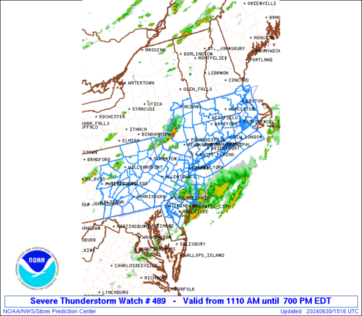
STATUS REPORT ON WW 489

SEVERE WEATHER THREAT CONTINUES RIGHT OF A LINE FROM 25 NNE AOO
TO 15 NNW AVP TO 10 N ALB.

..LEITMAN..06/30/24

ATTN...WFO...OKX...BOX...ALY...PHI...BGM...CTP...


STATUS REPORT FOR WS 489

SEVERE WEATHER THREAT CONTINUES FOR THE FOLLOWING AREAS

CTC001-003-005-007-009-011-013-015-301940-

CT
.    CONNECTICUT COUNTIES INCLUDED ARE

FAIRFIELD            HARTFORD            LITCHFIELD
MIDDLESEX            NEW HAVEN           NEW LONDON
TOLLAND              WINDHAM


DEC003-301940-

DE
.    DELAWARE COUNTIES INCLUDED ARE

NEW CASTLE


MAC003-005-009-011-013-015-017-021-023-025-027-301940-

MA
.    MASSACHUSETTS COUNTIES INCLUDED ARE

BERKSHIRE            BRISTOL             ESSEX
FRANKLIN             HAMPDEN             HAMPSHIRE
https://www.spc.noaa.gov/products/watch/ws0489.html
date: 2024-06-30, from: NOAA tornado/severe thunderstorm watches, mesoscale discussions, convective outlooks, fire weather outlooks

Mesoscale Discussion 1492
NWS Storm Prediction Center Norman OK
0126 PM CDT Sun Jun 30 2024

Areas affected...northern NJ into western Long Island/NYC Metro
vicinity

Concerning...Severe Thunderstorm Watch 489...

Valid 301826Z - 302000Z

The severe weather threat for Severe Thunderstorm Watch 489
continues.

SUMMARY...An intense bowing segment will move across northern New
Jersey into western Long Island and the New York City metro vicinity
over the next 1-2 hours. Damaging wind gusts are expected with these
storms.

DISCUSSION...A cluster of storms has rapidly intensified and
developed into a bowing segment near the northern NJ/PA state line
this afternoon. This activity will spread east/southeast over the
next 1-2 hours into the axis of strong instability oriented over the
northern Mid-Atlantic region. These storms have already produced
gusts to near 50 kt and areas of wind damage. This activity is
likely to continue producing severe/damaging wind gusts as storms
spread across northern NJ and the New York City metro vicinity.

..Leitman.. 06/30/2024

...Please see www.spc.noaa.gov for graphic product...

ATTN...WFO...OKX...PHI...BGM...

LAT...LON   41297509 41277469 41127395 41047352 40937324 40827318
            40507322 40357399 40477485 40667536 40857547 41077546
            41297509
https://www.spc.noaa.gov/products/md/md1492.html
date: 2024-06-30, from: NOAA tornado/severe thunderstorm watches, mesoscale discussions, convective outlooks, fire weather outlooks

Mesoscale Discussion 1491
NWS Storm Prediction Center Norman OK
0116 PM CDT Sun Jun 30 2024

Areas affected...eastern Kentucky...eastern Tennessee...southern
West Virginia...far western Virginia...and western North Carolina

Concerning...Severe potential...Watch unlikely

Valid 301816Z - 302015Z

Probability of Watch Issuance...20 percent

SUMMARY...Marginal threat for strong to severe gusts will remain
possible with thunderstorm activity through the afternoon/evening.

DISCUSSION...Thunderstorm activity continues to increase in coverage
across portions of eastern Kentucky into western Virginia this
afternoon. The air mass in this region has warmed and become more
unstable through the morning, with around 2000-2500 J/kg of MLCAPE
in recent surface objective analysis. This is also apparent in radar
and satellite trends for in echo tops and cloud top cooling with
ongoing thunderstorm activity. Upper-level flow remains modest
across the region, waning further with south and eastward extent
into far eastern Tennessee/Carolinas. As such, deep layer shear for
organization remains weak, though around 30-35 kts of effective
shear is analyzed across eastern Kentucky. As such, instances of
severe wind should remain fairly isolated and localized. A watch is
unlikely to be needed but trends will continue to be monitored.

..Thornton/Gleason.. 06/30/2024

...Please see www.spc.noaa.gov for graphic product...

ATTN...WFO...RNK...RLX...GSP...MRX...JKL...LMK...OHX...

LAT...LON   37318629 37688591 37848554 37768414 37878235 37668154
            36718144 35558187 35398221 35208335 35138488 37318629
https://www.spc.noaa.gov/products/md/md1491.html
date: 2024-06-30, from: NOAA tornado/severe thunderstorm watches, mesoscale discussions, convective outlooks, fire weather outlooks

Mesoscale Discussion 1490
NWS Storm Prediction Center Norman OK
1259 PM CDT Sun Jun 30 2024

Areas affected...southern NY into southern New England

Concerning...Severe Thunderstorm Watch 489...

Valid 301759Z - 301930Z

The severe weather threat for Severe Thunderstorm Watch 489
continues.

SUMMARY...A line of intense storms will shift east across southern
New England and Southern New York/portions of Long Island the next
couple of hours. Swaths of wind damage will accompany this activity.

DISCUSSION...A well organized bowing segment over CT will continue
to shift east at around 35-40 kt the next couple of hours. This
activity has a long history of producing wind damage, and this trend
is expected to continue as the bow moves across CT into RI and
southern MA through 4pm EDT.

An area of convection to the southwest of the bow continues to
become better organized from southern NY into western CT. This
activity should also continue generally eastward over the next
couple of hours and may impact portions of Long Island. Damaging
gusts may also accompany this activity.

..Leitman.. 06/30/2024

...Please see www.spc.noaa.gov for graphic product...

ATTN...WFO...BOX...OKX...ALY...PHI...

LAT...LON   42217266 42247085 41887055 41387073 41027155 40907210
            40857255 40837310 40897387 41087449 41367460 41637430
            41767337 42217266
https://www.spc.noaa.gov/products/md/md1490.html
date: 2024-06-30, from: NOAA tornado/severe thunderstorm watches, mesoscale discussions, convective outlooks, fire weather outlooks

URGENT - IMMEDIATE BROADCAST REQUESTED
Severe Thunderstorm Watch Number 489
NWS Storm Prediction Center Norman OK
1110 AM EDT Sun Jun 30 2024

The NWS Storm Prediction Center has issued a

* Severe Thunderstorm Watch for portions of
  Connecticut
  Northern Delaware
  Massachusetts
  New Jersey
  Southern New York
  Central and Eastern Pennsylvania
  Rhode Island
  Coastal Waters

* Effective this Sunday morning and evening from 1110 AM until
  700 PM EDT.

* Primary threats include...
  Widespread damaging winds likely with isolated significant gusts
    to 75 mph possible
  Isolated large hail events to 1.5 inches in diameter possible

SUMMARY...A mix of thunderstorm clusters and supercells should pose
a threat for numerous to widespread severe/damaging winds as they
move eastward this afternoon and evening. Peak wind gusts should
generally range around 60-70 mph, with isolated gusts perhaps
reaching up to 75 mph. Occasional hail around 1-1.5 inches in
diameter may also occur with any sustained supercell.

The severe thunderstorm watch area is approximately along and 100
statute miles east and west of a line from 35 miles north northwest
of Worcester MA to 30 miles west southwest of Philadelphia PA. For a
complete depiction of the watch see the associated watch outline
update (WOUS64 KWNS WOU9).

PRECAUTIONARY/PREPAREDNESS ACTIONS...

REMEMBER...A Severe Thunderstorm Watch means conditions are
favorable for severe thunderstorms in and close to the watch area.
Persons in these areas should be on the lookout for threatening
weather conditions and listen for later statements and possible
warnings. Severe thunderstorms can and occasionally do produce
tornadoes.

&&

AVIATION...A few severe thunderstorms with hail surface and aloft to
1.5 inches. Extreme turbulence and surface wind gusts to 65 knots. A
few cumulonimbi with maximum tops to 500. Mean storm motion vector
27035.

...Gleason
https://www.spc.noaa.gov/products/watch/ww0489.html
date: 2024-06-30, from: Eastern Pacific Basin GIS Data
No tropical cyclones as of Sun, 30 Jun 2024 18:24:48 GMT
date: 2024-06-30, from: NOAA tornado/severe thunderstorm watches, mesoscale discussions, convective outlooks, fire weather outlooks

STATUS REPORT ON WW 490

THE SEVERE WEATHER THREAT CONTINUES ACROSS THE ENTIRE WATCH AREA.

..LEITMAN..06/30/24

ATTN...WFO...GYX...CAR...BTV...


STATUS REPORT FOR WS 490

SEVERE WEATHER THREAT CONTINUES FOR THE FOLLOWING AREAS

MEC001-003-005-007-009-011-013-015-017-019-021-023-025-027-029-
031-301840-

ME
.    MAINE COUNTIES INCLUDED ARE

ANDROSCOGGIN         AROOSTOOK           CUMBERLAND
FRANKLIN             HANCOCK             KENNEBEC
KNOX                 LINCOLN             OXFORD
PENOBSCOT            PISCATAQUIS         SAGADAHOC
SOMERSET             WALDO               WASHINGTON
YORK


NHC001-003-005-007-009-011-013-015-017-019-301840-

NH
.    NEW HAMPSHIRE COUNTIES INCLUDED ARE

BELKNAP              CARROLL             CHESHIRE
COOS                 GRAFTON             HILLSBOROUGH
MERRIMACK            ROCKINGHAM          STRAFFORD
SULLIVAN


VTC005-009-017-027-301840-
https://www.spc.noaa.gov/products/watch/ws0490.html
date: 2024-06-30, from: NOAA tornado/severe thunderstorm watches, mesoscale discussions, convective outlooks, fire weather outlooks

URGENT - IMMEDIATE BROADCAST REQUESTED
Severe Thunderstorm Watch Number 490
NWS Storm Prediction Center Norman OK
1250 PM EDT Sun Jun 30 2024

The NWS Storm Prediction Center has issued a

* Severe Thunderstorm Watch for portions of
  Maine
  New Hampshire
  Eastern Vermont
  Coastal Waters

* Effective this Sunday afternoon and evening from 1250 PM until
  800 PM EDT.

* Primary threats include...
  Scattered damaging wind gusts to 70 mph likely
  Isolated large hail events to 1.5 inches in diameter possible
  A tornado or two possible

SUMMARY...Thunderstorms are expected to intensify this afternoon
while moving quickly eastward. Scattered severe/damaging winds up to
60-70 mph should be the main threat, but isolated hail around 1-1.5
inches in diameter may occur with any supercell. A brief tornado
also appears possible.

The severe thunderstorm watch area is approximately along and 60
statute miles east and west of a line from 25 miles north northwest
of Caribou ME to 20 miles southwest of Portsmouth NH. For a complete
depiction of the watch see the associated watch outline update
(WOUS64 KWNS WOU0).

PRECAUTIONARY/PREPAREDNESS ACTIONS...

REMEMBER...A Severe Thunderstorm Watch means conditions are
favorable for severe thunderstorms in and close to the watch area.
Persons in these areas should be on the lookout for threatening
weather conditions and listen for later statements and possible
warnings. Severe thunderstorms can and occasionally do produce
tornadoes.

&&

OTHER WATCH INFORMATION...CONTINUE...WW 489...

AVIATION...A few severe thunderstorms with hail surface and aloft to
1.5 inches. Extreme turbulence and surface wind gusts to 60 knots. A
few cumulonimbi with maximum tops to 500. Mean storm motion vector
27040.

...Gleason
https://www.spc.noaa.gov/products/watch/ww0490.html
date: 2024-06-30, from: Central Pacific Tropical Weather Outlook
000
ACPN50 PHFO 301737
TWOCP
Tropical Weather Outlook
NWS Central Pacific Hurricane Center
Honolulu HI
800 AM HST Sun Jun 30 2024
For the
central North Pacific…between 140W and 180W:
No tropical
cyclones are expected during the next 7 days.
$$
Forecaster Kino
https://www.nhc.noaa.gov/gtwo.php?basin=cpac
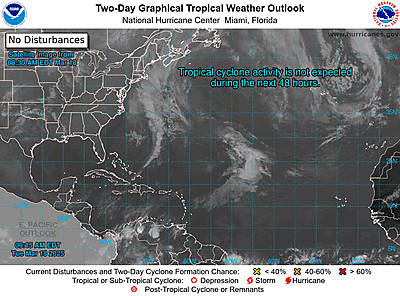
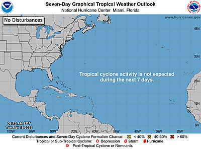
date: 2024-06-30, from: Graphical Tropical Weather Outlooks


https://www.nhc.noaa.gov/gtwo.php?basin=atlc
date: 2024-06-30, from: NOAA tornado/severe thunderstorm watches, mesoscale discussions, convective outlooks, fire weather outlooks

Day 2 Convective Outlook
NWS Storm Prediction Center Norman OK
1226 PM CDT Sun Jun 30 2024

Valid 011200Z - 021200Z

...THERE IS A SLIGHT RISK OF SEVERE THUNDERSTORMS OVER PARTS OF THE
CENTRAL AND NORTHERN PLAINS...

...SUMMARY...
Severe thunderstorms will be possible on Monday across the
northern/central Plains centered over Nebraska and South Dakota.
Areas of damaging winds and sporadic hail will be possible.

...Synopsis...
A broad upper trough will move into the northern and central Plains
on Monday, with a gradual weakening of the upper high over the
southern Plains. The strongest cooling aloft will occur over the
northern Plains, but gradual height falls will also develop over the
central Plains.

At the surface, a large area of high pressure will exist over the
Great Lakes, with a strengthening pressure gradient over the Plains
as low pressure develops over western NE/KS. A cold front will push
into the western Dakotas during the afternoon, with a warm front
lifting north across the mid MO Valley where a narrow plume of
higher dewpoints will exist.

...Central and northern Plains...
Early day elevated thunderstorms are likely over eastern KS and NE
within the warm advection regime, and this should generally weaken
as it lifts northeastward. Behind this activity, a plume of 70s F
dewpoints will spread northwestward into parts of central NE, while
strong heating and mixing develop across CO/western KS/western NE.
Lift will be maximized near the surface low, with clusters of storms
likely by late afternoon. Cellular activity may contain hail
initially before growing upscale into an MCS with damaging winds
increasingly possible as storms move toward the MO Valley. A cell or
two could produce a tornado near the warm front/hot plume interface
prior to storms growing upscale, as low-level shear along the warm
front will be favorable.

To the north and west, ascent with the upper trough will be
strongest from western NE into SD, with late afternoon storms
forming near the eastern WY border. Lengthy hodographs and steeper
midlevel lapse rates will favor hail, with damaging wind as well
developing eastward. Significant theta-e advection around 850 mb
will support both lift and destabilization with the late storms into
southwest MN and western IA.

..Jewell.. 06/30/2024
https://www.spc.noaa.gov/products/outlook/day2otlk_1730.html
date: 2024-06-30, from: Eastern Pacific Tropical Weather Outlook
000
ABPZ20 KNHC 301726
TWOEP
Tropical Weather Outlook
NWS National Hurricane Center Miami
FL
1100 AM PDT Sun Jun 30 2024
For the eastern North
Pacific…east of 140 degrees west longitude:
Offshore of
Southern Mexico:
A broad area of low pressure is expected to form
early this week a
few hundred miles south of the coast of
southern Mexico. Some
gradual development is possible, and a
tropical depression could
form around midweek while the system
moves west-northwestward
at 10 to 15 mph.
* Formation
chance through 48 hours…low…near 0 percent.
* Formation chance
through 7 days…medium…40 percent.
$$
Forecaster
Roberts
https://www.nhc.noaa.gov/gtwo.php?basin=epac
date: 2024-06-30, from: NOAA tornado/severe thunderstorm watches, mesoscale discussions, convective outlooks, fire weather outlooks

Day 1 Fire Weather Outlook
NWS Storm Prediction Center Norman OK
1150 AM CDT Sun Jun 30 2024

Valid 301700Z - 011200Z

...CRITICAL FIRE WEATHER AREA FOR PARTS OF EASTERN NV AND WESTERN
UT...

...17z Update...
The ISODRYT area was adjusted south and east for the latest hi-res
guidance. Isolated storms should develop late this afternoon with
little to no wetting rainfall over far northeast CA, southeast OR
and northern NV. A very isolated storm will remain possible over the
southern Cascades, though coverage is too limited for higher thunder
probabilities. Weak CAPE should support intermittent cloud to ground
lightning and the potential for ignitions through this evening.
Otherwise, minimal changes were made to the current outlook.
Critically dry and windy conditions are expected this afternoon over
the eastern Great Basin. See the previous discussion for more
information.

..Lyons.. 06/30/2024

.PREV DISCUSSION... /ISSUED 0157 AM CDT Sun Jun 30 2024/

...Synopsis...
An upper ridge will remain in place over the central CONUS as a
mid-level trough traverses the Interior west today. A surface
cyclone will become established across the Great Basin, with dry and
breezy conditions expected ahead of an approaching cold front during
the afternoon. Widespread 20+ mph sustained southwesterly surface
winds will coincide with 5-15 percent RH for much of the Great Basin
into the central Rockies. Critical highlights have been maintained
where these surface conditions will overlap with fuels that are most
favorable for supporting wildfire-spread potential.

Meanwhile, thunderstorms are expected to form immediately ahead of
the cold front across portions of the Pacific Northwest. These
storms are expected to be high-based since the boundary layer is
expected to mix up to at least 600 mb. With fuels drying across the
region, lightning strikes away from precipitation cores may support
ignitions, warranting the maintenance of isolated dry thunderstorm
highlights.

...Please see www.spc.noaa.gov/fire for graphic product...
https://www.spc.noaa.gov/products/fire_wx/fwdy1.html
date: 2024-06-30, from: NOAA tornado/severe thunderstorm watches, mesoscale discussions, convective outlooks, fire weather outlooks

Day 1 Convective Outlook
NWS Storm Prediction Center Norman OK
1130 AM CDT Sun Jun 30 2024

Valid 301630Z - 011200Z

...THERE IS AN ENHANCED RISK OF SEVERE THUNDERSTORMS ACROSS PARTS OF
SOUTHERN NEW ENGLAND AND THE EASTERN MID-ATLANTIC...

...THERE IS A SLIGHT RISK OF SEVERE THUNDERSTORMS ACROSS PARTS OF
THE NORTHERN HIGH PLAINS...

...SUMMARY...
Scattered to numerous damaging wind gusts are likely across parts of
the Northeast and Mid-Atlantic States this afternoon and evening.
Large hail and severe/damaging winds should also occur from southern
Montana into western North Dakota.

...Northeast/Mid-Atlantic into the Carolinas...
A mid-level trough over the Great Lakes and eastern Canada will
continue moving eastward through the period. An associated cold
front will likewise advance east-southeastward across New England
and much of the Mid-Atlantic through this evening. Based on area 12Z
soundings and recent surface observations, a very moist airmass is
in place ahead of the front, with surface dewpoints generally in the
low to mid 70s. Filtered daytime heating with broken cloud cover
will support weak to moderate instability through late this
afternoon, with most guidance continuing to suggest a narrow
corridor of 1000-2000 J/kg MLCAPE will be in place along/near the
I-95 corridor from southern New England to the eastern Mid-Atlantic.
Mid-level flow will increase through the day in tandem with the
upper trough, which will foster strong deep-layer shear and
organized convection.

Expectations are for thunderstorms to continue increasing in
coverage and intensity this afternoon, both along/ahead of the cold
front and a pre-frontal surface trough. Multiple rounds of intense
convection appear possible. Given a rather favorable thermodynamic
and kinematic parameter space, swaths of severe/damaging winds
generally 60-70 mph will likely occur as a mix of bowing line
segments/clusters and a few supercells sweep eastward through the
afternoon/evening. No changes have been made to the Enhanced Risk
across parts of southern New England into the Mid-Atlantic, where
the greatest concentration of damaging winds is still anticipated.
Isolated hail and perhaps a tornado may also occur with any
sustained supercell, although poor mid-level lapse rates and
modest/veered low-level flow should hinder both of these threats,
respectively. Deep-layer shear will be weaker with southward extent
across the Mid-Atlantic into the Carolinas. Convective mode should
also tend to be mainly multicellular across these regions. Even so,
steepened low-level lapse rates and ample instability should support
a threat for scattered damaging winds as thunderstorms develop and
spread eastward to the Atlantic Coast this afternoon/evening.

...Northern/Central High Plains...
A mid-level shortwave trough evident over the Northwest this morning
will progress eastward across the northern Rockies and adjacent High
Plains through tonight. A surface lee cyclone is forecast to deepen
and consolidate over northern WY/southeast MT by this evening, as
large-scale ascent preceding the upper trough overspreads the
northern High Plains. Even though low-level moisture is expected to
remain rather limited across this area, steep lapse rates and
daytime heating will contribute to at least weak instability
developing by late afternoon. Moderate to strong deep-layer shear
will support updraft organization. Cellular convection that
initially develops over the higher terrain of southwest MT and
vicinity should quickly grow upscale into a small bowing cluster as
it moves east-northeastward across central/eastern MT this evening.
Large hail may occur initially, but a transition to mainly a
severe/damaging wind threat appears likely as this mode transition
occurs. Isolated significant severe wind gusts (75-80 mph) appear
possible given the very steep/favorable low/mid-level lapse rates
expected. This wind threat may continue into parts of western ND and
vicinity tonight before convection eventually weakens.

Farther south, isolated to scattered thunderstorms should develop
along/east of the higher terrain from WY into CO. Various NAM/RAP
forecast soundings across this area show favorable shear for
organized convection, including the potential for a mix of
multicells and perhaps a couple of supercells. The southern fringe
of the stronger mid-level flow and the northwest edge of the
monsoonal moisture may overlap enough in western CO to support an
isolated threat for severe wind gusts.

...Arizona...
Low/mid-level moisture should gradually increase through the period
on the western periphery of a mid/upper-level high centered over the
southern Plains. Diurnal heating in the wake of overnight convection
should occur across the higher terrain of eastern/southeast AZ
through this afternoon, which will aid in the development of weak to
moderate instability. Expectations are for thunderstorms to
initially form over the higher terrain, and then slowly westward
late this afternoon and evening in response to around 15-20 kt of
east-southeasterly mid-level flow. A very well mixed boundary layer,
with steep lapse rates through much of the troposphere, should
support a threat for isolated strong to severe wind gusts with this
high-based convection.

..Gleason/Thornton.. 06/30/2024
https://www.spc.noaa.gov/products/outlook/day1otlk_1630.html