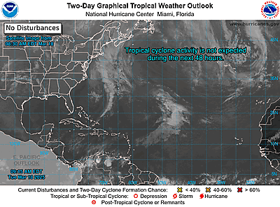
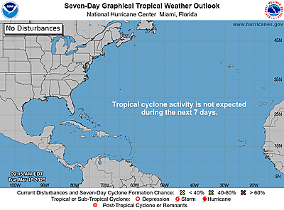
(date: 2024-08-11 10:17:33)
date: 2024-08-11, from: Eastern Pacific Basin GIS Data
No tropical cyclones as of Sun, 11 Aug 2024 17:15:03 GMT
date: 2024-08-11, from: NOAA tornado/severe thunderstorm watches, mesoscale discussions, convective outlooks, fire weather outlooks

Day 1 Fire Weather Outlook
NWS Storm Prediction Center Norman OK
1113 AM CDT Sun Aug 11 2024

Valid 111700Z - 121200Z

...NO CRITICAL AREAS...

A pair of isolated dry-thunderstorm risk areas have been introduced
for this morning's forecast update. 12 UTC soundings from BOI and
OTX sampled relatively dry low-level conditions and PWAT values
similar to previous days that have seen a mixture of wet and dry
thunderstorms. MRMS rainfall estimates and surface observations
suggest that most locations have not received wetting rainfall over
the past 48 hours with several lightning-caused fire starts have
been reported during this period. Morning HREF guidance shows a
signal for isolated convection this afternoon and early Tuesday
morning with favorable thermodynamic profiles in place for a mixture
of wet/dry thunderstorms. Given recent observations, the model
signals, and antecedent fuel conditions, risk highlights appear
warranted.

Localized elevated conditions remain likely across west-central NV
in the immediate lee of the northern Sierra Nevada as well as across
portions of eastern NV. However, such conditions are expected to
remain sufficiently localized to preclude highlights.

..Moore.. 08/11/2024

.PREV DISCUSSION... /ISSUED 1255 AM CDT Sun Aug 11 2024/

...Synopsis...
A belt of stronger mid-level winds will be present on the poleward
side of a flattened upper-level ridge in the southern U.S. With
time, a shortwave trough will amplify and move into northern
California and the northwest Great Basin. At the surface, the
pressure pattern will be rather disorganized until stronger pressure
falls occur in the Northwest late in the period.

Fire weather concerns are expected to be low for most areas today.
Some locally elevated conditions are possible in parts of
central/northern Nevada. RH will likely be in the 10-15% range, but
winds will be light. The potential for thunderstorms over
sufficiently dry fuels is also too low for highlights.

...Please see www.spc.noaa.gov/fire for graphic product...
https://www.spc.noaa.gov/products/fire_wx/fwdy1.html
date: 2024-08-11, from: NOAA tornado/severe thunderstorm watches, mesoscale discussions, convective outlooks, fire weather outlooks
No watches are valid as of Sun Aug 11 16:15:02 UTC 2024.
https://www.spc.noaa.gov/products/watch/
date: 2024-08-11, from: NOAA tornado/severe thunderstorm watches, mesoscale discussions, convective outlooks, fire weather outlooks
No Mesoscale Discussions are in effect as of Sun Aug 11 16:15:02 UTC 2024.
https://www.spc.noaa.gov/products/md/
date: 2024-08-11, from: NOAA tornado/severe thunderstorm watches, mesoscale discussions, convective outlooks, fire weather outlooks

Day 1 Convective Outlook
NWS Storm Prediction Center Norman OK
0742 AM CDT Sun Aug 11 2024

Valid 111300Z - 121200Z

...THERE IS A SLIGHT RISK OF SEVERE THUNDERSTORMS FOR WESTERN
NEBRASKA INTO NORTHEAST COLORADO AND NORTHWEST KANSAS...

...SUMMARY...
Scattered severe thunderstorms are possible across parts of the
central High Plains this afternoon into the early evening.

...Central High Plains to Black Hills...
Water-vapor imagery shows a potent mid-level shortwave trough moving
east across southern MT/WY this morning.  This upper feature is
forecast to reach the Black Hills by early to mid afternoon and
subsequently move into the IA/MO vicinity by early Monday morning.
At the surface, dominant high pressure will hold across the mid MS
Valley such that southeasterly low-level trajectories will be
maintained across the central High Plains.

Morning raob data over the lower MO Valley into eastern NE/KS
sampled a relatively cool/stable continental airmass.  Appreciable
destabilization will occur in the vicinity of a lee trough where
stronger heating is forecast today.  Some isolated thunderstorms
will likely shift eastward from MT/WY into the SD/NE Panhandle
vicinity by early afternoon with additional storm development likely
as stronger large-scale ascent impinges on the instability axis over
the High Plains.  Forecast soundings show long, straight hodographs
which will promote supercellular organization with the stronger
updrafts.  Widely scattered to scattered storms are possible from
the Black Hills southward into eastern CO/northwest KS.  Large hail
and severe gusts will be the primary hazards with the stronger
storms before this activity moves east and/or weakens by mid evening
related to the loss of heating.

...Raton Mesa east into the TX Panhandle and western OK...
A reservoir of greater moisture/buoyancy will exist with east extent
as a modifying outflow boundary becomes draped across the region
this afternoon in wake of morning storms over central OK.  An MCV
noted in radar imagery this morning will move east across northern
OK through the early afternoon with implied subsidence in its wake.
Little in the way of large-scale forcing for ascent will contribute
to suppressing convective development through mid afternoon.
However, heating over the Raton Mesa and TX Panhandle may foster
isolated storms late this afternoon into the early evening.  More
uncertain is if a couple of storms can develop farther east into OK
where large buoyancy (3000+ J/kg MLCAPE) is forecast with a weak
cap.  Model guidance varies considerably (as expected with a wide
array of potential solutions) but mesoscale trends will be monitored
for the possible inclusion of low-severe probabilities if
uncertainty decreases.

..Smith/Jewell.. 08/11/2024
https://www.spc.noaa.gov/products/outlook/day1otlk_1300.html
date: 2024-08-11, from: Central Pacific Tropical Weather Outlook
567
ACPN50 PHFO 111136
TWOCP
Tropical Weather Outlook
NWS Central Pacific Hurricane Center
Honolulu HI
200 AM HST Sun Aug 11 2024
For the
central North Pacific…between 140W and 180W:
No tropical
cyclones are expected through the next 7 days.
$$
Forecaster Almanza
https://www.nhc.noaa.gov/gtwo.php?basin=cpac
date: 2024-08-11, from: Central Pacific Basin Tropical Cyclones
No tropical cyclones as of Sun, 11 Aug 2024 17:15:03 GMT
date: 2024-08-11, from: Eastern Pacific Tropical Weather Outlook
000
ABPZ20 KNHC 111130
TWOEP
Tropical Weather Outlook
NWS National Hurricane Center Miami
FL
500 AM PDT Sun Aug 11 2024
For the eastern North
Pacific…east of 140 degrees west longitude:
South of
Southwestern Mexico (EP98):
Showers and thunderstorms have
decreased since yesterday in
association with a trough of low
pressure located a couple hundred
miles off the coast of
southwestern Mexico. The disturbance will be
moving into a much
less favorable environment by tonight as it
continues moving
west-northwestward around 15 mph, and formation
chances are
decreasing. Regardless of development, this system could
bring
some heavy rain to portions of coastal southwestern Mexico
during
the next day or so.
* Formation chance through 48 hours…low…10
percent.
* Formation chance through 7 days…low…10 percent.
$$
Forecaster Hagen/Cangialosi
https://www.nhc.noaa.gov/gtwo.php?basin=epac
date: 2024-08-11, from: Graphical Tropical Weather Outlooks


https://www.nhc.noaa.gov/gtwo.php?basin=atlc
date: 2024-08-11, from: NOAA tornado/severe thunderstorm watches, mesoscale discussions, convective outlooks, fire weather outlooks

Day 1 Convective Outlook
NWS Storm Prediction Center Norman OK
0732 PM CDT Sat Aug 10 2024

Valid 110100Z - 111200Z

...THERE IS A MARGINAL RISK OF SEVERE THUNDERSTORMS ACROSS THE
INTERMOUNTAIN WEST INTO THE HIGH PLAINS...

...SUMMARY...
Isolated severe thunderstorms, capable of localized severe gusts and
perhaps hail, remain possible this evening over parts of the
Intermountain West and into the High Plains.

...01z Update...

Mid-level short-wave trough is advancing east across the northern
intermountain region early this evening. This feature is beginning
to flatten the ridge over western WY and scattered convection has
responded downstream where boundary-layer heating is maximized. 00z
sounding from SLC exhibits near dry adiabatic lapse rate in the
lowest 4km, and modest deep-layer shear; although, PW values are not
particularly high with values around one inch. Latest diagnostic
data suggests pockets of MLCAPE around 500 J/kg extend from southern
MT into eastern CO where considerably more buoyancy exists,
especially across southeast CO into the northern TX Panhandle.
Several gusts have exceeded 50kt with convection late this afternoon
and this remains the primary concern for the next several hours.
After sunset, boundary-layer cooling should hinder convective gusts
as 0-3km lapse rates weaken.

..Darrow.. 08/11/2024
https://www.spc.noaa.gov/products/outlook/day1otlk_0100.html