(date: 2024-08-25 12:09:50)
date: 2024-08-25, from: NOAA tornado/severe thunderstorm watches, mesoscale discussions, convective outlooks, fire weather outlooks
No watches are valid as of Sun Aug 25 18:31:01 UTC 2024.
https://www.spc.noaa.gov/products/watch/
date: 2024-08-25, from: NOAA tornado/severe thunderstorm watches, mesoscale discussions, convective outlooks, fire weather outlooks
No Mesoscale Discussions are in effect as of Sun Aug 25 18:31:01 UTC 2024.
https://www.spc.noaa.gov/products/md/
date: 2024-08-25, from: Central Pacific Basin Tropical Cyclones

5-Day Uncertainty Track last
updated Sun, 25 Aug 2024 18:22:39 GMT

Wind Speed Probabilities last
updated Sun, 25 Aug 2024 15:39:04 GMT
https://www.nhc.noaa.gov/refresh/graphics_cp1+shtml/182239.shtml?cone
date: 2024-08-25, from: Central Pacific Basin Tropical Cyclones
000
WTPA31 PHFO 251758
TCPCP1

BULLETIN
Hurricane Hone Intermediate Advisory Number 13A
NWS Central Pacific Hurricane Center Honolulu HI   CP012024
800 AM HST Sun Aug 25 2024

...HONE GRADUALLY MOVING AWAY FROM THE BIG ISLAND BUT CONTINUES
TO BRING GUSTY WINDS AND WIDESPREAD RAINFALL...


SUMMARY OF 800 AM HST...1800 UTC...INFORMATION
----------------------------------------------
LOCATION...18.5N 156.6W
ABOUT 90 MI...145 KM SSW OF KONA HAWAII
ABOUT 210 MI...340 KM SSE OF HONOLULU HAWAII
MAXIMUM SUSTAINED WINDS...85 MPH...140 KM/H
PRESENT MOVEMENT...W OR 280 DEGREES AT 8 MPH...13 KM/H
MINIMUM CENTRAL PRESSURE...990 MB...29.23 INCHES


WATCHES AND WARNINGS
--------------------
CHANGES WITH THIS ADVISORY:

None.

SUMMARY OF WATCHES AND WARNINGS IN EFFECT:

A Tropical Storm Warning remains in effect for...
* Hawaii County

A Tropical Storm Warning means that tropical storm conditions are
expected somewhere within the warning area.

Interests elsewhere in Hawaii should monitor the progress of Hone.

For storm information specific to your area, please monitor
products issued by the National Weather Service office in
Honolulu Hawaii.


DISCUSSION AND OUTLOOK
----------------------
At 800 AM HST (1800 UTC), the center of Hurricane Hone was located
by Air Force Reserve Hurricane Hunter aircraft near latitude 18.5
North, longitude 156.6 West. Hone is moving toward the west near 8
mph (13 km/h). This general motion is expected to continue the next
couple of days, with some increase in forward speed.

Maximum sustained winds are near 85 mph (140 km/h) with higher
gusts. Hone is expected to gradually weaken the next couple of
days.

Hurricane-force winds extend outward up to 25 miles (35 km) from
the center and tropical-storm-force winds extend outward up to 115
miles (185 km).

The estimated minimum central pressure is 990 mb (29.23 inches).


HAZARDS AFFECTING LAND
----------------------
Key messages for Tropical Storm Hone can be found in the Tropical
Cyclone Discussion under AWIPS header TCDCP1 and WMO header WTPA41
PHFO, and on the web at hurricanes.gov/text/HFOTCDCP1.shtml.

WIND: Tropical Storm conditions will continue on the Big Island
through the morning hours. Winds are expected to be strongest
downslope of higher terrain, over headlands, and through passes.

RAINFALL: Hone is expected to produce an additional 3 to 6 inches
of rainfall over mainly southeast and south facing slopes of the
Big Island. Additional rainfall of 1 to 3 inches will be possible
over the smaller islands, mainly windward.

SURF: Swells generated by Hone are affecting portions of the
Hawaiian islands, producing life-threatening surf and rip
current conditions.


NEXT ADVISORY
-------------
Next complete advisory at 1100 AM HST.

$$
Forecaster Birchard
https://www.nhc.noaa.gov/text/refresh/HFOTCPCP1+shtml/251758.shtml
date: 2024-08-25, from: Graphical Tropical Weather Outlooks
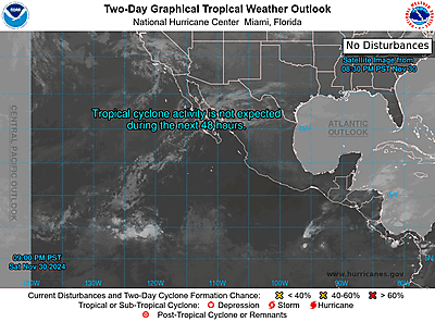
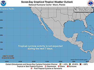
https://www.nhc.noaa.gov/gtwo.php?basin=epac
date: 2024-08-25, from: Graphical Tropical Weather Outlooks
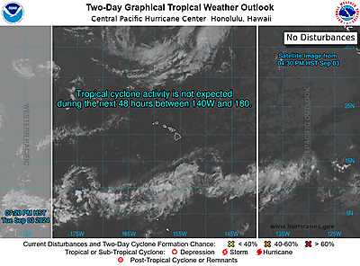
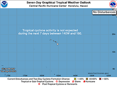
ZCZC HFOTWOCP ALL
TTAA00 PHFO DDHHMM
Tropical Weather Outlook
NWS Central Pacific Hurricane Center
Honolulu HI
800 AM HST Sun Aug 25 2024
For the
central North Pacific…between 140W and 180W:
Active
Systems:
The Central Pacific Hurricane Center in Honolulu, Hawaii
is issuing
advisories on Hurricane Hone. This system is located
about 100
miles southwest of Hilo, Hawaii, or about 250 miles
south southeast
of Honolulu, Hawaii, moving west around 8 mph.
Interests in Hawaii
should closely monitor this system.
The National Hurricane Center in Miami, Florida is issuing
advisories on Hurricane Gilma, located about midway between the
southern tip of the Baja California peninsula and the Hawaiian
Islands. Gilma is expected to move into the Central Pacific
Hurricane Center’s area of responsibility Monday night or early
Tuesday morning.
Elsewhere, no tropical cyclones are
expected during the next 7 days.
&&
Public
advisories on Hurricane Hone are issued under WMO
header WTPA31
PHFO and under AWIPS header HFOTCPCP1. Forecast
advisories on
Hurricane Hone are issued under WMO header
WTPA11 PHFO and under
AWIPS header HFOTCMCP1.
Public advisories on Hurricane
Gilma are issued under WMO
header WTPZ32 KNHC and under AWIPS
header MIATCPEP2. Forecast
advisories on Hurricane Gilma are
issued under WMO header
WTPZ22 KNHC and under AWIPS header
MIATCMEP2.
$$
Forecaster Vaughan
NNNN
https://www.nhc.noaa.gov/gtwo.php?basin=cpac
date: 2024-08-25, from: NOAA tornado/severe thunderstorm watches, mesoscale discussions, convective outlooks, fire weather outlooks
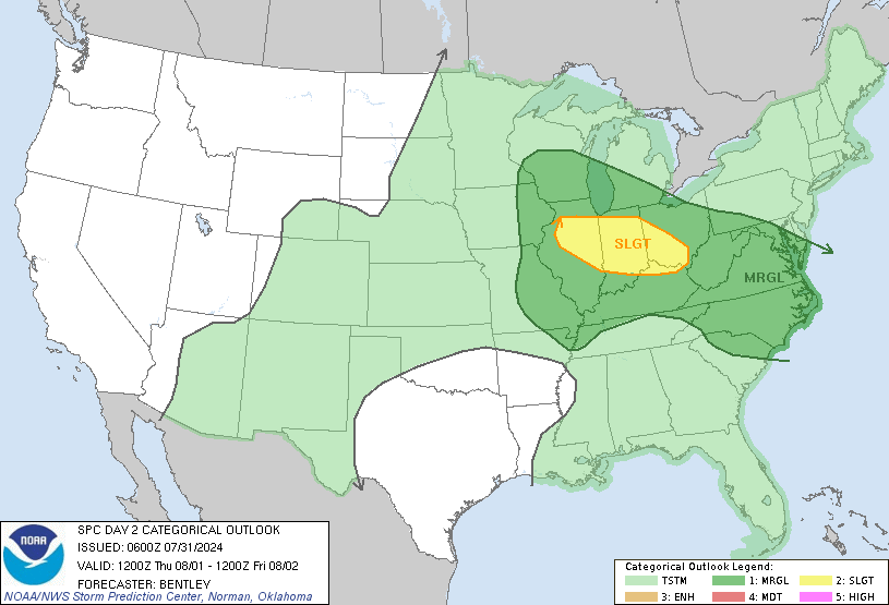
Day 2 Convective Outlook
NWS Storm Prediction Center Norman OK
1225 PM CDT Sun Aug 25 2024

Valid 261200Z - 271200Z

...THERE IS AN ENHANCED RISK OF SEVERE THUNDERSTORMS OVER PORTIONS
OF FAR NORTHERN NEBRASKA...EXTREME NORTHWEST IOWA...EASTERN SOUTH
DAKOTA...SOUTHERN/CENTRAL MINNESOTA...AND FAR WESTERN WISCONSIN...

...THERE IS A SLIGHT RISK OF SEVERE THUNDERSTORMS OVER PORTIONS OF
SOUTHERN NEW ENGLAND...

...SUMMARY...
Severe storms are expected to evolve within a zone extending from
the northern/central High Plains eastward to Wisconsin Monday
afternoon into the nighttime hours. Large to very large hail, and
swaths of severe, potentially damaging, gusts are expected,
especially across South Dakota into Minnesota.  A few severe storms
producing strong gusts and hail are also expected across southern
New England.

...South Dakota into MN/WI and vicinity...

An upper shortwave trough will develop east/northeast from the
Intermountain West to the Dakotas on Monday. This will flatten the
upper ridge over the Upper Midwest and a belt of enhanced
southwesterly mid/upper flow (50-60 kt at 500 mb) will overspread
the region. By late afternoon, 700 mb flow is expected to increase
to around 40-50 kt. Vertical wind profiles, and effective shear
magnitudes increasing to greater than 40 kt, will support supercell
thunderstorms.

At the surface, a cold front will extend from northern MN
southwestward into western SD during the morning. The front will
develop southeast through the day and into the evening, becoming
positioned from western WI/IA to the NE/KS border by Tuesday
morning. Ahead of the front, a very moist airmass (upper 60s to mid
70s F dewpoints) will be in place across portions of MN/WI/IA and
eastern SD, while a dryslot will be oriented over NE nosing into far
southeast SD/western IA. With increasing ascent through the day, and
persistent low-level warm advection, MLCIN should gradually erode.
MLCAPE values across warm/moist sector are forecast as high as
3000-5000 J/kg, decreasing with southwest extent into the drier
airmass. Steep midlevel lapse rates will within the strong to
extremely unstable airmass will support robust updrafts, and initial
supercell thunderstorms are expected to develop along the cold front
from SD into MN. Large to very large (isolated stones greater than 2
inches diameter) will be possible. While damaging gusts will also be
possible with cellular activity, one or more bowing segments/MCSs
are expected to develop into the evening hours as convection shifts
northeast across eastern SD/MN and eventually WI. As this occurs,
potential for severe/damaging wind swaths will increase and a few
gusts greater than 65 kt/75 mph are possible. Tornado potential is a
bit more uncertain, but would likely be locally increased near and
east of the surface low where low-level flow will remain more
southeasterly. This will enhance low-level SRH and frontal
convergence and a few tornadoes are possible with either supercells
or within mesovortex formation along bowing segments.

...Northern/Central High Plains...

Within the drier boundary-layer across southeast MT/eastern WY
southward into eastern CO/western KS/western NE, scattered
thunderstorms are expected to develop as the main upper trough
overspreads the area during the afternoon. High-based thunderstorms
amid steep low-level lapse rates will pose a risk for
strong/isolated severe outflow winds. Isolated large hail also is
possible, mainly from eastern WY into western SD/NE.

...New England and portions of the Upper OH Valley/Mid-Atlantic...

Modestly enhanced deep-layer northwesterly flow on the back side of
an upper trough will overspread the region. Pockets of 60 F
dewpoints and cool temperatures aloft will support modest
destabilization during the afternoon and thunderstorm bands/clusters
are expected. Locally strong gusts will be possible with the
activity. Isolated large hail also may be possible, especially over
southern New England where forecast hodographs show more favorable
vertical shear and elongated/straight hodographs.

..Leitman.. 08/25/2024
https://www.spc.noaa.gov/products/outlook/day2otlk_1730.html
date: 2024-08-25, from: NOAA tornado/severe thunderstorm watches, mesoscale discussions, convective outlooks, fire weather outlooks
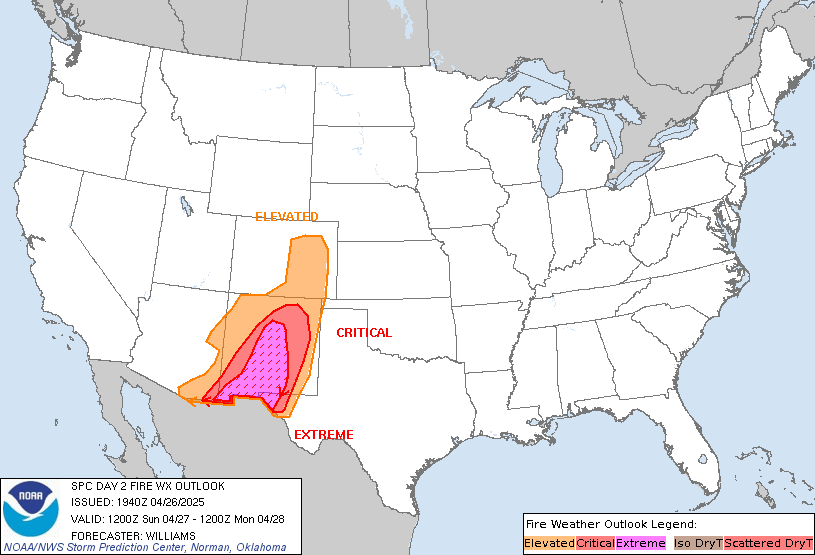
Day 2 Fire Weather Outlook
NWS Storm Prediction Center Norman OK
1211 PM CDT Sun Aug 25 2024

Valid 261200Z - 271200Z

...NO CRITICAL AREAS...

The previous forecast reasoning (see below) remains the same, and no
changes were needed with this update.

..Weinman.. 08/25/2024

.PREV DISCUSSION... /ISSUED 0142 AM CDT Sun Aug 25 2024/

...Synopsis...
A mid/upper-level trough is forecast to shift from the Northern
Rockies into the Northern Plains Day 2/Monday. As this occurs,
enhanced deep-layer flow is forecast to overspread portions of
Wyoming near the base of the aforementioned trough, which will
promote dry and breezy conditions. While locally elevated fire
weather conditions are probable -- mainly during the afternoon with
boundary-layer mixing -- fire weather conditions appear too
spotty/brief to introduce an Elevated area at this time.

...Please see www.spc.noaa.gov/fire for graphic product...
https://www.spc.noaa.gov/products/fire_wx/fwdy2.html
date: 2024-08-25, from: Graphical Tropical Weather Outlooks
https://www.nhc.noaa.gov/gtwo.php?basin=atlc
date: 2024-08-25, from: NOAA tornado/severe thunderstorm watches, mesoscale discussions, convective outlooks, fire weather outlooks
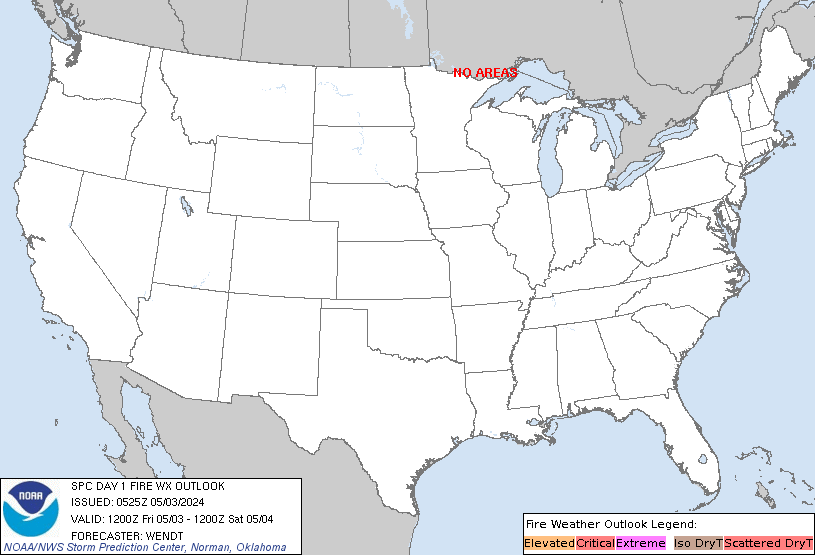
Day 1 Fire Weather Outlook
NWS Storm Prediction Center Norman OK
1156 AM CDT Sun Aug 25 2024

Valid 251700Z - 261200Z

Based on the latest observational data and high-resolution guidance,
an Elevated area was added over portions of southwest/central Utah
with this update. Here, breezy southwesterly surface winds
(sustained 20-25 mph) will overlap 15-20 percent RH ahead of a cold
front this afternoon. Despite slightly cooler temperatures and
higher RH than previous days, the breezy/gusty winds amid a couple
ongoing fire incidents warrant the highlights. Elsewhere, the
previous forecast (see below) remains on track.

..Weinman.. 08/25/2024

.PREV DISCUSSION... /ISSUED 0138 AM CDT Sun Aug 25 2024/

...Synopsis...
A mid/upper-level trough is forecast to gradually shift from the
Northern Great Basin into the Northern Rockies through tonight.
Ascent associated with the trough should foster isolated to widely
scattered thunderstorms this afternoon/evening across portions of
Idaho, Wyoming, Montana, and Nevada. While a mix of wet/dry
thunderstorms is expected, fast-moving thunderstorms atop receptive
fuels may promote new ignitions, especially along the periphery of
any heavier thunderstorm precipitation cores. In addition, gusty and
erratic outflow winds are possible with the strongest storms. Please
see the SPC Day 1 Convective Outlook for more information on the
nearby severe thunderstorm risk across portions of Wyoming.

...Please see www.spc.noaa.gov/fire for graphic product...
https://www.spc.noaa.gov/products/fire_wx/fwdy1.html
date: 2024-08-25, from: NOAA tornado/severe thunderstorm watches, mesoscale discussions, convective outlooks, fire weather outlooks

Day 1 Convective Outlook CORR 1
NWS Storm Prediction Center Norman OK
1138 AM CDT Sun Aug 25 2024

Valid 251630Z - 261200Z

...THERE IS A SLIGHT RISK OF SEVERE THUNDERSTORMS ACROSS THE
NORTHERN PLAINS/UPPER MIDWEST AND CENTRAL ROCKIES...

CORRECTED FOR NDFD THUNDER

...SUMMARY...
Severe wind gusts and hail are most probable today over parts of the
Four Corners to southwestern Wyoming, and this evening over portions
of the eastern Dakotas and western Minnesota.

...Northern Plains/Upper Midwest...
Scattered thunderstorms are expected to develop along/ahead of the
cold front and near a South Dakota surface wave, primarily this
evening after 00Z/7pm CDT, although enough moistening and heating
may occur for isolated late-afternoon development. Some supercells
and bowing lines/clusters are expected, with large hail and severe
wind gusts possible.

Intensifying thunderstorm development should occur as the front
encounters what is left of a diurnally well-heated and
still-unstable boundary-layer airmass. Forecast soundings indicate
the moist layer should deepen through the day beneath strong capping
and steep mid-level lapse rates, MLCAPE in the 3000-4000 J/kg range
possible. This will occur with gradually strengthening
west-southwesterly winds aloft with 30-45 kt effective shear.

Additional severe storms may occur late this afternoon into evening
within an evolving post-frontal environment across northeast Wyoming
into northwest South Dakota/southwest North Dakota, with moderate
buoyancy and very long/straight hodographs potentially supporting
storms capable of hail and possibly severe-caliber wind gusts.

...Central/southern Rockies...
Scattered thunderstorms are ongoing early today across eastern Utah
and western Colorado in advance of an upper-level trough centered
over Nevada. A greater coverage and intensity of storms should occur
into the afternoon as the boundary layer further warms/destabilizes.
Relatively strong mid/high-level southwesterlies will support ample
deep-layer/effective shear, with supercells and bowing clusters
possible in a corridor spanning portions of the Four Corners area to
northern Colorado/southwest Wyoming. Elongated and semi-straight
hodographs will support large-hail potential aside from a broader
regional risk for severe-caliber wind gusts.

...South-central High Plains...
Scattered slow-moving thunderstorms are expected this afternoon
particularly across eastern Colorado and northeast New Mexico.
Hot/well-mixed boundary layers within the pre-convective environment
will support the possibility of strong to locally severe-caliber
wind gusts through late afternoon until around sunset.

..Guyer/Wendt.. 08/25/2024
https://www.spc.noaa.gov/products/outlook/day1otlk_1630.html
date: 2024-08-25, from: NOAA tornado/severe thunderstorm watches, mesoscale discussions, convective outlooks, fire weather outlooks

Mesoscale Discussion 1987
NWS Storm Prediction Center Norman OK
1127 AM CDT Sun Aug 25 2024

Areas affected...parts of eastern Utah...adjacent northwestern
Colorado and southwestern Wyoming

Concerning...Severe potential...Watch possible

Valid 251627Z - 251830Z

Probability of Watch Issuance...40 percent

SUMMARY...Intensifying renewed thunderstorm development is possible
across much of eastern Utah by 1-2 PM MDT.  Widely scattered
stronger storms may pose a risk for severe hail and wind while
spreading northeastward and eastward through late afternoon.  While
it is still not yet certain that a severe weather watch will be
needed, trends are being monitored for this possibility.

DISCUSSION...Downstream of a seasonably vigorous short wave trough
slowly progressing east-northeastward through the Great Basin, a
narrow band of large-scale ascent continues to gradually spread east
of the Wasatch.  This is in the wake of initial low-level warm
advection driven convection now spreading spreading northeastward
through the Colorado and adjacent Wyoming Rockies, with insolation
across a relatively moist boundary layer over much of eastern Utah
contributing to increasing destabilization.

Through 18-20Z, models suggest that mixed-layer CAPE may increase to
500-1000 J/kg, coincident with further strengthening of south to
southwesterly mid/upper wind fields (including 30-70+ kt in the
700-300 mb layer).  As new thunderstorm development begins to
initiate, it appears that this regime will become potentially
conducive to evolution of isolated supercells.  In addition to
posing a risk for large hail, stronger storms may become capable of
producing locally severe wind gusts, particularly as they spread
across the more strongly heated and deeply mixed lower elevations
through late afternoon.

..Kerr/Guyer.. 08/25/2024

...Please see www.spc.noaa.gov for graphic product...

ATTN...WFO...RIW...GJT...SLC...

LAT...LON   40631059 41650798 40220842 38420926 37600986 37181085
            37551144 39331088 40631059
https://www.spc.noaa.gov/products/md/md1987.html
date: 2024-08-25, from: Central Pacific Basin Tropical Cyclones
000
WTPA61 PHFO 251630
TCUCP1

Hurricane Hone Tropical Cyclone Update
NWS Central Pacific Hurricane Center Honolulu HI   CP012024
630 AM HST Sun Aug 25 2024

...HURRICANE HONE CONTINUES TO LASH THE BIG ISLAND...

SUMMARY OF 600 AM HST...1600 UTC...INFORMATION
----------------------------------------------
ABOUT 95 MI...150 KM S OF KAILUA-KONA HAWAII
MAXIMUM SUSTAINED WINDS...85 MPH...140 KM/H
PRESENT MOVEMENT...W OR 280 DEGREES AT 8 MPH...13 KM/H
MINIMUM CENTRAL PRESSURE...988 MB...29.18 INCHES

$$

Forecaster Birchard
https://www.nhc.noaa.gov/text/refresh/HFOTCUCP1+shtml/251630.shtml
date: 2024-08-25, from: Central Pacific Basin Tropical Cyclones

5-Day Uncertainty Track last
updated Sun, 25 Aug 2024 15:36:41 GMT

Wind Speed Probabilities last
updated Sun, 25 Aug 2024 15:39:04 GMT
https://www.nhc.noaa.gov/refresh/graphics_cp1+shtml/153641.shtml?cone
date: 2024-08-25, from: Eastern Pacific Basin GIS Data
Shapefile last updated Sun, 25 Aug 2024 15:23:15 GMT
https://www.nhc.noaa.gov/gis/forecast/archive/wsp_120hrhalfDeg_latest.zip
date: 2024-08-25, from: Eastern Pacific Basin GIS Data
KMZ last updated Sun, 25 Aug 2024 14:47:54 GMT
https://www.nhc.noaa.gov/storm_graphics/api/EP072024_030adv_TRACK.kmz
date: 2024-08-25, from: Eastern Pacific Basin GIS Data
Initial and Forecast Surface Winds. Shapefile last updated Sun, 25 Aug 2024 14:47:21 GMT
https://www.nhc.noaa.gov/gis/forecast/archive/ep072024_fcst_030.zip
date: 2024-08-25, from: Eastern Pacific Basin GIS Data
KMZ last updated Sun, 25 Aug 2024 14:47:08 GMT
https://www.nhc.noaa.gov/storm_graphics/api/EP072024_030adv_CONE.kmz
date: 2024-08-25, from: Eastern Pacific Basin GIS Data
Track, Points, and Wind Swath. Shapefile last updated Sun, 25 Aug 2024 14:47:02 GMT
https://www.nhc.noaa.gov/gis/best_track/ep072024_best_track.zip
date: 2024-08-25, from: Eastern Pacific Basin GIS Data
KMZ last updated Sun, 25 Aug 2024 14:47:02 GMT
https://www.nhc.noaa.gov/gis/best_track/ep072024_best_track.kmz
date: 2024-08-25, from: Eastern Pacific Basin GIS Data
Forecast Track, Cone of Uncertainty, Watches/Warnings. Shapefile last updated Sun, 25 Aug 2024 14:46:55 GMT
https://www.nhc.noaa.gov/gis/forecast/archive/ep072024_5day_030.zip
date: 2024-08-25, from: Eastern Pacific Basin Tropical Cyclones

5-Day Uncertainty Track last
updated Sun, 25 Aug 2024 14:46:32 GMT

Wind Speed Probabilities last
updated Sun, 25 Aug 2024 15:28:55 GMT
https://www.nhc.noaa.gov/refresh/graphics_ep2+shtml/144632.shtml?cone
date: 2024-08-25, from: Eastern Pacific Basin Tropical Cyclones
000
WTPZ42 KNHC 251445
TCDEP2

Hurricane Gilma Discussion Number  30
NWS National Hurricane Center Miami FL       EP072024
500 AM HST Sun Aug 25 2024

Over the last 6 hours, Gilma's eye has continued to be present on
most of the infrared and proxy vis images. However, the eye has
become a bit more cloud-filled, and the convection over the
southwestern eyewall is slightly less robust. Although the CI
numbers from TAFB and SAB are still T-6.0/115 kt, the respective
Final T numbers are lower than that. Recent UW-CIMSS objective
intensity estimates range from 84 to 113 kt. Based on a blend of the
subjective and objective intensity estimates, the initial intensity
is nudged down slightly to 110 kt for this advisory.

Gilma is currently moving very near the 26C isotherm and is located
in an environment of low vertical wind shear. The middle troposphere
is fairly dry in the environment surrounding Gilma, but the cyclone
has been able to prevent the dry air from entraining into the center
enough to significantly disrupt the hurricane. The environmental
conditions are not forecast to become more conducive for
strengthening. Westerly vertical wind shear is forecast to increase
slightly by late tonight or early Monday. SSTs should decrease
slightly along the path of Gilma by late Monday or Monday night.
Based on these factors, only slow weakening is forecast for the next
24 h followed by more steady weakening after that. The confidence in
the intensity forecast seems slightly below average in the
short-term while Gilma straddles the 26C SST isotherm and remains in
relatively low shear. In the 24 to 96 h time frame, Gilma should be
weakening, but the rate at which it weakens is a bit uncertain. By
day 4, vertical wind shear increases to moderate to strong, making
it likely that Gilma should be significantly weaker in the 4- to
5-day time frame. Gilma is forecast to lose its convection and
become a remnant low by day 5. The NHC intensity forecast is similar
to the previous one, perhaps showing a slightly slower rate of
weakening in the 36-72 h period, closer to the latest intensity
consensus guidance.

Gilma's initial motion is estimated to be westward, or 275/8 kt. A
strengthening mid-tropospheric subtropical ridge situated to the
north of the hurricane should steer Gilma on a westward to
west-northwestward track through the forecast period. The official
forecast is nearly unchanged from the previous advisory and is close
to a blend of the TVCE and GFEX.


FORECAST POSITIONS AND MAX WINDS

INIT  25/1500Z 18.0N 133.5W  110 KT 125 MPH
 12H  26/0000Z 18.1N 134.8W  105 KT 120 MPH
 24H  26/1200Z 18.3N 136.5W   95 KT 110 MPH
 36H  27/0000Z 18.5N 138.3W   85 KT 100 MPH
 48H  27/1200Z 18.7N 140.1W   75 KT  85 MPH
 60H  28/0000Z 18.9N 142.0W   65 KT  75 MPH
 72H  28/1200Z 19.2N 143.8W   55 KT  65 MPH
 96H  29/1200Z 20.0N 147.4W   40 KT  45 MPH
120H  30/1200Z 20.6N 151.0W   30 KT  35 MPH...POST-TROP/REMNT LOW

$$
Forecaster Hagen/Pasch
https://www.nhc.noaa.gov/text/refresh/MIATCDEP2+shtml/251445.shtml
date: 2024-08-25, from: Eastern Pacific Basin Tropical Cyclones
653
FOPZ12 KNHC 251444
PWSEP2

HURRICANE GILMA WIND SPEED PROBABILITIES NUMBER  30
NWS NATIONAL HURRICANE CENTER MIAMI FL       EP072024
1500 UTC SUN AUG 25 2024

AT 1500Z THE CENTER OF HURRICANE GILMA WAS LOCATED NEAR LATITUDE
18.0 NORTH...LONGITUDE 133.5 WEST WITH MAXIMUM SUSTAINED WINDS NEAR
110 KTS...125 MPH...205 KM/H.

Z INDICATES COORDINATED UNIVERSAL TIME (GREENWICH)
   PACIFIC  DAYLIGHT TIME (PDT)...SUBTRACT 7 HOURS FROM Z TIME
   HAWAIIAN STANDARD TIME (HST)...SUBTRACT 10 HOURS FROM Z TIME

WIND SPEED PROBABILITY TABLE FOR SPECIFIC LOCATIONS

CHANCES OF SUSTAINED (1-MINUTE AVERAGE) WIND SPEEDS OF AT LEAST
   ...34 KT (39 MPH... 63 KM/H)...
   ...50 KT (58 MPH... 93 KM/H)...
   ...64 KT (74 MPH...119 KM/H)...
FOR LOCATIONS AND TIME PERIODS DURING THE NEXT 5 DAYS

PROBABILITIES FOR LOCATIONS ARE GIVEN AS OP(CP) WHERE
    OP  IS THE PROBABILITY OF THE EVENT BEGINNING DURING
        AN INDIVIDUAL TIME PERIOD (ONSET PROBABILITY)
   (CP) IS THE PROBABILITY OF THE EVENT OCCURRING BETWEEN
        12Z SUN AND THE FORECAST HOUR (CUMULATIVE PROBABILITY)

PROBABILITIES ARE GIVEN IN PERCENT
X INDICATES PROBABILITIES LESS THAN 1 PERCENT
PROBABILITIES FOR 34 KT AND 50 KT ARE SHOWN AT A GIVEN LOCATION WHEN
THE 5-DAY CUMULATIVE PROBABILITY IS AT LEAST 3 PERCENT.
PROBABILITIES FOR 34...50...64 KT SHOWN WHEN THE 5-DAY
64-KT CUMULATIVE PROBABILITY IS AT LEAST 1 PERCENT.


  - - - - WIND SPEED PROBABILITIES FOR SELECTED LOCATIONS - - - -

               FROM    FROM    FROM    FROM    FROM    FROM    FROM
  TIME       12Z SUN 00Z MON 12Z MON 00Z TUE 12Z TUE 12Z WED 12Z THU
PERIODS         TO      TO      TO      TO      TO      TO      TO
             00Z MON 12Z MON 00Z TUE 12Z TUE 12Z WED 12Z THU 12Z FRI

FORECAST HOUR    (12)   (24)    (36)    (48)    (72)    (96)   (120)
- - - - - - - - - - - - - - - - - - - - - - - - - - - - - - - - - -
LOCATION       KT

15N 135W       34  1   1( 2)   2( 4)   X( 4)   X( 4)   X( 4)   X( 4)

20N 135W       34 11  11(22)   3(25)   1(26)   X(26)   X(26)   X(26)

15N 140W       34  X   1( 1)   3( 4)   2( 6)   2( 8)   1( 9)   X( 9)

20N 140W       34  X   2( 2)  26(28)  38(66)   5(71)   X(71)   X(71)
20N 140W       50  X   X( X)   3( 3)  17(20)   4(24)   X(24)   X(24)
20N 140W       64  X   X( X)   1( 1)   7( 8)   2(10)   X(10)   X(10)

15N 145W       34  X   X( X)   X( X)   X( X)   3( 3)   1( 4)   X( 4)

20N 145W       34  X   X( X)   X( X)   3( 3)  30(33)  15(48)   X(48)
20N 145W       50  X   X( X)   X( X)   X( X)   8( 8)   6(14)   X(14)
20N 145W       64  X   X( X)   X( X)   X( X)   1( 1)   2( 3)   X( 3)

20N 150W       34  X   X( X)   X( X)   X( X)   X( X)   5( 5)   6(11)

20N 151W       34  X   X( X)   X( X)   X( X)   X( X)   2( 2)   5( 7)

$$
FORECASTER HAGEN/PASCH
https://www.nhc.noaa.gov/text/refresh/MIAPWSEP2+shtml/251444.shtml
date: 2024-08-25, from: Eastern Pacific Basin GIS Data
…GILMA STILL A MAJOR HURRICANE… As of 5:00 AM HST Sun Aug 25 the center of Gilma was located near 18.0, -133.5 with movement W at 9 mph. The minimum central pressure was 955 mb with maximum sustained winds of about 125 mph.
https://www.nhc.noaa.gov/text/refresh/MIATCPEP2+shtml/251444.shtml
date: 2024-08-25, from: Eastern Pacific Basin Tropical Cyclones
000
WTPZ22 KNHC 251444
TCMEP2

HURRICANE GILMA FORECAST/ADVISORY NUMBER  30
NWS NATIONAL HURRICANE CENTER MIAMI FL       EP072024
1500 UTC SUN AUG 25 2024

HURRICANE CENTER LOCATED NEAR 18.0N 133.5W AT 25/1500Z
POSITION ACCURATE WITHIN  15 NM

PRESENT MOVEMENT TOWARD THE WEST OR 275 DEGREES AT   8 KT

ESTIMATED MINIMUM CENTRAL PRESSURE  955 MB
EYE DIAMETER  10 NM
MAX SUSTAINED WINDS 110 KT WITH GUSTS TO 135 KT.
64 KT....... 15NE  20SE  15SW  15NW.
50 KT....... 30NE  30SE  30SW  40NW.
34 KT....... 80NE  50SE  60SW 100NW.
12 FT SEAS..180NE 120SE 150SW 180NW.
WINDS AND SEAS VARY GREATLY IN EACH QUADRANT.  RADII IN NAUTICAL
MILES ARE THE LARGEST RADII EXPECTED ANYWHERE IN THAT QUADRANT.

REPEAT...CENTER LOCATED NEAR 18.0N 133.5W AT 25/1500Z
AT 25/1200Z CENTER WAS LOCATED NEAR 17.9N 133.1W

FORECAST VALID 26/0000Z 18.1N 134.8W
MAX WIND 105 KT...GUSTS 130 KT.
64 KT... 15NE  20SE  15SW  15NW.
50 KT... 30NE  30SE  30SW  40NW.
34 KT... 80NE  60SE  50SW  90NW.

FORECAST VALID 26/1200Z 18.3N 136.5W
MAX WIND  95 KT...GUSTS 115 KT.
64 KT... 20NE  15SE  10SW  20NW.
50 KT... 40NE  30SE  20SW  40NW.
34 KT... 80NE  50SE  50SW  80NW.

FORECAST VALID 27/0000Z 18.5N 138.3W
MAX WIND  85 KT...GUSTS 105 KT.
64 KT... 20NE  10SE   0SW  20NW.
50 KT... 40NE  30SE  20SW  30NW.
34 KT... 80NE  50SE  50SW  70NW.

FORECAST VALID 27/1200Z 18.7N 140.1W
MAX WIND  75 KT...GUSTS  90 KT.
64 KT... 15NE   0SE   0SW  20NW.
50 KT... 30NE  20SE  20SW  30NW.
34 KT... 80NE  50SE  40SW  70NW.

FORECAST VALID 28/0000Z 18.9N 142.0W
MAX WIND  65 KT...GUSTS  80 KT.
50 KT... 30NE  20SE  20SW  30NW.
34 KT... 70NE  50SE  40SW  70NW.

FORECAST VALID 28/1200Z 19.2N 143.8W
MAX WIND  55 KT...GUSTS  65 KT.
50 KT... 30NE   0SE   0SW  30NW.
34 KT... 70NE  50SE  40SW  60NW.

EXTENDED OUTLOOK. NOTE...ERRORS FOR TRACK HAVE AVERAGED NEAR 100 NM
ON DAY 4 AND 125 NM ON DAY 5...AND FOR INTENSITY NEAR 15 KT EACH DAY

OUTLOOK VALID 29/1200Z 20.0N 147.4W
MAX WIND  40 KT...GUSTS  50 KT.
34 KT... 50NE  30SE  30SW  50NW.

OUTLOOK VALID 30/1200Z 20.6N 151.0W...POST-TROP/REMNT LOW
MAX WIND  30 KT...GUSTS  40 KT.

REQUEST FOR 3 HOURLY SHIP REPORTS WITHIN 300 MILES OF 18.0N 133.5W

NEXT ADVISORY AT 25/2100Z

$$
FORECASTER HAGEN/PASCH
https://www.nhc.noaa.gov/text/refresh/MIATCMEP2+shtml/251444.shtml
date: 2024-08-25, from: Eastern Pacific Basin GIS Data
Issued at Sun, 25 Aug 2024 14:44:12 GMT. This is only a prototype and the file format may change without notice.
https://www.nhc.noaa.gov/storm_graphics/EP07/atcf-ep072024.xml
date: 2024-08-25, from: Central Pacific Basin Tropical Cyclones
000
WTPA41 PHFO 251436
TCDCP1

Hurricane Hone Discussion Number  13
NWS Central Pacific Hurricane Center Honolulu HI   CP012024
500 AM HST Sun Aug 25 2024

Hone is passing by around 40 nautical miles south of South Point on
the Big Island of Hawaii this morning, where it is within radar
range. Combined radar, and data from an Air Force Reserve
reconnaissance aircraft mission earlier this morning, support
raising the initial intensity of Hone to 75 knots, keeping it a
Category 1 Hurricane. Despite recent subjective Dvorak estimates
suggesting a slightly lower intensity, the satellite presentation
has evolved markedly overnight, with cold cloud tops near -75 C
reinforcing the radar and aircraft-based intensities. The initial
intensity is raised to 75 kt for this advisory.

The initial motion of Hone is set at 280/07. This westward
trajectory is expected to persist over the coming days, influenced
by a subtropical ridge to the north. However, as Hone remains near
the Big Island through the early morning hours today, the
mountainous terrain could influence local steering currents,
potentially leading to localized and short-term deviations in the
storm's motion and intensity. As we move into the early to mid
portion of the week, Hone is projected to encounter increasing
vertical wind shear, which is expected to weaken the storm and make
it more shallow. This change in conditions will allow the low-level
trade wind flow to steer the system toward the west-southwest. The
official forecast track remains nearly identical to the previous
advisory and is closely aligned with the tightly clustered consensus
guidance.

Environmental conditions affecting Hone will remain steady over the
next 12 to 24 h, with sea surface temperatures between 26 C and 27
C, light to moderate vertical wind shear, and sufficient mid-level
moisture. This supports maintaining a steady trend in intensity
through the morning hours today. Although sea surface temperatures
are forecast to rise to around 27 C tonight and beyond as Hone
continues westward, increasing vertical wind shear will translate to
a gradual weakening trend later today through the middle of the
week. The intensity forecast closely follows dynamical consensus
guidance.

KEY MESSAGES:

1. Tropical Storm conditions will continue on the Big Island through
the morning hours. Winds are expected to be strongest downslope of
higher terrain, over headlands, and through passes.

2. Hone is expected to produce storm total rainfall of 6 to 12
inches over mainly windward and southeast facing slopes of the Big
Island, with locally higher amounts possible. Rainfall totals of 2
to 4 inches will be possible over portions of the smaller islands,
mainly windward.

3. Swells generated by Hone will continue today as this system
continues westward. Expect dangerous conditions with
life-threatening surf and rip currents.


FORECAST POSITIONS AND MAX WINDS

INIT  25/1500Z 18.3N 156.1W   75 KT  85 MPH
 12H  26/0000Z 18.6N 157.8W   70 KT  80 MPH
 24H  26/1200Z 18.9N 160.1W   60 KT  70 MPH
 36H  27/0000Z 19.0N 162.4W   55 KT  65 MPH
 48H  27/1200Z 19.1N 164.6W   50 KT  60 MPH
 60H  28/0000Z 19.4N 166.8W   50 KT  60 MPH
 72H  28/1200Z 19.7N 168.5W   45 KT  50 MPH
 96H  29/1200Z 20.5N 172.0W   40 KT  45 MPH
120H  30/1200Z 20.6N 175.0W   30 KT  35 MPH...POST-TROP/REMNT LOW

$$
Forecaster Jelsema/Gibbs
https://www.nhc.noaa.gov/text/refresh/HFOTCDCP1+shtml/251436.shtml
date: 2024-08-25, from: Central Pacific Basin Tropical Cyclones
000
FOPA11 PHFO 251435
PWSCP1

HURRICANE HONE WIND SPEED PROBABILITIES NUMBER  13
NWS CENTRAL PACIFIC HURRICANE CENTER HONOLULU HI   CP012024
1500 UTC SUN AUG 25 2024

AT 1500Z THE CENTER OF HURRICANE HONE WAS LOCATED NEAR LATITUDE 18.3
NORTH...LONGITUDE 156.1 WEST WITH MAXIMUM SUSTAINED WINDS NEAR 75
KTS...85 MPH...140 KM/H.

Z INDICATES COORDINATED UNIVERSAL TIME (GREENWICH)
   PACIFIC  DAYLIGHT TIME (PDT)...SUBTRACT 7 HOURS FROM Z TIME
   HAWAIIAN STANDARD TIME (HST)...SUBTRACT 10 HOURS FROM Z TIME

WIND SPEED PROBABILITY TABLE FOR SPECIFIC LOCATIONS

CHANCES OF SUSTAINED (1-MINUTE AVERAGE) WIND SPEEDS OF AT LEAST
   ...34 KT (39 MPH... 63 KM/H)...
   ...50 KT (58 MPH... 93 KM/H)...
   ...64 KT (74 MPH...119 KM/H)...
FOR LOCATIONS AND TIME PERIODS DURING THE NEXT 5 DAYS

PROBABILITIES FOR LOCATIONS ARE GIVEN AS OP(CP) WHERE
    OP  IS THE PROBABILITY OF THE EVENT BEGINNING DURING
        AN INDIVIDUAL TIME PERIOD (ONSET PROBABILITY)
   (CP) IS THE PROBABILITY OF THE EVENT OCCURRING BETWEEN
        12Z SUN AND THE FORECAST HOUR (CUMULATIVE PROBABILITY)

PROBABILITIES ARE GIVEN IN PERCENT
X INDICATES PROBABILITIES LESS THAN 1 PERCENT
PROBABILITIES FOR 34 KT AND 50 KT ARE SHOWN AT A GIVEN LOCATION WHEN
THE 5-DAY CUMULATIVE PROBABILITY IS AT LEAST 3 PERCENT.
PROBABILITIES FOR 34...50...64 KT SHOWN WHEN THE 5-DAY
64-KT CUMULATIVE PROBABILITY IS AT LEAST 1 PERCENT.


  - - - - WIND SPEED PROBABILITIES FOR SELECTED LOCATIONS - - - -

               FROM    FROM    FROM    FROM    FROM    FROM    FROM
  TIME       12Z SUN 00Z MON 12Z MON 00Z TUE 12Z TUE 12Z WED 12Z THU
PERIODS         TO      TO      TO      TO      TO      TO      TO
             00Z MON 12Z MON 00Z TUE 12Z TUE 12Z WED 12Z THU 12Z FRI

FORECAST HOUR    (12)   (24)    (36)    (48)    (72)    (96)   (120)
- - - - - - - - - - - - - - - - - - - - - - - - - - - - - - - - - -
LOCATION       KT

HILO           34  2   1( 3)   X( 3)   X( 3)   X( 3)   X( 3)   X( 3)

18N 156W       34 99   X(99)   X(99)   X(99)   X(99)   X(99)   X(99)
18N 156W       50 99   X(99)   X(99)   X(99)   X(99)   X(99)   X(99)

SOUTH POINT    34 99   X(99)   X(99)   X(99)   X(99)   X(99)   X(99)

21N 156W       34  2   2( 4)   X( 4)   X( 4)   X( 4)   X( 4)   X( 4)

KAILUA-KONA    34 21   1(22)   X(22)   X(22)   X(22)   X(22)   X(22)

KAHULUI        34  3   2( 5)   X( 5)   X( 5)   X( 5)   X( 5)   X( 5)

21N 158W       34  3   4( 7)   1( 8)   X( 8)   X( 8)   X( 8)   X( 8)

BARKING SANDS  34  1   3( 4)   1( 5)   1( 6)   X( 6)   X( 6)   X( 6)

HANA           34  2  15(17)   3(20)   X(20)   X(20)   X(20)   X(20)

LANAI CITY     34  4   2( 6)   1( 7)   X( 7)   X( 7)   X( 7)   X( 7)

KAUNAKAKAI     34  3   2( 5)   X( 5)   X( 5)   X( 5)   X( 5)   X( 5)

BUOY 51002     34 21   3(24)   X(24)   X(24)   X(24)   X(24)   X(24)

HONOLULU       34  2   3( 5)   1( 6)   X( 6)   X( 6)   X( 6)   X( 6)

JOINT BASE PHH 34  2   3( 5)   1( 6)   X( 6)   X( 6)   X( 6)   X( 6)

LIHUE          34  1   3( 4)   2( 6)   X( 6)   X( 6)   X( 6)   X( 6)

15N 160W       34  1   1( 2)   1( 3)   X( 3)   X( 3)   X( 3)   X( 3)

20N 160W       34  2  50(52)   5(57)   X(57)   X(57)   X(57)   X(57)
20N 160W       50  X   7( 7)   1( 8)   X( 8)   X( 8)   X( 8)   X( 8)
20N 160W       64  X   1( 1)   X( 1)   X( 1)   X( 1)   X( 1)   X( 1)

NIIHAU         34  1   3( 4)   2( 6)   X( 6)   X( 6)   X( 6)   X( 6)

21N 160W       34  2   9(11)   3(14)   X(14)   X(14)   X(14)   X(14)

BUOY 51003     34  2  66(68)  19(87)   X(87)   X(87)   X(87)   X(87)
BUOY 51003     50  X  21(21)  21(42)   X(42)   X(42)   X(42)   X(42)
BUOY 51003     64  X   3( 3)   5( 8)   X( 8)   X( 8)   X( 8)   X( 8)

NIHOA          34  X   1( 1)   2( 3)   1( 4)   X( 4)   X( 4)   X( 4)

22N 164W       34  X   1( 1)   2( 3)   3( 6)   2( 8)   X( 8)   X( 8)

NECKER         34  X   X( X)   1( 1)   1( 2)   1( 3)   X( 3)   X( 3)

20N 165W       34  X   1( 1)   4( 5)  29(34)  11(45)   X(45)   X(45)
20N 165W       50  X   X( X)   X( X)   7( 7)   3(10)   X(10)   X(10)
20N 165W       64  X   X( X)   X( X)   1( 1)   1( 2)   X( 2)   X( 2)

FR FRIG SHOALS 34  X   X( X)   X( X)   1( 1)   1( 2)   1( 3)   X( 3)

JOHNSTON ISL   34  X   X( X)   X( X)   X( X)   3( 3)   1( 4)   X( 4)

20N 170W       34  X   X( X)   X( X)   X( X)  15(15)  12(27)   X(27)
20N 170W       50  X   X( X)   X( X)   X( X)   2( 2)   3( 5)   X( 5)
20N 170W       64  X   X( X)   X( X)   X( X)   X( X)   1( 1)   X( 1)

20N 175W       34  X   X( X)   X( X)   X( X)   X( X)   3( 3)   3( 6)

$$
FORECASTER JELSEMA/GIBBS
https://www.nhc.noaa.gov/text/refresh/HFOPWSCP1+shtml/251435.shtml
date: 2024-08-25, from: Central Pacific Basin Tropical Cyclones
000
WTPA31 PHFO 251434
TCPCP1

BULLETIN
Hurricane Hone Advisory Number  13
NWS Central Pacific Hurricane Center Honolulu HI   CP012024
500 AM HST Sun Aug 25 2024

...HONE STRENGTHENS SLIGHTLY...
...TROPICAL STORM WARNING REMAINS IN EFFECT FOR THE BIG ISLAND...


SUMMARY OF 500 AM HST...1500 UTC...INFORMATION
----------------------------------------------
LOCATION...18.3N 156.1W
ABOUT 115 MI...190 KM SW OF HILO HAWAII
ABOUT 240 MI...385 KM SSE OF HONOLULU HAWAII
MAXIMUM SUSTAINED WINDS...85 MPH...140 KM/H
PRESENT MOVEMENT...W OR 280 DEGREES AT 8 MPH...13 KM/H
MINIMUM CENTRAL PRESSURE...988 MB...29.18 INCHES


WATCHES AND WARNINGS
--------------------
CHANGES WITH THIS ADVISORY:

None.

SUMMARY OF WATCHES AND WARNINGS IN EFFECT:

A Tropical Storm Warning remains in effect for...
* Hawaii County

A Tropical Storm Warning means that tropical storm conditions are
imminent or occurring somewhere within the warning area.

Interests elsewhere in Hawaii should monitor the progress of Hone.

For storm information specific to your area, please monitor
products issued by the National Weather Service office in
Honolulu Hawaii.


DISCUSSION AND OUTLOOK
----------------------
At 500 AM HST (1500 UTC), the center of Hurricane Hone was located
near latitude 18.3 North, longitude 156.1 West. Hone is moving
toward the west near 8 mph (13 km/h) and this motion is expected to
continue through the middle of the week.

Maximum sustained winds are near 85 mph (140 km/h) with higher
gusts. Little change in strength is expected through the morning
hours today, before a gradual weakening trend begins this afternoon
onward.

Hurricane-force winds extend outward up to 25 miles (35 km) from the
center and tropical-storm-force winds extend outward up to 115 miles
(185 km).

The estimated minimum central pressure is 988 mb (29.18 inches).


HAZARDS AFFECTING LAND
----------------------
Key messages for Tropical Storm Hone can be found in the Tropical
Cyclone Discussion under AWIPS header TCDCP1 and WMO header WTPA41
PHFO, and on the web at hurricanes.gov/text/HFOTCDCP1.shtml.

WIND: Tropical Storm conditions will continue on the Big Island
through the morning hours. Winds are expected to be strongest
downslope of higher terrain, over headlands, and through passes.

RAINFALL: Hone is expected to produce storm total rainfall of 6 to
12 inches over mainly windward and southeast facing slopes of the
Big Island, with locally higher amounts possible. Rainfall totals
of 2 to 4 inches will be possible over portions of the smaller
islands, mainly windward.

SURF: Surf associated with large swells generated by Hone will
continue today as Hone tracks westward. Expect dangerous conditions
with life-threatening surf and rip currents.


NEXT ADVISORY
-------------
Next intermediate advisory at 800 AM HST.
Next complete advisory at 1100 AM HST.

$$
Forecaster Jelsema/Gibbs
https://www.nhc.noaa.gov/text/refresh/HFOTCPCP1+shtml/251434.shtml
date: 2024-08-25, from: Central Pacific Basin Tropical Cyclones
000
WTPA21 PHFO 251434
TCMCP1

HURRICANE HONE FORECAST/ADVISORY NUMBER  13
NWS CENTRAL PACIFIC HURRICANE CENTER HONOLULU HI   CP012024
1500 UTC SUN AUG 25 2024

NOTICE... LAND-BASED TROPICAL CYCLONE WATCHES AND WARNINGS ARE NO
LONGER INCLUDED IN THE TROPICAL CYCLONE FORECAST/ADVISORY...(TCM).
CURRENT LAND-BASED COASTAL WATCHES AND WARNINGS CAN BE FOUND IN THE
MOST RECENTLY ISSUED TROPICAL CYCLONE PUBLIC ADVISORY...(TCP).

HURRICANE CENTER LOCATED NEAR 18.3N 156.1W AT 25/1500Z
POSITION ACCURATE WITHIN  15 NM

PRESENT MOVEMENT TOWARD THE WEST OR 280 DEGREES AT   7 KT

ESTIMATED MINIMUM CENTRAL PRESSURE  988 MB
MAX SUSTAINED WINDS  75 KT WITH GUSTS TO  90 KT.
64 KT....... 20NE   0SE   0SW  20NW.
50 KT....... 40NE  25SE  25SW  40NW.
34 KT.......100NE  70SE  60SW  80NW.
12 FT SEAS..230NE  70SE  50SW 230NW.
WINDS AND SEAS VARY GREATLY IN EACH QUADRANT.  RADII IN NAUTICAL
MILES ARE THE LARGEST RADII EXPECTED ANYWHERE IN THAT QUADRANT.

REPEAT...CENTER LOCATED NEAR 18.3N 156.1W AT 25/1500Z
AT 25/1200Z CENTER WAS LOCATED NEAR 18.1N 155.7W

FORECAST VALID 26/0000Z 18.6N 157.8W
MAX WIND  70 KT...GUSTS  85 KT.
64 KT... 15NE   0SE   0SW  15NW.
50 KT... 40NE  25SE  25SW  40NW.
34 KT...100NE  70SE  60SW  80NW.

FORECAST VALID 26/1200Z 18.9N 160.1W
MAX WIND  60 KT...GUSTS  75 KT.
50 KT... 35NE  20SE  15SW  35NW.
34 KT... 90NE  50SE  40SW  80NW.

FORECAST VALID 27/0000Z 19.0N 162.4W
MAX WIND  55 KT...GUSTS  65 KT.
50 KT... 30NE  15SE  10SW  30NW.
34 KT... 85NE  45SE  35SW  75NW.

FORECAST VALID 27/1200Z 19.1N 164.6W
MAX WIND  50 KT...GUSTS  60 KT.
50 KT... 25NE  10SE   5SW  25NW.
34 KT... 75NE  40SE  30SW  70NW.

FORECAST VALID 28/0000Z 19.4N 166.8W
MAX WIND  50 KT...GUSTS  60 KT.
50 KT... 20NE   5SE   0SW  20NW.
34 KT... 75NE  40SE  30SW  70NW.

FORECAST VALID 28/1200Z 19.7N 168.5W
MAX WIND  45 KT...GUSTS  55 KT.
34 KT... 70NE  35SE  25SW  65NW.

EXTENDED OUTLOOK. NOTE...ERRORS FOR TRACK HAVE AVERAGED NEAR 150 NM
ON DAY 4 AND 200 NM ON DAY 5...AND FOR INTENSITY NEAR 20 KT EACH DAY

OUTLOOK VALID 29/1200Z 20.5N 172.0W
MAX WIND  40 KT...GUSTS  50 KT.
34 KT... 60NE  20SE  15SW  45NW.

OUTLOOK VALID 30/1200Z 20.6N 175.0W...POST-TROP/REMNT LOW
MAX WIND  30 KT...GUSTS  40 KT.

REQUEST FOR 3 HOURLY SHIP REPORTS WITHIN 300 MILES OF 18.3N 156.1W

INTERMEDIATE PUBLIC ADVISORY...WTNT31 PHFO/HFOTCPCP1...AT 25/1800Z

NEXT ADVISORY AT 25/2100Z

$$
FORECASTER JELSEMA/GIBBS
https://www.nhc.noaa.gov/text/refresh/HFOTCMCP1+shtml/251434.shtml
date: 2024-08-25, from: NOAA tornado/severe thunderstorm watches, mesoscale discussions, convective outlooks, fire weather outlooks

Day 1 Convective Outlook
NWS Storm Prediction Center Norman OK
0756 AM CDT Sun Aug 25 2024

Valid 251300Z - 261200Z

...THERE IS A SLIGHT RISK OF SEVERE THUNDERSTORMS OVER PARTS OF THE
FOUR CORNERS TO SOUTHWESTERN WYOMING...AND OVER PORTIONS OF WESTERN
MINNESOTA AND THE EASTERN DAKOTAS...

...SUMMARY...
Severe gusts and hail are most probable today over parts of the Four
Corners to southwestern Wyoming, and this evening over portions of
western Minnesota and the eastern Dakotas.

...Synopsis...
A seasonally well-amplified mid/upper-level pattern will persist
over the CONUS, but with some important changes due to the
progression of embedded synoptic- to subsynoptic-scale features.  An
intermittently closed cyclone now over north-central NV will eject
slowly northeastward to southeastern ID through the period, while
devolving to an open-wave trough.  By 12Z tomorrow, the full trough
should extend from the MT Rockies southward through the remnant
low's vorticity max, then southwestward to southern NV.

Meanwhile, a broad anticyclone -- initially centered over northern
OK/southern KS -- will move northeastward, with the 500-mb high over
central MO by 12Z, and ridging north-northeastward across Lake
Superior.  The northward component of this shift should occur partly
in response to a well-defined low/trough in the subtropical
easterlies, now evident over the north-central to southwestern Gulf.
This feature should move ashore on the lower/middle TX Coast around
the end of the period.  Northeast of the high, a strong shortwave
trough now over northwestern QC will dig south-southeastward through
tonight, reaching the St. Lawrence Valley and approaching northern
NY by 12Z.

At the surface, 11Z analysis showed a persistent, very slowly
frontolytic, quasistationary boundary from just offshore of the
Carolinas to the north-central Gulf Coast, becoming a diffuse warm
front over astern parts of TX/OK.  Rich low-level moisture has
returned northward near this boundary in OK/AR and farther north
across parts of the central/northern Plains.  A low was drawn north
of MIB, with cold front southwestward across the northwestern corner
area of SD, into north-central WY.  By 00Z, the front should reach
from near the MN/ND/MB border confluence across the eastern Dakotas,
parts of north-central/southwestern NE and near CYS.  The front
should proceed overnight to a 12Z position from northeastern MN to
the FSD/SUX vicinity, central NE and eastern CO.

...Northern Plains/Upper Midwest...
Scattered thunderstorms are expected to develop along/ahead of the
cold front -- predominantly after 00Z, though enough moistening/
heating may occur for isolated late-afternoon development.
Supercells and bowing lines/clusters will be possible, offering
large hail and severe gusts.

Activity should occur as the front encounters what is left of a
diurnally well-heated and still-unstable boundary-layer airmass,
with only minimal diabatic cooling, due to the presence of rich
moisture near the surface,  Surface dewpoints already are commonly
in the 70s F in a swath of the warm sector with 11Z axis from
north-central ND south-southeastward across eastern portions of
SD/NE/KS and the Arklatex region.  Forecast soundings indicate the
moist layer should deepen through the day beneath strong capping,
and steep midlevel lapse rates.  With a deep troposphere still
present over this area, atop the favorably unstable boundary layer,
MLCAPE in the 3000-4000 J/kg range will be possible.  This will be
collocated with slowly strengthening flow aloft, such that 30-45-kt
effective-shear magnitudes will be possible from late afternoon
through the evening.

...Central/southern Rockies and vicinity, south-central Plains...
Scattered showers and thunderstorms, with at least isolated
strong-severe gust potential, should become common by this afternoon
in a vast, roughly triangular area in and near the outlook, from
western NM and eastern AZ to parts of southeastern MT and southern
KS.  Within that area, the greatest potential for severe should be
on the western fringes, with supercells and bowing clusters possible
in a corridor spanning portions of the Four Corners area to
southwestern WY.  In that region, the greatest diurnal
destabilization will overlap the most favorable deep-layer lapse
rates, and strengthening vertical shear ahead of the progressive
western trough.

Mid/upper-level moisture-channel imagery, available GPS PW data, and
surface analysis show a persistent plume of deep-layer monsoonal
moisture, maintaining some continuity from the ITCZ well south of
mainland MX, across parts of west-central MX and Chihuahua, to NM,
CO, WY and western NE.  Enough low-level moisture (PW above 1 inch
in some areas) to support organized convective potential extends
farther westward over the Four Corners area, especially into
northeastern AZ, eastern UT and western CO.  Forecast soundings in
that corridor show favorable deep shear for supercells, with
effective-shear magnitudes in the 40-55-kt range, and elongated,
rather straight low/middle-level hodographs favoring a large-hail
threat, in addition to the broader severe-gust potential.

Farther east, much of the higher terrain across the "marginal" area
will reach convective temperature relatively early in the
diurnal-heating cycle, with little CINH, resulting in abundant
development, slowing the pace of additional destabilization.  Still,
isolated strong/briefly severe gusts may occur, especially where
north-northeastward moving clusters of convection encounter pockets
of well-mixed boundary layer suitable for intense downdrafts.
Farther east onto the High Plains, more-favorable heating/mixing
will occur, but with weak shear nearer to the mid/upper high.

..Edwards/Bentley.. 08/25/2024
https://www.spc.noaa.gov/products/outlook/day1otlk_1300.html