(date: 2024-09-08 07:41:24)
date: 2024-09-08, from: NOAA tornado/severe thunderstorm watches, mesoscale discussions, convective outlooks, fire weather outlooks
No watches are valid as of Sun Sep 8 13:54:02 UTC 2024.
https://www.spc.noaa.gov/products/watch/
date: 2024-09-08, from: NOAA tornado/severe thunderstorm watches, mesoscale discussions, convective outlooks, fire weather outlooks
No Mesoscale Discussions are in effect as of Sun Sep 8 13:54:02 UTC 2024.
https://www.spc.noaa.gov/products/md/
date: 2024-09-08, from: Eastern Pacific Basin GIS Data
No tropical cyclones as of Sun, 08 Sep 2024 12:51:42 GMT
date: 2024-09-08, from: Graphical Tropical Weather Outlooks
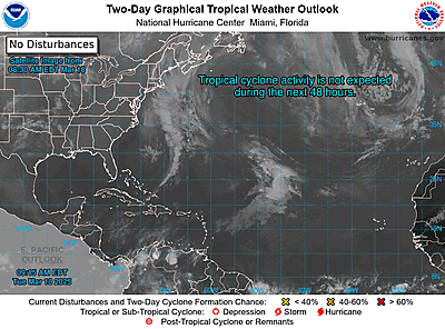
https://www.nhc.noaa.gov/gtwo.php?basin=atlc
date: 2024-09-08, from: NOAA tornado/severe thunderstorm watches, mesoscale discussions, convective outlooks, fire weather outlooks

Day 1 Convective Outlook
NWS Storm Prediction Center Norman OK
0724 AM CDT Sun Sep 08 2024

Valid 081300Z - 091200Z

...NO SEVERE THUNDERSTORM AREAS FORECAST...

...SUMMARY...
Though a few strong thunderstorm gusts may be noted in the interior
Northwest and central High Plains, severe potential appears too low
and disorganized for an outlook area.

...Synopsis/Discussion...
In mid/upper levels, the large-scale pattern will deamplify somewhat
over the CONUS this period, but maintain a mean trough in the Great
Lakes and eastern CONUS, and mean ridging over the Intermountain
West and Southwestern deserts.  A shortwave trough -- evident in
moisture-channel imagery over the interior of OR/WA into far
northern CA -- is forecast to continue weakening as it moves
northeastward, crossing the northern Rockies between 06-12Z.  Still,
associated cooling aloft and midlevel moisture, over pockets of
marginally favorable low-level moisture and diurnal surface heating,
will contribute to general thunderstorm potential in parts of the
interior Northwest and Intermountain West.  A few of these high-
based cells may produce strong gusts, but severe potential appears
to be limited by lack of greater moisture/buoyancy.

Farther east over the central Rockies and adjoining High Plains,
isolated to widely scattered thunderstorms are possible this
afternoon into evening.  Activity should be related to diabatic
heating of elevated terrain, along with lift near a surface lee
trough, and a corridor of meager but sufficient low-level moisture.
Beneath strongly difluent but weak west to northwest flow in mid/
upper levels, bulk shear should be modest, despite considerable
veering with height.  Here too, a few cells may produce strong gusts
through a well-mixed subcloud layer, and a severe gust cannot be
ruled out.  However, severe potential appears too isolated, poorly
focused and conditional for a categorical risk area.  Elsewhere,
isolated to scattered thunderstorms will be possible in a very moist
air mass (but with poor lapse rates) from parts of the Gulf Coast
States across FL and the southern Atlantic Coast.

..Edwards/Kerr.. 09/08/2024
https://www.spc.noaa.gov/products/outlook/day1otlk_1300.html
date: 2024-09-08, from: Eastern Pacific Tropical Weather Outlook
000
ABPZ20 KNHC 081136
TWOEP
Tropical Weather Outlook
NWS National Hurricane Center Miami
FL
500 AM PDT Sun Sep 8 2024
For the eastern North
Pacific…east of 140 degrees west longitude:
Offshore of
Southwestern Mexico:
An area of low pressure is forecast to form
during the early to
middle part of the week, near or just to the
south of the coast of
southern or southwestern Mexico.
Environmental conditions are
forecast to be conducive for some
gradual development of this
system, and a tropical depression
could form during the middle to
latter part of this week while it
moves generally northwestward,
near the coast of southwestern
Mexico.
* Formation chance through 48 hours…low…near 0
percent.
* Formation chance through 7 days…medium…50
percent.
$$
Forecaster Brown
https://www.nhc.noaa.gov/gtwo.php?basin=epac
date: 2024-09-08, from: Central Pacific Basin Tropical Cyclones
000
ACPN50 PHFO 081121
TWOCP
Tropical
Weather Outlook
NWS Central Pacific Hurricane Center Honolulu
HI
200 AM HST Sun Sep 8 2024
For the central North
Pacific…between 140W and 180W:
Approximately 1100 miles
southeast of Hilo, Hawaii:
Disorganized showers and thunderstorms
associated with a trough of
low pressure are located over 1000
miles southeast of Hilo, Hawaii.
Environmental conditions are
expected to be marginally conducive
for some subsequent
development of this system as it moves slowly
northward over the
next few days.
* Formation chance through 48 hours…low…near 10
percent.
* Formation chance through 7 days…low…20 percent.
Elsewhere, no tropical cyclones are expected during the next 7
days.
$$
Forecaster Kino
https://www.nhc.noaa.gov/gtwo.php?basin=cpac
date: 2024-09-08, from: Central Pacific Basin Tropical Cyclones
No tropical cyclones as of Sun, 08 Sep 2024 12:51:42 GMT
date: 2024-09-08, from: NOAA Weather Forecasts
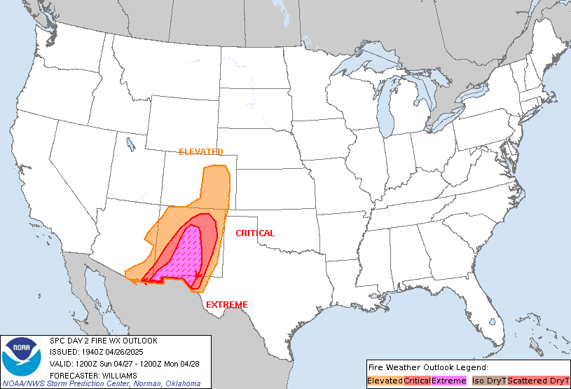
Day 2 Fire Weather Outlook
NWS Storm Prediction Center Norman OK
0210 AM CDT Sun Sep 08 2024

Valid 091200Z - 101200Z

...Synopsis...
A prominent shortwave, embedded within broader troughing over the
Pacific Northwest, is forecast to move quickly eastward over parts
of the Northern Rockies Monday. At the same time, ridging over the
West should continue to weaken as a belt of stronger southwesterly
flow aloft develops from the northern Great Basin and into the
northern Rockies. Increasing surface winds, and warm/dry conditions
will support the potential for elevated fire-weather conditions.

...Northwest and Great Basin...
As troughing settles over the West Coast, the mid-level flow will
continue to strengthen across the Sierras and northern Great Basin.
Surface winds of 15-25 mph appear likely as momentum from aloft
mixes down to the surface. Downsloping and continued warm
temperatures should keep the air mass quite dry with RH minimums of
15-20% likely. Several hours of widespread elevated to near-critical
fire-weather conditions are likely from northern CA/NV into parts of
southern ID and western WY.

A few hours of elevated to near-critical conditions are possible in
the lee of the Cascades as winds increase ahead of a cold front
moving onshore Monday. RH may be on the marginal side, particularly
with northward extent, as a cooler Pacific air mass move in.
However, downslope winds of 15-25 mph and recent active fire
behavior suggest some fire weather concerns will be possible.

...Northern Rockies...
As the shortwave trough approaches the Rockies, westerly flow aloft
should quickly increase. Downslope trajectories and intensifying lee
troughing will strengthen surface winds to 15-20 MPH across parts of
MT and WY. With hot temperatures and little recent rainfall
persisting, afternoon RH values should remain quite low, generally
below 20-25%. With increasing winds, receptive fuels, and persistent
dry conditions, periods of elevated fire-weather conditions are
likely over parts of the northern Rockies.

...Dry Thunder...
Across parts of the eastern Great Basin and central Rockies,
lingering monsoon moisture will likely support isolated to scattered
thunderstorms Monday afternoon. A mixed mode of wet and dry storms
is expected with PWATs of 0.7-1 inch, and increasing mid-level flow
supporting faster storm speeds. While there is some potential for
drier strikes, fuels across much of the area are less receptive and
storms should generally cluster with time. This suggests any dry
lightning potential will be limited.

..Lyons.. 09/08/2024

...Please see www.spc.noaa.gov/fire for graphic product...
https://www.spc.noaa.gov/products/fire_wx/fwdy2.html
date: 2024-09-05, from: NOAA tornado/severe thunderstorm watches, mesoscale discussions, convective outlooks, fire weather outlooks

Day 1 Convective Outlook
NWS Storm Prediction Center Norman OK
1124 AM CDT Thu Sep 05 2024

Valid 051630Z - 061200Z

...THERE IS A MARGINAL RISK OF SEVERE THUNDERSTORMS ACROSS PARTS OF
FAR SOUTH-CENTRAL COLORADO INTO NORTHERN/CENTRAL NEW MEXICO...

...SUMMARY...
Thunderstorms capable of producing isolated severe wind gusts and
hail will be possible today across parts of far south-central
Colorado into northern/central New Mexico.

...Synopsis...
Satellite imagery shows a shortwave trough moving southeastward
through the central Rockies, between the upper ridging in place over
the western Great Basin and the broad upper troughing across central
Canadian and northern Plains/Upper MS Valley. Another shortwave
trough exists over the Upper MS Valley. This shortwave trough is
forecast to continue progressing eastward through the base broad
central Canada/northern Plains trough, moving across the Upper Great
Lakes and into eastern Ontario.

Recent surface analysis places a surface low associated with this
shortwave over Lake Superior, with a cold front extending
southwestward from this low through KS and into northeast NM. This
front is forecast to progress southward/southeastward as its parent
surface low lifts northeastward. Isolated thunderstorms are possible
along this frontal boundary, but overall severity should be
mitigated by modest buoyancy and vertical shear. Greater
thunderstorm coverage and severity is anticipated over the southern
Rockies as the previously mentioned central Rockies shortwave trough
continues southeastward and promotes thunderstorm development.

Lastly, a tropical wave just off the TX Coast is contributing to
abundant moisture across much of Gulf Coast, with low 70s dewpoints
reaching into much of east TX and northern LA, and upper 70s across
FL. Precipitable water values over 2" cover much of this region as
well. Heavy rain is the primary threat (as indicated by the latest
Day 1 Excessive Rainfall Outlook from WPC), but a few water-loaded
downbursts capable of damaging gusts are possible from southeast TX
and southern/central LA eastward along the Gulf Coast and over the
Florida Peninsula. Coverage of these gusts is expected to be sparse
and too low to delineate a 5% wind probability area.

...Southern Rockies/southern High Plains...
Moderate low-level moisture is anticipated within the post-frontal
airmass across the southern Rockies and adjacent southern High
Plains this afternoon, characterized by dewpoints in the low to mid
50s across the High Plains and upper 40s across the higher terrain.
Even with this modest moisture, the airmass is expected to
destabilize, fostered by deep boundary-layer mixing and cool
temperatures aloft (i.e. around -10 deg C at 500 mb). Surface
easterlies/northeasterlies beneath modest westerlies aloft will
contribute to effective bulk shear around 35 kt, which is strong
enough for some updraft organization. Isolated hail is possible
across the higher terrain with the initially more cellular
development. Damaging gusts are expected to be the primary risk
thereafter as storms trend towards a more clustered mode and move
eastward into the more mixed southern High Plains.

..Mosier/Squitieri.. 09/05/2024
https://www.spc.noaa.gov/products/outlook/day1otlk_1630.html
date: 2024-09-04, from: NOAA tornado/severe thunderstorm watches, mesoscale discussions, convective outlooks, fire weather outlooks

Day 1 Convective Outlook
NWS Storm Prediction Center Norman OK
0259 PM CDT Wed Sep 04 2024

Valid 042000Z - 051200Z

...THERE IS A MARGINAL RISK OF SEVERE THUNDERSTORMS ACROSS PARTS OF
THE CENTRAL ROCKIES INTO THE NORTHERN/CENTRAL PLAINS AND UPPER
MISSISSIPPI VALLEY...

...SUMMARY...
Isolated strong to severe thunderstorms capable of gusty winds and
hail may occur this afternoon and evening across parts of the
central Rockies into the northern/central Plains and upper
Mississippi Valley.

...20Z Update...
The forecast remains on track, and no appreciable changes were made
to the outlook with this update. Isolated thunderstorms are
developing/spreading eastward across the central Rockies this
afternoon -- ahead of a positively tilted midlevel trough moving
across the region. The strongest storms will be capable of producing
marginally severe hail and isolated severe gusts. For additional
details, see MCD #2047. Across the central Plains into the Upper MS
Valley, severe-thunderstorm potential is more uncertain along/behind
the cold front this evening into the overnight hours. However, given
the potential for isolated instances of severe hail and locally
strong/damaging gusts, the Marginal Risk has been maintained across
this area.

Farther east, clusters of thunderstorms are tracking westward across
the central Gulf Coast, in an environment characterized by 2+ inch
PW and pockets of diurnal heating/boundary-layer destabilization.
Given some banded convection here -- aided by enhanced low-level
easterlies -- a couple water-loaded downbursts will be possible.
Overall, the severe threat still appears too localized/marginal for
5-percent severe wind probabilities.

..Weinman.. 09/04/2024

.PREV DISCUSSION... /ISSUED 1124 AM CDT Wed Sep 04 2024/

...Central Rockies into the central High Plains...
Recent satellite imagery reveals a broad shortwave trough currently
moving through southern ID and northern NV/UT. This shortwave trough
and accompanying cold mid-level temperatures are forecast to
continue eastward throughout the day, progressing across WY and
northern CO. Modest buoyancy, fostered mainly by cooling mid-level
temperatures, is anticipated across WY and adjacent parts of
northern CO as the shortwave trough progresses through. Thunderstorm
development is expected as the large-scale ascent attendant to the
shortwave trough interacts with this buoyancy during the afternoon.
Moderate mid-level westerlies will accompany this shortwave trough
as well, with the resulting increase in vertical shear supporting
the potential for a few more organized/persistent storms. Initially
more cellular development across the higher terrain could pose a
risk for isolated hail, particularly across south-central WY and
north-central CO where the best overlap between the stronger shear
and cold mid-level temperatures is expected. Damaging wind gusts are
possible as well, particularly as the storms reach the lower
elevations of central High Plains where a deeply mixed boundary
layer will be in place.

...Central Plains into the Upper MS Valley...
Recent surface analysis places a low over southeast ND, with weak
troughing extending southwestward from this low in east-central CO.
The primary cold front is west of this surface trough, extending
from the low over southeast ND into more of northwest SD and
adjacent northeast WY. The surface low is forecast to progress
east-southeastward throughout the day, reaching south-central MN by
late tonight. The attendant cold front is expected to push southward
during the same period, progressing through much of NE by early
Thursday morning.

Warm mid-level temperatures should preclude thunderstorm development
along the surface trough during the afternoon and evening. A few
isolated storms are possible during the evening behind the front as
the shortwave trough ejects out into the central Plains. Additional
thunderstorm development is expected overnight/early Thursday
morning across the Upper MS Valley, with some isolated hail possible
within the strongest storms.
https://www.spc.noaa.gov/products/outlook/day1otlk_2000.html
date: 2024-09-04, from: NOAA tornado/severe thunderstorm watches, mesoscale discussions, convective outlooks, fire weather outlooks
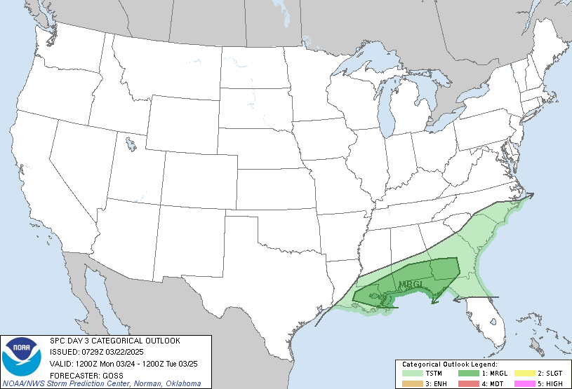
Day 3 Convective Outlook
NWS Storm Prediction Center Norman OK
0231 PM CDT Wed Sep 04 2024

Valid 061200Z - 071200Z

...NO SEVERE THUNDERSTORM AREAS FORECAST...

...SUMMARY...
Severe-thunderstorm potential appears relatively low for Friday,
though a few strong storms will be possible from near Lake Erie into
parts of the Ohio Valley.

...Synopsis...
An upper-level trough is forecast to amplify as it digs
southeastward across the Great Lakes and Ohio Valley regions on
Friday. A mid/upper-level cyclone is forecast to develop with time,
as a strong embedded shortwave moves southeastward into the base of
the trough by Friday evening. A leading cold front is forecast to
slow down and weaken across parts of the Ohio Valley, as a
reinforcing front moves through parts of the Great Lakes and
Midwest.

...Lake Erie/Ohio Vicinity...
Thunderstorms are expected to develop along a cold front Friday
afternoon as it moves through the Ohio Valley. Weak lapse rates and
a lack of richer low-level moisture will result in only modest
instability, but strong forcing ahead of the approaching trough
should permit for some stronger storms to develop Friday afternoon.
A well-mixed, inverted-v type thermodynamic profile will support
some gusty winds. However, the lack of stronger lower tropospheric
flow or greater instability will likely preclude a more widespread
damaging wind threat. Nonetheless, if greater instability appears
possible, severe probabilities may eventually be warranted.

..Bentley.. 09/04/2024
https://www.spc.noaa.gov/products/outlook/day3otlk_1930.html
date: 2024-09-04, from: NOAA tornado/severe thunderstorm watches, mesoscale discussions, convective outlooks, fire weather outlooks
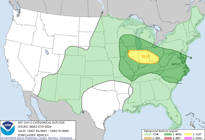
Day 2 Convective Outlook
NWS Storm Prediction Center Norman OK
1218 PM CDT Wed Sep 04 2024

Valid 051200Z - 061200Z

...THERE IS A MARGINAL RISK OF SEVERE THUNDERSTORMS ACROSS PARTS OF
NORTHEAST NEW MEXICO....

...SUMMARY...
A few strong to severe storms are possible across portions of
northeast New Mexico Thursday afternoon/evening.

...Synopsis...
An upper-level trough is forecast to amplify and move southeastward
across the Canadian Prairies into the upper Midwest/Great Lakes on
Thursday. To the southwest of this amplifying trough, a weakening
shortwave is forecast to move southeastward across the
central/southern Rockies into the southern High Plains. At the
surface, a cold front is forecast to extend southwestward from the
Great Lakes into parts of the Midwest and central/southern Plains
during the afternoon.

...Southern Rockies and High Plains...
A concentrated area of thunderstorms are forecast across northeast
New Mexico on Thursday as a sharp mid-level shortwave trough
advances southeast across the central/southern Rockies and interacts
with a pocket of instability in the post-frontal airmass across
northeast New Mexico. Some increasing mid-level flow associated with
this trough will overspread the region and provide 20 to 25 knots of
deep layer shear. This may be sufficient for some storm organization
and the potential for severe-wind gusts. Some small hail is also
possible, but relatively modest instability/shear may limit the
potential for large hail.

...Parts of the Upper Midwest...
Thunderstorms will likely be ongoing at the beginning of the period
along the frontal zone in northwest Wisconsin. Expect this activity
to wane by mid-morning as the low-level jet weakens. Strong height
falls will overspread the cold front by mid to late afternoon which
should support additional thunderstorm development along the cold
front during the afternoon/early evening. Forecast soundings show
limited moisture/instability (less than 1000 J/kg MLCAPE) and modest
effective shear (25-30 kts). This could support a few strong to
severe storms, but overall, expect the severe-weather threat to
remain limited/isolated.

..Bentley.. 09/04/2024
https://www.spc.noaa.gov/products/outlook/day2otlk_1730.html
date: 2024-09-04, from: NOAA tornado/severe thunderstorm watches, mesoscale discussions, convective outlooks, fire weather outlooks
Day 1 Fire Weather Outlook
NWS Storm Prediction Center Norman OK
1207 PM CDT Wed Sep 04 2024

Valid 041700Z - 051200Z

...NO CRITICAL AREAS...

No changes are needed to the D1 Fire Weather Outlook. See previous
discussion below for more information.

..Thornton.. 09/04/2024

.PREV DISCUSSION... /ISSUED 0108 AM CDT Wed Sep 04 2024/

...Synopsis...
Fire weather concerns appear limited for today across the country.
Breezy conditions will persist across the central Plains ahead of a
migratory surface trough. Low-level moisture has begun to advect
northward based on early-morning surface observations, and this
trend should continue through the day and modulate afternoon RH
minimums over the Plains. Areas of elevated fire weather conditions
are possible across central to southern UT as a cold front pushes
across the region, but confidence in prolonged/widespread elevated
conditions is limited and should occur over fuels that are only
modestly receptive. Dry conditions will persist across the Great
Basin and West Coast, but a building ridge over the western CONUS
will promote weak surface winds and limited fire concerns.

...Please see www.spc.noaa.gov/fire for graphic product...
https://www.spc.noaa.gov/products/fire_wx/fwdy1.html
date: 2024-09-01, from: Central Pacific Basin Tropical Cyclones

5-Day Uncertainty Track last
updated Sun, 01 Sep 2024 18:01:36 GMT

Wind Speed Probabilities last
updated Sun, 01 Sep 2024 15:50:55 GMT
https://www.nhc.noaa.gov/refresh/graphics_cp1+shtml/180136.shtml?cone
date: 2024-09-01, from: Central Pacific Basin Tropical Cyclones
000
WTPA31 PHFO 011758
TCPCP1

BULLETIN
Tropical Storm Hone Intermediate Advisory Number 41A
NWS Central Pacific Hurricane Center Honolulu HI   CP012024
800 AM HST Sun Sep 01 2024

...HONE TURNS WEST-NORTHWESTWARD TOWARD THE INTERNATIONAL DATE
LINE...


SUMMARY OF 800 AM HST...1800 UTC...INFORMATION
----------------------------------------------
LOCATION...25.3N 178.3W
ABOUT 210 MI...340 KM SSW OF MIDWAY ISLAND
ABOUT 1320 MI...2125 KM WNW OF HONOLULU HAWAII
MAXIMUM SUSTAINED WINDS...40 MPH...65 KM/H
PRESENT MOVEMENT...WNW OR 300 DEGREES AT 14 MPH...22 KM/H
MINIMUM CENTRAL PRESSURE...1007 MB...29.74 INCHES


WATCHES AND WARNINGS
--------------------
CHANGES WITH THIS ADVISORY:

None.

SUMMARY OF WATCHES AND WARNINGS IN EFFECT:

A Tropical Storm Watch is in effect for...

* Kure Atoll
* Midway Atoll

A Tropical Storm Watch means tropical storm conditions are possible
in the watch area within 48 hours.

For storm information specific to your area, please monitor
products issued by the National Weather Service office in
Honolulu Hawaii.


DISCUSSION AND OUTLOOK
----------------------
At 800 AM HST (1800 UTC), the broad mean center of elongating
Tropical Storm Hone and an extratropical low was located near
latitude 25.3 North, longitude 178.3 West. Hone is moving toward
the west-northwest near 14 mph (22 km/h). This general motion with
a decrease in forward speed is expected today as Hone merges with
the extratropical low. A turn toward the north and an increase in
forward speed is expected to resume on Monday. On the forecast
track, Hone, or the extratropical low associated with Hone, will be
passing near or just west of Kure Atoll near the International Date
Line late Monday or Monday night.

Maximum sustained winds are near 40 mph (65 km/h) with higher
gusts. Little change in strength is forecast during the next 48
hours.

Tropical-storm-force winds extend outward up to 60 miles (95 km)
from the center.

The estimated minimum central pressure is 1007 mb (29.74 inches).


HAZARDS AFFECTING LAND
----------------------
WIND: Tropical storm conditions are possible within the watch area
Monday and Monday night.

RAINFALL: Storm total rainfall of 2 to 4 inches is possible over
Midway and Kure Atolls.


NEXT ADVISORY
-------------
Next complete advisory at 1100 AM HST.

$$
Forecaster Wroe
https://www.nhc.noaa.gov/text/refresh/HFOTCPCP1+shtml/011758.shtml
date: 2024-09-01, from: NOAA tornado/severe thunderstorm watches, mesoscale discussions, convective outlooks, fire weather outlooks
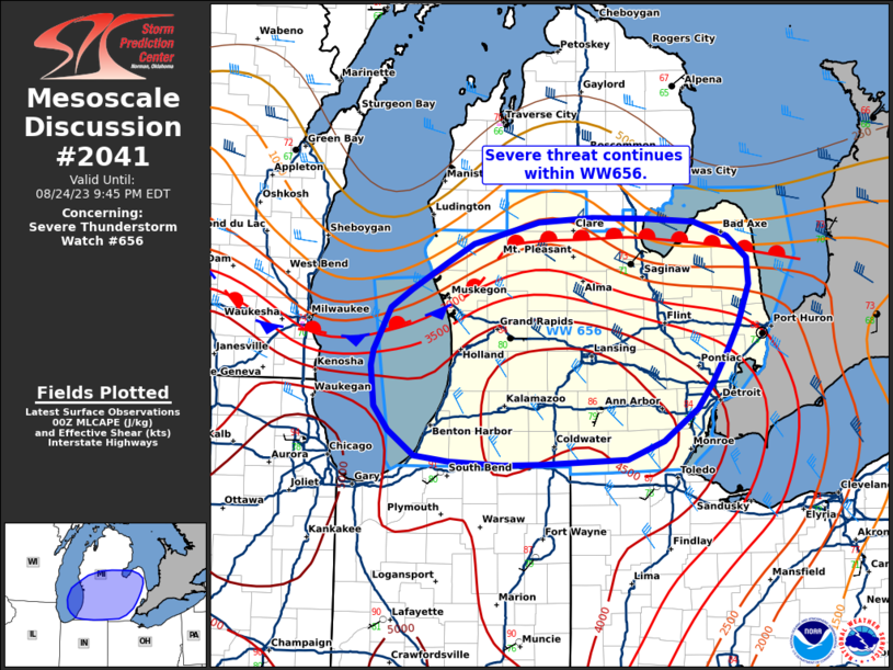
Mesoscale Discussion 2041
NWS Storm Prediction Center Norman OK
1254 PM CDT Sun Sep 01 2024

Areas affected...parts of western and northern New York

Concerning...Severe potential...Watch unlikely

Valid 011754Z - 011930Z

Probability of Watch Issuance...5 percent

SUMMARY...A broken line of storms may produce occasional gusty wind
this afternoon.

DISCUSSION...Inhibition has been mostly eroded across western and
northern New York as temperatures have warmed to the upper 70s to
low 80s with mid 60s dewpoints. Expect scattered thunderstorms to
develop along a cold front once it moves east of Lake Erie and Lake
Ontario. Storms may be not be that deep given the relatively shallow
thermodynamic profile shown by the RAP forecast soundings. However,
relatively strong flow through the column and a well-mixed boundary
layer may support efficient transport of gusty winds to the surface
within these storms. Isolated damaging wind gusts are possible
through the afternoon with this threat waning near sunset.

..Bentley/Bunting.. 09/01/2024

...Please see www.spc.noaa.gov for graphic product...

ATTN...WFO...BTV...ALY...BGM...BUF...

LAT...LON   43357915 43497832 43517714 43907704 44207653 44667583
            45167503 45587378 45557370 45137334 44107369 42977513
            42497697 42337806 42427885 42657931 43357915
https://www.spc.noaa.gov/products/md/md2041.html
date: 2024-09-01, from: Central Pacific Basin Tropical Cyclones

5-Day Uncertainty Track last
updated Sun, 01 Sep 2024 15:49:55 GMT

Wind Speed Probabilities last
updated Sun, 01 Sep 2024 15:50:55 GMT
https://www.nhc.noaa.gov/refresh/graphics_cp1+shtml/154955.shtml?cone
date: 2024-09-01, from: Central Pacific Basin Tropical Cyclones
000
WTPA41 PHFO 011500
TCDCP1

Tropical Storm Hone Discussion Number  41
NWS Central Pacific Hurricane Center Honolulu HI   CP012024
500 AM HST Sun Sep 01 2024

The satellite presentation of Hone has become very ragged overnight,
with the low-level circulation center becoming very difficult to
locate with much confidence. An 1130z Oceansat-3 pass indicated
that the low level center of Hone has shifted west-westward since
the previous and appears to be merging with the mid-level low just
east of the International Date Line. The latest subjective Dvorak
current intensity estimates from PHFO, SAB, and JTWC, all came in
at 2.5 (35 kt), while the objective intensity estimates were
similar. As a result, the initial intensity has been held at a
perhaps generous 35 kt for this advisory.

The initial motion is quite uncertain due to the low-level of Hone
being in the process of merging with the mid-level low to the
west, and is set at 300/12 kt. This general motion is expected
to  continue today and tonight along with a decrease in forward
speed as Hone merges with a mid-level low to the west.  Hone should
begin moving northward with an increase in forward speed Monday and
Monday night as it moves into a weakness in building mid-level
ridges to the northwest and east of the system. A shift back toward
the northwest is then expected late Tuesday through Thursday as a
low and mid-level ridge builds to the north of Hone. The latest
track forecast was adjusted to better align with the latest model
guidance and generally follows the TVCE consensus.

Hone will be in a relatively favorable environment during the next
couple days, with warm sea surface temperatures and low vertical
wind shear. The interaction with a mid-level low, ragged LLCC and
entrainment of dry mid-level air should act to minimize the
potential for intensification however. Beyond 48 hours mid-level
moisture drops off considerably and the latest simulated satellite
imagery from the GFS and ECMWF suggest a loss of deep convection by
72 hours. As a result, the intensity forecast holds Hone as a 35
kt Tropical Storm during the next couple days, with the cyclone
expected to become a post-tropical remnant low by 72 hours, and
dissipation occurring by 120 hours. The intensity forecast closely
follows the latest intensity consensus guidance.


FORECAST POSITIONS AND MAX WINDS

INIT  01/1500Z 25.0N 177.7W   35 KT  40 MPH
 12H  02/0000Z 25.4N 178.7W   35 KT  40 MPH
 24H  02/1200Z 25.7N 179.2W   35 KT  40 MPH
 36H  03/0000Z 27.1N 179.1W   35 KT  40 MPH
 48H  03/1200Z 28.8N 179.1W   35 KT  40 MPH
 60H  04/0000Z 30.2N 179.5W   30 KT  35 MPH
 72H  04/1200Z 31.0N 179.5E   25 KT  30 MPH...POST-TROPICAL
 96H  05/1200Z 31.5N 178.0E   20 KT  25 MPH...POST-TROPICAL
120H  06/1200Z...DISSIPATED

$$
Forecaster Jelsema
https://www.nhc.noaa.gov/text/refresh/HFOTCDCP1+shtml/011500.shtml
date: 2024-09-01, from: Central Pacific Basin Tropical Cyclones
000
WTPA31 PHFO 011459
TCPCP1

BULLETIN
Tropical Storm Hone Advisory Number  41
NWS Central Pacific Hurricane Center Honolulu HI   CP012024
500 AM HST Sun Sep 01 2024

...HONE TURNS WEST-NORTHWESTWARD TOWARD THE INTERNATIONAL DATE
LINE...


SUMMARY OF 500 AM HST...1500 UTC...INFORMATION
----------------------------------------------
LOCATION...25.0N 177.7W
ABOUT 220 MI...355 KM S OF MIDWAY ISLAND
ABOUT 1280 MI...2060 KM WNW OF HONOLULU HAWAII
MAXIMUM SUSTAINED WINDS...40 MPH...65 KM/H
PRESENT MOVEMENT...WNW OR 300 DEGREES AT 14 MPH...22 KM/H
MINIMUM CENTRAL PRESSURE...1007 MB...29.74 INCHES


WATCHES AND WARNINGS
--------------------
CHANGES WITH THIS ADVISORY:

None.

SUMMARY OF WATCHES AND WARNINGS IN EFFECT:

A Tropical Storm Watch is in effect for...

* Kure Atoll
* Midway Atoll

A Tropical Storm Watch means tropical storm conditions are possible
in the watch area within 48 hours.


DISCUSSION AND OUTLOOK
----------------------
At 500 AM HST (1500 UTC), the center of Tropical Storm Hone was
located near latitude 25.0 North, longitude 177.7 West. Hone is
moving toward the west-northwest near 14 mph (22 km/h). This
general motion with a decrease in forward speed is expected today
and tonight. A turn toward the north and an increase in forward
speed is expected to resume on Monday. On the forecast track, Hone
will be passing near or just west of Kure Atoll near the
International Date Line late Monday or Monday night.

Maximum sustained winds are near 40 mph (65 km/h) with higher gusts.
Little change in strength is forecast during the next 48 hours.

Tropical-storm-force winds extend outward up to 60 miles (95 km)
from the center.

The estimated minimum central pressure is 1007 mb (29.74 inches).


HAZARDS AFFECTING LAND
----------------------
WIND: Tropical storm conditions are possible within the watch area
Monday and Monday night.

RAINFALL: Storm total rainfall of 2 to 4 inches is possible over
Midway and Kure Atolls.


NEXT ADVISORY
-------------
Next intermediate advisory at 800 AM HST.
Next complete advisory at 1100 AM HST.

$$
Forecaster Jelsema
https://www.nhc.noaa.gov/text/refresh/HFOTCPCP1+shtml/011459.shtml
date: 2024-09-01, from: Central Pacific Basin Tropical Cyclones
000
FOPA11 PHFO 011459
PWSCP1

TROPICAL STORM HONE WIND SPEED PROBABILITIES NUMBER  41
NWS CENTRAL PACIFIC HURRICANE CENTER HONOLULU HI   CP012024
1500 UTC SUN SEP 01 2024

AT 1500Z THE CENTER OF TROPICAL STORM HONE WAS LOCATED NEAR LATITUDE
25.0 NORTH...LONGITUDE 177.7 WEST WITH MAXIMUM SUSTAINED WINDS NEAR
35 KTS...40 MPH...65 KM/H.

Z INDICATES COORDINATED UNIVERSAL TIME (GREENWICH)
   PACIFIC  DAYLIGHT TIME (PDT)...SUBTRACT 7 HOURS FROM Z TIME
   HAWAIIAN STANDARD TIME (HST)...SUBTRACT 10 HOURS FROM Z TIME

WIND SPEED PROBABILITY TABLE FOR SPECIFIC LOCATIONS

CHANCES OF SUSTAINED (1-MINUTE AVERAGE) WIND SPEEDS OF AT LEAST
   ...34 KT (39 MPH... 63 KM/H)...
   ...50 KT (58 MPH... 93 KM/H)...
   ...64 KT (74 MPH...119 KM/H)...
FOR LOCATIONS AND TIME PERIODS DURING THE NEXT 5 DAYS

PROBABILITIES FOR LOCATIONS ARE GIVEN AS OP(CP) WHERE
    OP  IS THE PROBABILITY OF THE EVENT BEGINNING DURING
        AN INDIVIDUAL TIME PERIOD (ONSET PROBABILITY)
   (CP) IS THE PROBABILITY OF THE EVENT OCCURRING BETWEEN
        12Z SUN AND THE FORECAST HOUR (CUMULATIVE PROBABILITY)

PROBABILITIES ARE GIVEN IN PERCENT
X INDICATES PROBABILITIES LESS THAN 1 PERCENT
PROBABILITIES FOR 34 KT AND 50 KT ARE SHOWN AT A GIVEN LOCATION WHEN
THE 5-DAY CUMULATIVE PROBABILITY IS AT LEAST 3 PERCENT.
PROBABILITIES FOR 34...50...64 KT SHOWN WHEN THE 5-DAY
64-KT CUMULATIVE PROBABILITY IS AT LEAST 1 PERCENT.


  - - - - WIND SPEED PROBABILITIES FOR SELECTED LOCATIONS - - - -

               FROM    FROM    FROM    FROM    FROM    FROM    FROM
  TIME       12Z SUN 00Z MON 12Z MON 00Z TUE 12Z TUE 12Z WED 12Z THU
PERIODS         TO      TO      TO      TO      TO      TO      TO
             00Z MON 12Z MON 00Z TUE 12Z TUE 12Z WED 12Z THU 12Z FRI

FORECAST HOUR    (12)   (24)    (36)    (48)    (72)    (96)   (120)
- - - - - - - - - - - - - - - - - - - - - - - - - - - - - - - - - -
LOCATION       KT

MIDWAY         34  X   X( X)   2( 2)   5( 7)   1( 8)   X( 8)   X( 8)

KURE           34  X   X( X)   6( 6)  16(22)   2(24)   X(24)   X(24)
KURE           50  X   X( X)   1( 1)   2( 3)   X( 3)   X( 3)   X( 3)

$$
FORECASTER JELSEMA
https://www.nhc.noaa.gov/text/refresh/HFOPWSCP1+shtml/011459.shtml
date: 2024-09-01, from: Central Pacific Basin Tropical Cyclones
000
WTPA21 PHFO 011459
TCMCP1

TROPICAL STORM HONE FORECAST/ADVISORY NUMBER  41
NWS CENTRAL PACIFIC HURRICANE CENTER HONOLULU HI   CP012024
1500 UTC SUN SEP 01 2024

NOTICE... LAND-BASED TROPICAL CYCLONE WATCHES AND WARNINGS ARE NO
LONGER INCLUDED IN THE TROPICAL CYCLONE FORECAST/ADVISORY...(TCM).
CURRENT LAND-BASED COASTAL WATCHES AND WARNINGS CAN BE FOUND IN THE
MOST RECENTLY ISSUED TROPICAL CYCLONE PUBLIC ADVISORY...(TCP).

TROPICAL STORM CENTER LOCATED NEAR 25.0N 177.7W AT 01/1500Z
POSITION ACCURATE WITHIN  60 NM

PRESENT MOVEMENT TOWARD THE WEST-NORTHWEST OR 300 DEGREES AT  12 KT

ESTIMATED MINIMUM CENTRAL PRESSURE 1007 MB
MAX SUSTAINED WINDS  35 KT WITH GUSTS TO  45 KT.
34 KT....... 50NE   0SE   0SW   0NW.
WINDS AND SEAS VARY GREATLY IN EACH QUADRANT.  RADII IN NAUTICAL
MILES ARE THE LARGEST RADII EXPECTED ANYWHERE IN THAT QUADRANT.

REPEAT...CENTER LOCATED NEAR 25.0N 177.7W AT 01/1500Z
AT 01/1200Z CENTER WAS LOCATED NEAR 24.8N 176.8W

FORECAST VALID 02/0000Z 25.4N 178.7W
MAX WIND  35 KT...GUSTS  45 KT.
34 KT... 50NE   0SE   0SW  30NW.

FORECAST VALID 02/1200Z 25.7N 179.2W
MAX WIND  35 KT...GUSTS  45 KT.
34 KT... 50NE   0SE   0SW  30NW.

FORECAST VALID 03/0000Z 27.1N 179.1W
MAX WIND  35 KT...GUSTS  45 KT.
34 KT... 40NE   0SE   0SW  20NW.

FORECAST VALID 03/1200Z 28.8N 179.1W
MAX WIND  35 KT...GUSTS  45 KT.
34 KT... 40NE   0SE   0SW  20NW.

FORECAST VALID 04/0000Z 30.2N 179.5W
MAX WIND  30 KT...GUSTS  40 KT.

FORECAST VALID 04/1200Z 31.0N 179.5E...POST-TROPICAL
MAX WIND  25 KT...GUSTS  35 KT.

EXTENDED OUTLOOK. NOTE...ERRORS FOR TRACK HAVE AVERAGED NEAR 150 NM
ON DAY 4 AND 200 NM ON DAY 5...AND FOR INTENSITY NEAR 20 KT EACH DAY

OUTLOOK VALID 05/1200Z 31.5N 178.0E...POST-TROPICAL
MAX WIND  20 KT...GUSTS  30 KT.

OUTLOOK VALID 06/1200Z...DISSIPATED

REQUEST FOR 3 HOURLY SHIP REPORTS WITHIN 300 MILES OF 25.0N 177.7W

INTERMEDIATE PUBLIC ADVISORY...WTNT31 PHFO/HFOTCPCP1...AT 01/1800Z

NEXT ADVISORY AT 01/2100Z

$$
FORECASTER JELSEMA
https://www.nhc.noaa.gov/text/refresh/HFOTCMCP1+shtml/011459.shtml