(date: 2024-09-22 16:58:17)
date: 2024-09-22, from: Eastern Pacific Basin GIS Data
KMZ last updated Sun, 22 Sep 2024 23:33:37 GMT
https://www.nhc.noaa.gov/storm_graphics/api/EP102024_001Aadv_TRACK.kmz
date: 2024-09-22, from: Eastern Pacific Basin GIS Data
KMZ last updated Sun, 22 Sep 2024 23:33:34 GMT
https://www.nhc.noaa.gov/storm_graphics/api/EP102024_001Aadv_WW.kmz
date: 2024-09-22, from: Eastern Pacific Basin GIS Data
Initial and Forecast Surface Winds. Shapefile last updated Sun, 22 Sep 2024 23:33:19 GMT
https://www.nhc.noaa.gov/gis/forecast/archive/ep102024_fcst_001.zip
date: 2024-09-22, from: Eastern Pacific Basin GIS Data
KMZ last updated Sun, 22 Sep 2024 23:33:09 GMT
https://www.nhc.noaa.gov/storm_graphics/api/EP102024_001Aadv_CONE.kmz
date: 2024-09-22, from: Eastern Pacific Basin GIS Data
Track, Points, and Wind Swath. Shapefile last updated Sun, 22 Sep 2024 23:33:01 GMT
https://www.nhc.noaa.gov/gis/best_track/ep102024_best_track.zip
date: 2024-09-22, from: Eastern Pacific Basin GIS Data
KMZ last updated Sun, 22 Sep 2024 23:33:01 GMT
https://www.nhc.noaa.gov/gis/best_track/ep102024_best_track.kmz
date: 2024-09-22, from: Eastern Pacific Basin GIS Data
Forecast Track, Cone of Uncertainty, Watches/Warnings. Shapefile last updated Sun, 22 Sep 2024 23:32:54 GMT
https://www.nhc.noaa.gov/gis/forecast/archive/ep102024_5day_001A.zip
date: 2024-09-22, from: Eastern Pacific Basin GIS Data
…DEPRESSION NEARLY STATIONARY TO THE SOUTH OF THE COAST OF SOUTHERN MEXICO… As of 6:00 PM CST Sun Sep 22 the center of Ten-E was located near 13.8, -98.7 with movement Stationary. The minimum central pressure was 1005 mb with maximum sustained winds of about 35 mph.
https://www.nhc.noaa.gov/text/refresh/MIATCPEP5+shtml/222332.shtml
date: 2024-09-22, from: Eastern Pacific Basin Tropical Cyclones

5-Day Uncertainty Track last
updated Sun, 22 Sep 2024 23:32:33 GMT

Wind Speed Probabilities last
updated Sun, 22 Sep 2024 21:23:36 GMT
https://www.nhc.noaa.gov/refresh/graphics_ep5+shtml/233233.shtml?cone
date: 2024-09-22, from: Eastern Pacific Basin GIS Data
Issued at Sun, 22 Sep 2024 23:32:00 GMT. This is only a prototype and the file format may change without notice.
https://www.nhc.noaa.gov/storm_graphics/EP10/atcf-ep102024.xml
date: 2024-09-22, from: Central Pacific Tropical Weather Outlook
000
ACPN50 PHFO 222323
TWOCP
Tropical Weather Outlook
NWS Central Pacific Hurricane Center
Honolulu HI
200 PM HST Sun Sep 22 2024
For the
central North Pacific…between 140W and 180W:
Approximately
1000 miles southeast of Hilo, Hawaii:
An area of low pressure
located far southeast of Hawaii continues
to produce disorganized
showers and thunderstorms, while conditions
aloft continue to
produce outflow in all quadrants. Environmental
conditions appear
conducive for some development over the next day
or two, and a
tropical depression could form as it moves
westward at 5 to 10
mph. By Wednesday, conditions will become
gradually less
conducive for development.
* Formation chance through 48
hours…medium…60 percent.
* Formation chance through 7
days…medium…60 percent.
$$
Forecaster JVC
https://www.nhc.noaa.gov/gtwo.php?basin=cpac
date: 2024-09-22, from: Eastern Pacific Tropical Weather Outlook
667
ABPZ20 KNHC 222322
TWOEP
Tropical Weather Outlook
NWS National Hurricane Center Miami
FL
500 PM PDT Sun Sep 22 2024
For the eastern North
Pacific…east of 140 degrees west longitude:
Active
Systems:
The National Hurricane Center is issuing advisories on
newly formed
Tropical Depression Ten-E, located south of southern
Mexico.
Central Portion of the East Pacific:
A
trough of low pressure located several hundred miles
west-southwest of southwestern Mexico is producing disorganized
showers and thunderstorms. Environmental conditions appear
conducive for some slow development of this system, and a tropical
depression could form during the middle part of the week while
the
system moves slowly eastward or northeastward.
*
Formation chance through 48 hours…low…10 percent.
* Formation
chance through 7 days…medium…40 percent.
Public Advisories
on Tropical Depression Ten-E are issued under WMO
header WTPZ35
KNHC and under AWIPS header MIATCPEP5.
Forecast/Advisories on
Tropical Depression Ten-E are issued under
WMO header WTPZ25 KNHC
and under AWIPS header MIATCMEP5.
$$
Forecaster
Kelly
https://www.nhc.noaa.gov/gtwo.php?basin=epac
date: 2024-09-22, from: Graphical Tropical Weather Outlooks
https://www.nhc.noaa.gov/gtwo.php?basin=atlc
date: 2024-09-22, from: NOAA tornado/severe thunderstorm watches, mesoscale discussions, convective outlooks, fire weather outlooks
No watches are valid as of Sun Sep 22 22:32:01 UTC 2024.
https://www.spc.noaa.gov/products/watch/
date: 2024-09-22, from: NOAA tornado/severe thunderstorm watches, mesoscale discussions, convective outlooks, fire weather outlooks
No Mesoscale Discussions are in effect as of Sun Sep 22 22:32:01 UTC 2024.
https://www.spc.noaa.gov/products/md/
date: 2024-09-22, from: Eastern Pacific Basin GIS Data
Shapefile last updated Sun, 22 Sep 2024 21:24:01 GMT
https://www.nhc.noaa.gov/gis/forecast/archive/wsp_120hrhalfDeg_latest.zip
date: 2024-09-22, from: NOAA Weather Forecasts
Day 3-8 Fire Weather Outlook
NWS Storm Prediction Center Norman OK
0416 PM CDT Sun Sep 22 2024

Valid 241200Z - 301200Z

Forecast guidance has come to a consensus for a cut off low which
will dominate the weather for much of the central and eastern CONUS
by the middle of this week. In addition, there is some potential for
tropical development which may eventually merge with this upper low
later this week. As this pattern evolves across the eastern CONUS,
ridging will build across the western CONUS. Some warmer conditions
are anticipated, however, winds are expected to be light across
areas with dry fuels. The only period with even elevated
fire-weather conditions forecast is on Day4/Wednesday when some dry
and breezy conditions may develop in the lee of the northern
Sierra/southern Cascades as a mid-level trough moves through the
Pacific Northwest. However, fuels are not critically dry in this
region. Therefore, only elevated conditions forecast at this time
and unreceptive fuels preclude the need for any critical
probabilities given the potential for fire-weather concerns is too
low.

..Bentley.. 09/22/2024

...Please see www.spc.noaa.gov/fire for graphic product...
https://www.spc.noaa.gov/products/exper/fire_wx/
date: 2024-09-22, from: Eastern Pacific Basin Tropical Cyclones
000
WTPZ45 KNHC 222057
TCDEP5

Tropical Depression Ten-E Discussion Number   1
NWS National Hurricane Center Miami FL       EP102024
300 PM CST Sun Sep 22 2024

Convection has gradually become better organized today in
association with an area of low pressure that the NHC has been
monitoring off the coast of southern Mexico. A recent scatterometer
pass shows the circulation is closed, with a well-defined center and
peak winds of about 30 kt over the southern semicircle. Therefore, a
new tropical depression has formed in the eastern Pacific basin.

The depression is nearly stationary, but a slow northeastward drift
is expected to begin later tonight. The track forecast is
challenging, as there is a large spread in the guidance regarding
the potential path of the system. Much of the track guidance shows
the system moving generally east-northeastward as it becomes
captured within the broader circulation of a developing Central
American Gyre. However, a couple of global models (ECMWF and UKMET)
instead show a northward drift over the next couple of days. The NHC
track forecast favors the first scenario, and generally lies between
the simple and corrected consensus aids. However, this track
forecast is of low confidence given the large spread in the models,
and adjustments will likely be required with future issuances.

The moist, unstable environment and very warm waters should be
conducive for some strengthening of the system during the next
couple of days. The NHC intensity forecast lies between the IVCN and
HCCA aids, but it should be noted that there are some models
indicating the system could reach hurricane strength. While this is
not explicitly forecast, it certainly cannot be ruled out given the
environmental and oceanic conditions, and interests along the coast
of southern Mexico should monitor the latest forecast updates. The
peak intensity of the system will be highly dependent on how long
the cyclone remains over water before reaching the coast, which is
quite uncertain given the track challenges described above.

Based on this forecast, the government of Mexico has issued a
Tropical Storm Watch for the southern coast of Mexico from Punta
Maldonado to Salina Cruz.


KEY MESSAGES:

1. Slow-moving Tropical Depression Ten-E will bring very heavy
rainfall to coastal portions of southern and southwestern Mexico
through the upcoming week. This heavy rainfall will bring a risk of
significant flash flooding and mudslides to the Mexican States of
Chiapas and Oaxaca, particularly in areas near the coast.

2. The depression is forecast to become a tropical storm while
moving near the coast of southern Mexico on Monday or Tuesday. A
Tropical Storm Watch has been issued for a portion of the coastline,
where tropical storm conditions could begin on Tuesday.

3. The system could strengthen more than forecast if it remains
over water. Interests along the coast of southern Mexico should
monitor the latest forecast updates, as a Hurricane Watch could be
required for a portion of the coastline later tonight or on Monday.


FORECAST POSITIONS AND MAX WINDS

INIT  22/2100Z 13.8N  98.7W   30 KT  35 MPH
 12H  23/0600Z 14.0N  98.6W   35 KT  40 MPH
 24H  23/1800Z 14.4N  98.2W   45 KT  50 MPH
 36H  24/0600Z 14.8N  97.5W   50 KT  60 MPH
 48H  24/1800Z 15.0N  96.6W   55 KT  65 MPH
 60H  25/0600Z 15.3N  95.6W   55 KT  65 MPH
 72H  25/1800Z 16.1N  94.1W   55 KT  65 MPH
 96H  26/1800Z 17.1N  92.9W   20 KT  25 MPH...INLAND
120H  27/1800Z...DISSIPATED

$$
Forecaster Reinhart
https://www.nhc.noaa.gov/text/refresh/MIATCDEP5+shtml/222057.shtml
date: 2024-09-22, from: Eastern Pacific Basin Tropical Cyclones
000
FOPZ15 KNHC 222050
PWSEP5

TROPICAL DEPRESSION TEN-E WIND SPEED PROBABILITIES NUMBER   1
NWS NATIONAL HURRICANE CENTER MIAMI FL       EP102024
2100 UTC SUN SEP 22 2024

AT 2100Z THE CENTER OF TROPICAL DEPRESSION TEN-E WAS LOCATED NEAR
LATITUDE 13.8 NORTH...LONGITUDE 98.7 WEST WITH MAXIMUM SUSTAINED
WINDS NEAR 30 KTS...35 MPH...55 KM/H.

Z INDICATES COORDINATED UNIVERSAL TIME (GREENWICH)
   PACIFIC  DAYLIGHT TIME (PDT)...SUBTRACT 7 HOURS FROM Z TIME
   HAWAIIAN STANDARD TIME (HST)...SUBTRACT 10 HOURS FROM Z TIME

WIND SPEED PROBABILITY TABLE FOR SPECIFIC LOCATIONS

CHANCES OF SUSTAINED (1-MINUTE AVERAGE) WIND SPEEDS OF AT LEAST
   ...34 KT (39 MPH... 63 KM/H)...
   ...50 KT (58 MPH... 93 KM/H)...
   ...64 KT (74 MPH...119 KM/H)...
FOR LOCATIONS AND TIME PERIODS DURING THE NEXT 5 DAYS

PROBABILITIES FOR LOCATIONS ARE GIVEN AS OP(CP) WHERE
    OP  IS THE PROBABILITY OF THE EVENT BEGINNING DURING
        AN INDIVIDUAL TIME PERIOD (ONSET PROBABILITY)
   (CP) IS THE PROBABILITY OF THE EVENT OCCURRING BETWEEN
        18Z SUN AND THE FORECAST HOUR (CUMULATIVE PROBABILITY)

PROBABILITIES ARE GIVEN IN PERCENT
X INDICATES PROBABILITIES LESS THAN 1 PERCENT
PROBABILITIES FOR 34 KT AND 50 KT ARE SHOWN AT A GIVEN LOCATION WHEN
THE 5-DAY CUMULATIVE PROBABILITY IS AT LEAST 3 PERCENT.
PROBABILITIES FOR 34...50...64 KT SHOWN WHEN THE 5-DAY
64-KT CUMULATIVE PROBABILITY IS AT LEAST 1 PERCENT.


  - - - - WIND SPEED PROBABILITIES FOR SELECTED LOCATIONS - - - -

               FROM    FROM    FROM    FROM    FROM    FROM    FROM
  TIME       18Z SUN 06Z MON 18Z MON 06Z TUE 18Z TUE 18Z WED 18Z THU
PERIODS         TO      TO      TO      TO      TO      TO      TO
             06Z MON 18Z MON 06Z TUE 18Z TUE 18Z WED 18Z THU 18Z FRI

FORECAST HOUR    (12)   (24)    (36)    (48)    (72)    (96)   (120)
- - - - - - - - - - - - - - - - - - - - - - - - - - - - - - - - - -
LOCATION       KT

15N 100W       34  1   3( 4)   2( 6)   1( 7)   X( 7)   X( 7)   X( 7)

ACAPULCO       34  X   1( 1)   1( 2)   1( 3)   X( 3)   X( 3)   X( 3)

P MALDONADO    34  X   3( 3)   3( 6)   2( 8)   1( 9)   X( 9)   X( 9)

P ANGEL        34  X   3( 3)  10(13)  14(27)   9(36)   1(37)   X(37)
P ANGEL        50  X   X( X)   1( 1)   3( 4)   3( 7)   X( 7)   X( 7)
P ANGEL        64  X   X( X)   X( X)   1( 1)   X( 1)   X( 1)   X( 1)

HUATULCO       34  X   X( X)   3( 3)   5( 8)   4(12)   1(13)   X(13)

15N 95W        34  X   1( 1)   4( 5)  11(16)  28(44)   1(45)   X(45)
15N 95W        50  X   X( X)   X( X)   3( 3)  10(13)   1(14)   X(14)
15N 95W        64  X   X( X)   X( X)   1( 1)   2( 3)   X( 3)   X( 3)

SALINA CRUZ    34  X   X( X)   X( X)   1( 1)   6( 7)   1( 8)   X( 8)

TAPACHULA      34  X   X( X)   X( X)   X( X)   2( 2)   1( 3)   X( 3)

$$
FORECASTER REINHART
https://www.nhc.noaa.gov/text/refresh/MIAPWSEP5+shtml/222050.shtml
date: 2024-09-22, from: Eastern Pacific Basin Tropical Cyclones
000
WTPZ25 KNHC 222049
TCMEP5

TROPICAL DEPRESSION TEN-E FORECAST/ADVISORY NUMBER   1
NWS NATIONAL HURRICANE CENTER MIAMI FL       EP102024
2100 UTC SUN SEP 22 2024

TROPICAL DEPRESSION CENTER LOCATED NEAR 13.8N  98.7W AT 22/2100Z
POSITION ACCURATE WITHIN  30 NM

PRESENT MOVEMENT STATIONARY

ESTIMATED MINIMUM CENTRAL PRESSURE 1005 MB
MAX SUSTAINED WINDS  30 KT WITH GUSTS TO  40 KT.
WINDS AND SEAS VARY GREATLY IN EACH QUADRANT.  RADII IN NAUTICAL
MILES ARE THE LARGEST RADII EXPECTED ANYWHERE IN THAT QUADRANT.

REPEAT...CENTER LOCATED NEAR 13.8N  98.7W AT 22/2100Z
AT 22/1800Z CENTER WAS LOCATED NEAR 13.8N  98.7W

FORECAST VALID 23/0600Z 14.0N  98.6W
MAX WIND  35 KT...GUSTS  45 KT.
34 KT... 20NE  20SE  20SW   0NW.

FORECAST VALID 23/1800Z 14.4N  98.2W
MAX WIND  45 KT...GUSTS  55 KT.
34 KT... 40NE  30SE  30SW  20NW.

FORECAST VALID 24/0600Z 14.8N  97.5W
MAX WIND  50 KT...GUSTS  60 KT.
50 KT...  0NE  10SE  10SW   0NW.
34 KT... 40NE  40SE  40SW  30NW.

FORECAST VALID 24/1800Z 15.0N  96.6W
MAX WIND  55 KT...GUSTS  65 KT.
50 KT... 10NE  15SE  10SW  10NW.
34 KT... 50NE  60SE  50SW  30NW.

FORECAST VALID 25/0600Z 15.3N  95.6W
MAX WIND  55 KT...GUSTS  65 KT.
50 KT... 15NE  15SE  10SW  10NW.
34 KT... 40NE  50SE  50SW  30NW.

FORECAST VALID 25/1800Z 16.1N  94.1W
MAX WIND  55 KT...GUSTS  65 KT.
50 KT... 15NE  15SE  10SW  10NW.
34 KT... 30NE  40SE  30SW  20NW.

EXTENDED OUTLOOK. NOTE...ERRORS FOR TRACK HAVE AVERAGED NEAR 100 NM
ON DAY 4 AND 125 NM ON DAY 5...AND FOR INTENSITY NEAR 15 KT EACH DAY

OUTLOOK VALID 26/1800Z 17.1N  92.9W...INLAND
MAX WIND  20 KT...GUSTS  30 KT.

OUTLOOK VALID 27/1800Z...DISSIPATED

REQUEST FOR 3 HOURLY SHIP REPORTS WITHIN 300 MILES OF 13.8N  98.7W

INTERMEDIATE PUBLIC ADVISORY...WTNT35 KNHC/MIATCPEP5...AT 23/0000Z

NEXT ADVISORY AT 23/0300Z

$$
FORECASTER REINHART
https://www.nhc.noaa.gov/text/refresh/MIATCMEP5+shtml/222049.shtml
date: 2024-09-22, from: NOAA tornado/severe thunderstorm watches, mesoscale discussions, convective outlooks, fire weather outlooks

Day 1 Convective Outlook
NWS Storm Prediction Center Norman OK
0246 PM CDT Sun Sep 22 2024

Valid 222000Z - 231200Z

...THERE IS A MARGINAL RISK OF SEVERE THUNDERSTORMS FROM WEST TEXAS
INTO THE LOWER OHIO RIVER VALLEY...

...SUMMARY...
Isolated severe thunderstorms are possible from southwest/west Texas
to western Kentucky.

...20z Update...
The previous forecast remains on track with no adjustments required.
Convection across West Texas into central Oklahoma continues to
intensify per GOES IR imagery with further intensification probable
through late afternoon. In general, the Texas Low Rolling Plains and
portions of Ozarks remain relatively more favorable for organized
severe convection due to better diurnal destabilization (MLCAPE has
increased to 1500-2000 J/kg) along and ahead of the front, but
instances of sporadic hail/damaging gusts remain possible across
northwest TX into OK. See the previous discussion below for
additional details.

..Moore.. 09/22/2024

.PREV DISCUSSION... /ISSUED 1127 AM CDT Sun Sep 22 2024/

...West Texas to the Ozarks and lower Ohio Valley...
Within a split flow regime, a southern-stream shortwave trough will
continue generally eastward while tending to weaken over the
south-central High Plains. Scattered showers and thunderstorms will
remain common near an east/southeastward-moving cold front that
extends from Lake Michigan southwestward across the middle
Mississippi Valley, with convection also occurring along/behind the
south/southeastward-moving portion of the front that extends from
the Ozarks across Oklahoma toward west/southwest Texas.

Outflows and cloud cover extending into the pre-frontal warm sector
will be factors, but somewhat stronger destabilization (possibly
1500-2000 J/kg MLCAPE) may occur by peak heating in areas such as
the Texas Low Rolling Plains/Permian Basin, and potentially parts of
the Ozarks. Moderately strong west-southwesterly flow aloft will
largely parallel the frontal zone, with near/pre-frontal effective
shear limited to 20-30 kt, with an exception being the elevated
convection from west/northwest Texas into Oklahoma where some
stronger cores could produce hail in the post-frontal environment.

Where storms intensify near the front this afternoon, strong to
locally damaging wind gusts (50-60 mph) and some hail (up to around
1 inch in diameter) will be possible through the early part of the
evening.
https://www.spc.noaa.gov/products/outlook/day1otlk_2000.html
date: 2024-09-22, from: NOAA tornado/severe thunderstorm watches, mesoscale discussions, convective outlooks, fire weather outlooks
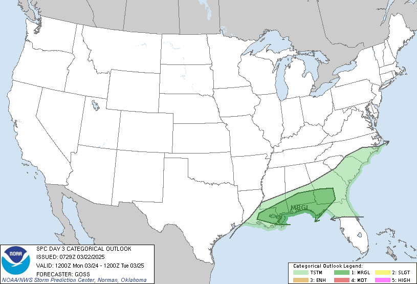
Day 3 Convective Outlook
NWS Storm Prediction Center Norman OK
0233 PM CDT Sun Sep 22 2024

Valid 241200Z - 251200Z

...NO SEVERE THUNDERSTORM AREAS FORECAST...

...SUMMARY...
Severe thunderstorm potential appears low on Tuesday.

...Synopsis...
Broad troughing aloft will continue over much of the
northern/central Plains into the Midwest on Tuesday. A lead
shortwave perturbation will initially be located in the Ozarks/lower
Ohio Valley region and move northeastward and weaken with time. In
the Plains, another shortwave perturbation will dig southward into
the southern Plains by Wednesday morning. This feature will get cut
off from the stronger upper-level flow in the Upper Great Lakes.
Overall, a generally weakening upper-level system will promote weak
to modest height falls across parts of the Tennessee Valley with a
weak cold front/surface low moving slowly eastward with time.

...Tennessee Valley...
Early day precipitation potential will again be possible. The
location and degree of surface destabilization remains in question.
It is possible for a few storms to develop during the afternoon
along the cold front. Mid-level flow will be sufficient for modest
storm organization in the strongest storms. However, continued poor
mid-level lapse rates and lack of focused forcing for ascent leaves
coverage of potentially severe storms in doubt. While a conditional
threat for isolated large hail and damaging winds may develop,
severe probabilities will be withheld and trends in guidance will
continue to be monitored.

..Wendt.. 09/22/2024
https://www.spc.noaa.gov/products/outlook/day3otlk_1930.html
date: 2024-09-22, from: NOAA Weather Forecasts
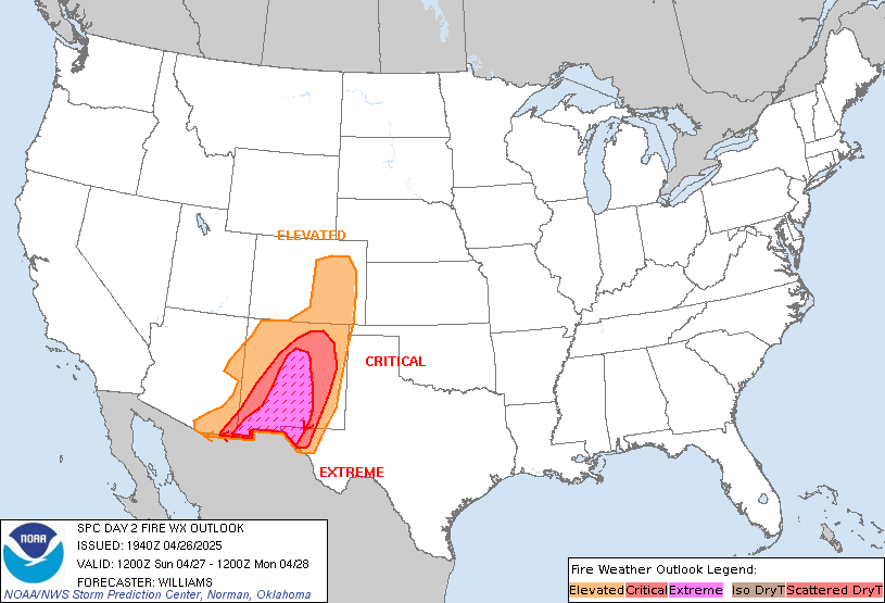
Day 2 Fire Weather Outlook
NWS Storm Prediction Center Norman OK
0223 PM CDT Sun Sep 22 2024

Valid 231200Z - 241200Z

...NO CRITICAL AREAS...

No changes. Fire weather concerns remain minimal on Monday.

..Bentley.. 09/22/2024

.PREV DISCUSSION... /ISSUED 0151 AM CDT Sun Sep 22 2024/

...Synopsis...
Fire weather concerns will be low on Monday across the CONUS. Across
the central US, cool and wet conditions continue beneath mid-level
troughing. Ridging will begin building across the western US with
warming conditions. Though some dry conditions are expected to
continue across the southwest, generally light winds will keep fire
concerns low.

...Please see www.spc.noaa.gov/fire for graphic product...
https://www.spc.noaa.gov/products/fire_wx/fwdy2.html
date: 2024-09-21, from: Eastern Pacific Basin GIS Data
No tropical cyclones as of Sat, 21 Sep 2024 17:50:15 GMT
date: 2024-09-21, from: NOAA tornado/severe thunderstorm watches, mesoscale discussions, convective outlooks, fire weather outlooks
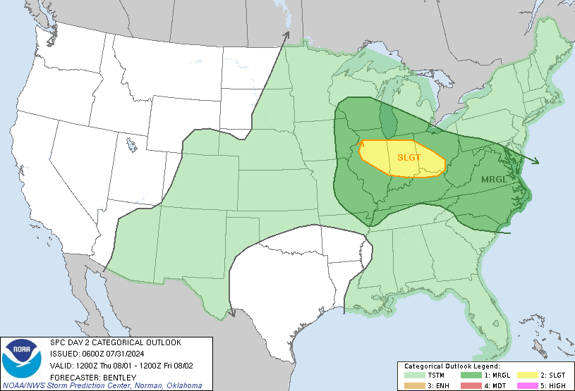
Day 2 Convective Outlook
NWS Storm Prediction Center Norman OK
1221 PM CDT Sat Sep 21 2024

Valid 221200Z - 231200Z

...THERE IS A MARGINAL RISK OF SEVERE THUNDERSTORMS FROM WEST TEXAS
TO SOUTHERN MISSOURI...

...SUMMARY...
Isolated severe thunderstorms are possible on Sunday from west Texas
to central/southern Missouri.

...Synopsis...
A filling mid-level low will move toward the central High Plains on
Sunday afternoon/evening. Moderate mid-level flow will maintain
southeast of this low and overspread the Oklahoma/southern Kansas
vicinity. At the surface, a cold front will extend from southern
Michigan across Illinois and Missouri and into Oklahoma and Texas.

...Southern Missouri across Oklahoma and into West Texas...
Thunderstorms will likely be ongoing along and ahead of the surface
front across the TX Panhandle and into Oklahoma and from central
Kansas, across Missouri, and to southern Illinois Sunday morning. A
seasonally moist airmass featuring upper 60s to perhaps low 70s
dewpoints will exist ahead of the surface front Sunday
afternoon/evening. Surface heating ahead of the front should result
in moderate instability amid a marginally sheared airmass. A few
stronger/organized storms are possible with a primary threat of
damaging wind gusts, especially where any clustering or line
segments can develop. Some large hail is also possible, where a few
supercells are possible across northwest Texas and West Texas.

The severe threat will be primarily diurnally driven with minimal
severe concerns after 1-3 UTC.

..Bentley.. 09/21/2024
https://www.spc.noaa.gov/products/outlook/day2otlk_1730.html
date: 2024-09-21, from: NOAA tornado/severe thunderstorm watches, mesoscale discussions, convective outlooks, fire weather outlooks

Day 1 Convective Outlook
NWS Storm Prediction Center Norman OK
1127 AM CDT Sat Sep 21 2024

Valid 211630Z - 221200Z

...THERE IS A SLIGHT RISK OF SEVERE THUNDERSTORMS ACROSS PORTIONS OF
THE SOUTHERN HIGH PLAINS....

...SUMMARY...
Scattered severe storms capable of all hazards are possible this
afternoon and evening across portions of the southern High Plains.

...Southern High Plains...
A potent upper low and associated 65-75 kt mid-level jet max
centered over AZ are expected to quickly move eastward,
overspreading the southern Rockies/High Plains this afternoon and
evening. At the surface, sustained southerly flow ahead of a
deepening surface low and trailing cold front over western NM will
support moderate destabilization (MLCAPE 1500-2000 J/kg) with
afternoon heating and continued low-level upslope. As the mid-level
system approaches, mid-level height falls and flow aloft will
intensify, elongating low and mid-level hodographs, allowing for
convective development/organization in the form of supercells.

One source of continued uncertainty is the ongoing elevated
convection and cloud debris centered north of a diffuse surface
boundary stretching from central NM to the western TX Panhandle. So
far, this boundary has been slowly lifting north with pronounced
low-level theta-e advection taking place to the south. As deep-layer
ascent intensifies through the late morning, continued convective
development to the north may support reinforcement and stalling of
the boundary. The northward extent of destabilization remains
unclear, though this boundary could serve as a focus for renewed
development of more robust convection expected later this afternoon.


Most CAM guidance shows scattered thunderstorms initiating off the
higher terrain of eastern NM, or ahead of the cold front farther
west by early this afternoon. These storms should quickly mature
with supportive thermodynamics and kinematics, eventually spreading
eastward into the TX Panhandle. The risk for large to very large
hail/severe gusts will likely accompany the stronger supercells, and
a threat for a couple tornadoes may be realized later this
afternoon/early evening from eastern NM into parts of adjacent west
TX, especially near the boundary where low-level shear may be
locally enhanced.

...Upper Midwest and MO Valley...
A second upper low near the international border is forecast to
quickly move eastward reaching the western Great Lakes by early this
evening. Weak ascent is expected ahead of a surging cold front and
diffuse wave cyclone across the northern MO valley and southern MN.
Surface moistening with a warm front lifting north near the IA/MN
border may act as a focus for more robust convective development
along the cold front late this afternoon. Increasingly orthogonal
deep-layer flow and steeping low/mid-level lapse rates could support
a mix of supercells and multi-cell clusters. A few of the stronger
storms may pose some hail/wind threat, which should peak in
intensity during the early evening. However, somewhat limited
heating and the lack of broader forcing for ascent suggests storm
coverage should remain isolated.

...Western PA into the Mid Atlantic...
Short-wave troughing across the upper OH Valley within mid-level
northwesterly flow is expected to support isolated to widely
scattered thunderstorms across western PA/VA later this afternoon.
Model forecast soundings with moderate buoyancy and modest
deep-layer shear would imply some of the stronger storms being
capable of an isolated risk for wind damage (50-60 mph) and perhaps
some hail. This activity will likely diminish by early evening
coincident with nocturnal cooling.

..Lyons/Goss.. 09/21/2024
https://www.spc.noaa.gov/products/outlook/day1otlk_1630.html
date: 2024-09-21, from: NOAA tornado/severe thunderstorm watches, mesoscale discussions, convective outlooks, fire weather outlooks
Day 1 Fire Weather Outlook
NWS Storm Prediction Center Norman OK
1118 AM CDT Sat Sep 21 2024

Valid 211700Z - 221200Z

...NO CRITICAL AREAS...

No changes needed to the ongoing forecast. See discussion below for
more details.

..Marsh.. 09/21/2024

.PREV DISCUSSION... /ISSUED 0156 AM CDT Sat Sep 21 2024/

...Synopsis...
Fire weather concerns will remain low across the CONUS today
as a cold front brings cooler temperatures and increasing
precipitation chances across much of the central/northern Plains.
Brief periods of Elevated fire weather concerns will be possible
across portions of New Mexico as enhanced mid-level flow rounds the
western US upper low. In this region, relative humidity reductions
to 15-20 percent will briefly overlap winds around 15-20 mph. Fuels
across this region remain unsupportive of large-fire spread at this
time with potential for additional rainfall from thunderstorm
activity on Saturday. As such, no areas were included with this
outlook.

...Please see www.spc.noaa.gov/fire for graphic product...
https://www.spc.noaa.gov/products/fire_wx/fwdy1.html
date: 2024-09-20, from: NOAA tornado/severe thunderstorm watches, mesoscale discussions, convective outlooks, fire weather outlooks

Day 1 Convective Outlook
NWS Storm Prediction Center Norman OK
0743 AM CDT Fri Sep 20 2024

Valid 201300Z - 211200Z

...THERE IS A MARGINAL RISK OF SEVERE THUNDERSTORMS FROM SOUTHWEST
LOWER MICHIGAN INTO PARTS OF ILLINOIS...INDIANA...AND SOUTHEAST
MISSOURI...AND OVER PARTS OF THE CENTRAL PLAINS...

...SUMMARY...
Isolated strong to severe thunderstorms are possible during the late
afternoon over parts of southwest Lower Michigan, Illinois, Indiana,
and southeast Missouri. Isolated strong to severe storms are also
possible across parts of the south-central Plains.

...Synopsis...
Shortwave trough currently moving through WI and Upper MI will
continue eastward through the Upper Great Lakes region today.
Another shortwave trough will follow quickly in its wake,
progressing across Alberta, Saskatchewan, and Manitoba, and adjacent
portions of MT and the northern Plains this evening and overnight.
Father south, a deep upper low with seasonably cold mid-level
temperatures will move from southern CA into AZ. Progression of this
low will dampen the northwestern periphery of the upper ridging
centered over TX.

A surface low attendant to this WI/Upper MI shortwave trough is
currently near the IA/WI/IL border intersection, with weak cold
front extending southwestward from this low to another subtle
surface low over the central OK/KS border. Surface troughing
continues southwestward from this secondary low, but this portion of
the boundary has taken on more warm-front-like characteristics over
the past several hours (evidenced by the dewpoint increase of 3-4
deg F over the past 3 hours across the eastern TX/OK Panhandle).
Enhanced westerly/southwesterly flow aloft attendant to both the
central Canada/MT shortwave trough and CA upper low will contribute
to sharpening surface lee troughing throughout the day and into this
evening.

...Central Plains...
Low-level moisture is expected to advect northward/northwestward
throughout the day as Thursday's cold front returns northward as a
warm front. As a result, low to mid 60s dewpoints will likely be in
place across south-central/southeast KS during the late afternoon.
Dewpoints will likely be in upper 50s farther west in southwest KS,
with notably drier conditions across the adjacent TX/OK Panhandles
where downsloping southwesterly surface winds are likely.

Southwesterly flow aloft ahead of the approaching upper low will
advect steep mid-level lapse rates northeastward through the
southern High Plains into western portions of the central Plains.
Modest buoyancy is anticipated during the late afternoon where these
lapse rates overlay the more favorable low-level moisture across
southern KS. Limited large-scale ascent and low-level confluence
near the warm front is anticipated over this region as well, with
isolated to widely scattered high-based thunderstorm anticipated.
Vertical shear will be modest, but still strong enough for
persist/organized storm structures, and the potential for some
strong gusts with the more robust storms. Some isolated hail is also
possible over south-central KS where buoyancy is maximized.

Low-level moisture will continue advection northward during the
evening and overnight, with a strengthening low-level jet
anticipated as well. Consequently, additional thunderstorm
development is expected after 04Z over northeast KS and adjacent far
southeast NE and northwest MO. Isolated hail is possible with the
strongest storms.

...Southwestern Lower MI into IN, IL, and southeast MO...
Upper 60s to low 70s dewpoints are expected from southwest Lower MI
southwestward across western IN, southern IL, and southeast MO.
Daytime heating of this moist low-level air mass will yield a
moderately unstable and uncapped air mass ahead of the approaching
front, and thunderstorm development is anticipated as the front
interacts with this airmass. Moderate vertical shear will be in
place, but poor lapse rates and notable mid-level dry air could make
updraft maintenance difficult. As such, a more multicellular storm
mode is anticipated. Highest storm coverage is expected over
southwest Lower MI and western IN, with warm mid-level temperatures
likely limiting coverage across southern IL and southeast MO.
Locally strong gusts will be the primary severe risk, with isolated,
marginally severe hail possible as well.

..Mosier/Broyles.. 09/20/2024
https://www.spc.noaa.gov/products/outlook/day1otlk_1300.html
date: 2024-09-20, from: NOAA tornado/severe thunderstorm watches, mesoscale discussions, convective outlooks, fire weather outlooks
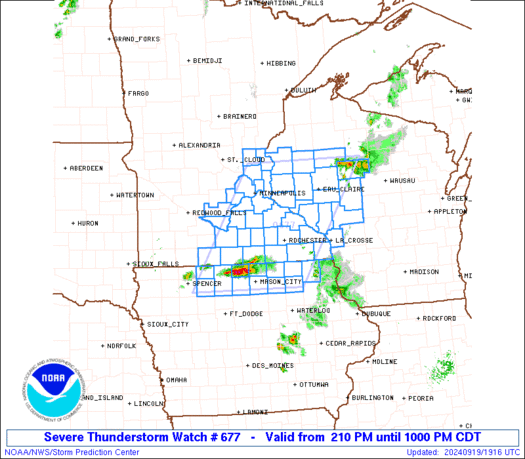
STATUS REPORT ON WW 677

SEVERE WEATHER THREAT CONTINUES RIGHT OF A LINE FROM 15 ENE FOD
TO 35 N MCW TO 55 NNE MSP.

..THORNTON..09/19/24

ATTN...WFO...DMX...ARX...MPX...


STATUS REPORT FOR WS 677

SEVERE WEATHER THREAT CONTINUES FOR THE FOLLOWING AREAS

IAC033-037-067-089-131-191-195-200040-

IA
.    IOWA COUNTIES INCLUDED ARE

CERRO GORDO          CHICKASAW           FLOYD
HOWARD               MITCHELL            WINNESHIEK
WORTH


MNC039-045-047-049-055-099-109-131-147-157-163-169-200040-

MN
.    MINNESOTA COUNTIES INCLUDED ARE

DODGE                FILLMORE            FREEBORN
GOODHUE              HOUSTON             MOWER
OLMSTED              RICE                STEELE
WABASHA              WASHINGTON          WINONA


WIC005-011-017-019-033-035-053-063-091-093-095-107-109-119-121-
200040-

WI
https://www.spc.noaa.gov/products/watch/ws0677.html
date: 2024-09-20, from: NOAA tornado/severe thunderstorm watches, mesoscale discussions, convective outlooks, fire weather outlooks

URGENT - IMMEDIATE BROADCAST REQUESTED
Severe Thunderstorm Watch Number 677
NWS Storm Prediction Center Norman OK
210 PM CDT Thu Sep 19 2024

The NWS Storm Prediction Center has issued a

* Severe Thunderstorm Watch for portions of
  Northern Iowa
  Southern and East-Central Minnesota
  Western Wisconsin

* Effective this Thursday afternoon and evening from 210 PM until
  1000 PM CDT.

* Primary threats include...
  Scattered large hail likely with isolated very large hail events
    to 2.5 inches in diameter possible
  Scattered damaging wind gusts to 70 mph possible
  A tornado or two possible

SUMMARY...Thunderstorms should continue to develop this afternoon
while posing a threat for large hail up to 1.5-2.5 inches in
diameter. As this activity spreads east-northeastward, damaging
winds around 60-70 mph may become more of a threat through this
evening, especially if thunderstorms can form into clusters. A
tornado or two also appears possible with any persistent,
surface-based supercell.

The severe thunderstorm watch area is approximately along and 75
statute miles east and west of a line from 45 miles north northwest
of Eau Claire WI to 15 miles southwest of Mason City IA. For a
complete depiction of the watch see the associated watch outline
update (WOUS64 KWNS WOU7).

PRECAUTIONARY/PREPAREDNESS ACTIONS...

REMEMBER...A Severe Thunderstorm Watch means conditions are
favorable for severe thunderstorms in and close to the watch area.
Persons in these areas should be on the lookout for threatening
weather conditions and listen for later statements and possible
warnings. Severe thunderstorms can and occasionally do produce
tornadoes.

&&

AVIATION...A few severe thunderstorms with hail surface and aloft to
2.5 inches. Extreme turbulence and surface wind gusts to 60 knots. A
few cumulonimbi with maximum tops to 500. Mean storm motion vector
24030.

...Gleason
https://www.spc.noaa.gov/products/watch/ww0677.html
date: 2024-09-20, from: NOAA tornado/severe thunderstorm watches, mesoscale discussions, convective outlooks, fire weather outlooks

STATUS REPORT ON WW 678

THE SEVERE WEATHER THREAT CONTINUES ACROSS THE ENTIRE WATCH AREA.

..THORNTON..09/19/24

ATTN...WFO...DLH...


STATUS REPORT FOR WT 678

SEVERE WEATHER THREAT CONTINUES FOR THE FOLLOWING AREAS

MNC017-031-075-115-137-200040-

MN
.    MINNESOTA COUNTIES INCLUDED ARE

CARLTON              COOK                LAKE
PINE                 ST. LOUIS


WIC003-007-013-031-099-113-129-200040-

WI
.    WISCONSIN COUNTIES INCLUDED ARE

ASHLAND              BAYFIELD            BURNETT
DOUGLAS              PRICE               SAWYER
WASHBURN


LSZ121-140-141-142-143-144-145-146-147-148-150-162-200040-

CW

.    ADJACENT COASTAL WATERS INCLUDED ARE

CHEQUAMEGON BAY-BAYFIELD TO OAK POINT WI
https://www.spc.noaa.gov/products/watch/ws0678.html
date: 2024-09-20, from: NOAA tornado/severe thunderstorm watches, mesoscale discussions, convective outlooks, fire weather outlooks

URGENT - IMMEDIATE BROADCAST REQUESTED
Tornado Watch Number 678
NWS Storm Prediction Center Norman OK
505 PM CDT Thu Sep 19 2024

The NWS Storm Prediction Center has issued a

* Tornado Watch for portions of
  Northeast Minnesota
  Northwest Wisconsin
  Lake Superior

* Effective this Thursday afternoon and evening from 505 PM until
  1100 PM CDT.

* Primary threats include...
  A couple tornadoes possible
  Scattered damaging wind gusts to 70 mph possible
  Scattered large hail events to 1.5 inches in diameter possible

SUMMARY...Scattered thunderstorms will continue to develop across
northeastern Minnesota and track eastward across the watch area this
evening.  Isolated intense/supercells are possible, capable of hail,
damaging winds, and a tornado or two.

The tornado watch area is approximately along and 50 statute miles
east and west of a line from 40 miles north northwest of Grand
Marais MN to 85 miles south of Duluth MN. For a complete depiction
of the watch see the associated watch outline update (WOUS64 KWNS
WOU8).

PRECAUTIONARY/PREPAREDNESS ACTIONS...

REMEMBER...A Tornado Watch means conditions are favorable for
tornadoes and severe thunderstorms in and close to the watch
area. Persons in these areas should be on the lookout for
threatening weather conditions and listen for later statements
and possible warnings.

&&

OTHER WATCH INFORMATION...CONTINUE...WW 677...

AVIATION...Tornadoes and a few severe thunderstorms with hail
surface and aloft to 1.5 inches. Extreme turbulence and surface wind
gusts to 60 knots. A few cumulonimbi with maximum tops to 500. Mean
storm motion vector 23035.

...Hart
https://www.spc.noaa.gov/products/watch/ww0678.html
date: 2024-09-20, from: NOAA tornado/severe thunderstorm watches, mesoscale discussions, convective outlooks, fire weather outlooks

STATUS REPORT ON WW 679

SEVERE WEATHER THREAT CONTINUES RIGHT OF A LINE FROM 35 S PNC TO
15 N CNU TO 30 S TOP.

..THORNTON..09/19/24

ATTN...WFO...ICT...TOP...SGF...EAX...TSA...


STATUS REPORT FOR WS 679

SEVERE WEATHER THREAT CONTINUES FOR THE FOLLOWING AREAS

KSC001-003-011-019-021-037-099-107-121-125-133-205-200040-

KS
.    KANSAS COUNTIES INCLUDED ARE

ALLEN                ANDERSON            BOURBON
CHAUTAUQUA           CHEROKEE            CRAWFORD
LABETTE              LINN                MIAMI
MONTGOMERY           NEOSHO              WILSON


MOC011-013-015-037-039-057-083-085-097-101-119-145-159-185-217-
200040-

MO
.    MISSOURI COUNTIES INCLUDED ARE

BARTON               BATES               BENTON
CASS                 CEDAR               DADE
HENRY                HICKORY             JASPER
JOHNSON              MCDONALD            NEWTON
PETTIS               ST. CLAIR           VERNON


OKC035-041-097-105-113-115-117-131-143-145-147-200040-
https://www.spc.noaa.gov/products/watch/ws0679.html
date: 2024-09-20, from: NOAA tornado/severe thunderstorm watches, mesoscale discussions, convective outlooks, fire weather outlooks

URGENT - IMMEDIATE BROADCAST REQUESTED
Severe Thunderstorm Watch Number 679
NWS Storm Prediction Center Norman OK
530 PM CDT Thu Sep 19 2024

The NWS Storm Prediction Center has issued a

* Severe Thunderstorm Watch for portions of
  Southeast Kansas
  Western Missouri
  Northeast Oklahoma

* Effective this Thursday afternoon from 530 PM until Midnight
  CDT.

* Primary threats include...
  Scattered damaging winds and isolated significant gusts to 75
    mph possible
  Isolated large hail events to 1.5 inches in diameter possible

SUMMARY...Scattered thunderstorms are expected to continue to
intensify through the evening across southeast Kansas and northern
Oklahoma, spreading into parts of western Missouri through the
evening.  Damaging winds and some hail are the main concerns.

The severe thunderstorm watch area is approximately along and 60
statute miles east and west of a line from 30 miles south of
Bartlesville OK to 100 miles north northeast of Joplin MO. For a
complete depiction of the watch see the associated watch outline
update (WOUS64 KWNS WOU9).

PRECAUTIONARY/PREPAREDNESS ACTIONS...

REMEMBER...A Severe Thunderstorm Watch means conditions are
favorable for severe thunderstorms in and close to the watch area.
Persons in these areas should be on the lookout for threatening
weather conditions and listen for later statements and possible
warnings. Severe thunderstorms can and occasionally do produce
tornadoes.

&&

OTHER WATCH INFORMATION...CONTINUE...WW 677...WW 678...

AVIATION...A few severe thunderstorms with hail surface and aloft to
1.5 inches. Extreme turbulence and surface wind gusts to 65 knots. A
few cumulonimbi with maximum tops to 500. Mean storm motion vector
28025.

...Hart
https://www.spc.noaa.gov/products/watch/ww0679.html
date: 2024-09-19, from: NOAA tornado/severe thunderstorm watches, mesoscale discussions, convective outlooks, fire weather outlooks
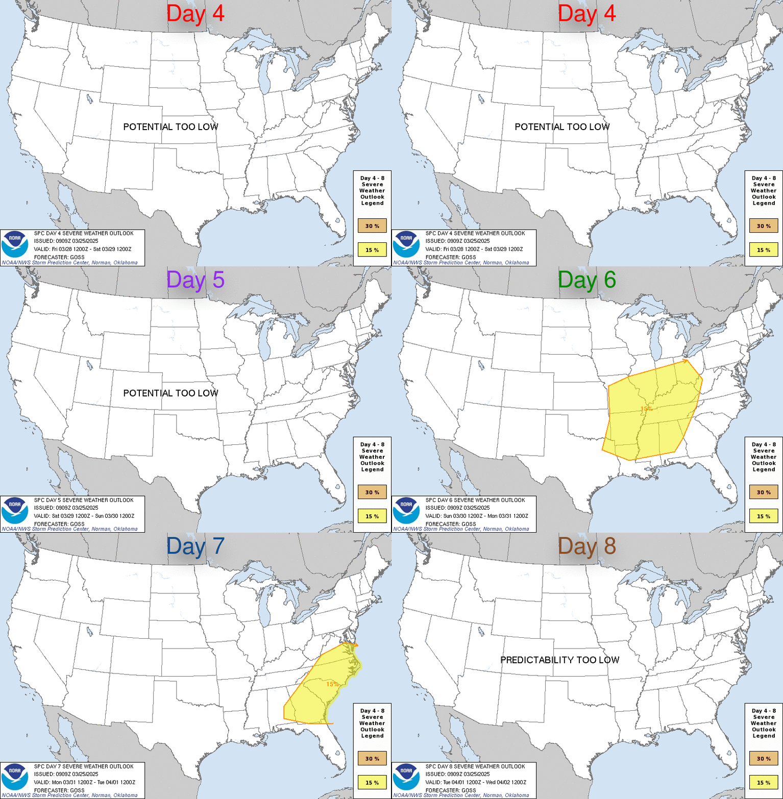
Day 4-8 Convective Outlook
NWS Storm Prediction Center Norman OK
0356 AM CDT Thu Sep 19 2024

Valid 221200Z - 271200Z

...DISCUSSION...
Some severe potential is evident on both D4/Sunday and D5/Monday.
But both regimes appear to be focused on the mesoscale, rendering
insufficient predictability at this time frame for a 15 percent
highlight. A combination of both low predictability and potential is
apparent mid-week next week.

A southern-stream shortwave trough is expected to progress from the
Southwest into the central Great Plains on D4. A confined belt of
enhanced mid-level southwesterlies overspreading a corridor of rich
boundary-layer moisture just ahead of an attendant weak surface
cyclone may yield a severe-storm threat on Sunday afternoon. Per
consensus of latest guidance, the most favored area could be
centered around the Lower MO Valley. This shortwave trough may
continue northeastward towards the Upper MS Valley into D5. Guidance
spread increases with the degree of forward speed, along with
potential weakening of the flow fields surrounding the trough.
Still, a similar setup may occur on Monday in parts of the Midwest,
centered on the southwest Great Lakes region. Mid-level lapse rates
on both days are uniformly depicted to be weak, suggestive of
lower-end severe potential.
https://www.spc.noaa.gov/products/exper/day4-8/
date: 2024-09-18, from: NOAA tornado/severe thunderstorm watches, mesoscale discussions, convective outlooks, fire weather outlooks

Mesoscale Discussion 2084
NWS Storm Prediction Center Norman OK
0342 PM CDT Wed Sep 18 2024

Areas affected...The eastern Texas Panhandle into northwest Oklahoma
and southern Kansas

Concerning...Severe potential...Watch unlikely

Valid 182042Z - 182245Z

Probability of Watch Issuance...20 percent

SUMMARY...Thunderstorm development is expected by late
afternoon/early evening across the eastern Texas Panhandle and into
adjacent portions of northwest Oklahoma and southern Kansas.
Thunderstorm coverage should remain sufficiently isolated to
preclude watch issuance, but instances of severe hail/wind will be
possible.

DISCUSSION...Latest GOES imagery shows deepening cumulus along a
weakly confluent surface trough across the TX Panhandle into
southern KS. The southerly flow regime across the region has helped
offset the influence of diurnal mixing with dewpoints remaining the
low to mid 60s. Concurrently, temperatures are warming into the low
to mid 90s, which is eroding inhibition and supporting MLCAPE
upwards of around 1000 J/kg. Any further improvements to the
thermodynamic environment will be modest through late afternoon,
namely in the form of steepening low-level lapse rates as
temperatures peak in the mid to upper 90s. However, nearly zonal
30-35 knot flow aloft is supporting somewhat elongated mid-level
hodographs with similar effective bulk shear values. This kinematic
environment should support organized convection, including the
potential for a supercell or two with an attendant risk for large
hail (most likely up to 1.0-1.75 inches in diameter) and severe
winds. Based on the aforementioned satellite trends, at least a
couple of storms appear probable, but the fairly weak forcing for
ascent along the surface trough and stronger inhibition downstream
into OK and KS suggests that storm coverage and duration may be
limited. Consequently, watch issuance is unlikely.

..Moore/Gleason.. 09/18/2024

...Please see www.spc.noaa.gov for graphic product...

ATTN...WFO...ICT...OUN...DDC...LUB...AMA...

LAT...LON   35020160 36810046 37789985 38129965 38369910 38379879
            38259853 38039837 37809827 37549819 37309817 37039825
            36739841 36279872 35839903 35389952 34999987 34700026
            34590067 34620121 34670144 34850167 35020160
https://www.spc.noaa.gov/products/md/md2084.html
date: 2024-09-18, from: NOAA tornado/severe thunderstorm watches, mesoscale discussions, convective outlooks, fire weather outlooks

Mesoscale Discussion 2083
NWS Storm Prediction Center Norman OK
0253 PM CDT Wed Sep 18 2024

Areas affected...parts of eastern South Dakota...adjacent
northeastern Nebraska and southwestern Minnesota

Concerning...Severe potential...Watch possible

Valid 181953Z - 182230Z

Probability of Watch Issuance...40 percent

SUMMARY...The initiation of one or two strong storms appears
possible late this afternoon.  Sustained storm development may
include the evolution of supercell structures posing a risk for
severe hail, and perhaps some potential for a tornado by early
evening.  Due to the isolated nature, it is not certain that a
severe weather watch is needed, but trends are being monitored.

DISCUSSION...Although stronger mid-level height falls appear to be
shifting to the north, a destabilizing warm sector boundary layer
across the eastern South Dakota vicinity will remain beneath weakly
difluent cyclonic mid-level flow into early evening.  With
mixed-layer CAPE now on the order of 1500 J/kg, beneath 30-50 kt
southwesterly mid/upper flow, the environment appears at least
conditionally supportive of supercells, and low-level hodographs may
enlarge with clockwise curvature as southerly flow around 850 mb is
forecast to strengthen some (to around 30+ kt) through 22-00Z.

Although low-level forcing for sustained convective development
remains unclear, weak warm advection to the east of the dryline may
be supporting ongoing attempts at deepening convection east of Huron
into the Watertown vicinity.  And objective analysis has indicated a
persistent localized area of enhanced convergence along a confluence
zone near/west of Yankton.

Model output, including the convection allowing guidance, suggest
that probabilities for thunderstorm development are generally low
into early evening.  However, the initiation of one or two storms
appears possible.  If this is sustained, this may include the
evolution of supercell structures posing a risk for severe hail, and
perhaps some potential for a tornado.

..Kerr/Gleason.. 09/18/2024

...Please see www.spc.noaa.gov for graphic product...

ATTN...WFO...MPX...FSD...OAX...ABR...LBF...

LAT...LON   45389647 44609622 42819716 42949859 44379830 45219788
            45549726 45389647
https://www.spc.noaa.gov/products/md/md2083.html
date: 2024-09-15, from: Eastern Pacific Basin GIS Data
KMZ last updated Sun, 15 Sep 2024 14:43:44 GMT
https://www.nhc.noaa.gov/storm_graphics/api/EP092024_013adv_TRACK.kmz
date: 2024-09-15, from: Eastern Pacific Basin GIS Data
Track, Points, and Wind Swath. Shapefile last updated Sun, 15 Sep 2024 14:42:13 GMT
https://www.nhc.noaa.gov/gis/best_track/ep092024_best_track.zip
date: 2024-09-15, from: Eastern Pacific Basin GIS Data
KMZ last updated Sun, 15 Sep 2024 14:42:13 GMT
https://www.nhc.noaa.gov/gis/best_track/ep092024_best_track.kmz
date: 2024-09-15, from: Eastern Pacific Basin GIS Data
Initial and Forecast Surface Winds. Shapefile last updated Sun, 15 Sep 2024 14:42:13 GMT
https://www.nhc.noaa.gov/gis/forecast/archive/ep092024_fcst_013.zip
date: 2024-09-15, from: Eastern Pacific Basin GIS Data
KMZ last updated Sun, 15 Sep 2024 14:42:04 GMT
https://www.nhc.noaa.gov/storm_graphics/api/EP092024_013adv_CONE.kmz
date: 2024-09-15, from: Eastern Pacific Basin GIS Data
Forecast Track, Cone of Uncertainty, Watches/Warnings. Shapefile last updated Sun, 15 Sep 2024 14:41:53 GMT
https://www.nhc.noaa.gov/gis/forecast/archive/ep092024_5day_013.zip
date: 2024-09-15, from: Eastern Pacific Basin Tropical Cyclones

5-Day Uncertainty Track last
updated Sun, 15 Sep 2024 14:41:29 GMT

Wind Speed Probabilities last
updated Sun, 15 Sep 2024 15:28:48 GMT
https://www.nhc.noaa.gov/refresh/graphics_ep4+shtml/144129.shtml?cone
date: 2024-09-15, from: Eastern Pacific Basin Tropical Cyclones
227
WTPZ44 KNHC 151440
TCDEP4

Post-Tropical Cyclone Ileana Discussion Number  13
NWS National Hurricane Center Miami FL       EP092024
800 AM MST Sun Sep 15 2024

Ileana has been devoid of deep convection since yesterday afternoon,
as the system has been within a strong wind shear and very dry
environment. Given the lack of convection, the system is being
designated as a post-tropical remnant low.  An ASCAT-C pass from
late last night depicted winds near 30 kt over the Gulf of
California near northern Sinaloa.  Given this, will hold the
intensity at 30 kt for this advisory, although that may be generous.

The system has been meandering over the Gulf of California with a
motion of 310/3 kt.  The remnant low will increase forward speed
later today as it continues northwestward.  The remnant low will
continue to weaken throughout the day, and is forecast to dissipate
on Monday.

This is the last advisory on this system. For additional
information on the remnant low please see High Seas Forecasts issued
by the National Weather Service, under AWIPS header NFDHSFEPI, WMO
header FZPN02 KWBC, and on the web at
ocean.weather.gov/shtml/NFDHSFEPI.php


FORECAST POSITIONS AND MAX WINDS

INIT  15/1500Z 25.7N 109.6W   30 KT  35 MPH...POST-TROPICAL
 12H  16/0000Z 26.1N 110.1W   25 KT  30 MPH...POST-TROP/REMNT LOW
 24H  16/1200Z 27.3N 111.0W   20 KT  25 MPH...POST-TROP/REMNT LOW
 36H  17/0000Z...DISSIPATED

$$
Forecaster Kelly
https://www.nhc.noaa.gov/text/refresh/MIATCDEP4+shtml/151440.shtml
date: 2024-09-15, from: Eastern Pacific Basin GIS Data
…ILEANA BECOMES A REMNANT LOW… …THIS IS THE LAST ADVISORY… As of 8:00 AM MST Sun Sep 15 the center of Ileana was located near 25.7, -109.6 with movement NW at 3 mph. The minimum central pressure was 1006 mb with maximum sustained winds of about 35 mph.
https://www.nhc.noaa.gov/text/refresh/MIATCPEP4+shtml/151439.shtml
date: 2024-09-15, from: Eastern Pacific Basin Tropical Cyclones
221
FOPZ14 KNHC 151439
PWSEP4

POST-TROPICAL CYCLONE ILEANA WIND SPEED PROBABILITIES NUMBER  13
NWS NATIONAL HURRICANE CENTER MIAMI FL       EP092024
1500 UTC SUN SEP 15 2024

AT 1500Z THE CENTER OF POST-TROPICAL CYCLONE ILEANA WAS LOCATED NEAR
LATITUDE 25.7 NORTH...LONGITUDE 109.6 WEST WITH MAXIMUM SUSTAINED
WINDS NEAR 30 KTS...35 MPH...55 KM/H.

Z INDICATES COORDINATED UNIVERSAL TIME (GREENWICH)
   PACIFIC  DAYLIGHT TIME (PDT)...SUBTRACT 7 HOURS FROM Z TIME
   HAWAIIAN STANDARD TIME (HST)...SUBTRACT 10 HOURS FROM Z TIME

WIND SPEED PROBABILITY TABLE FOR SPECIFIC LOCATIONS

CHANCES OF SUSTAINED (1-MINUTE AVERAGE) WIND SPEEDS OF AT LEAST
   ...34 KT (39 MPH... 63 KM/H)...
   ...50 KT (58 MPH... 93 KM/H)...
   ...64 KT (74 MPH...119 KM/H)...
FOR LOCATIONS AND TIME PERIODS DURING THE NEXT 5 DAYS

PROBABILITIES FOR LOCATIONS ARE GIVEN AS OP(CP) WHERE
    OP  IS THE PROBABILITY OF THE EVENT BEGINNING DURING
        AN INDIVIDUAL TIME PERIOD (ONSET PROBABILITY)
   (CP) IS THE PROBABILITY OF THE EVENT OCCURRING BETWEEN
        12Z SUN AND THE FORECAST HOUR (CUMULATIVE PROBABILITY)

PROBABILITIES ARE GIVEN IN PERCENT
X INDICATES PROBABILITIES LESS THAN 1 PERCENT
PROBABILITIES FOR 34 KT AND 50 KT ARE SHOWN AT A GIVEN LOCATION WHEN
THE 5-DAY CUMULATIVE PROBABILITY IS AT LEAST 3 PERCENT.
PROBABILITIES FOR 34...50...64 KT SHOWN WHEN THE 5-DAY
64-KT CUMULATIVE PROBABILITY IS AT LEAST 1 PERCENT.


  - - - - WIND SPEED PROBABILITIES FOR SELECTED LOCATIONS - - - -

               FROM    FROM    FROM    FROM    FROM    FROM    FROM
  TIME       12Z SUN 00Z MON 12Z MON 00Z TUE 12Z TUE 12Z WED 12Z THU
PERIODS         TO      TO      TO      TO      TO      TO      TO
             00Z MON 12Z MON 00Z TUE 12Z TUE 12Z WED 12Z THU 12Z FRI

FORECAST HOUR    (12)   (24)    (36)    (48)    (72)    (96)   (120)
- - - - - - - - - - - - - - - - - - - - - - - - - - - - - - - - - -
LOCATION       KT

$$
FORECASTER KELLY
https://www.nhc.noaa.gov/text/refresh/MIAPWSEP4+shtml/151439.shtml
date: 2024-09-15, from: Eastern Pacific Basin GIS Data
Issued at Sun, 15 Sep 2024 14:39:31 GMT. This is only a prototype and the file format may change without notice.
https://www.nhc.noaa.gov/storm_graphics/EP09/atcf-ep092024.xml
date: 2024-09-15, from: Eastern Pacific Basin Tropical Cyclones
198
WTPZ24 KNHC 151438
TCMEP4

POST-TROPICAL CYCLONE ILEANA FORECAST/ADVISORY NUMBER  13
NWS NATIONAL HURRICANE CENTER MIAMI FL       EP092024
1500 UTC SUN SEP 15 2024

POST-TROPICAL CYCLONE CENTER LOCATED NEAR 25.7N 109.6W AT 15/1500Z
POSITION ACCURATE WITHIN  20 NM

PRESENT MOVEMENT TOWARD THE NORTHWEST OR 310 DEGREES AT   3 KT

ESTIMATED MINIMUM CENTRAL PRESSURE 1006 MB
MAX SUSTAINED WINDS  30 KT WITH GUSTS TO  40 KT.
WINDS AND SEAS VARY GREATLY IN EACH QUADRANT.  RADII IN NAUTICAL
MILES ARE THE LARGEST RADII EXPECTED ANYWHERE IN THAT QUADRANT.

REPEAT...CENTER LOCATED NEAR 25.7N 109.6W AT 15/1500Z
AT 15/1200Z CENTER WAS LOCATED NEAR 25.5N 109.5W

FORECAST VALID 16/0000Z 26.1N 110.1W...POST-TROP/REMNT LOW
MAX WIND  25 KT...GUSTS  35 KT.

FORECAST VALID 16/1200Z 27.3N 111.0W...POST-TROP/REMNT LOW
MAX WIND  20 KT...GUSTS  30 KT.

FORECAST VALID 17/0000Z...DISSIPATED

REQUEST FOR 3 HOURLY SHIP REPORTS WITHIN 300 MILES OF 25.7N 109.6W

THIS IS THE LAST FORECAST/ADVISORY ISSUED BY THE NATIONAL HURRICANE
CENTER ON THIS SYSTEM. FOR ADDITIONAL INFORMATION ON THE REMNANT LOW
PLEASE SEE HIGH SEAS FORECASTS ISSUED BY THE NATIONAL WEATHER
SERVICE...UNDER AWIPS HEADER NFDHSFEPI AND WMO HEADER FZPN02 KWBC.


$$
FORECASTER KELLY
https://www.nhc.noaa.gov/text/refresh/MIATCMEP4+shtml/151438.shtml