(date: 2024-10-13 09:42:43)
date: 2024-10-13, from: NOAA Weather Forecasts

Day 1 Fire Weather Outlook
NWS Storm Prediction Center Norman OK
1128 AM CDT Sun Oct 13 2024

Valid 131700Z - 141200Z

...17Z Update...
A minor areal extension was made to the Elevated area across OK to
include portions of southern KS. Observational trends in relative
humidity, along with the latest hires guidance, suggest a drop to
near or just below 20 percent will occur by early this afternoon
within this added region. Northerly wind speeds behind a cold front
are also expected to increase to around 15 to 20 mph later today. In
addition, fuels are highly receptive to fire spread across the
Plains. Please see the previous discussion for the Elevated area
across AZ and UT, where the forecast has not been adjusted.

..Barnes.. 10/13/2024

.PREV DISCUSSION... /ISSUED 1224 AM CDT Sun Oct 13 2024/

...Synopsis...
A mid-level shortwave trough will transition to a closed low over
the northern Great Basin, providing some enhancement to the
mid-level flow and stronger southerly surface winds over portions of
northwestern Arizona into southern Utah. Dry/breezy post-frontal
flow in Oklahoma will also support Elevated fire-weather concerns.

...Northwest Arizona into Utah...
The forecast has trended a little less dry, with relative humidity
values between 15-20% and 15-20 MPH winds. The strongest winds
(approaching 20 MPH sustained) will be confined to northwest
Arizona, where ERC values are on the lower end at the 80th annual
percentile and relative humidity is closer to 20%. Further north in
Utah, fuels vary between the 90th and 95th annual percentiles and
are colocated with <15% relative humidity values, but confidence in
winds exceeding sustained 15 MPH is lower. Given the overall spread
of moisture, wind speeds, and fuel percentiles over the area,
Elevated highlights have been maintained with no introduction of
Critical areas.

...Oklahoma...
Forecast guidance has come into better agreement for 15-20% relative
humidity and 15 MPH winds during the afternoon as a cold front moves
southward across Oklahoma. Fuels guidance shows ERC values at or
exceeding the 98th annual percentile, supporting both wildfire
ignition and spread.

...Please see www.spc.noaa.gov/fire for graphic product...
https://www.spc.noaa.gov/products/fire_wx/fwdy1.html
date: 2024-10-13, from: NOAA tornado/severe thunderstorm watches, mesoscale discussions, convective outlooks, fire weather outlooks
No watches are valid as of Sun Oct 13 16:30:02 UTC 2024.
https://www.spc.noaa.gov/products/watch/
date: 2024-10-13, from: NOAA tornado/severe thunderstorm watches, mesoscale discussions, convective outlooks, fire weather outlooks
No Mesoscale Discussions are in effect as of Sun Oct 13 16:30:02 UTC 2024.
https://www.spc.noaa.gov/products/md/
date: 2024-10-13, from: NOAA tornado/severe thunderstorm watches, mesoscale discussions, convective outlooks, fire weather outlooks

Day 1 Convective Outlook
NWS Storm Prediction Center Norman OK
1116 AM CDT Sun Oct 13 2024

Valid 131630Z - 141200Z

...THERE IS A MARGINAL RISK OF SEVERE THUNDERSTORMS THIS AFTERNOON
AND EVENING FROM THE NORTHERN APPALACHIANS INTO PARTS OF THE
TENNESSEE VALLEY....

...SUMMARY...
Strong to locally severe thunderstorms are possible, mainly this
evening, from Pennsylvania southward to the Tennessee Valley.
Isolated wind damage should be the main threat.

...Central/Southern Appalachians into the Tennessee Valley...
Water vapor loop shows a fast-moving and deepening shortwave trough
over WI.  This feature will dig southeastward across the Great Lakes
region through the day, with fast flow aloft extending eastward
across the central Appalachians.  A surface low currently over
northern OH will track eastward across PA along a warm front, while
an associated cold front sweeps southeastward across OH/WV/KY/TN.
Low-level moisture is quite limited ahead of this system, which will
limit coverage and overall intensity of convection.  However, over
half of morning CAM solutions suggest thunderstorm development along
the front this afternoon and evening, where winds aloft and steep
low-level lapse rates will promote a risk of locally gusty/damaging
winds.

The MRGL risk area has been extended northeastward into parts of
central/northeast PA, ahead of the surface low and along the warm
front.  CAPE will be very weak in this area, but forecast soundings
and some CAM guidance suggest the potential for 1 or 2 rotating
storms capable of gusty wind or perhaps a brief spin-up around peak
heating.

..Hart/Weinman.. 10/13/2024
https://www.spc.noaa.gov/products/outlook/day1otlk_1630.html
date: 2024-10-13, from: Eastern Pacific Basin GIS Data
No tropical cyclones as of Sun, 13 Oct 2024 14:55:00 GMT
date: 2024-10-13, from: NOAA tornado/severe thunderstorm watches, mesoscale discussions, convective outlooks, fire weather outlooks

Day 1 Convective Outlook
NWS Storm Prediction Center Norman OK
0746 AM CDT Sun Oct 13 2024

Valid 131300Z - 141200Z

...THERE IS A MARGINAL RISK OF SEVERE THUNDERSTORMS ACROSS PARTS OF
THE CENTRAL/SOUTHERN APPALACHIANS AND TENNESSEE VALLEY...

...SUMMARY...
Strong to locally severe thunderstorms are possible, mainly this
evening, across parts of the central/southern Appalachians and
Tennessee Valley. Isolated wind damage and marginally severe hail
should be the main threats.

...Central/Southern Appalachians into the Tennessee Valley...
Ongoing elevated thunderstorms across northeast OH and western PA
should continue eastward this morning in tandem with an enhanced
west-southwesterly low-level jet. This activity is expected to
outpace low-level moisture return and related destabilization today,
and eventually weaken. But in the short term, small hail remains
possible. Meanwhile, a vigorous shortwave trough over the Upper
Midwest will dig southeastward through the base of a large-scale
mid/upper trough, and yield amplification of this trough southward
across the Great Lakes through Monday morning. Ascent preceding this
shortwave trough will overspread parts of the central/southern
Appalachians into the TN Valley, mainly during the evening and
overnight.

A leading and weaker mid-level perturbation will encourage the
primary surface low to develop eastward across PA this afternoon
through early evening. A surface cold front will extend southwest of
this low into the TN Valley. Convective development along the front
appears likely to be delayed until early evening, as the
strengthening large-scale ascent aids in increasing low-level
convergence along the front amid generally veered flow within the
warm sector. Surface dew points should largely range from the mid
50s in WV to a narrow corridor of low 60s in TN, yielding a plume of
MLCAPE around 500-1500 J/kg amid initially steep mid-level lapse
rates.

Recent guidance still differs regarding storm coverage along/ahead
of the cold front this evening, from almost none to scattered. This
is perhaps in response to the ascent with the shortwave trough
strengthening after peak diurnal heating. The strongest 700 mb
westerlies (around 40-55 kt) should be confined to mainly northeast
of the TN Valley. Forecast hodographs above this level appear small,
owing to weakening winds with height as fast mid/upper flow lags to
the north-northwest. This suggests supercell structures may struggle
to develop/be sustained. But the strong 700 mb flow could support
localized damaging winds in any multicell clusters that can form.
Farther southwest, somewhat greater buoyancy could foster small to
marginally severe hail as well. The overall severe threat appears
likely to remain rather isolated, and no changes have been made to
the Marginal Risk with this update.

..Gleason/Jewell.. 10/13/2024
https://www.spc.noaa.gov/products/outlook/day1otlk_1300.html
date: 2024-10-13, from: Central Pacific Tropical Weather Outlook
000
ACPN50 PHFO 131237
TWOCP
Tropical Weather Outlook
NWS Central Pacific Hurricane Center
Honolulu HI
200 AM HST Sun Oct 13 2024
For the
central North Pacific…between 140W and 180W:
No tropical
cyclones are expected during the next 7 days.
$$
Forecaster Blood
https://www.nhc.noaa.gov/gtwo.php?basin=cpac
date: 2024-10-13, from: Central Pacific Basin Tropical Cyclones
No tropical cyclones as of Sun, 13 Oct 2024 14:55:00 GMT
date: 2024-10-13, from: Graphical Tropical Weather Outlooks


https://www.nhc.noaa.gov/gtwo.php?basin=atlc
date: 2024-10-13, from: Eastern Pacific Tropical Weather Outlook
000
ABPZ20 KNHC 131137
TWOEP
Tropical Weather Outlook
NWS National Hurricane Center Miami
FL
500 AM PDT Sun Oct 13 2024
For the eastern North
Pacific…east of 140 degrees west longitude:
Tropical
cyclone formation is not expected during the next 7 days.
$$
Forecaster Konarik/Papin
https://www.nhc.noaa.gov/gtwo.php?basin=epac
date: 2024-10-12, from: NOAA tornado/severe thunderstorm watches, mesoscale discussions, convective outlooks, fire weather outlooks

Day 3 Convective Outlook
NWS Storm Prediction Center Norman OK
0200 PM CDT Sat Oct 12 2024

Valid 141200Z - 151200Z

...NO SEVERE THUNDERSTORM AREAS FORECAST...

...SUMMARY...
The risk for thunderstorms still appears negligible across much of
the U.S. Monday through Monday night.

...Synopsis...
A broad mid-level trough, with embedded perturbations, will persist
across the eastern CONUS as a 500 mb cut-off low continues to
meander over the Four Corners region. Widespread surface high
pressure behind a cold front will overspread the MS Valley toward
the Gulf Coast and Atlantic Seaboard, resulting in enough static
stability to limit thunderstorm development over most locales. The
cold front should be drifting southward across the FL Peninsula,
with thunderstorms possible across southern portions of the state by
afternoon. A couple of lightning flashes are also possible over
portions of Lake Michigan and Lake Erie (and immediate surrounding
landmass), as cold mid-level temperatures associated with the upper
trough overspread relatively warm waters. Finally, cooler mid-level
temperatures and associated lapse rates accompanying the cut-off low
may support a couple of thunderstorms over the higher terrain of the
Four Corners given the assistance of orographic lift.

..Squitieri.. 10/12/2024
https://www.spc.noaa.gov/products/outlook/day3otlk_1930.html
date: 2024-10-12, from: NOAA tornado/severe thunderstorm watches, mesoscale discussions, convective outlooks, fire weather outlooks

Day 2 Fire Weather Outlook
NWS Storm Prediction Center Norman OK
0142 PM CDT Sat Oct 12 2024

Valid 131200Z - 141200Z

...20Z Update...
The previous forecast remains accurate and no changes are needed.
Please see the discussion below for details.

..Barnes.. 10/12/2024

.PREV DISCUSSION... /ISSUED 1258 AM CDT Sat Oct 12 2024/

...Synopsis...
A mid-level shortwave trough will transition to a closed low over
the northern Great Basin on Sunday, providing some enhancement to
the mid-level flow and stronger southerly winds over portions of
northwestern Arizona into southern Utah. Dry/breezy pre-frontal flow
in Texas and post-frontal flow in Oklahoma may result in Elevated
fire-weather conditions as well.

...Northwest Arizona into Utah...
15-20 MPH winds and 10-15% relative humidity values are expected as
daytime heating and boundary-layer mixing occurs during the
afternoon, with some areas seeing locally critical conditions where
topography supports enhanced surface winds. These conditions will
overspread fuels modestly to very receptive to wildfire ignition and
spread, with ERC values between the 80th and 95th annual
percentiles.

...Central Texas...
Portions of central Texas may see Elevated fire-weather conditions
on Sunday, where warm/dry southwesterly flow ahead of a
southward-moving cold front will support at least 15 MPH winds with
boundary-layer relative humidity values between 10% and 20%.
However, these conditions don't currently overlap with especially
receptive fuels, and there is still uncertainty in the surface wind
speeds reaching sustained Elevated criteria.

...Oklahoma...
Much of Oklahoma could also experience some Elevated fire-weather
conditions in a dry and breezy post-frontal airmass. However,
ensemble guidance indicates spread/uncertainty in both
boundary-layer relative humidity and wind speeds supporting wildfire
spread, and recent wetting rainfall has lessened fuel receptiveness
in portions of Central Oklahoma. Still, much of the fuels
surrounding the areas recently rained on have ERC values exceeding
the 95th annual percentile. If future forecast guidance comes into
better agreement about the meteorological conditions, Elevated
highlights may be warranted.

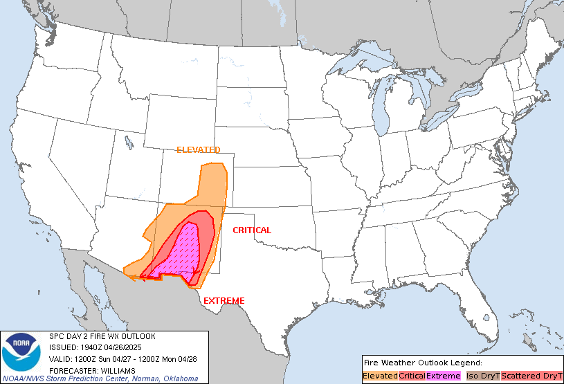
...Please see www.spc.noaa.gov/fire for graphic product...
https://www.spc.noaa.gov/products/fire_wx/fwdy2.html
date: 2024-10-12, from: NOAA tornado/severe thunderstorm watches, mesoscale discussions, convective outlooks, fire weather outlooks

Day 2 Convective Outlook
NWS Storm Prediction Center Norman OK
1204 PM CDT Sat Oct 12 2024

Valid 131200Z - 141200Z

...THERE IS A MARGINAL RISK OF SEVERE THUNDERSTORMS FOR PORTIONS OF
THE CENTRAL APPALACHIANS...

...SUMMARY...
Strong thunderstorms cannot be ruled out in a corridor across West
Virginia, and perhaps into portions of eastern Kentucky and
southwestern Virginia, late tomorrow (Sunday) afternoon and evening.
Small to marginally severe hail and potentially damaging wind gusts
are the main concerns.

...Synopsis...
A mid-level trough will amplify across the eastern half of the CONUS
as a 500 mb cut-off low meanders over the Interior West and a second
upper trough impinges on the West Coast tomorrow (Sunday). A surface
low will translate across the eastern OH Valley and Mid Atlantic
states during the day, promoting deep-layer ascent amid just enough
moisture return to support thunderstorm development (a couple of
which may be strong). Meanwhile, steep lapse rates associated with
the 500 mb low over the Four Corners, in conjunction with adequate
surface heating and orographic lift, may support isolated
thunderstorm development. Daytime heating of a moist airmass may
also encourage the development of a few thunderstorms over the
southern FL Peninsula.

...Central Appalachians...
As the surface low progresses toward the Mid Atlantic, a cold front
will sag southeastward across the eastern OH Valley into the central
Appalachians by afternoon peak heating, providing lift for at least
isolated thunderstorm development. Surface dewpoints are expected to
only reach the mid 50s F. However, 7+ C/km low and mid-level lapse
rates may support over 1000 J/kg SBCAPE, that combined with rapidly
strengthening vertical wind profiles and 35+ kts of effective bulk
shear, may support organized multicells immediately ahead of the
cold front. A couple of damaging gusts or instances of small to
marginally severe hail cannot be ruled out with the stronger storms.

..Squitieri.. 10/12/2024
https://www.spc.noaa.gov/products/outlook/day2otlk_1730.html