(date: 2024-10-26 06:11:16)
date: 2024-10-25, from: Eastern Pacific Basin GIS Data
KMZ last updated Fri, 25 Oct 2024 14:40:13 GMT
https://www.nhc.noaa.gov/storm_graphics/api/EP122024_016adv_CONE.kmz
date: 2024-10-25, from: Eastern Pacific Basin GIS Data
Forecast Track, Cone of Uncertainty, Watches/Warnings. Shapefile last updated Fri, 25 Oct 2024 14:40:06 GMT
https://www.nhc.noaa.gov/gis/forecast/archive/ep122024_5day_016.zip
date: 2024-10-25, from: Eastern Pacific Basin Tropical Cyclones
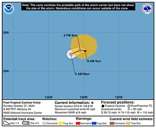
5-Day Uncertainty Track last
updated Fri, 25 Oct 2024 14:39:40 GMT
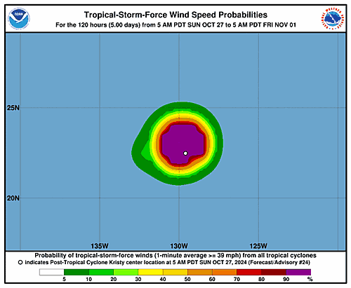
Wind Speed Probabilities last
updated Fri, 25 Oct 2024 14:39:40 GMT
https://www.nhc.noaa.gov/refresh/graphics_ep2+shtml/143940.shtml?cone
date: 2024-10-25, from: Eastern Pacific Basin Tropical Cyclones
000
WTPZ42 KNHC 251438
TCDEP2

Hurricane Kristy Discussion Number  16
NWS National Hurricane Center Miami FL       EP122024
800 AM PDT Fri Oct 25 2024

Southerly to southwesterly wind shear is starting to take its toll
on Kristy as the system is losing organization. The eye has become
cloud filled during the last several hours, with the convective
pattern becoming more asymmetric. Deep convection continues to wrap
within the eyewall, although a recent AMSR2 microwave pass
depicts the inner core is starting to erode. Objective and
subjective intensity estimates have been decreasing steadily this
morning and range from 105-115 kt. Using a blend of these
estimates, the initial intensity for this advisory is set to 110 kt.

Kristy is moving toward the west-northwest with an estimated motion
of 300/12 kt. The system will move more northwestward to
north-northwestward for the next few days, steered along the
southwestern periphery of a ridge located over the eastern Pacific.
Towards the end of the period, as the system weakens and becomes a
remnant low, Kristy's forward speed will also decrease with a turn
toward the west-southwest within the low-level flow. The NHC
forecast is very near the previous one with a slight nudge
northward, towards the corrected and simple consensus track aids.

The environment along the forecast path of Kristy is only becoming
increasingly hostile. Vertical wind shear is forecast to continue to
rise, with cooling sea-surface temperatures and drier mid-levels of
the atmosphere. Thus, steady to rapid weakening is anticipated
through the forecast period. Model simulated satellite data depicts
that Kristy will struggle to produce convection late this
weekend, becoming a post-tropical cyclone in 60 h, and dissipating
into a trough by 96 h. The latest NHC intensity forecast follows
these model trends.


FORECAST POSITIONS AND MAX WINDS

INIT  25/1500Z 15.8N 124.8W  110 KT 125 MPH
 12H  26/0000Z 17.0N 126.2W  100 KT 115 MPH
 24H  26/1200Z 18.8N 127.8W   85 KT 100 MPH
 36H  27/0000Z 20.8N 128.9W   65 KT  75 MPH
 48H  27/1200Z 22.4N 129.7W   45 KT  50 MPH
 60H  28/0000Z 23.0N 130.5W   30 KT  35 MPH...POST-TROP/REMNT LOW
 72H  28/1200Z 22.4N 131.7W   25 KT  30 MPH...POST-TROP/REMNT LOW
 96H  29/1200Z...DISSIPATED

$$
Forecaster Kelly
https://www.nhc.noaa.gov/text/refresh/MIATCDEP2+shtml/251438.shtml
date: 2024-10-25, from: Eastern Pacific Basin GIS Data
…KRISTY WEAKENING… As of 8:00 AM PDT Fri Oct 25 the center of Kristy was located near 15.8, -124.8 with movement WNW at 14 mph. The minimum central pressure was 952 mb with maximum sustained winds of about 125 mph.
https://www.nhc.noaa.gov/text/refresh/MIATCPEP2+shtml/251438.shtml
date: 2024-10-25, from: Eastern Pacific Basin Tropical Cyclones
000
FOPZ12 KNHC 251438
PWSEP2

HURRICANE KRISTY WIND SPEED PROBABILITIES NUMBER  16
NWS NATIONAL HURRICANE CENTER MIAMI FL       EP122024
1500 UTC FRI OCT 25 2024

AT 1500Z THE CENTER OF HURRICANE KRISTY WAS LOCATED NEAR LATITUDE
15.8 NORTH...LONGITUDE 124.8 WEST WITH MAXIMUM SUSTAINED WINDS NEAR
110 KTS...125 MPH...205 KM/H.

Z INDICATES COORDINATED UNIVERSAL TIME (GREENWICH)
   PACIFIC  DAYLIGHT TIME (PDT)...SUBTRACT 7 HOURS FROM Z TIME
   HAWAIIAN STANDARD TIME (HST)...SUBTRACT 10 HOURS FROM Z TIME

WIND SPEED PROBABILITY TABLE FOR SPECIFIC LOCATIONS

CHANCES OF SUSTAINED (1-MINUTE AVERAGE) WIND SPEEDS OF AT LEAST
   ...34 KT (39 MPH... 63 KM/H)...
   ...50 KT (58 MPH... 93 KM/H)...
   ...64 KT (74 MPH...119 KM/H)...
FOR LOCATIONS AND TIME PERIODS DURING THE NEXT 5 DAYS

PROBABILITIES FOR LOCATIONS ARE GIVEN AS OP(CP) WHERE
    OP  IS THE PROBABILITY OF THE EVENT BEGINNING DURING
        AN INDIVIDUAL TIME PERIOD (ONSET PROBABILITY)
   (CP) IS THE PROBABILITY OF THE EVENT OCCURRING BETWEEN
        12Z FRI AND THE FORECAST HOUR (CUMULATIVE PROBABILITY)

PROBABILITIES ARE GIVEN IN PERCENT
X INDICATES PROBABILITIES LESS THAN 1 PERCENT
PROBABILITIES FOR 34 KT AND 50 KT ARE SHOWN AT A GIVEN LOCATION WHEN
THE 5-DAY CUMULATIVE PROBABILITY IS AT LEAST 3 PERCENT.
PROBABILITIES FOR 34...50...64 KT SHOWN WHEN THE 5-DAY
64-KT CUMULATIVE PROBABILITY IS AT LEAST 1 PERCENT.


  - - - - WIND SPEED PROBABILITIES FOR SELECTED LOCATIONS - - - -

               FROM    FROM    FROM    FROM    FROM    FROM    FROM
  TIME       12Z FRI 00Z SAT 12Z SAT 00Z SUN 12Z SUN 12Z MON 12Z TUE
PERIODS         TO      TO      TO      TO      TO      TO      TO
             00Z SAT 12Z SAT 00Z SUN 12Z SUN 12Z MON 12Z TUE 12Z WED

FORECAST HOUR    (12)   (24)    (36)    (48)    (72)    (96)   (120)
- - - - - - - - - - - - - - - - - - - - - - - - - - - - - - - - - -
LOCATION       KT

15N 125W       34 99   X(99)   X(99)   X(99)   X(99)   X(99)   X(99)

20N 125W       34  1   5( 6)   1( 7)   1( 8)   X( 8)   X( 8)   X( 8)

15N 130W       34  1   2( 3)   X( 3)   X( 3)   X( 3)   X( 3)   X( 3)

20N 130W       34  X   9( 9)  35(44)   1(45)   X(45)   X(45)   X(45)
20N 130W       50  X   2( 2)   6( 8)   1( 9)   X( 9)   X( 9)   X( 9)
20N 130W       64  X   X( X)   2( 2)   X( 2)   X( 2)   X( 2)   X( 2)

25N 130W       34  X   X( X)   3( 3)   4( 7)   3(10)   X(10)   X(10)

$$
FORECASTER KELLY
https://www.nhc.noaa.gov/text/refresh/MIAPWSEP2+shtml/251438.shtml
date: 2024-10-25, from: Eastern Pacific Basin Tropical Cyclones
000
WTPZ22 KNHC 251437
TCMEP2

HURRICANE KRISTY FORECAST/ADVISORY NUMBER  16
NWS NATIONAL HURRICANE CENTER MIAMI FL       EP122024
1500 UTC FRI OCT 25 2024

HURRICANE CENTER LOCATED NEAR 15.8N 124.8W AT 25/1500Z
POSITION ACCURATE WITHIN  20 NM

PRESENT MOVEMENT TOWARD THE WEST-NORTHWEST OR 300 DEGREES AT  12 KT

ESTIMATED MINIMUM CENTRAL PRESSURE  952 MB
MAX SUSTAINED WINDS 110 KT WITH GUSTS TO 135 KT.
64 KT....... 25NE  15SE  20SW  25NW.
50 KT....... 40NE  30SE  30SW  40NW.
34 KT....... 90NE  70SE  60SW  90NW.
12 FT SEAS..210NE 180SE 180SW 180NW.
WINDS AND SEAS VARY GREATLY IN EACH QUADRANT.  RADII IN NAUTICAL
MILES ARE THE LARGEST RADII EXPECTED ANYWHERE IN THAT QUADRANT.

REPEAT...CENTER LOCATED NEAR 15.8N 124.8W AT 25/1500Z
AT 25/1200Z CENTER WAS LOCATED NEAR 15.5N 124.3W

FORECAST VALID 26/0000Z 17.0N 126.2W
MAX WIND 100 KT...GUSTS 120 KT.
64 KT... 25NE  15SE  20SW  25NW.
50 KT... 40NE  30SE  30SW  40NW.
34 KT...100NE  70SE  60SW  90NW.

FORECAST VALID 26/1200Z 18.8N 127.8W
MAX WIND  85 KT...GUSTS 105 KT.
64 KT... 20NE  10SE  10SW  20NW.
50 KT... 40NE  30SE  30SW  40NW.
34 KT...100NE  70SE  60SW  90NW.

FORECAST VALID 27/0000Z 20.8N 128.9W
MAX WIND  65 KT...GUSTS  80 KT.
64 KT... 10NE   0SE   0SW  10NW.
50 KT... 40NE  30SE  30SW  40NW.
34 KT...100NE  60SE  60SW  90NW.

FORECAST VALID 27/1200Z 22.4N 129.7W
MAX WIND  45 KT...GUSTS  55 KT.
34 KT...100NE  30SE  40SW  90NW.

FORECAST VALID 28/0000Z 23.0N 130.5W...POST-TROP/REMNT LOW
MAX WIND  30 KT...GUSTS  40 KT.

FORECAST VALID 28/1200Z 22.4N 131.7W...POST-TROP/REMNT LOW
MAX WIND  25 KT...GUSTS  35 KT.

EXTENDED OUTLOOK. NOTE...ERRORS FOR TRACK HAVE AVERAGED NEAR 100 NM
ON DAY 4 AND 125 NM ON DAY 5...AND FOR INTENSITY NEAR 15 KT EACH DAY

OUTLOOK VALID 29/1200Z...DISSIPATED

REQUEST FOR 3 HOURLY SHIP REPORTS WITHIN 300 MILES OF 15.8N 124.8W

NEXT ADVISORY AT 25/2100Z

$$
FORECASTER KELLY
https://www.nhc.noaa.gov/text/refresh/MIATCMEP2+shtml/251437.shtml
date: 2024-10-25, from: NOAA Weather Forecasts
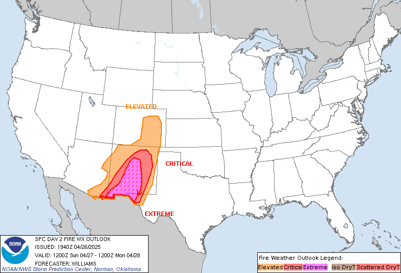
Day 2 Fire Weather Outlook
NWS Storm Prediction Center Norman OK
0201 AM CDT Fri Oct 25 2024

Valid 261200Z - 271200Z

...NO CRITICAL AREAS...

...Synopsis...
Strong ridging will dominate the CONUS D2/Saturday as the
upper-level flow pattern amplifies. The prior cold front will
continue eastward with trailing high pressure remaining over the
central CONUS. Increasing flow aloft over the West will support the
development of modest lee troughing and downslope flow over the
Front Range, while offshore flow is expected over the Northeast.
Local fire-weather concerns could develop, but are not expected to
be widespread.

...Lee of the Rockies and High Plains...
As the upper ridge shifts east, westerly flow will overspread the
Rockies and High Plains beginning early Saturday. As a result, weak
lee troughing should develop and encourage breezy winds across parts
of the Front Range and the High Plains. While not overly strong,
periodic 15-20 mph surface winds and downslope drying will support
RH values as low as 20-25%. The occasional stronger winds may
overlap with areas of receptive fuels supporting a few hours of
locally elevated fire-weather conditions. However, with only
sporadic winds and marginal RH, more widespread fire-weather
concerns appear unlikely.

...Northeast...
In the wake of the cold front moving offshore, a cooler, but still
dry and breezy air mass may develop over parts of the Northeast
Saturday. As the ridge shifts eastward, flow aloft will gradually
become more northwesterly and intensify. This should support dry
offshore flow over much of the East Coast. While RH values may not
be overly low, a few hours of RH below 30% appear likely given the
dry origins of the continental air mass. With little recent
rainfall, area fuels are quite dry. A few hours of locally elevated
fire-weather conditions are possible, despite marginal winds and RH.

..Lyons.. 10/25/2024

...Please see www.spc.noaa.gov/fire for graphic product...
https://www.spc.noaa.gov/products/fire_wx/fwdy2.html
date: 2024-10-24, from: Eastern Pacific Basin GIS Data
KMZ last updated Thu, 24 Oct 2024 14:34:55 GMT
https://www.nhc.noaa.gov/storm_graphics/api/EP122024_012adv_TRACK.kmz
date: 2024-10-24, from: Eastern Pacific Basin GIS Data
Initial and Forecast Surface Winds. Shapefile last updated Thu, 24 Oct 2024 14:34:30 GMT
https://www.nhc.noaa.gov/gis/forecast/archive/ep122024_fcst_012.zip
date: 2024-10-24, from: Eastern Pacific Basin GIS Data
KMZ last updated Thu, 24 Oct 2024 14:34:11 GMT
https://www.nhc.noaa.gov/storm_graphics/api/EP122024_012adv_CONE.kmz
date: 2024-10-24, from: Eastern Pacific Basin GIS Data
Forecast Track, Cone of Uncertainty, Watches/Warnings. Shapefile last updated Thu, 24 Oct 2024 14:34:04 GMT
https://www.nhc.noaa.gov/gis/forecast/archive/ep122024_5day_012.zip
date: 2024-10-24, from: Eastern Pacific Basin Tropical Cyclones

5-Day Uncertainty Track last
updated Thu, 24 Oct 2024 14:33:39 GMT

Wind Speed Probabilities last
updated Thu, 24 Oct 2024 15:22:54 GMT
https://www.nhc.noaa.gov/refresh/graphics_ep2+shtml/143339.shtml?cone
date: 2024-10-24, from: Eastern Pacific Basin Tropical Cyclones
000
WTPZ42 KNHC 241432
TCDEP2

Hurricane Kristy Discussion Number  12
NWS National Hurricane Center Miami FL       EP122024
800 AM PDT Thu Oct 24 2024

Kristy's satellite presentation has improved this morning as the eye
has reappeared on infrared and visible imagery, with deep convection
wrapping around the center. A recent AMSR2 microwave pass depicted
that the system has completed an eyewall replacement cycle, with an
inner core becoming re-established and contracting towards the
center. Subjective Dvorak satellite intensity estimate data-T values
have increased since the previous advisory with T6.5 from both
TAFB and SAB. Given these intensity estimates and recent satellite
images, the intensity is set to 130 kt for this advisory.

The hurricane is moving westward at an estimated motion of 270/15
kt, being steered by a ridge located over the northeastern Pacific.
Kristy will gradually round the southwestern portion of the ridge
over the next day or so, with a turn to the northwest then
north-northwest continuing through the weekend between the flow of
the aforementioned ridge and a trough to the west. By the end of the
weekend, Kristy is forecast to rapidly weaken with the remnants
turning west-southwestward within the low-level steering flow. The
NHC forecast was nudged slightly to the right of the previous
forecast, closer to the simple consensus aids.

Kristy is forecast to remain within a favorable environment for the
next 24 hours or so, with warm sea surface temperatures and light
vertical wind shear. The intensity forecast calls for some slight
re-intensification during this time, although recent microwave
imagery depicts that another eyewall replacement cycle could occur,
which would cause some intensity fluctuations in the short term.
Thereafter, the environment quickly becomes hostile with strong wind
shear, drier air and cooler sea surface temperatures along the
forecast track of Kristy. Guidance is in fairly good agreement that
rapid weakening should occur through the end of the forecast period.
Model simulated satellite imagery depicts that Kristy will begin to
lose convection and become a post-tropical remnant low around 72 h,
and depicts the system opening into a trough by 120 h. The NHC
intensity forecast follows these trends, showing rapid weakening,
and now has the remnant low status at 72h, and dissipation at 120 h.


FORECAST POSITIONS AND MAX WINDS

INIT  24/1500Z 14.1N 120.3W  130 KT 150 MPH
 12H  25/0000Z 14.4N 122.3W  135 KT 155 MPH
 24H  25/1200Z 15.3N 124.8W  120 KT 140 MPH
 36H  26/0000Z 16.8N 126.9W  110 KT 125 MPH
 48H  26/1200Z 18.6N 128.7W   95 KT 110 MPH
 60H  27/0000Z 20.6N 130.0W   70 KT  80 MPH
 72H  27/1200Z 22.3N 131.2W   50 KT  60 MPH...POST-TROPICAL
 96H  28/1200Z 21.5N 133.3W   30 KT  35 MPH...POST-TROP/REMNT LOW
120H  29/1200Z...DISSIPATED

$$
Forecaster Kelly/B.Adams
https://www.nhc.noaa.gov/text/refresh/MIATCDEP2+shtml/241432.shtml
date: 2024-10-24, from: Eastern Pacific Basin Tropical Cyclones
000
FOPZ12 KNHC 241432
PWSEP2

HURRICANE KRISTY WIND SPEED PROBABILITIES NUMBER  12
NWS NATIONAL HURRICANE CENTER MIAMI FL       EP122024
1500 UTC THU OCT 24 2024

AT 1500Z THE CENTER OF HURRICANE KRISTY WAS LOCATED NEAR LATITUDE
14.1 NORTH...LONGITUDE 120.3 WEST WITH MAXIMUM SUSTAINED WINDS NEAR
130 KTS...150 MPH...240 KM/H.

Z INDICATES COORDINATED UNIVERSAL TIME (GREENWICH)
   PACIFIC  DAYLIGHT TIME (PDT)...SUBTRACT 7 HOURS FROM Z TIME
   HAWAIIAN STANDARD TIME (HST)...SUBTRACT 10 HOURS FROM Z TIME

WIND SPEED PROBABILITY TABLE FOR SPECIFIC LOCATIONS

CHANCES OF SUSTAINED (1-MINUTE AVERAGE) WIND SPEEDS OF AT LEAST
   ...34 KT (39 MPH... 63 KM/H)...
   ...50 KT (58 MPH... 93 KM/H)...
   ...64 KT (74 MPH...119 KM/H)...
FOR LOCATIONS AND TIME PERIODS DURING THE NEXT 5 DAYS

PROBABILITIES FOR LOCATIONS ARE GIVEN AS OP(CP) WHERE
    OP  IS THE PROBABILITY OF THE EVENT BEGINNING DURING
        AN INDIVIDUAL TIME PERIOD (ONSET PROBABILITY)
   (CP) IS THE PROBABILITY OF THE EVENT OCCURRING BETWEEN
        12Z THU AND THE FORECAST HOUR (CUMULATIVE PROBABILITY)

PROBABILITIES ARE GIVEN IN PERCENT
X INDICATES PROBABILITIES LESS THAN 1 PERCENT
PROBABILITIES FOR 34 KT AND 50 KT ARE SHOWN AT A GIVEN LOCATION WHEN
THE 5-DAY CUMULATIVE PROBABILITY IS AT LEAST 3 PERCENT.
PROBABILITIES FOR 34...50...64 KT SHOWN WHEN THE 5-DAY
64-KT CUMULATIVE PROBABILITY IS AT LEAST 1 PERCENT.


  - - - - WIND SPEED PROBABILITIES FOR SELECTED LOCATIONS - - - -

               FROM    FROM    FROM    FROM    FROM    FROM    FROM
  TIME       12Z THU 00Z FRI 12Z FRI 00Z SAT 12Z SAT 12Z SUN 12Z MON
PERIODS         TO      TO      TO      TO      TO      TO      TO
             00Z FRI 12Z FRI 00Z SAT 12Z SAT 12Z SUN 12Z MON 12Z TUE

FORECAST HOUR    (12)   (24)    (36)    (48)    (72)    (96)   (120)
- - - - - - - - - - - - - - - - - - - - - - - - - - - - - - - - - -
LOCATION       KT

15N 120W       34 99   X(99)   X(99)   X(99)   X(99)   X(99)   X(99)

15N 125W       34  3  93(96)   2(98)   X(98)   X(98)   X(98)   X(98)
15N 125W       50  X  73(73)   6(79)   X(79)   X(79)   X(79)   X(79)
15N 125W       64  X  38(38)   9(47)   X(47)   X(47)   X(47)   X(47)

20N 125W       34  X   2( 2)   3( 5)   5(10)   3(13)   X(13)   X(13)

15N 130W       34  X   1( 1)   3( 4)   2( 6)   1( 7)   X( 7)   X( 7)

20N 130W       34  X   X( X)   3( 3)  40(43)  40(83)   X(83)   X(83)
20N 130W       50  X   X( X)   X( X)  11(11)  37(48)   X(48)   X(48)
20N 130W       64  X   X( X)   X( X)   4( 4)  17(21)   X(21)   X(21)

25N 130W       34  X   X( X)   X( X)   X( X)  10(10)   2(12)   X(12)

20N 135W       34  X   X( X)   X( X)   X( X)   3( 3)   4( 7)   X( 7)

25N 135W       34  X   X( X)   X( X)   X( X)   2( 2)   2( 4)   X( 4)

$$
FORECASTER KELLY/B.ADAMS
https://www.nhc.noaa.gov/text/refresh/MIAPWSEP2+shtml/241432.shtml
date: 2024-10-24, from: Eastern Pacific Basin GIS Data
…MAJOR HURRICANE KRISTY CONTINUES WESTWARD… As of 8:00 AM PDT Thu Oct 24 the center of Kristy was located near 14.1, -120.3 with movement W at 17 mph. The minimum central pressure was 933 mb with maximum sustained winds of about 150 mph.
https://www.nhc.noaa.gov/text/refresh/MIATCPEP2+shtml/241431.shtml
date: 2024-10-24, from: Eastern Pacific Basin Tropical Cyclones
000
WTPZ22 KNHC 241431
TCMEP2

HURRICANE KRISTY FORECAST/ADVISORY NUMBER  12
NWS NATIONAL HURRICANE CENTER MIAMI FL       EP122024
1500 UTC THU OCT 24 2024

HURRICANE CENTER LOCATED NEAR 14.1N 120.3W AT 24/1500Z
POSITION ACCURATE WITHIN  20 NM

PRESENT MOVEMENT TOWARD THE WEST OR 270 DEGREES AT  15 KT

ESTIMATED MINIMUM CENTRAL PRESSURE  933 MB
EYE DIAMETER  10 NM
MAX SUSTAINED WINDS 130 KT WITH GUSTS TO 160 KT.
64 KT....... 20NE  10SE  10SW  20NW.
50 KT....... 40NE  30SE  30SW  40NW.
34 KT....... 90NE  70SE  60SW  90NW.
12 FT SEAS..210NE 120SE 105SW 150NW.
WINDS AND SEAS VARY GREATLY IN EACH QUADRANT.  RADII IN NAUTICAL
MILES ARE THE LARGEST RADII EXPECTED ANYWHERE IN THAT QUADRANT.

REPEAT...CENTER LOCATED NEAR 14.1N 120.3W AT 24/1500Z
AT 24/1200Z CENTER WAS LOCATED NEAR 14.0N 119.7W

FORECAST VALID 25/0000Z 14.4N 122.3W
MAX WIND 135 KT...GUSTS 165 KT.
64 KT... 20NE  15SE  15SW  20NW.
50 KT... 40NE  30SE  30SW  40NW.
34 KT... 90NE  70SE  60SW  90NW.

FORECAST VALID 25/1200Z 15.3N 124.8W
MAX WIND 120 KT...GUSTS 145 KT.
64 KT... 25NE  20SE  20SW  25NW.
50 KT... 40NE  40SE  30SW  40NW.
34 KT... 90NE  70SE  60SW  90NW.

FORECAST VALID 26/0000Z 16.8N 126.9W
MAX WIND 110 KT...GUSTS 135 KT.
64 KT... 30NE  20SE  20SW  30NW.
50 KT... 50NE  40SE  40SW  50NW.
34 KT...100NE  80SE  60SW 100NW.

FORECAST VALID 26/1200Z 18.6N 128.7W
MAX WIND  95 KT...GUSTS 115 KT.
64 KT... 30NE  20SE  20SW  30NW.
50 KT... 60NE  40SE  40SW  50NW.
34 KT...110NE  80SE  70SW 100NW.

FORECAST VALID 27/0000Z 20.6N 130.0W
MAX WIND  70 KT...GUSTS  85 KT.
50 KT... 50NE  30SE  30SW  40NW.
34 KT...110NE  70SE  70SW 100NW.

FORECAST VALID 27/1200Z 22.3N 131.2W...POST-TROPICAL
MAX WIND  50 KT...GUSTS  60 KT.
50 KT... 20NE  10SE  10SW  20NW.
34 KT... 90NE  40SE  50SW  90NW.

EXTENDED OUTLOOK. NOTE...ERRORS FOR TRACK HAVE AVERAGED NEAR 100 NM
ON DAY 4 AND 125 NM ON DAY 5...AND FOR INTENSITY NEAR 15 KT EACH DAY

OUTLOOK VALID 28/1200Z 21.5N 133.3W...POST-TROP/REMNT LOW
MAX WIND  30 KT...GUSTS  40 KT.

OUTLOOK VALID 29/1200Z...DISSIPATED

REQUEST FOR 3 HOURLY SHIP REPORTS WITHIN 300 MILES OF 14.1N 120.3W

NEXT ADVISORY AT 24/2100Z

$$
FORECASTER KELLY/B.ADAMS
https://www.nhc.noaa.gov/text/refresh/MIATCMEP2+shtml/241431.shtml
date: 2024-10-23, from: NOAA tornado/severe thunderstorm watches, mesoscale discussions, convective outlooks, fire weather outlooks

Day 1 Fire Weather Outlook
NWS Storm Prediction Center Norman OK
1054 AM CDT Wed Oct 23 2024

Valid 231700Z - 241200Z

...NO CRITICAL AREAS...

No changes were necessary and please see the previous discussion for
more details.

..Nauslar.. 10/23/2024

.PREV DISCUSSION... /ISSUED 1148 PM CDT Tue Oct 22 2024/

...Synopsis...
Large-scale critical fire weather conditions are not anticipated on
Wednesday.

A surface high pressure will move across the central United States
today in the wake of a departing mid-level shortwave. This will
reinforce the dry airmass entrenched across the central U.S.
However, slightly cooler temperatures, especially as you go farther
north, will act to limit relative humidity from falling low enough
to support critical fire weather conditions.

Across the Northeast, gusty winds will develop ahead of an
approaching cold front. Despite these strong, gusty winds (perhaps
gusting up to 30 mph), relative humidity should remain sufficiently
high (around 40%) to prevent the need for highlights.

...Please see www.spc.noaa.gov/fire for graphic product...
https://www.spc.noaa.gov/products/fire_wx/fwdy1.html
date: 2024-10-23, from: Eastern Pacific Basin GIS Data
KMZ last updated Wed, 23 Oct 2024 14:49:31 GMT
https://www.nhc.noaa.gov/storm_graphics/api/EP122024_008adv_TRACK.kmz
date: 2024-10-23, from: Eastern Pacific Basin GIS Data
Initial and Forecast Surface Winds. Shapefile last updated Wed, 23 Oct 2024 14:49:23 GMT
https://www.nhc.noaa.gov/gis/forecast/archive/ep122024_fcst_008.zip
date: 2024-10-23, from: Eastern Pacific Basin GIS Data
KMZ last updated Wed, 23 Oct 2024 14:49:09 GMT
https://www.nhc.noaa.gov/storm_graphics/api/EP122024_008adv_CONE.kmz
date: 2024-10-23, from: Eastern Pacific Basin GIS Data
Forecast Track, Cone of Uncertainty, Watches/Warnings. Shapefile last updated Wed, 23 Oct 2024 14:49:01 GMT
https://www.nhc.noaa.gov/gis/forecast/archive/ep122024_5day_008.zip
date: 2024-10-23, from: Eastern Pacific Basin Tropical Cyclones

5-Day Uncertainty Track last
updated Wed, 23 Oct 2024 14:48:51 GMT

Wind Speed Probabilities last
updated Wed, 23 Oct 2024 15:24:18 GMT
https://www.nhc.noaa.gov/refresh/graphics_ep2+shtml/144851.shtml?cone
date: 2024-10-23, from: Eastern Pacific Basin Tropical Cyclones
000
WTPZ42 KNHC 231442
TCDEP2

Hurricane Kristy Discussion Number   8
NWS National Hurricane Center Miami FL       EP122024
800 AM MST Wed Oct 23 2024

The impressive rapid intensification of Kristy has continued this
morning. The gradually warming eye of the hurricane is surrounded by
a ring of very deep convection, with infrared cloud tops as cold as
-75 to -80 deg C. GOES-West derived motion winds indicate good
upper-level outflow, particularly over the southern and western
portions of the circulation. Subjective Dvorak classifications were
a consensus T5.5/102-kt from TAFB and SAB at 12 UTC. Satellite
trends suggest Kristy has kept strengthening since that time, and
the initial intensity is set at 110 kt, following the rising
objective estimates from UW-CIMSS.

The hurricane is moving quickly westward (265/17 kt) while being
steered by a strong subtropical ridge to its north. This quick
westward motion should continue for the next 24-36 h. Then, an
upper-level trough between the Hawaiian Islands and the west coast
of the United States is forecast to erode the western extent of the
ridge. As a result, Kristy is expected to move toward the
west-northwest and northwest late this week and into the weekend. A
westward motion is shown by day 5, as it is anticipated that Kristy
will become highly sheared and decoupled, with the vertically
shallow vortex steered by the low-level ridge. No significant
changes were made to the latest NHC track forecast.

Kristy is a relatively small hurricane that remains susceptible to
rapid intensity fluctuations in a weak shear environment over warm
SSTs. The latest GFS and ECMWF SHIPS output shows a 50 to 60 percent
chance of a 20-kt increase during the next 12 h, and the satellite
trends suggest continued near-term strengthening is likely. The
updated NHC forecast reflects these signals and lies above the
intensity guidance in the near term, showing Kristy peaking as a
category 4 hurricane on Thursday. By Friday, the aforementioned
trough is expected to impart increased shear on the hurricane, which
should induce weakening through the rest of the 5-day forecast
period. With SHIPS-diagnosed shear values of 40-50 kt by the
weekend, Kristy is forecast to quickly weaken over the weekend and
degenerate to a post-tropical remnant low by 120 h.


FORECAST POSITIONS AND MAX WINDS

INIT  23/1500Z 14.3N 113.9W  110 KT 125 MPH
 12H  24/0000Z 14.2N 116.4W  125 KT 145 MPH
 24H  24/1200Z 14.1N 119.7W  130 KT 150 MPH
 36H  25/0000Z 14.3N 122.5W  125 KT 145 MPH
 48H  25/1200Z 15.1N 125.1W  115 KT 130 MPH
 60H  26/0000Z 16.5N 127.3W  105 KT 120 MPH
 72H  26/1200Z 18.0N 129.3W   90 KT 105 MPH
 96H  27/1200Z 20.5N 132.5W   55 KT  65 MPH
120H  28/1200Z 21.0N 136.5W   30 KT  35 MPH...POST-TROP/REMNT LOW

$$
Forecaster Reinhart
https://www.nhc.noaa.gov/text/refresh/MIATCDEP2+shtml/231442.shtml
date: 2024-10-23, from: Eastern Pacific Basin Tropical Cyclones
000
FOPZ12 KNHC 231441
PWSEP2

HURRICANE KRISTY WIND SPEED PROBABILITIES NUMBER   8
NWS NATIONAL HURRICANE CENTER MIAMI FL       EP122024
1500 UTC WED OCT 23 2024

AT 1500Z THE CENTER OF HURRICANE KRISTY WAS LOCATED NEAR LATITUDE
14.3 NORTH...LONGITUDE 113.9 WEST WITH MAXIMUM SUSTAINED WINDS NEAR
110 KTS...125 MPH...205 KM/H.

Z INDICATES COORDINATED UNIVERSAL TIME (GREENWICH)
   PACIFIC  DAYLIGHT TIME (PDT)...SUBTRACT 7 HOURS FROM Z TIME
   HAWAIIAN STANDARD TIME (HST)...SUBTRACT 10 HOURS FROM Z TIME

WIND SPEED PROBABILITY TABLE FOR SPECIFIC LOCATIONS

CHANCES OF SUSTAINED (1-MINUTE AVERAGE) WIND SPEEDS OF AT LEAST
   ...34 KT (39 MPH... 63 KM/H)...
   ...50 KT (58 MPH... 93 KM/H)...
   ...64 KT (74 MPH...119 KM/H)...
FOR LOCATIONS AND TIME PERIODS DURING THE NEXT 5 DAYS

PROBABILITIES FOR LOCATIONS ARE GIVEN AS OP(CP) WHERE
    OP  IS THE PROBABILITY OF THE EVENT BEGINNING DURING
        AN INDIVIDUAL TIME PERIOD (ONSET PROBABILITY)
   (CP) IS THE PROBABILITY OF THE EVENT OCCURRING BETWEEN
        12Z WED AND THE FORECAST HOUR (CUMULATIVE PROBABILITY)

PROBABILITIES ARE GIVEN IN PERCENT
X INDICATES PROBABILITIES LESS THAN 1 PERCENT
PROBABILITIES FOR 34 KT AND 50 KT ARE SHOWN AT A GIVEN LOCATION WHEN
THE 5-DAY CUMULATIVE PROBABILITY IS AT LEAST 3 PERCENT.
PROBABILITIES FOR 34...50...64 KT SHOWN WHEN THE 5-DAY
64-KT CUMULATIVE PROBABILITY IS AT LEAST 1 PERCENT.


  - - - - WIND SPEED PROBABILITIES FOR SELECTED LOCATIONS - - - -

               FROM    FROM    FROM    FROM    FROM    FROM    FROM
  TIME       12Z WED 00Z THU 12Z THU 00Z FRI 12Z FRI 12Z SAT 12Z SUN
PERIODS         TO      TO      TO      TO      TO      TO      TO
             00Z THU 12Z THU 00Z FRI 12Z FRI 12Z SAT 12Z SUN 12Z MON

FORECAST HOUR    (12)   (24)    (36)    (48)    (72)    (96)   (120)
- - - - - - - - - - - - - - - - - - - - - - - - - - - - - - - - - -
LOCATION       KT

15N 115W       34 97   X(97)   X(97)   X(97)   X(97)   X(97)   X(97)
15N 115W       50 15   X(15)   X(15)   X(15)   X(15)   X(15)   X(15)
15N 115W       64  1   X( 1)   X( 1)   X( 1)   X( 1)   X( 1)   X( 1)

15N 120W       34  X  81(81)   9(90)   X(90)   X(90)   X(90)   X(90)
15N 120W       50  X  29(29)  15(44)   X(44)   X(44)   X(44)   X(44)
15N 120W       64  X  10(10)   9(19)   X(19)   X(19)   X(19)   X(19)

15N 125W       34  X   X( X)  13(13)  77(90)   4(94)   X(94)   X(94)
15N 125W       50  X   X( X)   2( 2)  61(63)  10(73)   X(73)   X(73)
15N 125W       64  X   X( X)   X( X)  40(40)   9(49)   X(49)   X(49)

20N 125W       34  X   X( X)   X( X)   2( 2)   7( 9)   1(10)   X(10)

15N 130W       34  X   X( X)   X( X)   2( 2)  13(15)   3(18)   X(18)

20N 130W       34  X   X( X)   X( X)   X( X)  38(38)  32(70)   X(70)
20N 130W       50  X   X( X)   X( X)   X( X)  10(10)  22(32)   X(32)
20N 130W       64  X   X( X)   X( X)   X( X)   4( 4)  11(15)   X(15)

25N 130W       34  X   X( X)   X( X)   X( X)   X( X)   3( 3)   X( 3)

20N 135W       34  X   X( X)   X( X)   X( X)   1( 1)  10(11)   7(18)
20N 135W       50  X   X( X)   X( X)   X( X)   X( X)   1( 1)   2( 3)

25N 135W       34  X   X( X)   X( X)   X( X)   X( X)   2( 2)   2( 4)

$$
FORECASTER REINHART
https://www.nhc.noaa.gov/text/refresh/MIAPWSEP2+shtml/231441.shtml
date: 2024-10-23, from: Eastern Pacific Basin Tropical Cyclones
000
WTPZ32 KNHC 231441
TCPEP2

BULLETIN
Hurricane Kristy Advisory Number   8
NWS National Hurricane Center Miami FL       EP122024
800 AM MST Wed Oct 23 2024

...KRISTY RAPIDLY INTENSIFIES INTO A MAJOR HURRICANE...
...ADDITIONAL STRENGTHENING IS EXPECTED...


SUMMARY OF 800 AM MST...1500 UTC...INFORMATION
----------------------------------------------
LOCATION...14.3N 113.9W
ABOUT 650 MI...1045 KM SSW OF THE SOUTHERN TIP OF BAJA CALIFORNIA
ABOUT 365 MI...590 KM SSW OF SOCORRO ISLAND
MAXIMUM SUSTAINED WINDS...125 MPH...205 KM/H
PRESENT MOVEMENT...W OR 265 DEGREES AT 20 MPH...31 KM/H
MINIMUM CENTRAL PRESSURE...954 MB...28.17 INCHES


WATCHES AND WARNINGS
--------------------
There are no coastal watches or warnings in effect.


DISCUSSION AND OUTLOOK
----------------------
At 800 AM MST (1500 UTC), the eye of Hurricane Kristy was located
near latitude 14.3 North, longitude 113.9 West. Kristy is moving
toward the west near 20 mph (31 km/h), and this general motion is
expected to continue through Thursday. A gradual turn toward the
west-northwest and northwest is expected on Friday and into the
weekend.

Maximum sustained winds have increased to near 125 mph (205 km/h)
with higher gusts. Kristy is a category 3 hurricane on the
Saffir-Simpson Hurricane Wind Scale. Additional steady to rapid
strengthening is expected during the next day or so. Gradual
weakening is forecast to begin on Friday.

Hurricane-force winds extend outward up to 15 miles (30 km) from the
center and tropical-storm-force winds extend outward up to 80 miles
(130 km).

The estimated minimum central pressure is 954 mb (28.17 inches).


HAZARDS AFFECTING LAND
----------------------
SURF:  Swells generated by Kristy will affect portions of the west
coast of the Baja California peninsula late this week. These swells
are likely to cause life-threatening surf and rip current
conditions. Please consult products from your local weather office.


NEXT ADVISORY
-------------
Next complete advisory at 200 PM MST.

$$
Forecaster Reinhart
https://www.nhc.noaa.gov/text/refresh/MIATCPEP2+shtml/231441.shtml
date: 2024-10-23, from: Eastern Pacific Basin Tropical Cyclones
000
WTPZ22 KNHC 231441
TCMEP2

HURRICANE KRISTY FORECAST/ADVISORY NUMBER   8
NWS NATIONAL HURRICANE CENTER MIAMI FL       EP122024
1500 UTC WED OCT 23 2024

HURRICANE CENTER LOCATED NEAR 14.3N 113.9W AT 23/1500Z
POSITION ACCURATE WITHIN  20 NM

PRESENT MOVEMENT TOWARD THE WEST OR 265 DEGREES AT  17 KT

ESTIMATED MINIMUM CENTRAL PRESSURE  954 MB
MAX SUSTAINED WINDS 110 KT WITH GUSTS TO 135 KT.
64 KT....... 15NE  10SE  10SW  15NW.
50 KT....... 30NE  20SE  20SW  30NW.
34 KT....... 70NE  50SE  40SW  60NW.
12 FT SEAS..210NE 120SE  60SW 120NW.
WINDS AND SEAS VARY GREATLY IN EACH QUADRANT.  RADII IN NAUTICAL
MILES ARE THE LARGEST RADII EXPECTED ANYWHERE IN THAT QUADRANT.

REPEAT...CENTER LOCATED NEAR 14.3N 113.9W AT 23/1500Z
AT 23/1200Z CENTER WAS LOCATED NEAR 14.4N 113.0W

FORECAST VALID 24/0000Z 14.2N 116.4W
MAX WIND 125 KT...GUSTS 150 KT.
64 KT... 20NE  15SE  15SW  20NW.
50 KT... 40NE  30SE  30SW  30NW.
34 KT... 70NE  50SE  40SW  60NW.

FORECAST VALID 24/1200Z 14.1N 119.7W
MAX WIND 130 KT...GUSTS 160 KT.
64 KT... 20NE  15SE  15SW  20NW.
50 KT... 40NE  30SE  30SW  40NW.
34 KT... 80NE  60SE  50SW  80NW.

FORECAST VALID 25/0000Z 14.3N 122.5W
MAX WIND 125 KT...GUSTS 150 KT.
64 KT... 25NE  20SE  20SW  25NW.
50 KT... 40NE  40SE  40SW  40NW.
34 KT... 90NE  60SE  60SW  90NW.

FORECAST VALID 25/1200Z 15.1N 125.1W
MAX WIND 115 KT...GUSTS 140 KT.
64 KT... 30NE  20SE  20SW  30NW.
50 KT... 50NE  40SE  40SW  50NW.
34 KT...100NE  70SE  70SW  90NW.

FORECAST VALID 26/0000Z 16.5N 127.3W
MAX WIND 105 KT...GUSTS 130 KT.
50 KT... 50NE  40SE  40SW  50NW.
34 KT...110NE  80SE  70SW 100NW.

FORECAST VALID 26/1200Z 18.0N 129.3W
MAX WIND  90 KT...GUSTS 110 KT.
50 KT... 50NE  40SE  40SW  50NW.
34 KT...110NE  70SE  70SW 100NW.

EXTENDED OUTLOOK. NOTE...ERRORS FOR TRACK HAVE AVERAGED NEAR 100 NM
ON DAY 4 AND 125 NM ON DAY 5...AND FOR INTENSITY NEAR 15 KT EACH DAY

OUTLOOK VALID 27/1200Z 20.5N 132.5W
MAX WIND  55 KT...GUSTS  65 KT.
50 KT... 30NE  10SE  10SW  30NW.
34 KT...100NE  50SE  50SW 100NW.

OUTLOOK VALID 28/1200Z 21.0N 136.5W...POST-TROP/REMNT LOW
MAX WIND  30 KT...GUSTS  40 KT.

REQUEST FOR 3 HOURLY SHIP REPORTS WITHIN 300 MILES OF 14.3N 113.9W

NEXT ADVISORY AT 23/2100Z

$$
FORECASTER REINHART
https://www.nhc.noaa.gov/text/refresh/MIATCMEP2+shtml/231441.shtml
date: 2024-10-22, from: Eastern Pacific Basin GIS Data
KMZ last updated Tue, 22 Oct 2024 20:56:37 GMT
https://www.nhc.noaa.gov/storm_graphics/api/EP122024_005adv_TRACK.kmz
date: 2024-10-22, from: Eastern Pacific Basin GIS Data
Initial and Forecast Surface Winds. Shapefile last updated Tue, 22 Oct 2024 20:56:19 GMT
https://www.nhc.noaa.gov/gis/forecast/archive/ep122024_fcst_005.zip
date: 2024-10-22, from: Eastern Pacific Basin GIS Data
KMZ last updated Tue, 22 Oct 2024 20:56:13 GMT
https://www.nhc.noaa.gov/storm_graphics/api/EP122024_005adv_CONE.kmz
date: 2024-10-22, from: Eastern Pacific Basin GIS Data
Forecast Track, Cone of Uncertainty, Watches/Warnings. Shapefile last updated Tue, 22 Oct 2024 20:55:58 GMT
https://www.nhc.noaa.gov/gis/forecast/archive/ep122024_5day_005.zip
date: 2024-10-22, from: Eastern Pacific Basin Tropical Cyclones

5-Day Uncertainty Track last
updated Tue, 22 Oct 2024 20:55:35 GMT

Wind Speed Probabilities last
updated Tue, 22 Oct 2024 21:22:57 GMT
https://www.nhc.noaa.gov/refresh/graphics_ep2+shtml/205535.shtml?cone
date: 2024-10-22, from: Eastern Pacific Basin Tropical Cyclones
000
WTPZ42 KNHC 222053
TCDEP2

Hurricane Kristy Discussion Number   5
NWS National Hurricane Center Miami FL       EP122024
200 PM MST Tue Oct 22 2024

Recent satellite and ASCAT data show Kristy has strengthened
significantly over the last six hours. Satellite imagery shows
persistent convection starting to wrap around a potential inner
core, with high-level cirrus clouds beginning to clear out,
revealing a developing eye. The ASCAT pass from 1618z showed a
robust wind field, with a max wind retrieval of 53 kt. The
subjective Dvorak intensity estimates also concur with these
observations, with T3.5/55 kt from TAFB and T4.0/65 kt from SAB at
18 UTC. Given the improvement on satellite since that time, the
initial intensity is now set at the upper-end of these estimates at
65 kt, making Kristy a hurricane.

Kristy continues to move just north of due west this afternoon as it
skirts along the periphery of a deep-layered subtropical
ridge. Current motion is set at 275/16 kt and this westward motion
should continue for the next couple of days. The cyclone will begin
to track poleward starting this weekend around 60-72 hours as a
mid-level trough impinges on the ridge. Uncertainty increases by
that time given differences in the global models as to the evolution
of the synoptic pattern.  As such, the latest NHC track forecast
remains close to the previous one over the next couple of days and
is just a little to the south of the previous forecast track
thereafter.

The intensity forecast remains quite bullish, with rapid
intensification expected within the next 12-24 hours as Kristy
encounters a very favorable environment as indicated by the GFS- and
ECMWF-SHIPS guidance. The latter aid also indicates a 40 percent
chance of a 40 kt increase in intensity in 24 hours, nearly ten
times the climatological average. The latest NHC forecast will
explicitly show Kristy intensifying up to 100 kt major hurricane
intensity in 24 h, with a peak intensity of 115 kt at 60 h. After
60-72 h, Kristy will encounter a more hostile environment, with
increasing shear and cooler sea surface temperatures which will
likely weaken the cyclone by the end of the forecast. Kristy is
likely to become post-tropical in 120 h as it loses convective
organization.


FORECAST POSITIONS AND MAX WINDS

INIT  22/2100Z 14.7N 108.5W   65 KT  75 MPH
 12H  23/0600Z 14.6N 111.0W   85 KT 100 MPH
 24H  23/1800Z 14.4N 114.5W  100 KT 115 MPH
 36H  24/0600Z 14.2N 118.0W  105 KT 120 MPH
 48H  24/1800Z 14.2N 121.0W  110 KT 125 MPH
 60H  25/0600Z 14.7N 123.8W  115 KT 130 MPH
 72H  25/1800Z 15.7N 126.5W  110 KT 125 MPH
 96H  26/1800Z 18.7N 130.7W   70 KT  80 MPH
120H  27/1800Z 21.0N 134.5W   40 KT  45 MPH...POST-TROPICAL

$$
Forecaster Torres-Vazquez/Papin
https://www.nhc.noaa.gov/text/refresh/MIATCDEP2+shtml/222053.shtml
date: 2024-10-22, from: NOAA tornado/severe thunderstorm watches, mesoscale discussions, convective outlooks, fire weather outlooks
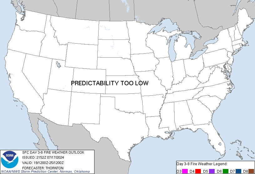
Day 3-8 Fire Weather Outlook
NWS Storm Prediction Center Norman OK
0346 PM CDT Tue Oct 22 2024

Valid 241200Z - 301200Z

Fire weather concerns will remain low in the extended. High pressure
will build in across the CONUS through the mid to late week, with
occasional shortwave progression across the northern periphery
bringing a more zonal westerly flow pattern across the Rockies. This
may bring potential for breezy conditions across portions of the
northern and central Plains, primarily on D3 - Thursday. A period of
Elevated to Critical winds and relative humidity will be possible in
the Texas and Oklahoma Panhandles. Recent rainfall has left fuels in
this region less receptive to fire spread. Elsewhere, confidence in
any areas of widespread relative humidity reductions overlapping
winds remains limited at this time.

A deeper trough may impact the CONUS late in the period D6 - Sunday
into D7 - Monday bringing a potential increase in winds but also
potential for cooler/wetter conditions. Areas across southern
Arizona will remain dry and may see a period of Elevated to Critical
fire weather conditions on D7 - Monday. This area may need
highlights as confidence increases in the coming days.

..Thornton.. 10/22/2024

...Please see www.spc.noaa.gov/fire for graphic product...
https://www.spc.noaa.gov/products/exper/fire_wx/
date: 2024-10-22, from: Eastern Pacific Basin Tropical Cyclones
000
FOPZ12 KNHC 222044
PWSEP2

HURRICANE KRISTY WIND SPEED PROBABILITIES NUMBER   5
NWS NATIONAL HURRICANE CENTER MIAMI FL       EP122024
2100 UTC TUE OCT 22 2024

AT 2100Z THE CENTER OF HURRICANE KRISTY WAS LOCATED NEAR LATITUDE
14.7 NORTH...LONGITUDE 108.5 WEST WITH MAXIMUM SUSTAINED WINDS NEAR
65 KTS...75 MPH...120 KM/H.

Z INDICATES COORDINATED UNIVERSAL TIME (GREENWICH)
   PACIFIC  DAYLIGHT TIME (PDT)...SUBTRACT 7 HOURS FROM Z TIME
   HAWAIIAN STANDARD TIME (HST)...SUBTRACT 10 HOURS FROM Z TIME

WIND SPEED PROBABILITY TABLE FOR SPECIFIC LOCATIONS

CHANCES OF SUSTAINED (1-MINUTE AVERAGE) WIND SPEEDS OF AT LEAST
   ...34 KT (39 MPH... 63 KM/H)...
   ...50 KT (58 MPH... 93 KM/H)...
   ...64 KT (74 MPH...119 KM/H)...
FOR LOCATIONS AND TIME PERIODS DURING THE NEXT 5 DAYS

PROBABILITIES FOR LOCATIONS ARE GIVEN AS OP(CP) WHERE
    OP  IS THE PROBABILITY OF THE EVENT BEGINNING DURING
        AN INDIVIDUAL TIME PERIOD (ONSET PROBABILITY)
   (CP) IS THE PROBABILITY OF THE EVENT OCCURRING BETWEEN
        18Z TUE AND THE FORECAST HOUR (CUMULATIVE PROBABILITY)

PROBABILITIES ARE GIVEN IN PERCENT
X INDICATES PROBABILITIES LESS THAN 1 PERCENT
PROBABILITIES FOR 34 KT AND 50 KT ARE SHOWN AT A GIVEN LOCATION WHEN
THE 5-DAY CUMULATIVE PROBABILITY IS AT LEAST 3 PERCENT.
PROBABILITIES FOR 34...50...64 KT SHOWN WHEN THE 5-DAY
64-KT CUMULATIVE PROBABILITY IS AT LEAST 1 PERCENT.


  - - - - WIND SPEED PROBABILITIES FOR SELECTED LOCATIONS - - - -

               FROM    FROM    FROM    FROM    FROM    FROM    FROM
  TIME       18Z TUE 06Z WED 18Z WED 06Z THU 18Z THU 18Z FRI 18Z SAT
PERIODS         TO      TO      TO      TO      TO      TO      TO
             06Z WED 18Z WED 06Z THU 18Z THU 18Z FRI 18Z SAT 18Z SUN

FORECAST HOUR    (12)   (24)    (36)    (48)    (72)    (96)   (120)
- - - - - - - - - - - - - - - - - - - - - - - - - - - - - - - - - -
LOCATION       KT

15N 110W       34 99   X(99)   X(99)   X(99)   X(99)   X(99)   X(99)
15N 110W       50 84   X(84)   X(84)   X(84)   X(84)   X(84)   X(84)
15N 110W       64 44   X(44)   X(44)   X(44)   X(44)   X(44)   X(44)

ISLA CLARION   34  X   2( 2)   1( 3)   X( 3)   X( 3)   X( 3)   X( 3)

15N 115W       34  1  84(85)   9(94)   X(94)   X(94)   X(94)   X(94)
15N 115W       50  X  45(45)  24(69)   X(69)   X(69)   X(69)   X(69)
15N 115W       64  X  19(19)  23(42)   X(42)   X(42)   X(42)   X(42)

10N 120W       34  X   X( X)   2( 2)   2( 4)   X( 4)   X( 4)   X( 4)

15N 120W       34  X   X( X)  31(31)  59(90)   1(91)   X(91)   X(91)
15N 120W       50  X   X( X)   4( 4)  57(61)   2(63)   X(63)   X(63)
15N 120W       64  X   X( X)   1( 1)  37(38)   2(40)   X(40)   X(40)

15N 125W       34  X   X( X)   X( X)   5( 5)  85(90)   1(91)   X(91)
15N 125W       50  X   X( X)   X( X)   X( X)  67(67)   1(68)   X(68)
15N 125W       64  X   X( X)   X( X)   X( X)  45(45)   1(46)   X(46)

20N 125W       34  X   X( X)   X( X)   X( X)   4( 4)   5( 9)   X( 9)

15N 130W       34  X   X( X)   X( X)   X( X)   7( 7)  14(21)   1(22)
15N 130W       50  X   X( X)   X( X)   X( X)   X( X)   4( 4)   X( 4)
15N 130W       64  X   X( X)   X( X)   X( X)   X( X)   1( 1)   X( 1)

20N 130W       34  X   X( X)   X( X)   X( X)   1( 1)  46(47)   6(53)
20N 130W       50  X   X( X)   X( X)   X( X)   X( X)  16(16)   4(20)
20N 130W       64  X   X( X)   X( X)   X( X)   X( X)   6( 6)   2( 8)

15N 135W       34  X   X( X)   X( X)   X( X)   X( X)   2( 2)   1( 3)

20N 135W       34  X   X( X)   X( X)   X( X)   X( X)   4( 4)  13(17)
20N 135W       50  X   X( X)   X( X)   X( X)   X( X)   1( 1)   2( 3)

25N 135W       34  X   X( X)   X( X)   X( X)   X( X)   X( X)   4( 4)

$$
FORECASTER TORRES-VAZQUEZ/PAPIN
https://www.nhc.noaa.gov/text/refresh/MIAPWSEP2+shtml/222044.shtml
date: 2024-10-22, from: Eastern Pacific Basin GIS Data
…KRISTY BECOMES A HURRICANE AND APPEARS POISED TO RAPIDLY INTENSIFY… As of 2:00 PM MST Tue Oct 22 the center of Kristy was located near 14.7, -108.5 with movement W at 18 mph. The minimum central pressure was 988 mb with maximum sustained winds of about 75 mph.
https://www.nhc.noaa.gov/text/refresh/MIATCPEP2+shtml/222044.shtml
date: 2024-10-22, from: Eastern Pacific Basin Tropical Cyclones
000
WTPZ22 KNHC 222042
TCMEP2

HURRICANE KRISTY FORECAST/ADVISORY NUMBER   5
NWS NATIONAL HURRICANE CENTER MIAMI FL       EP122024
2100 UTC TUE OCT 22 2024

HURRICANE CENTER LOCATED NEAR 14.7N 108.5W AT 22/2100Z
POSITION ACCURATE WITHIN  30 NM

PRESENT MOVEMENT TOWARD THE WEST OR 275 DEGREES AT  16 KT

ESTIMATED MINIMUM CENTRAL PRESSURE  988 MB
MAX SUSTAINED WINDS  65 KT WITH GUSTS TO  75 KT.
64 KT....... 15NE   0SE   0SW   0NW.
50 KT....... 35NE  30SE  20SW  30NW.
34 KT....... 60NE  40SE  40SW  60NW.
12 FT SEAS..120NE  60SE  60SW  90NW.
WINDS AND SEAS VARY GREATLY IN EACH QUADRANT.  RADII IN NAUTICAL
MILES ARE THE LARGEST RADII EXPECTED ANYWHERE IN THAT QUADRANT.

REPEAT...CENTER LOCATED NEAR 14.7N 108.5W AT 22/2100Z
AT 22/1800Z CENTER WAS LOCATED NEAR 14.6N 107.7W

FORECAST VALID 23/0600Z 14.6N 111.0W
MAX WIND  85 KT...GUSTS 105 KT.
64 KT... 15NE  10SE  10SW  15NW.
50 KT... 40NE  30SE  30SW  40NW.
34 KT... 70NE  50SE  40SW  60NW.

FORECAST VALID 23/1800Z 14.4N 114.5W
MAX WIND 100 KT...GUSTS 120 KT.
64 KT... 20NE  15SE  10SW  15NW.
50 KT... 40NE  30SE  20SW  35NW.
34 KT... 70NE  50SE  40SW  60NW.

FORECAST VALID 24/0600Z 14.2N 118.0W
MAX WIND 105 KT...GUSTS 130 KT.
64 KT... 20NE  15SE  15SW  20NW.
50 KT... 40NE  30SE  25SW  35NW.
34 KT... 70NE  50SE  60SW  80NW.

FORECAST VALID 24/1800Z 14.2N 121.0W
MAX WIND 110 KT...GUSTS 135 KT.
64 KT... 25NE  20SE  20SW  25NW.
50 KT... 40NE  35SE  30SW  40NW.
34 KT... 80NE  60SE  60SW  90NW.

FORECAST VALID 25/0600Z 14.7N 123.8W
MAX WIND 115 KT...GUSTS 140 KT.
50 KT... 45NE  35SE  30SW  45NW.
34 KT... 95NE  70SE  70SW  95NW.

FORECAST VALID 25/1800Z 15.7N 126.5W
MAX WIND 110 KT...GUSTS 135 KT.
50 KT... 55NE  40SE  35SW  50NW.
34 KT...110NE  75SE  65SW  90NW.

EXTENDED OUTLOOK. NOTE...ERRORS FOR TRACK HAVE AVERAGED NEAR 100 NM
ON DAY 4 AND 125 NM ON DAY 5...AND FOR INTENSITY NEAR 15 KT EACH DAY

OUTLOOK VALID 26/1800Z 18.7N 130.7W
MAX WIND  70 KT...GUSTS  85 KT.
50 KT... 50NE  35SE  30SW  40NW.
34 KT...110NE  70SE  60SW 100NW.

OUTLOOK VALID 27/1800Z 21.0N 134.5W...POST-TROPICAL
MAX WIND  40 KT...GUSTS  50 KT.
34 KT...100NE  60SE  60SW 110NW.

REQUEST FOR 3 HOURLY SHIP REPORTS WITHIN 300 MILES OF 14.7N 108.5W

NEXT ADVISORY AT 23/0300Z

$$
FORECASTER TORRES-VAZQUEZ/PAPIN=
https://www.nhc.noaa.gov/text/refresh/MIATCMEP2+shtml/222042.shtml
date: 2024-10-22, from: NOAA tornado/severe thunderstorm watches, mesoscale discussions, convective outlooks, fire weather outlooks

Day 1 Convective Outlook
NWS Storm Prediction Center Norman OK
0311 PM CDT Tue Oct 22 2024

Valid 222000Z - 231200Z

...NO SEVERE THUNDERSTORM AREAS FORECAST...

...SUMMARY...
Severe thunderstorms are not expected today through tonight.

...20z Update...

The general thunderstorm areas have been removed from northern MN
and the IL vicinity as lightning probabilities are expected to
rapidly diminish over the next 1-2 hours. A few flashes are still
possible across the TX Big Bend vicinity into early evening. Severe
storms are not expected.

..Leitman.. 10/22/2024
https://www.spc.noaa.gov/products/outlook/day1otlk_2000.html
date: 2024-10-22, from: NOAA tornado/severe thunderstorm watches, mesoscale discussions, convective outlooks, fire weather outlooks

Day 3 Convective Outlook RESENT 1
NWS Storm Prediction Center Norman OK
0307 PM CDT Tue Oct 22 2024

Valid 241200Z - 251200Z

...THERE IS A MARGINAL RISK OF SEVERE THUNDERSTORMS FROM NORTHEAST
KANSAS INTO NORTHERN MISSOURI AND SOUTHERN IOWA...

...SUMMARY...
A few storms may produce hail on Thursday from far northeast Kansas
across northern Missouri and into southern Iowa.

...Synopsis and Discussion...
On Thursday, a progressive upper trough will move from the central
and northern Rockies into the Plains, as upper ridging briefly
develops from the OH Valley into the Northeast. High pressure will
be in place over much of the East in the wake of the previous days
cold front, providing generally stable conditions there.

In association with the Rockies/Plains trough, a cold front will
push quickly southeastward across the northern and central Plains,
extending roughly from MN into the TX Panhandle by 00Z. Modest
boundary-layer moistening will occur with dewpoints in the low to
mid 50s F as far north as southwest IA.

As the cold front interacts with the narrow plume of instability, at
least isolated surface-based storms are anticipated during the late
afternoon, trending toward elevated through the evening, from
northeast KS into northern MO and IA. Forecast soundings show
steepening lapse rates aloft along with veering winds with height,
suggesting a supercell, even if elevated, may occur, with hail risk.
The favored zone for initiation will be the KS portion of the cold
front where low-level lapse rates will be steepest. Overall, the
main limiting factor for this event will be moisture quality as lift
and shear will be favorable.

..Jewell.. 10/22/2024
https://www.spc.noaa.gov/products/outlook/day3otlk_1930.html
date: 2024-10-22, from: Eastern Pacific Basin GIS Data
KMZ last updated Tue, 22 Oct 2024 08:38:55 GMT
https://www.nhc.noaa.gov/storm_graphics/api/EP122024_003adv_TRACK.kmz
date: 2024-10-22, from: Eastern Pacific Basin GIS Data
Initial and Forecast Surface Winds. Shapefile last updated Tue, 22 Oct 2024 08:38:37 GMT
https://www.nhc.noaa.gov/gis/forecast/archive/ep122024_fcst_003.zip
date: 2024-10-22, from: Eastern Pacific Basin GIS Data
KMZ last updated Tue, 22 Oct 2024 08:38:28 GMT
https://www.nhc.noaa.gov/storm_graphics/api/EP122024_003adv_CONE.kmz
date: 2024-10-22, from: Eastern Pacific Basin GIS Data
Forecast Track, Cone of Uncertainty, Watches/Warnings. Shapefile last updated Tue, 22 Oct 2024 08:38:13 GMT
https://www.nhc.noaa.gov/gis/forecast/archive/ep122024_5day_003.zip
date: 2024-10-22, from: Eastern Pacific Basin Tropical Cyclones

5-Day Uncertainty Track last
updated Tue, 22 Oct 2024 08:37:50 GMT

Wind Speed Probabilities last
updated Tue, 22 Oct 2024 09:28:54 GMT
https://www.nhc.noaa.gov/refresh/graphics_ep2+shtml/083750.shtml?cone
date: 2024-10-22, from: Eastern Pacific Basin Tropical Cyclones
000
WTPZ42 KNHC 220835
TCDEP2

Tropical Storm Kristy Discussion Number   3
NWS National Hurricane Center Miami FL       EP122024
300 AM CST Tue Oct 22 2024

Satellite images indicate that Kristy has continued to gradually
become better organized during the overnight hours.  A convective
burst has been occurring over the low-level center, an indication
that a central core could be forming.  The cyclone also has some
impressive curved banding to the north and west, although these
bands are a bit far from the center.  A pair of ASCAT passes from
22/0346 UTC and 22/0441 UTC showed tropical storm force winds in
the northern semi-circle, with vectors in the 35 to 38 kt range.
Since the time of the ASCAT passes, Kristy's convection has become
better organized, with latest subjective Dvorak intensity estimates
from TAFB and SAB at a consensus T-3.0/45 kt.  The initial intensity
is nudged upward to 45 kt for this advisory.

Kristy is estimated to be moving west-northwestward, or 285/13 kt.
A strong subtropical ridge to the north of the cyclone will steer
it westward for the next 3 days or so.  Friday into the weekend, a
turn to the west-northwest or northwest is expected as Kristy rounds
the western periphery of the mid to upper-level ridge, and a
mid-latitude upper-level trough approaches from the west.  The track
forecast is largely unchanged from the previous official forecast
and lies in the middle of the guidance envelope.  It should be noted
that there is quite a bit of spread in the track guidance at days 4
and 5, so confidence in this part of the forecast is a bit below
average.

Environmental conditions are favorable for steady strengthening,
and rapid intensification cannot be ruled out.  For the next
72 h, Kristy will remain within an environment of warm ocean
temperatures, relatively weak vertical wind shear, and a moist
troposphere.  Beyond 72 h, southerly or southwesterly vertical wind
shear will begin to increase over the cyclone, becoming strong in 4
to 5 days.  Kristy should also cross the 26C isotherm in about 4
days and move into a much more stable environment.  Therefore,
weakening should begin in 3 to 4 days, with the potential for rapid
weakening in 4 to 5 days.  The intensity forecast is largely
unchanged from the previous prediction, which calls for Kristy to
peak at 100 kt in a few days, and lies near the middle of the
guidance envelope.


FORECAST POSITIONS AND MAX WINDS

INIT  22/0900Z 14.2N 104.8W   45 KT  50 MPH
 12H  22/1800Z 14.3N 107.1W   60 KT  70 MPH
 24H  23/0600Z 14.4N 110.4W   70 KT  80 MPH
 36H  23/1800Z 14.3N 113.8W   85 KT 100 MPH
 48H  24/0600Z 14.2N 117.2W   95 KT 110 MPH
 60H  24/1800Z 14.3N 120.3W  100 KT 115 MPH
 72H  25/0600Z 14.8N 123.0W  100 KT 115 MPH
 96H  26/0600Z 17.1N 127.9W   90 KT 105 MPH
120H  27/0600Z 20.3N 131.6W   65 KT  75 MPH

$$
Forecaster Hagen
https://www.nhc.noaa.gov/text/refresh/MIATCDEP2+shtml/220835.shtml
date: 2024-10-22, from: Eastern Pacific Basin Tropical Cyclones
000
FOPZ12 KNHC 220834
PWSEP2

TROPICAL STORM KRISTY WIND SPEED PROBABILITIES NUMBER   3
NWS NATIONAL HURRICANE CENTER MIAMI FL       EP122024
0900 UTC TUE OCT 22 2024

AT 0900Z THE CENTER OF TROPICAL STORM KRISTY WAS LOCATED NEAR
LATITUDE 14.2 NORTH...LONGITUDE 104.8 WEST WITH MAXIMUM SUSTAINED
WINDS NEAR 45 KTS...50 MPH...85 KM/H.

Z INDICATES COORDINATED UNIVERSAL TIME (GREENWICH)
   PACIFIC  DAYLIGHT TIME (PDT)...SUBTRACT 7 HOURS FROM Z TIME
   HAWAIIAN STANDARD TIME (HST)...SUBTRACT 10 HOURS FROM Z TIME

WIND SPEED PROBABILITY TABLE FOR SPECIFIC LOCATIONS

CHANCES OF SUSTAINED (1-MINUTE AVERAGE) WIND SPEEDS OF AT LEAST
   ...34 KT (39 MPH... 63 KM/H)...
   ...50 KT (58 MPH... 93 KM/H)...
   ...64 KT (74 MPH...119 KM/H)...
FOR LOCATIONS AND TIME PERIODS DURING THE NEXT 5 DAYS

PROBABILITIES FOR LOCATIONS ARE GIVEN AS OP(CP) WHERE
    OP  IS THE PROBABILITY OF THE EVENT BEGINNING DURING
        AN INDIVIDUAL TIME PERIOD (ONSET PROBABILITY)
   (CP) IS THE PROBABILITY OF THE EVENT OCCURRING BETWEEN
        06Z TUE AND THE FORECAST HOUR (CUMULATIVE PROBABILITY)

PROBABILITIES ARE GIVEN IN PERCENT
X INDICATES PROBABILITIES LESS THAN 1 PERCENT
PROBABILITIES FOR 34 KT AND 50 KT ARE SHOWN AT A GIVEN LOCATION WHEN
THE 5-DAY CUMULATIVE PROBABILITY IS AT LEAST 3 PERCENT.
PROBABILITIES FOR 34...50...64 KT SHOWN WHEN THE 5-DAY
64-KT CUMULATIVE PROBABILITY IS AT LEAST 1 PERCENT.


  - - - - WIND SPEED PROBABILITIES FOR SELECTED LOCATIONS - - - -

               FROM    FROM    FROM    FROM    FROM    FROM    FROM
  TIME       06Z TUE 18Z TUE 06Z WED 18Z WED 06Z THU 06Z FRI 06Z SAT
PERIODS         TO      TO      TO      TO      TO      TO      TO
             18Z TUE 06Z WED 18Z WED 06Z THU 06Z FRI 06Z SAT 06Z SUN

FORECAST HOUR    (12)   (24)    (36)    (48)    (72)    (96)   (120)
- - - - - - - - - - - - - - - - - - - - - - - - - - - - - - - - - -
LOCATION       KT

15N 105W       34 62   X(62)   X(62)   X(62)   X(62)   X(62)   X(62)

CLIPPERTON IS  34  1   2( 3)   1( 4)   X( 4)   X( 4)   X( 4)   X( 4)

10N 110W       34  X   3( 3)   X( 3)   X( 3)   X( 3)   X( 3)   X( 3)

15N 110W       34  2  87(89)   1(90)   X(90)   X(90)   X(90)   X(90)
15N 110W       50  X  48(48)   3(51)   X(51)   X(51)   X(51)   X(51)
15N 110W       64  X  16(16)   2(18)   X(18)   X(18)   X(18)   X(18)

ISLA SOCORRO   34  X   3( 3)   1( 4)   X( 4)   X( 4)   X( 4)   X( 4)

ISLA CLARION   34  X   X( X)   4( 4)   3( 7)   X( 7)   X( 7)   X( 7)

10N 115W       34  X   X( X)   3( 3)   1( 4)   X( 4)   X( 4)   X( 4)

15N 115W       34  X   2( 2)  55(57)  32(89)   X(89)   X(89)   X(89)
15N 115W       50  X   X( X)  17(17)  43(60)   X(60)   X(60)   X(60)
15N 115W       64  X   X( X)   4( 4)  29(33)   1(34)   X(34)   X(34)

10N 120W       34  X   X( X)   X( X)   1( 1)   4( 5)   X( 5)   X( 5)

15N 120W       34  X   X( X)   X( X)  18(18)  71(89)   X(89)   X(89)
15N 120W       50  X   X( X)   X( X)   3( 3)  58(61)   X(61)   X(61)
15N 120W       64  X   X( X)   X( X)   1( 1)  39(40)   X(40)   X(40)

20N 120W       34  X   X( X)   X( X)   X( X)   2( 2)   1( 3)   X( 3)

10N 125W       34  X   X( X)   X( X)   X( X)   2( 2)   1( 3)   X( 3)

15N 125W       34  X   X( X)   X( X)   X( X)  39(39)  35(74)   1(75)
15N 125W       50  X   X( X)   X( X)   X( X)  11(11)  32(43)   X(43)
15N 125W       64  X   X( X)   X( X)   X( X)   4( 4)  20(24)   1(25)

20N 125W       34  X   X( X)   X( X)   X( X)   1( 1)  12(13)   2(15)

15N 130W       34  X   X( X)   X( X)   X( X)   X( X)  13(13)   3(16)
15N 130W       50  X   X( X)   X( X)   X( X)   X( X)   2( 2)   1( 3)
15N 130W       64  X   X( X)   X( X)   X( X)   X( X)   1( 1)   X( 1)

20N 130W       34  X   X( X)   X( X)   X( X)   X( X)  15(15)  42(57)
20N 130W       50  X   X( X)   X( X)   X( X)   X( X)   3( 3)  23(26)
20N 130W       64  X   X( X)   X( X)   X( X)   X( X)   1( 1)  10(11)

25N 130W       34  X   X( X)   X( X)   X( X)   X( X)   X( X)   4( 4)

20N 135W       34  X   X( X)   X( X)   X( X)   X( X)   X( X)   9( 9)

25N 135W       34  X   X( X)   X( X)   X( X)   X( X)   X( X)   4( 4)

$$
FORECASTER HAGEN
https://www.nhc.noaa.gov/text/refresh/MIAPWSEP2+shtml/220834.shtml
date: 2024-10-22, from: Eastern Pacific Basin GIS Data
…KRISTY CONTINUES TO STRENGTHEN… As of 3:00 AM CST Tue Oct 22 the center of Kristy was located near 14.2, -104.8 with movement WNW at 15 mph. The minimum central pressure was 1001 mb with maximum sustained winds of about 50 mph.
https://www.nhc.noaa.gov/text/refresh/MIATCPEP2+shtml/220834.shtml
date: 2024-10-22, from: Eastern Pacific Basin Tropical Cyclones
000
WTPZ22 KNHC 220833
TCMEP2

TROPICAL STORM KRISTY FORECAST/ADVISORY NUMBER   3
NWS NATIONAL HURRICANE CENTER MIAMI FL       EP122024
0900 UTC TUE OCT 22 2024

TROPICAL STORM CENTER LOCATED NEAR 14.2N 104.8W AT 22/0900Z
POSITION ACCURATE WITHIN  30 NM

PRESENT MOVEMENT TOWARD THE WEST-NORTHWEST OR 285 DEGREES AT  13 KT

ESTIMATED MINIMUM CENTRAL PRESSURE 1001 MB
MAX SUSTAINED WINDS  45 KT WITH GUSTS TO  55 KT.
34 KT....... 50NE   0SE   0SW  50NW.
12 FT SEAS.. 90NE  30SE  30SW  60NW.
WINDS AND SEAS VARY GREATLY IN EACH QUADRANT.  RADII IN NAUTICAL
MILES ARE THE LARGEST RADII EXPECTED ANYWHERE IN THAT QUADRANT.

REPEAT...CENTER LOCATED NEAR 14.2N 104.8W AT 22/0900Z
AT 22/0600Z CENTER WAS LOCATED NEAR 14.1N 104.0W

FORECAST VALID 22/1800Z 14.3N 107.1W
MAX WIND  60 KT...GUSTS  75 KT.
50 KT... 20NE   0SE   0SW   0NW.
34 KT... 60NE  30SE  20SW  60NW.

FORECAST VALID 23/0600Z 14.4N 110.4W
MAX WIND  70 KT...GUSTS  85 KT.
64 KT... 10NE   0SE   0SW   0NW.
50 KT... 20NE  15SE   0SW  15NW.
34 KT... 60NE  40SE  40SW  60NW.

FORECAST VALID 23/1800Z 14.3N 113.8W
MAX WIND  85 KT...GUSTS 105 KT.
64 KT... 15NE  10SE   0SW  10NW.
50 KT... 30NE  20SE  15SW  20NW.
34 KT... 70NE  50SE  50SW  70NW.

FORECAST VALID 24/0600Z 14.2N 117.2W
MAX WIND  95 KT...GUSTS 115 KT.
64 KT... 20NE  15SE  10SW  15NW.
50 KT... 40NE  30SE  20SW  30NW.
34 KT... 80NE  60SE  60SW  80NW.

FORECAST VALID 24/1800Z 14.3N 120.3W
MAX WIND 100 KT...GUSTS 120 KT.
50 KT... 40NE  30SE  30SW  40NW.
34 KT... 90NE  70SE  70SW  90NW.

FORECAST VALID 25/0600Z 14.8N 123.0W
MAX WIND 100 KT...GUSTS 120 KT.
50 KT... 50NE  40SE  30SW  50NW.
34 KT...100NE  80SE  70SW 100NW.

EXTENDED OUTLOOK. NOTE...ERRORS FOR TRACK HAVE AVERAGED NEAR 100 NM
ON DAY 4 AND 125 NM ON DAY 5...AND FOR INTENSITY NEAR 15 KT EACH DAY

OUTLOOK VALID 26/0600Z 17.1N 127.9W
MAX WIND  90 KT...GUSTS 110 KT.
50 KT... 60NE  40SE  30SW  50NW.
34 KT...110NE  90SE  70SW 110NW.

OUTLOOK VALID 27/0600Z 20.3N 131.6W
MAX WIND  65 KT...GUSTS  80 KT.
50 KT... 40NE  40SE  30SW  40NW.
34 KT...110NE  70SE  60SW 100NW.

REQUEST FOR 3 HOURLY SHIP REPORTS WITHIN 300 MILES OF 14.2N 104.8W

NEXT ADVISORY AT 22/1500Z

$$
FORECASTER HAGEN
https://www.nhc.noaa.gov/text/refresh/MIATCMEP2+shtml/220833.shtml
date: 2024-10-21, from: Eastern Pacific Basin GIS Data
No tropical cyclones as of Mon, 21 Oct 2024 17:39:20 GMT
date: 2024-10-21, from: NOAA tornado/severe thunderstorm watches, mesoscale discussions, convective outlooks, fire weather outlooks

Day 2 Convective Outlook
NWS Storm Prediction Center Norman OK
1219 PM CDT Mon Oct 21 2024

Valid 221200Z - 231200Z

...NO SEVERE THUNDERSTORM AREAS FORECAST...

...SUMMARY...
No severe thunderstorms are forecast on Tuesday.

...Synopsis...
A shortwave trough is forecast to be over western IA early Tuesday
morning before continuing northeastward throughout the day across
the Mid/Upper MS Valley and Upper Great Lakes and becoming absorbed
in the stronger westerlies. Isolated to widely scattered elevated
thunderstorms are possible Tuesday morning ahead of this wave across
the Mid MS Valley. Buoyancy will be modest, which should temper
updraft strength in most of these storms. However, relatively cool
mid-level temperatures and enhanced mid-level flow could result in
enough buoyancy and shear for a few instances of small hail.

Another shortwave trough is expected to progress through the
Canadian Prairies on Tuesday. This shortwave is expected to amplify
considerably as it moves into far northwestern Ontario. By 12Z
Wednesday, this shortwave is expected to extend from the Hudson Bay
through western Ontario and the Upper Midwest. A surface low will
precede this system, with an attendant cold front pushing
southeastward across the Upper Midwest and Upper Great Lakes.
Low-level moisture in the vicinity of this front will be minimal,
but increasing mid-level moisture coupled with cold mid-level
temperatures could still promote enough buoyancy for a few deeper
updrafts capable of producing lightning from northern MN into far
northern WI and western upper MI.

Lastly, a thunderstorm or two appears possible across southern
portions of far west TX/TX Big Bend vicinity Tuesday afternoon.
Here, some airmass destabilization appears possible amid strong
heating, and there could be just enough low-level convergence for
convective initiation. Overall coverage in this area is currently
expected to be less than 10%.

..Mosier.. 10/21/2024
https://www.spc.noaa.gov/products/outlook/day2otlk_1730.html
date: 2024-10-21, from: NOAA tornado/severe thunderstorm watches, mesoscale discussions, convective outlooks, fire weather outlooks

Day 1 Convective Outlook
NWS Storm Prediction Center Norman OK
1105 AM CDT Mon Oct 21 2024

Valid 211630Z - 221200Z

...THERE IS A SLIGHT RISK OF SEVERE THUNDERSTORMS LATER THIS
AFTERNOON/EVENING FROM CENTRAL KS INTO SOUTH CENTRAL NE...

...SUMMARY...
A few severe thunderstorms with large hail are possible across
central Kansas into south central Nebraska, mainly from mid
afternoon to early evening.

...Central Plains...
A compact upper low over eastern CO will track eastward today into
the central Plains.  As this occurs, an associated surface Pacific
cold front / dryline will sweep eastward across KS/northwest OK.
The air mass ahead of the front will be moderately moist with
dewpoints in the 50s to near 60 F, along with at least pockets of
considerable daytime heating.  This will lead to a corridor of
potential convective initiation during the peak-heating hours.  Most
CAM solutions suggest 2-3 mesoscale zones along the boundary where
robust storms may form.  One is near the weak surface low in
southern NE where a few low-topped supercells capable of large hail
and perhaps a tornado are possible.  Another is in the area of
strongest diurnal CAPE in southern KS where hail should be the main
concern.  The final one is much lower confidence over southwest OK,
where only a small minority of CAMs initiate convection.

Also expanded marginal wind probabilities northeastward into eastern
NE and northeast KS.  CAPE will be very limited in this region, but
strong insolation will produce steep low-level lapse rates as
convection arrives from the west around peak-heating.  This might be
sufficient for gusty winds in the stronger cells.

..Hart/Gleason.. 10/21/2024
https://www.spc.noaa.gov/products/outlook/day1otlk_1630.html
date: 2024-10-21, from: NOAA tornado/severe thunderstorm watches, mesoscale discussions, convective outlooks, fire weather outlooks
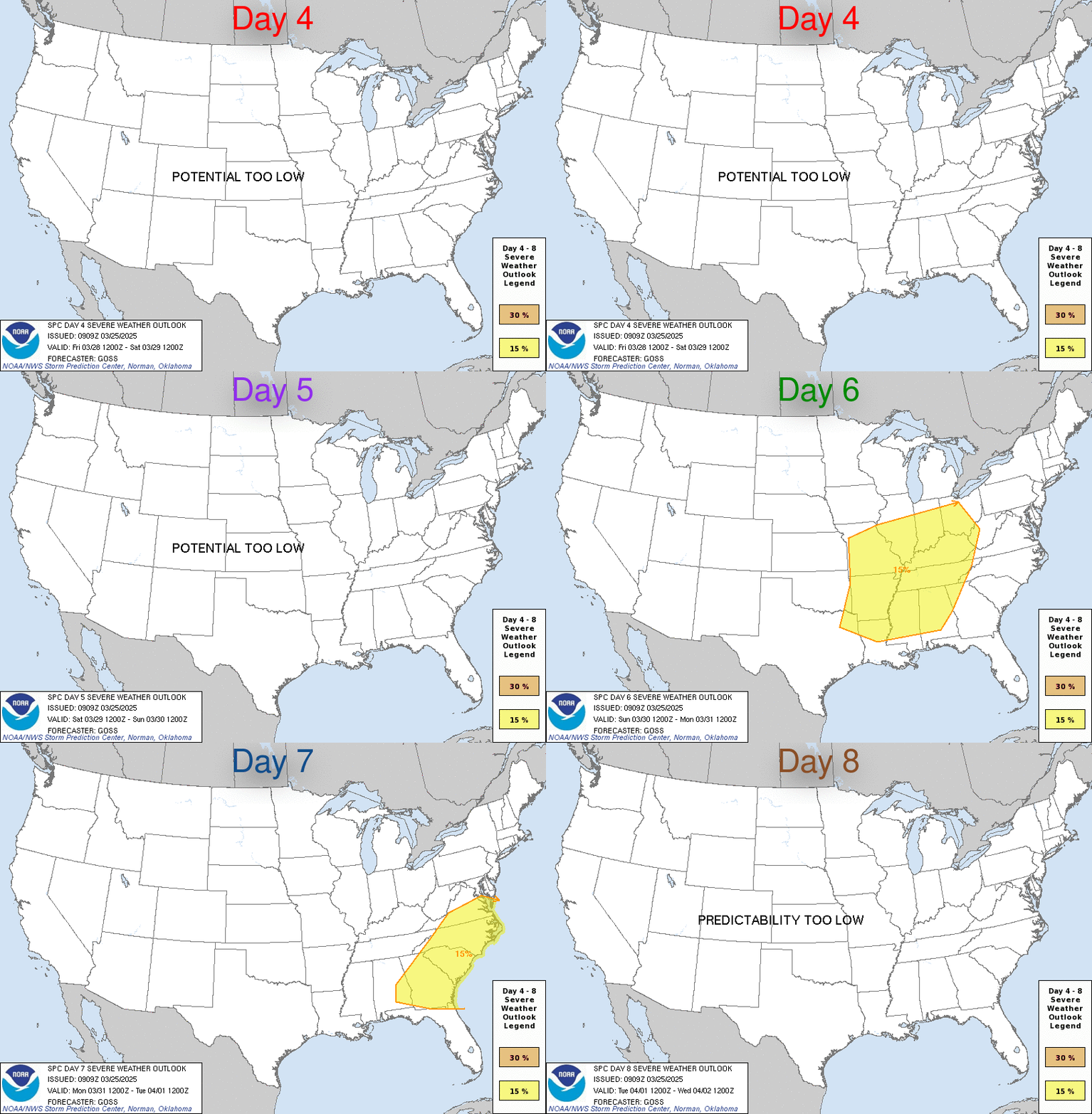
Day 4-8 Convective Outlook
NWS Storm Prediction Center Norman OK
0800 AM CDT Mon Oct 21 2024

Valid 241200Z - 291200Z

...DISCUSSION...
A mid-level trough will cross the central and eastern CONUS on
D4/Thursday and D5/Friday with a surface front advancing east
through the period. Moisture will remain limited ahead of this front
and thus, severe weather is not expected. In the wake of this front,
high pressure will build into the Midwest on D6/Saturday and move
into the Mid-Atlantic by D7/Sunday. This will result in tranquil
weather through the weekend. Extended range guidance does suggest
the potential for some return moisture flow by early next week, but
there is considerable uncertainty in the upper-level pattern and any
potential severe weather threat would likely be after Monday/D8.
https://www.spc.noaa.gov/products/exper/day4-8/
date: 2024-10-20, from: NOAA tornado/severe thunderstorm watches, mesoscale discussions, convective outlooks, fire weather outlooks

Day 1 Convective Outlook
NWS Storm Prediction Center Norman OK
0756 PM CDT Sat Oct 19 2024

Valid 200100Z - 201200Z

...THERE IS A SLIGHT RISK OF SEVERE THUNDERSTORMS ACROSS EASTERN NEW
MEXICO AND PARTS OF WEST TEXAS...

...SUMMARY...
Large hail, severe gusts and some tornado threat remain possible
across eastern New Mexico and portions of far West Texas this
evening.

...01z Update...

Strongest 500mb flow appears to be translating through the base of
the trough into western NM early this evening. This speed max will
advance into northern NM by the end of the period which will allow
the upper low to begin ejecting northeast toward the Four Corners.
Even so, negligible height changes will be noted across eastern
NM/West TX during the overnight hours. Scattered-numerous
thunderstorms have developed ahead of this upper feature with a
broken band of strong/severe convection currently extending from
near El Paso, northeast into Harding County NM, southwest of
Clayton. Several supercells have developed along this corridor which
are likely producing hail at/near severe levels, especially Chaves
County. 00z soundings from both AMA and MAF exhibited substantial
capping in the 700-750mb layer, though mid-level lapse rates are
steep. A bit west, uncapped profiles are noted at EPZ and ABQ with
strong deep-layer shear evident. Thunderstorms should continue to
develop along the leading edge of upper trough/influence where
inhibition is weak. Organized structures remain possible and large
hail is the primary risk, though gusts and perhaps a tornado or two
can not be ruled out this evening.

..Darrow.. 10/20/2024
https://www.spc.noaa.gov/products/outlook/day1otlk_0100.html