(date: 2024-11-17 16:11:25)
date: 2024-11-18, from: NOAA tornado/severe thunderstorm watches, mesoscale discussions, convective outlooks, fire weather outlooks
No watches are valid as of Mon Nov 18 00:04:01 UTC 2024.
https://www.spc.noaa.gov/products/watch/
date: 2024-11-18, from: NOAA tornado/severe thunderstorm watches, mesoscale discussions, convective outlooks, fire weather outlooks
No Mesoscale Discussions are in effect as of Mon Nov 18 00:04:01 UTC 2024.
https://www.spc.noaa.gov/products/md/
date: 2024-11-17, from: Eastern Pacific Basin GIS Data
No tropical cyclones as of Sun, 17 Nov 2024 23:40:46 GMT
date: 2024-11-17, from: Central Pacific Tropical Weather Outlook
000
ACPN50 PHFO 172325
TWOCP
Tropical Weather Outlook
NWS Central Pacific Hurricane Center
Honolulu HI
200 PM HST Sun Nov 17 2024
For the
central North Pacific…between 140W and 180W:
No tropical
cyclones are expected during the next 7 days.
$$
Forecaster Foster
https://www.nhc.noaa.gov/gtwo.php?basin=cpac
date: 2024-11-17, from: Eastern Pacific Tropical Weather Outlook
000
ABPZ20 KNHC 172318
TWOEP
Tropical Weather Outlook
NWS National Hurricane Center Miami
FL
400 PM PST Sun Nov 17 2024
For the eastern North
Pacific…east of 140 degrees west longitude:
Offshore of
Southwestern Mexico:
An area of low pressure located about one
hundred miles offshore of
the coast of southwestern Mexico is
producing disorganized showers
and thunderstorms. Development
appears unlikely due to strong
upper-level winds during the next
day or so while the system moves
east-southeastward at 5 to 10
mph, roughly parallel to the
southwestern coast of Mexico.
* Formation chance through 48 hours…low…10 percent.
* Formation
chance through 7 days…low…10 percent.
$$
Forecaster
Reinhart
https://www.nhc.noaa.gov/gtwo.php?basin=epac
date: 2024-11-17, from: Graphical Tropical Weather Outlooks


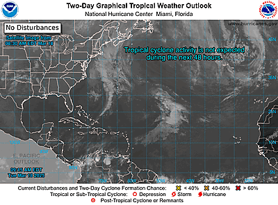
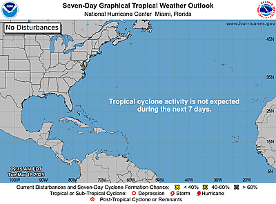
https://www.nhc.noaa.gov/gtwo.php?basin=atlc
date: 2024-11-17, from: NOAA tornado/severe thunderstorm watches, mesoscale discussions, convective outlooks, fire weather outlooks

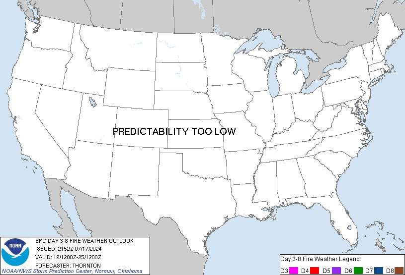
Day 3-8 Fire Weather Outlook
NWS Storm Prediction Center Norman OK
0254 PM CST Sun Nov 17 2024

Valid 191200Z - 251200Z

Fire weather concerns will remain limited through much of the
extended period with the exception of the southern CA coast on
D3/Tuesday. The upper low currently over northern Mexico is forecast
to eject into the Plains and the Midwest over the next 48 hours.
Widespread rain chances will accompany this features as it shifts
northeast. Additionally, an upper trough off the coast of the
Pacific Northwest will continue to support widespread rain/snow
chances along parts of the West Coast and Pacific Northwest through
early next week. As a result, fuels will likely remain unreceptive
to fire spread for most locations, though some drying is anticipated
from the lower CO River Valley into the central High Plains where
ensemble guidance shows relatively low probabilities for wetting
precipitation.

...D3/Tue - Southern California Coast...
Long-range ensemble guidance continues to trend towards a weaker
surface high across the northern Great Basin during the late D2/Mon
to early D4/Wed time frame. Consequently, most solutions now show
low probability of reaching and/or maintaining a strong offshore
pressure gradient along the southern CA coast (only a 30% chance of
seeing an LAX-DAG pressure gradient of -5 mb or less). As a result,
confidence in widespread critical fire weather conditions continues
to wane. Latest trends suggest that the offshore pressure gradient
will likely be maximized between 12-18 UTC D3/Tuesday. Elevated to
locally critical fire weather conditions appear possible during this
period, but may extend into early D4/Wednesday. However, confidence
in prolonged elevated and/or critical conditions extending into
D4/Wednesday is sufficiently low to warrant removal of the 40% risk
area.

...D3/Tue - Central High Plains...
The surface low associated with the ejecting upper trough (currently
over northern Mexico) is forecast to reach the upper MS River Valley
as it begins to occlude on D3/Tuesday. Westerly low-level winds are
expected to intensify across the central Plains in response to the
tightening pressure gradient with widespread 15-25 mph winds likely.
Downslope trajectories off the northern Rockies may support some
degree of drying across the western Dakotas into western NE, though
an influx of cooler continental air should modulate RH reductions.
However, limited rainfall is expected across this region through
mid-week, which may allow for some drying of finer fuels. The
potential for fire weather concerns appears too limited at this time
given current fuel conditions and the overall RH forecast, but
trends will be monitored for a wind-driven fire concern.

..Moore.. 11/17/2024

...Please see www.spc.noaa.gov/fire for graphic product...
https://www.spc.noaa.gov/products/exper/fire_wx/
date: 2024-11-17, from: NOAA tornado/severe thunderstorm watches, mesoscale discussions, convective outlooks, fire weather outlooks

Day 1 Convective Outlook
NWS Storm Prediction Center Norman OK
0155 PM CST Sun Nov 17 2024

Valid 172000Z - 181200Z

...THERE IS AN ENHANCED RISK OF SEVERE THUNDERSTORMS FROM NORTHWEST
TEXAS INTO FAR SOUTHWEST OKLAHOMA...

...SUMMARY...
Scattered severe thunderstorms are expected to develop across parts
of west/northwest Texas into southwest Oklahoma this evening and
continuing through daybreak on Monday, posing a risk for severe
gusts and a few tornadoes.

...20Z Update...

...Southern Plains...
General forecast outlined in the previous discussion remain valid,
with the cyclone currently entering northwest Mexico expected to
continue eastward across northern Mexico before then ejecting more
northeastward across the southern High Plains late tonight/early
tomorrow morning. A strong mid-level jet will accompany this system,
with 90-100 kt of 500-mb flow spreading across west TX and into
southwest OK by early tomorrow. An intense low-level jet will
develop ahead of this wave, with 60+ kt at 850-mb likely stretching
from the TX Hill Country through central OK by 12Z Monday.

Modest low-level moisture is still anticipated ahead of this system.
Current surface analysis places the mid 60s dewpoints along and
southeast of a line from PVJ in south-central OK to north of DRT in
the Edwards Plateau. This area of greater low-level moisture will
continue to advect northwestward throughout the day and evening,
ahead of the approaching wave and associated surface low. Surface
analysis also reveals a stationary boundary from END in
north-central OK southwestward to just west of INK in the TX Trans
Pecos. This boundary will likely provide the favored corridor for
surface low progress late this evening and overnight.

A strongly forced band of thunderstorm is still anticipated,
beginning around 04-06Z in the Permian Basin vicinity, with this
band then expected to rapidly move northeastward just ahead of the
surface low, reaching central OK by 12Z. Intense low-level kinematic
fields will precede this line, with strong flow associated with the
mid-level jet as well. Resulting fast storm motion and downward
momentum transfer supports the potential for severe gusts, despite
the relatively modest thermodynamic environment. Highest probability
for severe gusts is over northwest TX and far southwest OK from 09Z
to 12Z Monday. A tornado risk will accompany this line as well, with
the highest tornado probability in the same location and time as the
greatest severe-wind threat.

..Mosier.. 11/17/2024

.PREV DISCUSSION... /ISSUED 1030 AM CST Sun Nov 17 2024/

...Synopsis...
Water-vapor imagery this morning shows a potent mid-level low/trough
over northwest Mexico with a downstream ridge centered over the
eastern Gulf of Mexico.  A mid-level vorticity maximum near the
middle part of the Gulf of California will pivot east into Chihuahua
by mid evening while the larger-scale trough becomes negatively
tilted and moves northeastward into the southern High Plains.  In
the low levels, cyclogenesis over northern Mexico will gradually
evolve today before the surface low deepens tonight reaching the
northwest TX/western OK vicinity at the end of the period.
Seasonably moist air via southeasterly flow from the western Gulf
will advect into west TX before a Pacific front sweeps eastward
across the Chihuahuan Desert and portions of the southern High
Plains tonight.  An attendant warm frontal zone will advance
northward from north TX into OK late.

...Southern Great Plains...
The 12 UTC Fort Worth, TX observed sounding showed an adequately
moist/deep moist layer featuring a mean mixing ratio of 12.6 g/kg.
The richer low-level moisture, featuring dewpoints in the mid-upper
60s as of late morning, is currently near the I-35 corridor from the
Metroplex and areas south/southeast.  Moisture advection will
contribute to gradual destabilization through this evening across
parts of west TX northeastward into southwest OK despite
considerable cloud cover through the day.  As an intense 100-kt
500-mb speed max moves from Chihuahua into west TX overnight,
large-scale ascent will favor the development of scattered
thunderstorms initially developing near the Permian Basin vicinity
and becoming more widespread as very strong low-level warm advection
attendant to an intensifying LLJ develops tonight.  Model guidance
indicates 250-1000 J/kg MLCAPE across the destabilizing warm sector.
A forced band of storms will likely evolve tonight across west TX
and rapidly move northeast in the area southeast of the surface low
track.  As the squall line matures, the propensity for severe gusts
will probably increase despite relatively poor lapse given the
intense flow expected to develop.  It remains uncertain if cellular
development will occur either ahead of the line or be loosely
maintained in parts of the larger band of storms.  Nonetheless,
elongated and enlarged hodographs will favor a risk for scattered
severe gusts and possibly a tornado risk, especially as the squall
line encounters greater moisture from west-central TX northeastward
into southwest OK late.
https://www.spc.noaa.gov/products/outlook/day1otlk_2000.html
date: 2024-11-17, from: NOAA tornado/severe thunderstorm watches, mesoscale discussions, convective outlooks, fire weather outlooks

Day 3 Convective Outlook
NWS Storm Prediction Center Norman OK
0126 PM CST Sun Nov 17 2024

Valid 191200Z - 201200Z

...THERE IS A MARGINAL RISK OF SEVERE THUNDERSTORMS FOR PORTIONS OF
THE CENTRAL GULF COAST...

...SUMMARY...
Thunderstorms associated with isolated severe gusts and perhaps a
tornado will be possible across parts of the central Gulf states on
Tuesday.

...Synopsis...
A mid-level trough will amplify while traversing the Plains states
and Upper MS Valley region on Tuesday, reinforcing surface high
pressure and associated cooler temperatures behind a cold front
poised to sweep across the OH/TN Valleys into the Southeast. As the
primary surface low over the upper MS Valley ejects into Ontario
through the day, surface lee troughing should occur along the
central Gulf Coast, supporting continued onshore moisture advection.
Given a modest, trailing low-level jet aiding in the moisture
advection, enough shear and instability along the Gulf Coast may
encourage strong to isolated severe thunderstorm development.

...Portions of the central Gulf Coast Region...
Surface lee troughing will encourage mid to upper 60s F surface
dewpoints to advect onshore amid adequate surface heating during the
day, contributing to over 500 J/kg MLCAPE by afternoon. As storms
intensify within a warm-air advection regime, veering/strengthening
of the vertical wind profile will support modestly curved hodographs
ahead of the storms. Transient supercells may develop from some of
the stronger updrafts, with damaging gusts and perhaps a tornado
possible.

..Squitieri.. 11/17/2024
https://www.spc.noaa.gov/products/outlook/day3otlk_1930.html
date: 2024-11-16, from: NOAA tornado/severe thunderstorm watches, mesoscale discussions, convective outlooks, fire weather outlooks

Day 2 Convective Outlook
NWS Storm Prediction Center Norman OK
1126 AM CST Sat Nov 16 2024

Valid 171200Z - 181200Z

...THERE IS A SLIGHT RISK OF SEVERE THUNDERSTORMS ACROSS PORTIONS OF
WESTERN INTO CENTRAL TEXAS...

...SUMMARY...
Strong to severe thunderstorms are expected to develop across parts
of western, central and northwest Texas from Sunday evening through
daybreak on Monday, posing a risk for severe gusts and possibly a
few tornadoes.

...Synopsis...
A negatively tilted mid-level trough will eject into the southern
Plains tomorrow (Sunday) into tomorrow night as a second mid-level
trough impinges on the Interior West. By tomorrow night into early
Monday morning, surface low development is expected across western
TX as strong upper support and an 80 kt mid-level speed max
overspread the southern Plains. Low-level warm-air advection
accompanying the developing surface low will support modest
boundary-layer destabilization across central TX into southern OK,
where adequate lift and shear will support some potential for severe
thunderstorms.

...Southern Plains - Sunday Night into early Monday Morning...
By around 06Z Monday morning, a surface low should begin to
materialize just south of the TX Panhandle with the ejection of the
aforementioned mid-level trough. Despite poor low and mid-level
lapse rates, modest surface-850 mb theta-e advection will support a
corridor of 500-750 J/kg SBCAPE across central TX into extreme
southern OK during the 06-12Z time frame. Given strong forcing for
ascent and south-southwesterly 500 mb flow oriented roughly parallel
with an approaching cold front, a squall line is expected to develop
and advance northeast in tandem with the surface low. Modest veering
but rapid strengthening with height of the vertical wind profile
will support large, curved hodographs ahead of the squall line.
0-500 m SRH may exceed 200 m2/s2, with 0-3 km SRH reaching 400 m2/s2
in spots. However, questions remain regarding how much SRH can be
effectively ingested into thunderstorm updrafts given scant buoyancy
profiles. Still, effective downward momentum transport of the strong
synoptic flow aloft may support severe gusts within the squall line.
Furthermore, if strong enough low-level WAA can appreciably
destabilize the nocturnal boundary-layer, then isolated QLCS
tornadoes may also occur. Any QLCS tornadoes that can develop will
most likely occur with any LEWPS or mesovortices within portions of
the squall line preceding the surface low track, where low-level
winds will be most backed and low-level shear will be strongest.

..Squitieri.. 11/16/2024
https://www.spc.noaa.gov/products/outlook/day2otlk_1730.html
date: 2024-11-16, from: NOAA tornado/severe thunderstorm watches, mesoscale discussions, convective outlooks, fire weather outlooks

Day 1 Convective Outlook
NWS Storm Prediction Center Norman OK
1028 AM CST Sat Nov 16 2024

Valid 161630Z - 171200Z

...NO SEVERE THUNDERSTORM AREAS FORECAST...

...SUMMARY...
Severe thunderstorms are not expected today.

...Synopsis/Discussion...
Morning water-vapor imagery depicts a midlevel shortwave trough
tracking eastward from eastern MT into the Dakotas. This feature
will continue eastward across the northern Plains/Canadian Prairies
into the overnight/early morning hours. In the 04-12Z time frame,
associated cooling aloft atop a cool/stable boundary layer will
contribute to weak elevated instability across the Upper Midwest.
Given strong low-level warm advection and midlevel ascent preceding
the trough, isolated thunderstorms are possible.

Farther south, a separate low-level jet will promote a band of
showers over the Upper TX Coast during the overnight hours. Related
low-level warming/moistening will contribute to weak instability,
though dry air aloft should generally limit lightning potential.

..Weinman.. 11/16/2024
https://www.spc.noaa.gov/products/outlook/day1otlk_1630.html
date: 2024-11-16, from: NOAA tornado/severe thunderstorm watches, mesoscale discussions, convective outlooks, fire weather outlooks

Day 1 Fire Weather Outlook
NWS Storm Prediction Center Norman OK
1002 AM CST Sat Nov 16 2024

Valid 161700Z - 171200Z

The previous forecast remains on track with no changes needed.
Latest observations show wind speeds already increasing to 15-20 mph
with gusts up to 20-30 mph. Similarly, RH values have fallen into
the 20-35% range with some further reduction possible through early
afternoon. Consideration was made for an upgrade to a Critical risk
across parts of New England where conditions are currently the
driest and 20+ mph gusts are being observed. However, wind speeds
are expected to abate slightly through the afternoon away from
terrain features (critical conditions appear most probable in the
lee of Ponco and Catskill mountains).

..Moore.. 11/16/2024

.PREV DISCUSSION... /ISSUED 1122 PM CST Fri Nov 15 2024/

...Synopsis...
A belt of stronger mid-level winds will be favorably placed across
portions of New England and Mid-Atlantic today. A stronger surface
pressure gradient will also remain across the region. A few hours of
elevated fire weather appear likely. Winds of 10-15 mph and RH
25-40% amid very dry fuels will support large fire potential during
the afternoon. A few stronger gusts are possible as well, but
boundary-layer mixing should be limited enough to keep these gusts
isolated.

...Please see www.spc.noaa.gov/fire for graphic product...
https://www.spc.noaa.gov/products/fire_wx/fwdy1.html
date: 2024-11-16, from: NOAA tornado/severe thunderstorm watches, mesoscale discussions, convective outlooks, fire weather outlooks

Day 1 Convective Outlook
NWS Storm Prediction Center Norman OK
0634 AM CST Sat Nov 16 2024

Valid 161300Z - 171200Z

...NO SEVERE THUNDERSTORM AREAS FORECAST...

...SUMMARY...
Severe thunderstorms are not expected today.

...Synopsis and Discussion...
Within large-scale upper troughing over the western CONUS, a
shortwave trough should move eastward across the northern Plains and
Canadian Prairie provinces through the period. A related surface low
over the northern Plains this morning will develop generally
northeastward into western Ontario by late tonight. Low-level
warm/moist advection will occur ahead of these features across parts
of the Upper Midwest through much of the period. While instability
is expected to remain rather muted, sufficient MUCAPE for elevated
convection may exist by late evening into the overnight hours across
this region. Overall lightning coverage will probably tend to be
rather isolated given the weak instability forecast.

..Gleason/Kerr.. 11/16/2024
https://www.spc.noaa.gov/products/outlook/day1otlk_1300.html
date: 2024-11-14, from: NOAA tornado/severe thunderstorm watches, mesoscale discussions, convective outlooks, fire weather outlooks

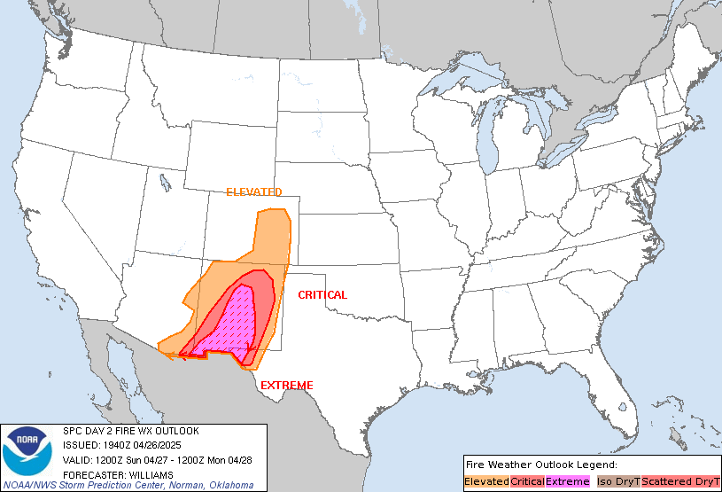
Day 2 Fire Weather Outlook
NWS Storm Prediction Center Norman OK
1248 PM CST Thu Nov 14 2024

Valid 151200Z - 161200Z

The ongoing forecast for elevated fire-weather conditions tomorrow
(Friday) is still on track across portions of New England (see
previous discussion below).  The area was slightly expanded to the
north and south where meteorological conditions will be similar to
the rest of the area, and fuels are also abnormally dry (i.e., ERC
values exceeding the 90th percentile).

Over portions of eastern Arizona and western New Mexico, strong
south-southwesterly surface winds and low RH are likely during the
afternoon hours, but fuels will likely not be receptive for
large-fire spread (i.e., ERC values generally below the 60th
percentile).

..Jirak.. 11/14/2024

.PREV DISCUSSION... /ISSUED 0202 AM CST Thu Nov 14 2024/

...Synopsis...
...New England...
Post-frontal offshore flow will return across the New England coast
on Friday. Relative humidity reductions to around 30-40 percent will
be possible with northwesterly breezes around 10-15 mph. Given
drought conditions and very little recent rainfall, Elevated fire
weather concerns will be likely with fuels in the region remaining
receptive to fire spread.

...Southern Arizona and Western New Mexico...
A deepening trough will bring increasing westerly flow aloft and
strong southwesterly surface winds across portions of Arizona and
New Mexico. Relative humidity reductions to around 10-15 percent
will overlap sustained winds around 15-20 mph. Portions of
southeastern Arizona and western New Mexico have seen less recent
rain/snowfall, with potential for some drying of fine fuels
possible. Overall, ERCs are largely at or below the 50th percentile.

...Please see www.spc.noaa.gov/fire for graphic product...
https://www.spc.noaa.gov/products/fire_wx/fwdy2.html
date: 2024-11-14, from: NOAA tornado/severe thunderstorm watches, mesoscale discussions, convective outlooks, fire weather outlooks

Day 1 Convective Outlook
NWS Storm Prediction Center Norman OK
0647 PM CST Wed Nov 13 2024

Valid 140100Z - 141200Z

...THERE IS A MARGINAL RISK OF SEVERE THUNDERSTORMS ACROSS PARTS OF
THE CENTRAL GULF COAST AND ALONG PARTS OF THE WEST COAST...

...SUMMARY...
Isolated severe thunderstorms, associated with a marginal threat for
tornadoes and wind damage, will be possible across the central Gulf
Coast this evening. Isolated severe gusts will also be possible
along parts of the West Coast.

...Central Gulf Coast...
A mid-level trough, evident on water vapor imagery, is moving into
the Ark-La-Tex. Further to the east, a lead shortwave trough is
moving through the central Gulf Coast states, where a moist airmass
is in place. Surface dewpoints across the central Gulf Coast region
range from the mid 70s F near the coast to the mid 60s F over much
of southwestern Alabama. Scattered thunderstorms are ongoing near
the moist axis. The stronger cells are expected to move
northeastward across far southern Mississippi and into southwest
Alabama this evening. RAP forecasts soundings in far southwest
Alabama at 03Z have MLCAPE near 750 J/kg, 0-6 km shear in the 35 to
40 knot range, and some directional shear in the low to mid-levels.
This should be sufficient for a marginal severe threat this evening.
A potential for isolated severe gusts may exist with semi-organized
line segments. A marginal tornado threat will also be possible with
the more discrete rotating cells.

...West Coast...
A mid-level trough is evident on water vapor imagery over southwest
Oregon and northern California. Mid-level moisture associated with
the trough, large-scale ascent and steep lapse rates are
contributing to thunderstorm potential along the coast of northern
California, Oregon and Washington. Some of the storms may become
strong enough to mix low-level winds of about 35 to 40 knots down to
the surface. A few gusts could approach severe limits this evening.

..Broyles.. 11/14/2024
https://www.spc.noaa.gov/products/outlook/day1otlk_0100.html