(date: 2024-11-19 12:51:37)
date: 2024-11-19, from: NOAA tornado/severe thunderstorm watches, mesoscale discussions, convective outlooks, fire weather outlooks
No watches are valid as of Tue Nov 19 20:39:01 UTC 2024.
https://www.spc.noaa.gov/products/watch/
date: 2024-11-19, from: NOAA tornado/severe thunderstorm watches, mesoscale discussions, convective outlooks, fire weather outlooks
No Mesoscale Discussions are in effect as of Tue Nov 19 20:39:01 UTC 2024.
https://www.spc.noaa.gov/products/md/
date: 2024-11-19, from: NOAA tornado/severe thunderstorm watches, mesoscale discussions, convective outlooks, fire weather outlooks
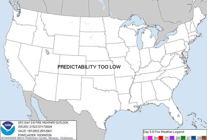
Day 3-8 Fire Weather Outlook
NWS Storm Prediction Center Norman OK
0219 PM CST Tue Nov 19 2024

Valid 211200Z - 271200Z

Fire weather concerns are expected to remain limited through early
next week across the country. The upper trough currently in place
across the central U.S. will gradually shift east through the
remainder of the week with attendant rain chances overspreading much
of the Great Lakes and New England regions. Upper ridging appears
likely across the inter-mountain West/Plains in the wake of the
eastern trough, which will promote dry conditions but relatively
benign low-level gradient winds. Along the West Coast, the
intensifying low off the Pacific Northwest coast will maintain
widespread rain/snow chances through the end of the week before
gradually de-amplifying and shifting inland. Most regions are
expected to see some degree of precipitation by the weekend, which
will mitigate fuel/fire concerns.

The only exceptions to this will be the Four Corners and the
southern to central Plains where the probability for wetting
rainfall appears fairly low. Some fuel drying is anticipated across
these regions, though recent heavy rain across the Plains will
require multiple days of warm, dry, and windy conditions to support
a fire concern. Long-range ensemble guidance hints that a breakdown
of the upper ridge is likely by early next week, which may support
dry/windy conditions across the Four Corners/southern Plains as
shortwave troughs propagate eastward within the mean zonal flow
regime. However, confidence in any fire concern is very low at this
range.

..Moore.. 11/19/2024

...Please see www.spc.noaa.gov/fire for graphic product...
https://www.spc.noaa.gov/products/exper/fire_wx/
date: 2024-11-19, from: NOAA tornado/severe thunderstorm watches, mesoscale discussions, convective outlooks, fire weather outlooks

Day 1 Convective Outlook
NWS Storm Prediction Center Norman OK
0135 PM CST Tue Nov 19 2024

Valid 192000Z - 201200Z

...NO SEVERE THUNDERSTORM AREAS FORECAST...

...SUMMARY...
Severe thunderstorm potential is expected to remain low the
remainder of the afternoon thought tonight.

...20z Update - Central Gulf Coast vicinity...

Severe probabilities have been removed as inland convection has
outpaced axis of modest instability. Any stronger storms are
expected to remain offshore.

..Leitman.. 11/19/2024

.PREV DISCUSSION... /ISSUED 1021 AM CST Tue Nov 19 2024/

...Middle Gulf Coast including southern AL/FL Panhandle...
Severe-weather potential is expected to remain relatively limited
today and largely relegated to near-coastal areas of southern
Alabama and the Florida Panhandle. A longwave trough will remain
centered across a broad part of the Midwest and Great Lakes, well to
the north of a weak surface wave and a nearby narrow inland warm
sector along the middle Gulf Coast. This warm/moist sector will
largely focus offshore due to a lack of more appreciable
cyclogenesis and persistent showers/thunderstorms inland.

The southern extent of a persistent but weakening (25-40 kt)
south-southwesterly low-level jet will migrate slowly eastward today
across the Gulf Coast vicinity. A brief waterspout and/or tornado
could occur with low-topped rotating cells along or very near the
coast given adequate 0-1 km SRH and greater low-level moisture
present (generally 70s F surface dewpoints). Otherwise, isolated
damaging wind gusts may occur with convection moving eastward along
or just ahead of the front. Meager instability should keep the
severe potential rather isolated and marginal overall.
https://www.spc.noaa.gov/products/outlook/day1otlk_2000.html
date: 2024-11-19, from: NOAA tornado/severe thunderstorm watches, mesoscale discussions, convective outlooks, fire weather outlooks

Day 3 Convective Outlook
NWS Storm Prediction Center Norman OK
0128 PM CST Tue Nov 19 2024

Valid 211200Z - 221200Z

...NO THUNDERSTORM AREAS FORECAST...

...SUMMARY...
Thunderstorms are not expected on Thursday.

...Synopsis...
A deep mid/upper-level low will move slowly east-southeastward from
the Great Lakes into the Mid-Atlantic/southern New England through
the period. Ahead of this feature and north of a related coastal
surface low, cold temperatures aloft/modestly steep midlevel lapse
rates will contribute to weak elevated instability over immediate
coastal areas of southern New England during the morning hours.
While an isolated lightning flash will be possible within a swath of
warm-advection precipitation, the overall coverage appears too
limited for a General Thunderstorm area. Elsewhere, expansive
surface ridging over the western/central CONUS and related offshore
flow will limit thunderstorm potential.

..Weinman.. 11/19/2024
https://www.spc.noaa.gov/products/outlook/day3otlk_1930.html
date: 2024-11-19, from: Eastern Pacific Basin GIS Data
No tropical cyclones as of Tue, 19 Nov 2024 18:48:09 GMT
date: 2024-11-19, from: Graphical Tropical Weather Outlooks
https://www.nhc.noaa.gov/gtwo.php?basin=cpac
date: 2024-11-19, from: Graphical Tropical Weather Outlooks
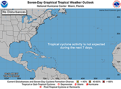
https://www.nhc.noaa.gov/gtwo.php?basin=atlc
date: 2024-11-19, from: Graphical Tropical Weather Outlooks
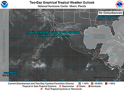
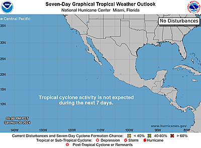
https://www.nhc.noaa.gov/gtwo.php?basin=epac
date: 2024-11-19, from: NOAA tornado/severe thunderstorm watches, mesoscale discussions, convective outlooks, fire weather outlooks
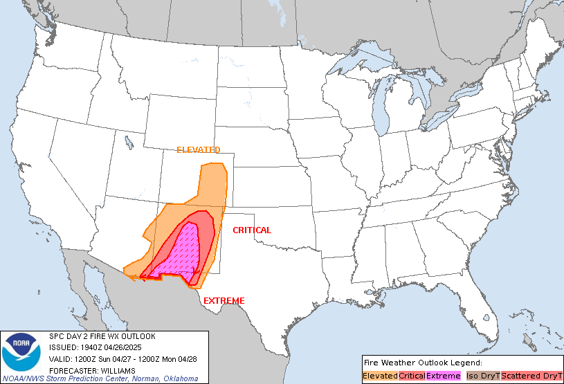
Day 2 Fire Weather Outlook
NWS Storm Prediction Center Norman OK
1223 PM CST Tue Nov 19 2024

Valid 201200Z - 211200Z

The previous forecast remains on track with only minor adjustments
needed based on latest high-res guidance. Similar conditions to
today (Tuesday) remain likely Wednesday across the Plains and will
support a wind-driven fire weather concern. For additional details
see the previous discussion below.

..Moore.. 11/19/2024

.PREV DISCUSSION... /ISSUED 1240 AM CST Tue Nov 19 2024/

...Synopsis...
The strong upper trough in the central Plains will move east on
Wednesday. A strong belt of northwesterly mid-level winds will
remain over the Plains. A new surface low will then deepen in the
Lower Great Lakes region.

...Central Plains...
A similar setup to Tuesday will again occur on Wednesday across
parts of Wyoming, South Dakota, and Nebraska. Temperatures will
again remain quite cool, but the remaining dry airmass coupled with
a modest downslope wind component will promote 20-30% RH by the
afternoon. Winds will again be the primary driver of fire weather
concern with 15-25 mph sustained winds being fairly common along
with stronger gusts. The fire weather threat should begin to
diminish by mid/late afternoon as the surface pressure gradient
weakens.

...Please see www.spc.noaa.gov/fire for graphic product...
https://www.spc.noaa.gov/products/fire_wx/fwdy2.html
date: 2024-11-19, from: Central Pacific Basin Tropical Cyclones
No tropical cyclones as of Tue, 19 Nov 2024 18:48:09 GMT
date: 2024-11-19, from: NOAA tornado/severe thunderstorm watches, mesoscale discussions, convective outlooks, fire weather outlooks

Day 2 Convective Outlook
NWS Storm Prediction Center Norman OK
1127 AM CST Tue Nov 19 2024

Valid 201200Z - 211200Z

...NO SEVERE THUNDERSTORM AREAS FORECAST...

...SUMMARY...
Severe weather is not expected on Wednesday. Isolated thunderstorms
are most likely over parts of Florida and the Carolinas, and along
the coastal Pacific Northwest.

...Synopsis...
A deep upper trough/low will evolve eastward from the Upper MS
Valley into the Great Lakes through the period. In response, a
surface low will deepen and gradually occlude over the Great Lakes,
while a related cold front moves eastward across the eastern states.
Strong midlevel height falls preceding the upper trough will promote
scattered showers with isolated/embedded lightning along/ahead of
the cold front. Despite strong deep-layer westerly flow/shear
accompanying the trough, limited heating/poor lapse rates and dry
air aloft should limit updraft intensity. Over the western FL
Peninsula, richer boundary-layer moisture will be in place
along/ahead of the front, where guidance indicates a weak frontal
wave low during the morning. Here, strong low-level flow (and curved
low-level hodographs) could favor a few strong/rotating storms
approaching the coast, though weak instability/lapse rates should
limit the severe threat over land.

Farther west, several perturbations embedded in a belt of strong
mid/upper-level westerly flow -- within the base of a midlevel low
off the BC coast --  will promote isolated thunderstorms across the
Pacific Northwest coast through the period. Elongated hodographs
(with ample low-level curvature) will conditionally support a few
strong/embedded cells capable of locally strong gusts and possibly
waterspouts. However, any severe threat onshore appears too
conditional for severe probabilities at this time.

..Weinman.. 11/19/2024
https://www.spc.noaa.gov/products/outlook/day2otlk_1730.html
date: 2024-11-19, from: NOAA tornado/severe thunderstorm watches, mesoscale discussions, convective outlooks, fire weather outlooks

Day 1 Convective Outlook
NWS Storm Prediction Center Norman OK
1021 AM CST Tue Nov 19 2024

Valid 191630Z - 201200Z

...THERE IS A MARGINAL RISK OF SEVERE THUNDERSTORMS ACROSS PARTS OF
THE GULF COAST...

...SUMMARY...
Thunderstorms producing isolated strong wind gusts and perhaps a
tornado are possible across the middle Gulf Coast vicinity today.

...Middle Gulf Coast including southern AL/FL Panhandle...
Severe-weather potential is expected to remain relatively limited
today and largely relegated to near-coastal areas of southern
Alabama and the Florida Panhandle. A longwave trough will remain
centered across a broad part of the Midwest and Great Lakes, well to
the north of a weak surface wave and a nearby narrow inland warm
sector along the middle Gulf Coast. This warm/moist sector will
largely focus offshore due to a lack of more appreciable
cyclogenesis and persistent showers/thunderstorms inland.

The southern extent of a persistent but weakening (25-40 kt)
south-southwesterly low-level jet will migrate slowly eastward today
across the Gulf Coast vicinity. A brief waterspout and/or tornado
could occur with low-topped rotating cells along or very near the
coast given adequate 0-1 km SRH and greater low-level moisture
present (generally 70s F surface dewpoints). Otherwise, isolated
damaging wind gusts may occur with convection moving eastward along
or just ahead of the front. Meager instability should keep the
severe potential rather isolated and marginal overall.

..Guyer/Flournoy.. 11/19/2024
https://www.spc.noaa.gov/products/outlook/day1otlk_1630.html
date: 2024-11-19, from: NOAA tornado/severe thunderstorm watches, mesoscale discussions, convective outlooks, fire weather outlooks

Mesoscale Discussion 2236
NWS Storm Prediction Center Norman OK
0609 PM CST Mon Nov 18 2024

Areas affected...Southeast TX...Central LA

Concerning...Tornado Watch 711...

Valid 190009Z - 190145Z

The severe weather threat for Tornado Watch 711 continues.

SUMMARY...Scattered supercells will continue spreading northeast
across the eastern half of ww711.

DISCUSSION...Several long-lived supercells are noted within ww711
early this evening. One in particular is crossing Newton County TX
into northwestern Vernon Parish. This activity appears partly aided
by the right-entrance region of the mid-level jet, along with
sustained low-level warm advection. While lapse rates are not that
steep, low-mid 70s surface dew points are contributing to
significant buoyancy. Until the LLJ lifts north of this air mass,
organized supercell threat will likely continue. Primary risk
continues to be damaging winds along with some tornado risk,
especially for the next few hours.

..Darrow.. 11/19/2024

...Please see www.spc.noaa.gov for graphic product...

ATTN...WFO...LCH...SHV...

LAT...LON   30789387 32019304 32019223 30969261 30419330 30789387
https://www.spc.noaa.gov/products/md/md2236.html
date: 2024-11-19, from: NOAA tornado/severe thunderstorm watches, mesoscale discussions, convective outlooks, fire weather outlooks

Day 1 Convective Outlook
NWS Storm Prediction Center Norman OK
0635 PM CST Mon Nov 18 2024

Valid 190100Z - 191200Z

...THERE IS A SLIGHT RISK OF SEVERE THUNDERSTORMS FROM EXTREME
SOUTHEAST TEXAS INTO PORTIONS OF LOUISIANA AND EXTREME SOUTH-CENTRAL
ARKANSAS...

...SUMMARY...
A risk for a couple of tornadoes and damaging winds will persist
into late evening or the early overnight hours across the Lower
Mississippi Valley.

...Mid-MO Valley to Lower MS Valley...

Severe probabilities have been removed from most of east TX
northward into MO/KS/NE/IA based on current location of the surface
cold front and ongoing convection. Any remaining convection across
the Mid-MO Valley vicinity will continue to weaken with eastward
extent given a dearth of instability.

Further south, severe probabilities remain unchanged (other than
trimming behind ongoing QLCS) across the Lower MS Valley. A risk for
isolated severe gusts and a couple of tornadoes remain possible,
especially over the next few hours. By late evening into the
overnight hours, severe potential is expected to become lower with
eastward extent across southern MS/southeast LA and southern AL as
large-scale ascent is rapidly becoming further displaced from better
boundary layer moisture. Strong vertical shear will persist, but
surface-based parcels likely will be unable to realize the favorable
SRH environment, limiting severe potential with eastward extent.

..Leitman.. 11/19/2024
https://www.spc.noaa.gov/products/outlook/day1otlk_0100.html
date: 2024-11-19, from: NOAA tornado/severe thunderstorm watches, mesoscale discussions, convective outlooks, fire weather outlooks

STATUS REPORT ON WW 711

SEVERE WEATHER THREAT CONTINUES RIGHT OF A LINE FROM 40 NNE HOU
TO 5 NE SHV.

..LYONS..11/18/24

ATTN...WFO...LCH...SHV...HGX...


STATUS REPORT FOR WT 711

SEVERE WEATHER THREAT CONTINUES FOR THE FOLLOWING AREAS

LAC011-013-031-043-049-069-079-081-085-115-127-182340-

LA
.    LOUISIANA PARISHES INCLUDED ARE

BEAUREGARD           BIENVILLE           DE SOTO
GRANT                JACKSON             NATCHITOCHES
RAPIDES              RED RIVER           SABINE
VERNON               WINN


TXC199-241-291-351-403-405-419-457-182340-

TX
.    TEXAS COUNTIES INCLUDED ARE

HARDIN               JASPER              LIBERTY
NEWTON               SABINE              SAN AUGUSTINE
SHELBY               TYLER


THE WATCH STATUS MESSAGE IS FOR GUIDANCE PURPOSES ONLY.  PLEASE
REFER TO WATCH COUNTY NOTIFICATION STATEMENTS FOR OFFICIAL
INFORMATION ON COUNTIES...INDEPENDENT CITIES AND MARINE ZONES
CLEARED FROM SEVERE THUNDERSTORM AND TORNADO WATCHES.
https://www.spc.noaa.gov/products/watch/ws0711.html
date: 2024-11-19, from: NOAA tornado/severe thunderstorm watches, mesoscale discussions, convective outlooks, fire weather outlooks

URGENT - IMMEDIATE BROADCAST REQUESTED
Tornado Watch Number 711
NWS Storm Prediction Center Norman OK
255 PM CST Mon Nov 18 2024

The NWS Storm Prediction Center has issued a

* Tornado Watch for portions of
  Western and Central Louisiana
  East and Southeast Texas

* Effective this Monday afternoon and evening from 255 PM until
  800 PM CST.

* Primary threats include...
  A couple tornadoes possible
  Scattered damaging wind gusts to 65 mph possible

SUMMARY...Scattered thunderstorms will continue to develop and
intensify this afternoon into the evening.  A few of the stronger
storms will evolve into supercells and pose a risk for a couple of
tornadoes.

The tornado watch area is approximately along and 60 statute miles
east and west of a line from 45 miles north of Natchitoches LA to 90
miles southwest of Fort Polk LA. For a complete depiction of the
watch see the associated watch outline update (WOUS64 KWNS WOU1).

PRECAUTIONARY/PREPAREDNESS ACTIONS...

REMEMBER...A Tornado Watch means conditions are favorable for
tornadoes and severe thunderstorms in and close to the watch
area. Persons in these areas should be on the lookout for
threatening weather conditions and listen for later statements
and possible warnings.

&&

AVIATION...Tornadoes and a few severe thunderstorms with hail
surface and aloft to 0.5 inches. Extreme turbulence and surface wind
gusts to 55 knots. A few cumulonimbi with maximum tops to 450. Mean
storm motion vector 22035.

...Smith
https://www.spc.noaa.gov/products/watch/ww0711.html
date: 2024-11-18, from: NOAA tornado/severe thunderstorm watches, mesoscale discussions, convective outlooks, fire weather outlooks

Day 1 Convective Outlook
NWS Storm Prediction Center Norman OK
0659 AM CST Mon Nov 18 2024

Valid 181300Z - 191200Z

...THERE IS A SLIGHT RISK OF SEVERE THUNDERSTORMS ACROSS PARTS OF
THE SOUTHERN PLAINS...AND FROM PORTIONS OF EAST TEXAS INTO LOUISIANA
AND FAR SOUTHERN ARKANSAS...

...SUMMARY...
Thunderstorms may continue to produce occasional strong to severe
gusts and perhaps a couple brief tornadoes across parts of north
Texas into central Oklahoma this morning. A threat for a few
tornadoes and damaging winds will also exist this afternoon and
evening from parts of east Texas into Louisiana and vicinity.

...Synopsis...
A negatively tilted shortwave trough over the southern High Plains
this morning will eject northeastward across the central Plains and
mid MO Valley through this evening. Attendant 80-100 kt mid-level
jet will likewise overspread OK/KS into western MO by late
afternoon, while a strong (50-60+ kt) southerly low-level jet aids
in northward moisture transport across parts of the southern/central
Plains and lower/mid MS Valley. At the surface, a deep low over
western OK will develop northeastward through the day in tandem with
the ejecting shortwave trough, eventually reaching the Upper Midwest
late tonight. A related cold front will sweep quickly eastward
across the southern/central Plains and into the mid MS Valley
through the period, before decelerating over the lower MS Valley
late tonight into early Tuesday morning.

...Southern Plains...
With low-level winds remaining very strong per area VWPs (up to
50-60 kt at 1 km AGL), an ongoing QLCS across central/southern OK
into north-central TX may continue to pose a risk for occasional
strong to severe winds in the short term this morning as it moves
east-northeastward. Ample low-level shear will also support a
continued threat for embedded circulations and a couple brief QLCS
tornadoes this morning. This line is expected to outpace better
low-level moisture return and already weak instability in the next
couple of hours (see very weak surface-based instability in 12Z
soundings from OUN/FWD). Accordingly, nearly all guidance shows
gradual weakening of the line over the next several hours as it
moves into eastern OK and northeast TX. Still, at least an isolated
threat for strong to damaging winds and perhaps a tornado could
persist, even as the thermodynamic environment becomes increasingly
marginal with eastward extent.

...East Texas into the Lower Mississippi Valley...
The southern portion of the squall line along/ahead of the cold
front should tend to remain weak through early afternoon, before
potentially restrengthening by mid/late afternoon into the early
evening. This should occur as the line/cold front encounters a more
buoyant airmass across parts of east TX into LA and southern AR,
where MLCAPE may reach up to 500-1000 J/kg with daytime heating,
even though mid-level lapse rates will remain poor. This region will
remain displaced well south of better forcing associated with the
ejecting shortwave trough. Even so, strengthening mid-level
southwesterly flow through the day will support 40-50 kt of
deep-layer shear and some threat for supercells ahead of the front.
Sufficient southerly low-level winds will also support adequate 0-1
km shear and a threat for a few tornadoes. Most high-resolution
guidance shows either the line restrengthening and/or supercells
developing ahead of it by late afternoon. Have therefore included a
Slight Risk from parts of east TX into LA and vicinity to account
for this potential.

...Central Plains/Ozarks into the Mid Missouri Valley...
Later today, a secondary area of thunderstorms may form closer to
the surface low and behind the initial QLCS from north-central OK
into central/eastern KS and eventually the mid MO Valley. This
convection may develop in a modestly steep mid-level lapse rate
environment amid more unidirectional southwesterly deep-layer flow
near the exit region of the mid-level jet. Even though instability
will remain weak, a couple of strong to severe thunderstorms may
pose an isolated risk for gusty winds, a tornado, and perhaps
marginally severe hail. Based on latest guidance trends, have
expanded the Marginal Risk northward some to include parts of the
mid MO Valley.

..Gleason/Kerr.. 11/18/2024
https://www.spc.noaa.gov/products/outlook/day1otlk_1300.html