(date: 2024-12-08 07:05:11)
date: 2024-12-08, from: NOAA tornado/severe thunderstorm watches, mesoscale discussions, convective outlooks, fire weather outlooks
No Mesoscale Discussions are in effect as of Sun Dec 8 13:29:02 UTC 2024.
https://www.spc.noaa.gov/products/md/
date: 2024-12-08, from: NOAA tornado/severe thunderstorm watches, mesoscale discussions, convective outlooks, fire weather outlooks
No watches are valid as of Sun Dec 8 13:29:02 UTC 2024.
https://www.spc.noaa.gov/products/watch/
date: 2024-12-08, from: NOAA tornado/severe thunderstorm watches, mesoscale discussions, convective outlooks, fire weather outlooks

Day 1 Convective Outlook
NWS Storm Prediction Center Norman OK
0642 AM CST Sun Dec 08 2024

Valid 081300Z - 091200Z

...NO SEVERE THUNDERSTORM AREAS FORECAST...

...SUMMARY...
Severe thunderstorms are not expected through tonight.

...Discussion...
Split upper-level flow will initially prevail over the CONUS, with
an east/northeastward-accelerating southern-stream shortwave trough
advancing from the southern Plains to the Tennessee Valley and Lower
Ohio Valley, while an additional upper trough amplifies over the
Northwest. A broad area of warm advection will support scattered
elevated convection today near the upper Texas coast and southern
Louisiana, northward into North Texas/southeast Oklahoma and the
ArkLaTex region. The potential for lightning-producing convection is
expected to expand east-northeastward toward the ArkLaMiss and
Mid-South into tonight. Due to the elevated nature of the convection
and weak instability, severe weather is not expected.

..Guyer/Broyles.. 12/08/2024
https://www.spc.noaa.gov/products/outlook/day1otlk_1300.html
date: 2024-12-08, from: NOAA tornado/severe thunderstorm watches, mesoscale discussions, convective outlooks, fire weather outlooks

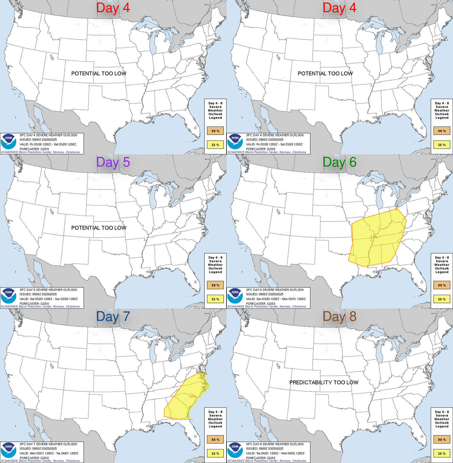
Day 4-8 Convective Outlook
NWS Storm Prediction Center Norman OK
0400 AM CST Sun Dec 08 2024

Valid 111200Z - 161200Z

...DISCUSSION...
Medium-range guidance is in good agreement that a deep upper trough
will be over much of the central and eastern CONUS early
D4/Wednesday morning. At the same time, a surface low is forecast to
be over eastern PA, with an attendant cold front extending
southwestward from this low across the central Carolinas,
southeastern GA, and northern FL.

A shortwave trough is forecast to move within the larger upper
troughing, moving from the TN Valley/Southeast through the
Mid-Atlantic on D4/Wednesday. This evolution will help induce a more
negative tilt to the parent troughing while encouraging an eastward
shift and deamplification as well. The cold front will also quickly
shift eastward off the East Coast. A fairly narrow warm sector may
precede this front, but poor lapse rates will limit instability.
This low buoyancy will counter the strong shear expected, resulting
in mostly weak updrafts and tempering any severe potential.

Stable conditions are expected across the CONUS on D5/Thursday as
high pressure shifts from the northern Plains into the OH Valley.
Some modest moisture return may potentially begin across TX on
D6/Friday ahead of a low-amplitude, southern-stream shortwave trough
expected to move across the southern Plains late D6/Friday and early
D7/Saturday. Guidance varies on the strength and speed of this wave,
limiting predictability, but some thunderstorms are possible across
central/east TX and LA late D6/Friday and early D7/Saturday as this
wave interacts with the return moisture.
https://www.spc.noaa.gov/products/exper/day4-8/
date: 2024-12-08, from: NOAA Weather Forecasts

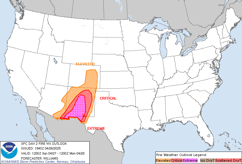
Day 2 Fire Weather Outlook
NWS Storm Prediction Center Norman OK
0144 AM CST Sun Dec 08 2024

Valid 091200Z - 101200Z

...Synopsis...
...Southern California Coast...
Fire weather concerns will likely emerge along the southern CA coast
by late Monday amid strengthening offshore pressure gradient winds.
A gradual amplification of the upper trough currently over the
Pacific Northwest is anticipated over the next 48 hours as it shifts
east/southeast. In its wake, an unseasonably strong 1035-1040 mb
surface high (around the 90th percentile for early December) is
expected to settle into the northern Great Basin through late Monday
into early Tuesday. This will promote a strengthening offshore
pressure gradient along the southern CA coast with the DAG-LAX
gradient approaching elevated thresholds by Monday afternoon and
critical thresholds (-9 to -11 mb) by 12 UTC Tuesday. As such,
northeasterly winds are expected to increase through the afternoon
and into the overnight hours with gusts upwards of 40-60 mph
possible within the terrain. 07 UTC surface observations show dry
conditions (10-20% RH) already in place within the coastal
mountains, which should see limited RH recovery prior to the onset
of stronger winds. As such, elevated fire weather conditions are
expected by Monday afternoon with critical conditions becoming
increasingly likely/widespread during the 06-12 UTC period Monday
night/Tuesday morning.

...Southeast New Mexico into southwestern Texas...
West/northwesterly gradient winds are forecast to increase through
the day across southeast NM into southwestern TX ahead of a
southward-pushing cold front. Latest ensemble guidance suggests
sustained winds between 15-20 mph are likely with RH reductions into
the teens and low 20s probable. While elevated fire weather
conditions will likely emerge, latest ERC analyses continue to
suggest that fuels are not supportive of a robust fire threat at
this time.

..Moore.. 12/08/2024

...Please see www.spc.noaa.gov/fire for graphic product...
https://www.spc.noaa.gov/products/fire_wx/fwdy2.html
date: 2024-12-05, from: NOAA tornado/severe thunderstorm watches, mesoscale discussions, convective outlooks, fire weather outlooks

Mesoscale Discussion 2250
NWS Storm Prediction Center Norman OK
0850 AM CST Thu Dec 05 2024

Areas affected...parts of the Northeast

Concerning...Snow Squall

Valid 051450Z - 051715Z

SUMMARY...Multiple clusters and loosely banded snow squalls may
persist east into early afternoon, mainly across the southern half
of New York into northern parts of Pennsylvania and New Jersey.

DISCUSSION...Near a low-level cyclone centered just north of the
Binghamton area, scattered bursts of heavy snow are ongoing across
parts of southern NY into northeast PA, where surface temperatures
have fallen below freezing along the leading edge of stronger
westerly winds. Upstream, a lake-induced hybrid squall is ongoing
across western NY into northwest PA where more widespread
quarter-mile visibilities have been observed. Per 12Z CAM guidance,
both areas should move east into midday. The western area will be
replaced by a lake-effect snow band this afternoon, connected from
the southern portion of Lake Huron to the eastern part of Lake Erie
within a west-northwesterly flow regime. Surface temperatures will
remain marginal for snow-squall conditions along the
southern/eastern portion of the region (near the I-95 corridor).

..Grams.. 12/05/2024

...Please see www.spc.noaa.gov for graphic product...

ATTN...WFO...OKX...ALY...PHI...BGM...BUF...CTP...

LAT...LON   42997377 41897358 41397393 41027426 40917449 40917488
            41487585 41557761 41527865 41957923 42677830 43047747
            43267624 43277469 42997377
https://www.spc.noaa.gov/products/md/md2250.html
date: 2024-12-02, from: NOAA tornado/severe thunderstorm watches, mesoscale discussions, convective outlooks, fire weather outlooks

Day 1 Convective Outlook
NWS Storm Prediction Center Norman OK
0145 PM CST Mon Dec 02 2024

Valid 022000Z - 031200Z

...NO SEVERE THUNDERSTORM AREAS FORECAST...

...SUMMARY...
Severe thunderstorms are not expected through tonight.

...20z Update...
No changes are needed to the current D1 Convective Outlook. See
previous discussion below for more information.

..Thornton.. 12/02/2024

.PREV DISCUSSION... /ISSUED 1020 AM CST Mon Dec 02 2024/

...Synopsis and Discussion...
A large-scale upper trough will persist over the eastern states
today, while developing slowly eastward towards the western Atlantic
through tonight. Rather cold mid-level temperatures will be present
across the Great Lakes, which may support sporadic lightning flashes
with ongoing lake effect snow bands. The best chance for isolated
lightning appears to be with the band over Lake Huron.

Across deep south TX, the potential for thunderstorms over land
appears lower than earlier, as a stout cap noted on the observed 12Z
BRO sounding will likely inhibit deep convection. While there may
still be some chance for thunderstorms along/near a coastal surface
front, the better lightning potential should tend to remain offshore
through the end of the period.
https://www.spc.noaa.gov/products/outlook/day1otlk_2000.html
date: 2024-12-02, from: NOAA tornado/severe thunderstorm watches, mesoscale discussions, convective outlooks, fire weather outlooks

Day 3 Convective Outlook
NWS Storm Prediction Center Norman OK
0125 PM CST Mon Dec 02 2024

Valid 041200Z - 051200Z

...NO SEVERE THUNDERSTORM AREAS FORECAST...

...SUMMARY...
A few thunderstorms are possible from East Texas into the ArkLaMiss
on Wednesday. No severe thunderstorms are expected.

...Synopsis and Discussion...
A strong shortwave trough and accompanying intense jet streak are
forecast to progress quickly southeastward from the Canadian
Prairies/northern Plains through the Upper Midwest, Upper Great
Lakes, and Ohio Valley on Wednesday. By early Thursday morning, the
mid-latitude cyclone associated with this shortwave is forecast to
be over the Lower Great Lakes, with the strong jet streak (i.e. over
120 kt at 500 mb) stretching through its base from IN through the
Mid-Atlantic. Strong height falls and cold mid-level temperatures
will spread eastward with this system, but the cold, dry, and stable
airmass in place across the region will preclude thunderstorm
development.

Some moderate low-level moisture advection is anticipated from the
TX Coast into the Lower MS Valley, with mid 60s dewpoints likely
extending from the Middle TX Coastal Plain into far southwest LA by
late Wednesday afternoon. Enhanced low/mid-level flow will persist
throughout the day across this region, contributing to a large area
of precipitation from the Middle TX Coast through east and much of
LA and southern AR. A few deeper updrafts are possible embedded
within this larger area of precipitation, with occasional lightning
flashes possible throughout the afternoon and overnight.

..Mosier.. 12/02/2024
https://www.spc.noaa.gov/products/outlook/day3otlk_1930.html
date: 2024-12-02, from: Graphical Tropical Weather Outlooks
The Central North Pacific hurricane season runs from June 1st through November 30th.
https://www.nhc.noaa.gov/gtwo.php?basin=cpac
date: 2024-12-02, from: Central Pacific Basin Tropical Cyclones
The Central North Pacific hurricane season runs from June 1st through November 30th.
date: 2024-12-02, from: NOAA tornado/severe thunderstorm watches, mesoscale discussions, convective outlooks, fire weather outlooks

Day 2 Convective Outlook
NWS Storm Prediction Center Norman OK
1115 AM CST Mon Dec 02 2024

Valid 031200Z - 041200Z

...NO SEVERE THUNDERSTORM AREAS FORECAST...

...SUMMARY...
Isolated thunderstorms are possible along the Texas Coast. No severe
thunderstorms are expected.

...Synopsis and Discussion...
Upper troughing extending from the northern Mid-Atlantic states into
the north-central Gulf of Mexico early Tuesday is forecast to
progress eastward off the East Coast throughout the day. In its
wake, a strong shortwave trough is expected to drop through the
Canadian Prairies into the northern Plains/Upper Midwest late
Tuesday/early Wednesday.

Strong surface ridging associated with a continental polar airmass
ushered in by lead troughing is also forecast to shift eastward from
the Mid-South into central Appalachians throughout the day. A
reinforcing surge of cold air associated with the Canadian Prairies
shortwave trough will move into the northern/central Plains and
Upper Midwest late Tuesday night through early Wednesday morning.

This overall pattern will maintain largely stable conditions across
the central and eastern CONUS while also supporting easterly flow
across the Gulf of Mexico, which will result in some modest
low-level moisture advection into TX Gulf Coast. Additionally, low
to mid-level flow will increase across this region late
Tuesday/early Wednesday in response to a deepening surface low and
large-scale mass response. The resulting warm-air advection could
result in a few isolated thunderstorms along the TX Coast, beginning
across south TX early Tuesday before gradually shifting northward
throughout the period.

..Mosier.. 12/02/2024
https://www.spc.noaa.gov/products/outlook/day2otlk_1730.html
date: 2024-12-02, from: Graphical Tropical Weather Outlooks
The Eastern North Pacific hurricane season runs from May 15th through November 30th.
https://www.nhc.noaa.gov/gtwo.php?basin=epac
date: 2024-12-02, from: Eastern Pacific Basin GIS Data
The Eastern North Pacific hurricane season runs from May 15th through November 30th.
date: 2024-12-02, from: NOAA tornado/severe thunderstorm watches, mesoscale discussions, convective outlooks, fire weather outlooks

Day 1 Fire Weather Outlook
NWS Storm Prediction Center Norman OK
1052 AM CST Mon Dec 02 2024

Valid 021700Z - 031200Z

...NO CRITICAL AREAS...

The previous forecast (see below) remains on track, and no changes
were needed with this update.

..Weinman.. 12/02/2024

.PREV DISCUSSION... /ISSUED 0231 AM CST Mon Dec 02 2024/

...Synopsis...
Broad mid-level troughing will prevail across the eastern U.S.,
resulting in surface high pressure and associated cool conditions
overspreading much of the CONUS. As such, quiescent fire weather
conditions may be expected over most locales. One exception may be
the southern Florida Peninsula, where dry northwesterly surface flow
(i.e. 5-10 mph winds amid 25-35 percent RH) will be in place for at
least a few hours around afternoon peak heating. However, relatively
weaker surface winds, along with the marginal receptiveness of
fuels, suggest that wildfire spread potential should remain
localized.

...Please see www.spc.noaa.gov/fire for graphic product...
https://www.spc.noaa.gov/products/fire_wx/fwdy1.html
date: 2024-12-02, from: NOAA tornado/severe thunderstorm watches, mesoscale discussions, convective outlooks, fire weather outlooks

Day 1 Convective Outlook
NWS Storm Prediction Center Norman OK
1020 AM CST Mon Dec 02 2024

Valid 021630Z - 031200Z

...NO SEVERE THUNDERSTORM AREAS FORECAST...

...SUMMARY...
Severe thunderstorms are not expected through tonight.

...Synopsis and Discussion...
A large-scale upper trough will persist over the eastern states
today, while developing slowly eastward towards the western Atlantic
through tonight. Rather cold mid-level temperatures will be present
across the Great Lakes, which may support sporadic lightning flashes
with ongoing lake effect snow bands. The best chance for isolated
lightning appears to be with the band over Lake Huron.

Across deep south TX, the potential for thunderstorms over land
appears lower than earlier, as a stout cap noted on the observed 12Z
BRO sounding will likely inhibit deep convection. While there may
still be some chance for thunderstorms along/near a coastal surface
front, the better lightning potential should tend to remain offshore
through the end of the period.

..Gleason/Wendt.. 12/02/2024
https://www.spc.noaa.gov/products/outlook/day1otlk_1630.html
date: 2024-12-02, from: Graphical Tropical Weather Outlooks
The Atlantic hurricane season runs from June 1st through November 30th.
https://www.nhc.noaa.gov/gtwo.php?basin=atlc
date: 2024-12-01, from: NOAA tornado/severe thunderstorm watches, mesoscale discussions, convective outlooks, fire weather outlooks

Day 3-8 Fire Weather Outlook
NWS Storm Prediction Center Norman OK
0321 PM CST Sun Dec 01 2024

Valid 031200Z - 091200Z

On Day 3/Tuesday, an expansive surface high will shift southeastward
from the Middle MS Valley into the Southeast. On the southeastern
periphery of this feature, a modest pressure gradient will promote
locally breezy northerly surface winds amid a dry antecedent air
mass across portions of southern FL. While locally elevated
fire-weather conditions are possible (given modestly receptive
fuels), the potential for critical conditions appears low.

Thereafter, fire-weather concerns should be minimal across the CONUS
through the extended forecast period, as northwesterly flow aloft
persists from the northern Rockies into the Southeast -- limiting
the overlap of warm/dry/breezy conditions.

..Weinman.. 12/01/2024

...Please see www.spc.noaa.gov/fire for graphic product...