(date: 2024-12-15 07:05:11)
date: 2024-12-15, from: NOAA tornado/severe thunderstorm watches, mesoscale discussions, convective outlooks, fire weather outlooks
No watches are valid as of Sun Dec 15 14:15:02 UTC 2024.
https://www.spc.noaa.gov/products/watch/
date: 2024-12-15, from: NOAA tornado/severe thunderstorm watches, mesoscale discussions, convective outlooks, fire weather outlooks
No Mesoscale Discussions are in effect as of Sun Dec 15 14:15:02 UTC 2024.
https://www.spc.noaa.gov/products/md/
date: 2024-12-15, from: NOAA tornado/severe thunderstorm watches, mesoscale discussions, convective outlooks, fire weather outlooks

Day 1 Convective Outlook
NWS Storm Prediction Center Norman OK
0624 AM CST Sun Dec 15 2024

Valid 151300Z - 161200Z

...THERE IS A MARGINAL RISK OF SEVERE THUNDERSTORMS FROM PORTIONS OF
NORTH TEXAS TO THE OZARKS...

...SUMMARY...
Isolated hail near severe limits is possible tonight from portions
of north Texas to the Ozarks.

...Synopsis...
In mid/upper levels, a low-amplitude longwave pattern will remain in
place over the CONUS, with progressive shortwave to synoptic troughs
traversing the prevailing westerlies.  The leading trough --
currently anchored by a closed low near the northern IL/IN border --
should devolve to an open wave and move to the northern Mid-Atlantic
region by 12Z tomorrow.  Meanwhile, a series of shortwaves and
vorticity lobes -- occupying broadly cyclonic flow over much of the
western CONUS -- will consolidate/phase somewhat through the period
while shifting eastward.  By 00Z, a loosely organized synoptic
trough will extend from the Dakotas across the central High Plains
to AZ.  Overnight, a closed 500-mb low should develop over southern
MB, with the trough extending across central NE/KS to southern NM
and northwestern MX by 12Z.

At the surface, 11Z analysis showed a decaying cold to stationary
front from eastern IL across southern AR, north-central and west-
central TX.  This boundary will move slowly northward through the
day and continue to weaken.  Meanwhile, cold frontogenesis is
forecast today ahead of the mid/upper trough, and over parts of the
central/northern Plains.  This Plains front should reach western
parts of MN/IA, northeastern to south-central KS, and the TX
Panhandle by 00Z.  By 12Z, the cold front should reach central/
southern IL, the Ozarks, eastern/southern OK, and the TX South
Plains region.

...North TX to the Lower OH Valley...
Episodic, isolated to scattered thunderstorms are expected
throughout the period, embedded in a plume of low-level warm/moist
advection and moisture transport extending from central/east TX to
the lower Ohio Valley.  Through the day, this activity will occur in
weak midlevel lapse rates and modest deep shear, with most or all of
it elevated over a relatively stable, near-surface layer, and
accordingly minimal severe potential.  Meanwhile, surface dewpoints
in the 60s F will spread northward into and across much of the
outlook area, as the older boundary becomes diffuse ahead of the
Plains cold front.

Concurrent with height falls aloft and increasing deep shear, the
warm conveyor and accompanying isentropic ascent to LFC should
intensify this evening amid mass response to the consolidation/
approach of the mid/upper trough, and related 45-55-kt LLJ.
Greatest thunderstorm coverage in the plume is expected after about
03Z from near the Red River Valley to the Ozarks, spreading into the
lower Ohio Valley from around 09Z onward.  During phases when
convection is still relatively discrete, and around the southern
part of denser/later convective coverage, the most vigorous cells
may produce severe hail.  Forecast soundings show a nearly
saturated, near-neutral stability profile in the boundary layer over
north TX to eastern OK, and perhaps into some of northwestern AR,
depending on outflow timing/intensity.  This renders profiles that
may be effectively surface-based, with MLCAPE in the 1000-1500 J/kg
rage and slightly greater MUCAPE, but still often containing weak,
near-surface static stability.  At this time, severe-gust/tornado
potential appears too conditional and low to draw even marginal
categorical probabilities for those hazards, and the previous
outlook area still appears to capture the consensus of most
probable, favorably positioned convection in the plume as well.

..Edwards/Goss.. 12/15/2024
https://www.spc.noaa.gov/products/outlook/day1otlk_1300.html
date: 2024-12-14, from: NOAA tornado/severe thunderstorm watches, mesoscale discussions, convective outlooks, fire weather outlooks

Mesoscale Discussion 2267
NWS Storm Prediction Center Norman OK
0458 AM CST Sat Dec 14 2024

Areas affected...eastern Iowa...northwestern Illinois...and vicinity

Concerning...Freezing rain

Valid 141058Z - 141700Z

SUMMARY...Freezing rain -- at rates locally in excess of 0.10"/hour
-- will continue spreading north-northeastward across eastern Iowa
and into northwestern Illinois through midday.

DISCUSSION...Latest radar loop shows an expansive area of
precipitation ongoing from the Arklatex region northward across the
Lower Missouri and Mid Mississippi Valleys this morning.  The
precipitation is occurring in an area of warm
advection/quasigeostropic ascent, east of a 1013 mb surface low over
central Kansas, and associated upper low moving eastward across
Nebraska and Kansas this morning.

A cold boundary layer remains in place across this region, on the
western fringe of a 1048 mb high centered in the vicinity of the
Pennsylvania/New York border area.  As low-level theta-e advection
continues ascending atop the cold low-level airmass, resulting
ascent will continue to support the broad/ongoing area of
precipitation over the next several hours.

Currently, the surface freezing line extends from the Omaha area
east-southeastward into southern Illinois north of the St. Louis
area.  North of this line, mixed/wintry precipitation is observed,
mainly in the form of freezing rain.  The most substantial freezing
rain has occurred over southeastern Iowa recently, with KOTM
(Ottumwa) reporting 0.13" in the past hour.  This area of moderate
precipitation will continue spreading north-northeastward with time,
across eastern Iowa and northwestern Illinois, with ice
accumulations likely.

..Goss.. 12/14/2024

...Please see www.spc.noaa.gov for graphic product...

ATTN...WFO...LOT...ILX...MKX...LSX...DVN...ARX...DMX...EAX...

LAT...LON   40859281 42109289 43389206 43369069 42498949 41588893
            40229008 40169187 40859281
https://www.spc.noaa.gov/products/md/md2267.html
date: 2024-12-12, from: NOAA Weather Forecasts

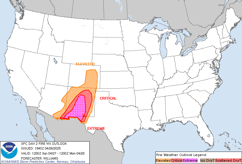
Day 2 Fire Weather Outlook
NWS Storm Prediction Center Norman OK
0108 AM CST Thu Dec 12 2024

Valid 131200Z - 141200Z

...Synopsis...
Fire weather concerns are expected to emerge across the southern
High Plains on Friday afternoon as a progressive upper wave
traverses the southern Rockies. Recent water-vapor imagery depicts
an upper wave off the coast of the Pacific Northwest. This feature
is expected to reach central NM by around peak heating on Friday. In
response to the arrival of the wave, an antecedent lee cyclone
across east/southeast CO will intensify with an attendant low-level
wind response. Recent ensemble guidance shows a strong signal for
sustained 20 mph winds across eastern NM into parts of the
northwestern TX Panhandle. The typically drier/windier deterministic
solutions hint that sustained winds up to 25 mph (gusting to 35-40
mph) are possible, and this appears reasonable given the favorable
timing of peak heating with the passage of a 40-50 knot 700 mb jet.
The downslope flow regime should promote RH reductions well into the
low teens, and possible into the single digits for some locations.
As such, widespread elevated to critical fire weather conditions
appear likely. The primary modulating factor is fuel status, which
appears unfavorable for fire spread based on recent ERC/fuel
guidance. However, finer 1-hour grasses may see sufficient drying to
support a fire concern for some areas.

..Moore.. 12/12/2024

...Please see www.spc.noaa.gov/fire for graphic product...
https://www.spc.noaa.gov/products/fire_wx/fwdy2.html
date: 2024-12-08, from: NOAA tornado/severe thunderstorm watches, mesoscale discussions, convective outlooks, fire weather outlooks

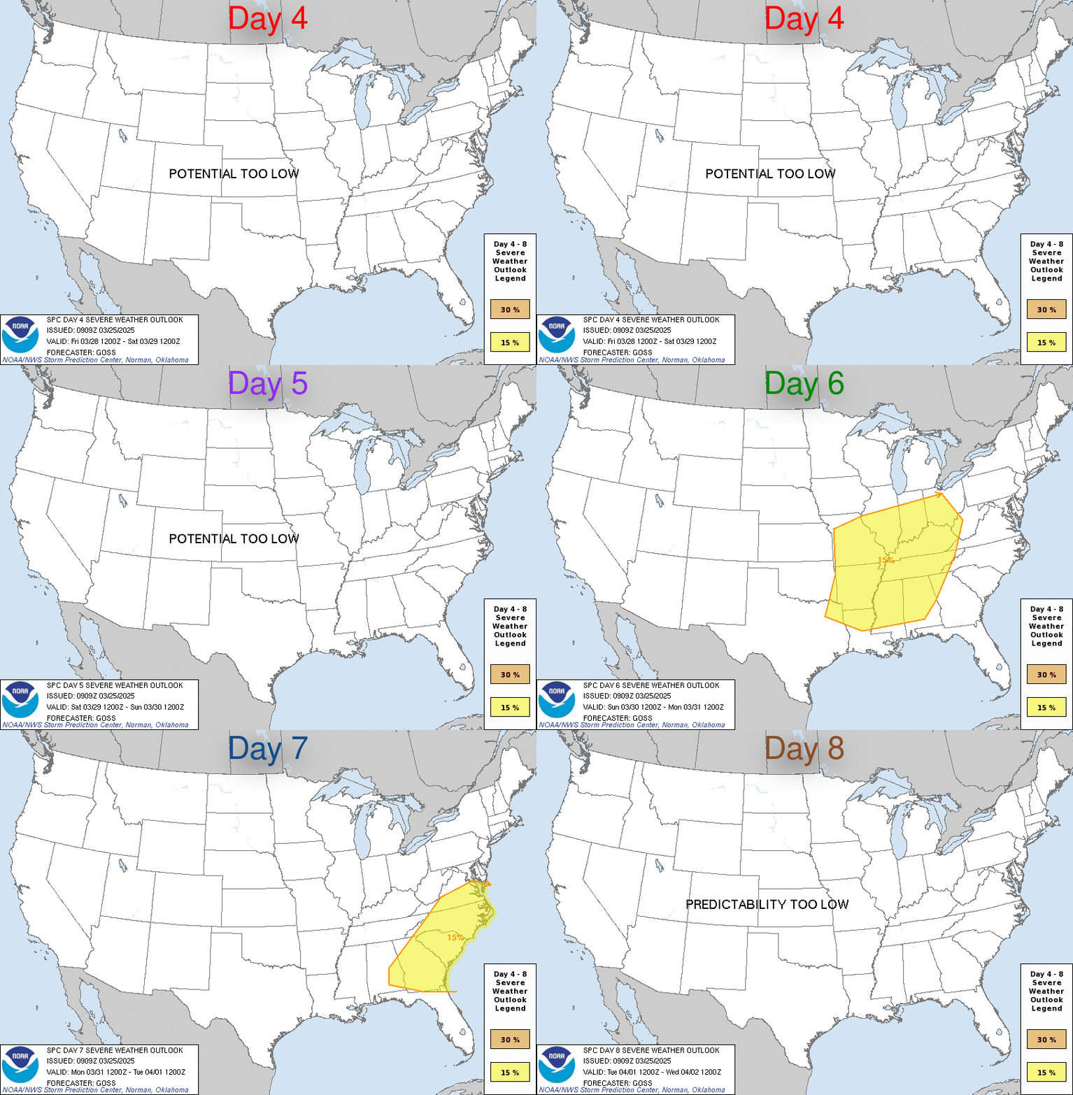
Day 4-8 Convective Outlook
NWS Storm Prediction Center Norman OK
0400 AM CST Sun Dec 08 2024

Valid 111200Z - 161200Z

...DISCUSSION...
Medium-range guidance is in good agreement that a deep upper trough
will be over much of the central and eastern CONUS early
D4/Wednesday morning. At the same time, a surface low is forecast to
be over eastern PA, with an attendant cold front extending
southwestward from this low across the central Carolinas,
southeastern GA, and northern FL.

A shortwave trough is forecast to move within the larger upper
troughing, moving from the TN Valley/Southeast through the
Mid-Atlantic on D4/Wednesday. This evolution will help induce a more
negative tilt to the parent troughing while encouraging an eastward
shift and deamplification as well. The cold front will also quickly
shift eastward off the East Coast. A fairly narrow warm sector may
precede this front, but poor lapse rates will limit instability.
This low buoyancy will counter the strong shear expected, resulting
in mostly weak updrafts and tempering any severe potential.

Stable conditions are expected across the CONUS on D5/Thursday as
high pressure shifts from the northern Plains into the OH Valley.
Some modest moisture return may potentially begin across TX on
D6/Friday ahead of a low-amplitude, southern-stream shortwave trough
expected to move across the southern Plains late D6/Friday and early
D7/Saturday. Guidance varies on the strength and speed of this wave,
limiting predictability, but some thunderstorms are possible across
central/east TX and LA late D6/Friday and early D7/Saturday as this
wave interacts with the return moisture.