(date: 2023-11-17 17:10:36)
date: 2023-11-17, from: Eastern Pacific Basin GIS Data
No tropical cyclones as of Fri, 17 Nov 2023 23:57:08 GMT
date: 2023-11-17, from: Graphical Tropical Weather Outlooks


ZCZC MIATWOAT ALL
TTAA00 KNHC DDHHMM
Tropical Weather Outlook
NWS National Hurricane Center Miami
FL
700 PM EST Fri Nov 17 2023
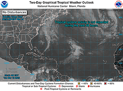
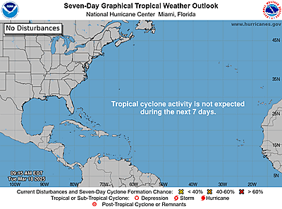
For the North
Atlantic…Caribbean Sea and the Gulf of Mexico:
Active
Systems:
The National Hurricane Center is issuing advisories on
Potential
Tropical Cyclone Twenty-Two, located over the
north-central
Caribbean Sea.
* Formation chance through 48
hours…low…20 percent.
* Formation chance through 7 days…low…20
percent.
$$
Forecaster Cangialosi
NNNN
https://www.nhc.noaa.gov/gtwo.php?basin=atlc
date: 2023-11-17, from: Central Pacific Tropical Weather Outlook
000
ACPN50 PHFO 172332
TWOCP
Tropical Weather Outlook
NWS Central Pacific Hurricane Center
Honolulu HI
200 PM HST Fri Nov 17 2023
For the
central North Pacific…between 140W and 180W:
No tropical
cyclones are expected during the next 7 days.
$$
Forecaster Kodama
https://www.nhc.noaa.gov/gtwo.php?basin=cpac
date: 2023-11-17, from: Eastern Pacific Basin Tropical Cyclones
000
ABPZ20 KNHC 172330
TWOEP
Tropical
Weather Outlook
NWS National Hurricane Center Miami FL
400 PM
PST Fri Nov 17 2023
For the eastern North Pacific…east of 140
degrees west longitude:
Central East Pacific:
An area of
low pressure located about 850 miles south-southwest of
the
southern tip of the Baja California Peninsula is producing
disorganized showers and thunderstorms. Development, if any, of
this system is expected to be slow to occur over the next day or two
while the disturbance moves slowly westward. By early next week,
environmental conditions are forecast to become less conducive for
further development.
* Formation chance through 48
hours…low…10 percent.
* Formation chance through 7 days…low…10
percent.
$$
Forecaster Cangialosi
https://www.nhc.noaa.gov/gtwo.php?basin=epac
date: 2023-11-17, from: NOAA tornado/severe thunderstorm watches, mesoscale discussions, convective outlooks, fire weather outlooks

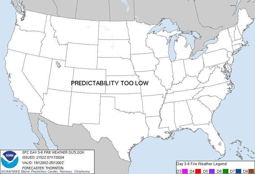
Day 3-8 Fire Weather Outlook
NWS Storm Prediction Center Norman OK
0335 PM CST Fri Nov 17 2023

Valid 191200Z - 251200Z

A strong upper-level trough will dig into the Southwest late this
weekend and continue eastward through the Southeast. While ridging
aloft will quickly build in the West behind this features, another
trough is forecast to take a similar path mid/late next week. At the
surface, a cold front will move through the southern Plains early
next week with another expected as the second trough moves eastward
late next week into the weekend.

...Southern High Plains...
With the approach of the trough this weekend, areas of dry and
breezy conditions will be possible. Precipitation associated with
the trough will occur within parts of the region, but some areas may
not receive much rainfall. At present, the driest conditions appear
most likely from the Trans-Pecos into the South Plains. Additional
dry and windy conditions are possible toward the end of next week
with the next trough forecast to move into the region. Given the
potential for precipitation and the cooler temperatures behind the
initial cold front, the threat of critical fire weather remains low
at this time.

...Southern California...
Model guidance continues to suggest potential for strong
northerly/northeasterly wind even late Sunday into Monday afternoon.
Given the upper-level wind support along the western flank of the
trough, strong wind gusts will be likely, particularly within the
terrain. Even with dry and windy conditions, current fuel
information, in addition to the rain expected to occur into this
Saturday, suggests fire weather risk with this event does not appear
to be high.

..Wendt.. 11/17/2023

...Please see www.spc.noaa.gov/fire for graphic product...
https://www.spc.noaa.gov/products/exper/fire_wx/
date: 2023-11-17, from: NOAA tornado/severe thunderstorm watches, mesoscale discussions, convective outlooks, fire weather outlooks

Day 1 Convective Outlook
NWS Storm Prediction Center Norman OK
0200 PM CST Fri Nov 17 2023

Valid 172000Z - 181200Z

...NO SEVERE THUNDERSTORM AREAS FORECAST...

...SUMMARY...
Severe thunderstorms are not forecast across the contiguous United
States through tonight.

...Discussion...
No appreciable change was made to the previous convective outlook.

..Smith.. 11/17/2023

.PREV DISCUSSION... /ISSUED 1031 AM CST Fri Nov 17 2023/

...Discussion...
A long-wave trough will continue advancing eastward across eastern
North America today, accompanied by a southeastward surface
cold-frontal advance across the eastern half of the country.  By
late in the period, this front will have cleared most of the
southern and eastern U.S., with northerly low-level flow prevailing.

Farther west, an upper low off the California coast is forecast to
weaken, moving inland as an open wave through the period.

Showers will continue over eastern Florida this afternoon near a
weak offshore surface low, though most lightning should remain
confined to the immediate coastal areas, and offshore.

Meanwhile, as the aforementioned cold front advances, showers and
possibly a thunderstorm or two will affect portions of the Ohio
Valley and central Appalachians today.  Overnight, as the front
crosses the East Coast states, a few lightning flashes may occur
near the North Carolina Outer Banks.

Finally, thunder may occur across portions of California and
Arizona, ahead of the advancing upper system.  In all of these
areas, severe weather is not expected.
https://www.spc.noaa.gov/products/outlook/day1otlk_2000.html
date: 2023-11-17, from: NOAA tornado/severe thunderstorm watches, mesoscale discussions, convective outlooks, fire weather outlooks

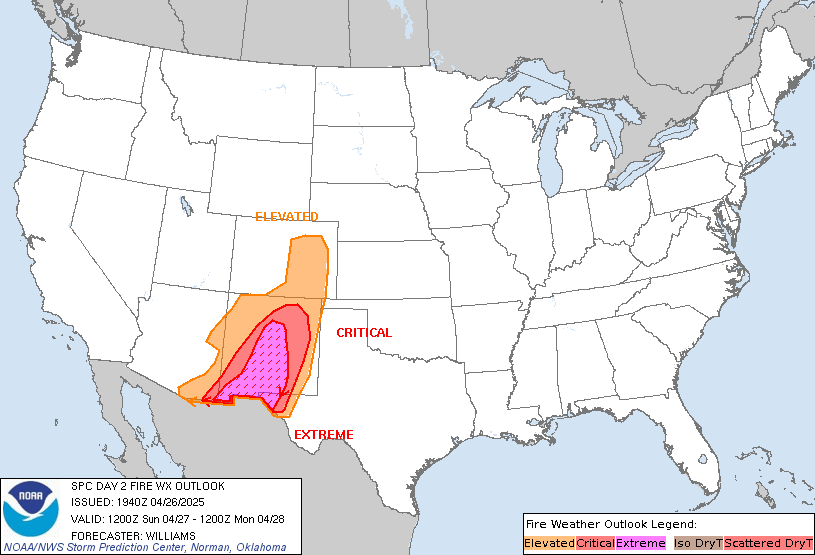
Day 2 Fire Weather Outlook
NWS Storm Prediction Center Norman OK
0108 PM CST Fri Nov 17 2023

Valid 181200Z - 191200Z

A few hours of marginally elevated fire weather conditions appear
more likely within parts of the Piedmont. RH at or below 30% is
still expected. The strongest pressure gradient may occur prior to
the warmest temperatures during the afternoon. Winds of 10-15 mph
(locally higher) will be possible. A few higher gusts could also
occur, though vertical mixing will not likely be overly robust.
Given the state of fuels and recent fire activity, some potential
for large fires, or at least exacerbation of current fires, will
exist.

..Wendt.. 11/17/2023

.PREV DISCUSSION... /ISSUED 0147 AM CST Fri Nov 17 2023/

...Synopsis...
The broad upper trough over the eastern US is forecast to move
offshore as moderate to strong cyclonic flow aloft overspreads the
northeastern US. At the same time, broad toughing to the west will
shift eastward into the Four Corners and southern Plains deepening a
lee low east of the Rockies. To the east, high pressure over the MS
and OH Valleys will force gusty northerly winds over parts of the
Appalachians as a cold front moves into the Southeast. Localized dry
and breezy conditions are possible over parts of VA and NC Saturday,
but broader fire-weather concerns should remain limited.

...Central Appalachians...
In the wake of the cold front, surface high pressure is forecast to
develop over the lower OH Valley. The increase in the surface
pressure gradient will help bolster northwesterly surface winds
across parts of western VA and NC Saturday afternoon. While slightly
cooler given the post-frontal air mass, downslope drying with RH
values below 30% and occasional gusts to 15 mph may support a few
hours of locally elevated fire-weather conditions given,
unseasonably dry fuels and recent fire activity.

...Please see www.spc.noaa.gov/fire for graphic product...
https://www.spc.noaa.gov/products/fire_wx/fwdy2.html
date: 2023-11-17, from: NOAA tornado/severe thunderstorm watches, mesoscale discussions, convective outlooks, fire weather outlooks

Day 2 Convective Outlook
NWS Storm Prediction Center Norman OK
1053 AM CST Fri Nov 17 2023

Valid 181200Z - 191200Z

...NO SEVERE THUNDERSTORM AREAS FORECAST...

...SUMMARY...
Severe thunderstorms are not expected on Saturday.

...Synopsis...
A mid-level trough near the CA coast early Saturday morning will
feature a disturbance moving through its base and reaching the
central High Plains by mid evening.  An upstream disturbance will
dig southeast from the eastern Pacific into the Great Basin during
the period, thereby reinforcing the larger-scale trough over the
West.  Surface high pressure will be centered over the MS Valley and
lee troughing/cyclogenesis will occur over the central/southern High
Plains.  The initial stage of poleward transport of low-level
moisture will occur across the southern High Plains into western KS
as a LLJ intensifies Saturday night.  Showers and isolated
thunderstorms are possible over a large portion of the Four Corners
states during the day/evening before isolated showers/thunderstorm
chances develop overnight across parts of the Great Plains.  Farther
west, showers and isolated thunderstorms will be possible across
parts of CA into NV where pockets of weak instability develops.

..Smith.. 11/17/2023
https://www.spc.noaa.gov/products/outlook/day2otlk_1730.html
date: 2023-11-17, from: NOAA tornado/severe thunderstorm watches, mesoscale discussions, convective outlooks, fire weather outlooks

Day 1 Convective Outlook
NWS Storm Prediction Center Norman OK
1031 AM CST Fri Nov 17 2023

Valid 171630Z - 181200Z

...NO SEVERE THUNDERSTORM AREAS FORECAST...

...SUMMARY...
Severe thunderstorms are not forecast across the contiguous United
States through tonight.

...Discussion...
A long-wave trough will continue advancing eastward across eastern
North America today, accompanied by a southeastward surface
cold-frontal advance across the eastern half of the country.  By
late in the period, this front will have cleared most of the
southern and eastern U.S., with northerly low-level flow prevailing.

Farther west, an upper low off the California coast is forecast to
weaken, moving inland as an open wave through the period.

Showers will continue over eastern Florida this afternoon near a
weak offshore surface low, though most lightning should remain
confined to the immediate coastal areas, and offshore.

Meanwhile, as the aforementioned cold front advances, showers and
possibly a thunderstorm or two will affect portions of the Ohio
Valley and central Appalachians today.  Overnight, as the front
crosses the East Coast states, a few lightning flashes may occur
near the North Carolina Outer Banks.

Finally, thunder may occur across portions of California and
Arizona, ahead of the advancing upper system.  In all of these
areas, severe weather is not expected.

..Goss/Bentley.. 11/17/2023
https://www.spc.noaa.gov/products/outlook/day1otlk_1630.html
date: 2023-11-16, from: NOAA tornado/severe thunderstorm watches, mesoscale discussions, convective outlooks, fire weather outlooks

Day 1 Fire Weather Outlook
NWS Storm Prediction Center Norman OK
1034 AM CST Thu Nov 16 2023

Valid 161700Z - 171200Z

...NO CRITICAL AREAS...

The current D1 Fire Weather Outlook is on track with no updates
needed. See previous discussion below.

..Thornton.. 11/16/2023

.PREV DISCUSSION... /ISSUED 1239 AM CST Thu Nov 16 2023/

...Synopsis...
Fire weather potential will be limited today across the country.
Early-morning water-vapor imagery depicts an upper shortwave trough
traversing the U.S./Canadian border. Ahead of this feature, steady
surface pressure falls have been observed over the past 12 hours
across eastern MT and the Dakotas with a surface low beginning to
organize over the region. This low will continue to deepen and drift
east through the day as an attendant cold front (already noted over
northeast MT/northwest ND) sweeps to the south/southeast. Breezy
conditions are expected ahead of and behind the front with winds
gusting as high as 25-35 mph. However, the combination of moisture
advection ahead of the front and an influx of cooler temperatures
behind the front should modulate afternoon RH reductions. Localized
elevated conditions are possible in the immediate lee of the central
to southern Rockies (mainly from southeast CO to northeast NM),
where pre-frontal westerly downslope flow may support areas of 15-20
mph winds and RH values in the 20-30% range. Such conditions are
expected to be too transient and localized to warrant highlights.

...Please see www.spc.noaa.gov/fire for graphic product...
https://www.spc.noaa.gov/products/fire_wx/fwdy1.html
date: 2023-11-16, from: NOAA tornado/severe thunderstorm watches, mesoscale discussions, convective outlooks, fire weather outlooks

Day 1 Convective Outlook
NWS Storm Prediction Center Norman OK
0628 AM CST Thu Nov 16 2023

Valid 161300Z - 171200Z

...NO SEVERE THUNDERSTORM AREAS FORECAST...

...SUMMARY...
A few strong storms may threaten the southern and eastern Florida
Peninsula, but the bulk of the activity is expected to remain
offshore.

...Synopsis...
The mid/upper-level pattern over the western CONUS will continue to
be characterized by converging split flow in the Rockies region --
downstream from a cut-off synoptic cyclone over the Pacific.  That
cyclone will begin to move slowly eastward through the period, but
will remain well offshore until day 2.  An ejecting, deamplifying,
basal shortwave trough will cross the central CA coastal areas
around 00Z.  Forecast soundings suggest deep-enough buoyancy for
isolated coastal and inland thunder potential with convection
occupying a related swath of large-scale DCVA/lift and strongly
difluent mid/upper flow.  Isolated elevated thunderstorms also may
develop in a low-level warm/moist-advection swath farther southeast
from the lower Colorado River Valley across parts of AZ, but with
more marginal instability and somewhat weaker lift.

A northern-stream trough initially was located from northwestern
Hudson Bay southwestward over MT.  This feature should amplify and
move eastward to northwestern ON, Lake Superior, the upper
Mississippi Valley, and the lower Missouri Valley by 12Z tomorrow.
Downstream height falls will spread over much of the eastern CONUS.
The southeastern periphery of those height falls will encourage a
continued slow eastward shift of a weaker, southern-stream,
mid/upper-level trough now apparent in moisture-channel imagery over
the eastern Gulf.  That trough should extend from just off the
JAX/DAB area southwestward across the peninsula near FMY by 12Z.  As
that occurs, a low-level cyclone -- its center now apparent in
satellite imagery near 26N89W -- will be left behind to continue
drifting southwestward and weakening gradually.

A quasistationary frontal zone extends from there roughly eastward
across parts of the Keys and Straits to another low -- apparent as
part of a prominent MCV on radar and satellite imagery near Bimini.
Extensive convection has accompanied the eastern circulation --
which may pivot northward near the Gulf Stream today, but remaining
largely offshore.  Behind/southwest of it, several stable layers
aloft -- sampled by 12Z KEY/MFL soundings, should inhibit convective
potential over south FL.  Scattered showers and isolated
thunderstorms may occur in MCV-enhanced/deep low-level easterlies
farther north across central/eastern FL.  Adequate speed shear, but
little directional change in the easterly layer, will render modest,
somewhat hook-shaped low-level hodographs, beneath weak midlevel
southerlies/southwesterlies.  A few cells may exhibit weak rotation
inland, or produce strong gusts with downdrafts superimposed on the
ambient/gradient flow, but the greatest convective coverage and
intensity should be out to sea.

..Edwards/Gleason.. 11/16/2023
https://www.spc.noaa.gov/products/outlook/day1otlk_1300.html