(date: 2023-11-05 13:02:41)
date: 2023-11-05, from: Eastern Pacific Basin GIS Data
Track, Points, and Wind Swath. Shapefile last updated Sun, 05 Nov 2023 20:35:55 GMT
https://www.nhc.noaa.gov/gis/best_track/ep192023_best_track.zip
date: 2023-11-05, from: Eastern Pacific Basin GIS Data
KMZ last updated Sun, 05 Nov 2023 20:35:55 GMT
https://www.nhc.noaa.gov/gis/best_track/ep192023_best_track.kmz
date: 2023-11-05, from: Eastern Pacific Basin GIS Data
Initial and Forecast Surface Winds. Shapefile last updated Sun, 05 Nov 2023 20:35:55 GMT
https://www.nhc.noaa.gov/gis/forecast/archive/ep192023_fcst_033.zip
date: 2023-11-05, from: Eastern Pacific Basin GIS Data
KMZ last updated Sun, 05 Nov 2023 20:34:55 GMT
https://www.nhc.noaa.gov/storm_graphics/api/EP192023_033adv_CONE.kmz
date: 2023-11-05, from: Eastern Pacific Basin GIS Data
Forecast Track, Cone of Uncertainty, Watches/Warnings. Shapefile last updated Sun, 05 Nov 2023 20:34:47 GMT
https://www.nhc.noaa.gov/gis/forecast/archive/ep192023_5day_033.zip
date: 2023-11-05, from: Eastern Pacific Basin Tropical Cyclones
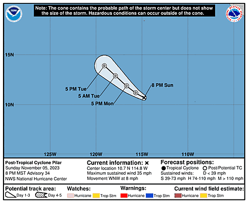
5-Day Uncertainty Track last
updated Sun, 05 Nov 2023 20:34:18 GMT
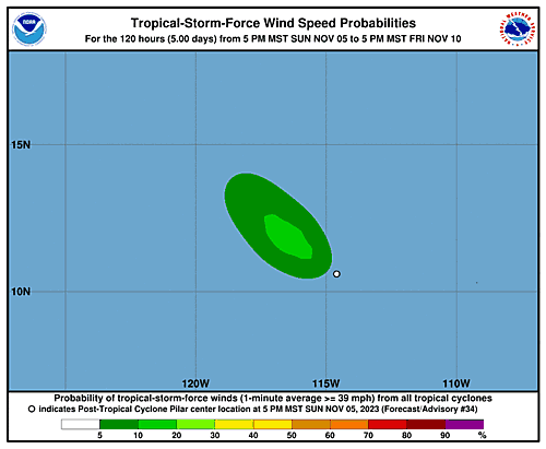
Wind Speed Probabilities last
updated Sun, 05 Nov 2023 20:34:18 GMT
https://www.nhc.noaa.gov/refresh/graphics_ep4+shtml/203418.shtml?cone
date: 2023-11-05, from: Eastern Pacific Basin Tropical Cyclones
000
WTPZ44 KNHC 052033
TCDEP4

Tropical Storm Pilar Discussion Number  33
NWS National Hurricane Center Miami FL       EP192023
200 PM MST Sun Nov 05 2023

Just after the issuance of the previous advisory, Pilar's center
popped out from beneath the convective overcast and is now located
at least 150 n mi to the southwest of an ongoing cluster of deep
convection.  Subjective Dvorak CI numbers from TAFB and SAB are now
down to 2.0/30 kt and 2.5/35 kt, respectively, and objective
estimates have fallen to between 35-40 kt.  Based on these data,
Pilar's initial intensity is lowered to 35 kt.  Strengthening
westerly to southwesterly shear is already taking its toll on
Pilar, and atmospheric conditions are only expected to become more
hostile over the next few days.  The NHC intensity forecast is near
the low end of the guidance, most closely following the SHIPS,
LGEM, and GFS solutions, and shows Pilar becoming a remnant low by
36 hours.  Since the storm remains over warm waters around 29
degrees Celsius, the forecast allows for the possibility of
convective redevelopment near the center tonight or on Monday.  But
if this does not occur, Pilar could become post-tropical as early
as tonight.  The remnant low is forecast to dissipate in about 3
days.

With the center becoming more apparent earlier this morning, it's
clear that a westward motion has continued (now estimated to be
275/9 kt).  The dynamical models are not handling Pilar's current
motion well at all since nearly all of them show an immediate
northwestward turn, and as a result, the NHC track forecast is
along the left side of the guidance envelope and leans toward the
shallow Trajectory and Beta model (TABS), especially in the short
term.  This new prediction is significantly west of the previous
forecast due to the adjusted initial position, and accounting for
Pilar's recent motion.


FORECAST POSITIONS AND MAX WINDS

INIT  05/2100Z 10.6N 114.3W   35 KT  40 MPH
 12H  06/0600Z 11.1N 115.3W   35 KT  40 MPH
 24H  06/1800Z 11.7N 116.2W   30 KT  35 MPH
 36H  07/0600Z 12.5N 117.2W   25 KT  30 MPH...POST-TROP/REMNT LOW
 48H  07/1800Z 13.7N 118.3W   25 KT  30 MPH...POST-TROP/REMNT LOW
 60H  08/0600Z 15.0N 119.3W   20 KT  25 MPH...POST-TROP/REMNT LOW
 72H  08/1800Z...DISSIPATED

$$
Forecaster Berg
https://www.nhc.noaa.gov/text/refresh/MIATCDEP4+shtml/052033.shtml
date: 2023-11-05, from: Eastern Pacific Basin Tropical Cyclones
000
FOPZ14 KNHC 052033
PWSEP4

TROPICAL STORM PILAR WIND SPEED PROBABILITIES NUMBER  33
NWS NATIONAL HURRICANE CENTER MIAMI FL       EP192023
2100 UTC SUN NOV 05 2023

AT 2100Z THE CENTER OF TROPICAL STORM PILAR WAS LOCATED NEAR
LATITUDE 10.6 NORTH...LONGITUDE 114.3 WEST WITH MAXIMUM SUSTAINED
WINDS NEAR 35 KTS...40 MPH...65 KM/H.

Z INDICATES COORDINATED UNIVERSAL TIME (GREENWICH)
   PACIFIC  STANDARD TIME (PST)...SUBTRACT 8 HOURS FROM Z TIME
   HAWAIIAN STANDARD TIME (HST)...SUBTRACT 10 HOURS FROM Z TIME

WIND SPEED PROBABILITY TABLE FOR SPECIFIC LOCATIONS

CHANCES OF SUSTAINED (1-MINUTE AVERAGE) WIND SPEEDS OF AT LEAST
   ...34 KT (39 MPH... 63 KM/H)...
   ...50 KT (58 MPH... 93 KM/H)...
   ...64 KT (74 MPH...119 KM/H)...
FOR LOCATIONS AND TIME PERIODS DURING THE NEXT 5 DAYS

PROBABILITIES FOR LOCATIONS ARE GIVEN AS OP(CP) WHERE
    OP  IS THE PROBABILITY OF THE EVENT BEGINNING DURING
        AN INDIVIDUAL TIME PERIOD (ONSET PROBABILITY)
   (CP) IS THE PROBABILITY OF THE EVENT OCCURRING BETWEEN
        18Z SUN AND THE FORECAST HOUR (CUMULATIVE PROBABILITY)

PROBABILITIES ARE GIVEN IN PERCENT
X INDICATES PROBABILITIES LESS THAN 1 PERCENT
PROBABILITIES FOR 34 KT AND 50 KT ARE SHOWN AT A GIVEN LOCATION WHEN
THE 5-DAY CUMULATIVE PROBABILITY IS AT LEAST 3 PERCENT.
PROBABILITIES FOR 34...50...64 KT SHOWN WHEN THE 5-DAY
64-KT CUMULATIVE PROBABILITY IS AT LEAST 1 PERCENT.


  - - - - WIND SPEED PROBABILITIES FOR SELECTED LOCATIONS - - - -

               FROM    FROM    FROM    FROM    FROM    FROM    FROM
  TIME       18Z SUN 06Z MON 18Z MON 06Z TUE 18Z TUE 18Z WED 18Z THU
PERIODS         TO      TO      TO      TO      TO      TO      TO
             06Z MON 18Z MON 06Z TUE 18Z TUE 18Z WED 18Z THU 18Z FRI

FORECAST HOUR    (12)   (24)    (36)    (48)    (72)    (96)   (120)
- - - - - - - - - - - - - - - - - - - - - - - - - - - - - - - - - -
LOCATION       KT

15N 120W       34  X   X( X)   X( X)   1( 1)   2( 3)   X( 3)   X( 3)

$$
FORECASTER BERG
https://www.nhc.noaa.gov/text/refresh/MIAPWSEP4+shtml/052033.shtml
date: 2023-11-05, from: Eastern Pacific Basin GIS Data
…PILAR UNRAVELING… …COULD BECOME A REMNANT LOW TONIGHT OR ON MONDAY… As of 2:00 PM MST Sun Nov 5 the center of Pilar was located near 10.6, -114.3 with movement W at 10 mph. The minimum central pressure was 1005 mb with maximum sustained winds of about 40 mph.
https://www.nhc.noaa.gov/text/refresh/MIATCPEP4+shtml/052032.shtml
date: 2023-11-05, from: Eastern Pacific Basin Tropical Cyclones
000
WTPZ24 KNHC 052032
TCMEP4

TROPICAL STORM PILAR FORECAST/ADVISORY NUMBER  33
NWS NATIONAL HURRICANE CENTER MIAMI FL       EP192023
2100 UTC SUN NOV 05 2023

NOTICE... LAND-BASED TROPICAL CYCLONE WATCHES AND WARNINGS ARE NO
LONGER INCLUDED IN THE TROPICAL CYCLONE FORECAST/ADVISORY...(TCM).
CURRENT LAND-BASED COASTAL WATCHES AND WARNINGS CAN BE FOUND IN THE
MOST RECENTLY ISSUED TROPICAL CYCLONE PUBLIC ADVISORY...(TCP).

TROPICAL STORM CENTER LOCATED NEAR 10.6N 114.3W AT 05/2100Z
POSITION ACCURATE WITHIN  20 NM

PRESENT MOVEMENT TOWARD THE WEST OR 275 DEGREES AT   9 KT

ESTIMATED MINIMUM CENTRAL PRESSURE 1005 MB
MAX SUSTAINED WINDS  35 KT WITH GUSTS TO  45 KT.
34 KT....... 60NE   0SE   0SW   0NW.
12 FT SEAS.. 60NE   0SE   0SW  60NW.
WINDS AND SEAS VARY GREATLY IN EACH QUADRANT.  RADII IN NAUTICAL
MILES ARE THE LARGEST RADII EXPECTED ANYWHERE IN THAT QUADRANT.

REPEAT...CENTER LOCATED NEAR 10.6N 114.3W AT 05/2100Z
AT 05/1800Z CENTER WAS LOCATED NEAR 10.5N 113.9W

FORECAST VALID 06/0600Z 11.1N 115.3W
MAX WIND  35 KT...GUSTS  45 KT.
34 KT... 40NE   0SE   0SW   0NW.

FORECAST VALID 06/1800Z 11.7N 116.2W
MAX WIND  30 KT...GUSTS  40 KT.

FORECAST VALID 07/0600Z 12.5N 117.2W...POST-TROP/REMNT LOW
MAX WIND  25 KT...GUSTS  35 KT.

FORECAST VALID 07/1800Z 13.7N 118.3W...POST-TROP/REMNT LOW
MAX WIND  25 KT...GUSTS  35 KT.

FORECAST VALID 08/0600Z 15.0N 119.3W...POST-TROP/REMNT LOW
MAX WIND  20 KT...GUSTS  30 KT.

FORECAST VALID 08/1800Z...DISSIPATED

REQUEST FOR 3 HOURLY SHIP REPORTS WITHIN 300 MILES OF 10.6N 114.3W

NEXT ADVISORY AT 06/0300Z

$$
FORECASTER BERG
https://www.nhc.noaa.gov/text/refresh/MIATCMEP4+shtml/052032.shtml
date: 2023-11-05, from: Eastern Pacific Basin GIS Data
Issued at Sun, 05 Nov 2023 20:32:33 GMT. This is only a prototype and the file format may change without notice.
https://www.nhc.noaa.gov/storm_graphics/EP19/atcf-ep192023.xml
date: 2023-11-05, from: NOAA tornado/severe thunderstorm watches, mesoscale discussions, convective outlooks, fire weather outlooks

Day 1 Convective Outlook
NWS Storm Prediction Center Norman OK
0149 PM CST Sun Nov 05 2023

Valid 052000Z - 061200Z

...THERE IS A MARGINAL RISK OF SEVERE THUNDERSTORMS ACROSS COASTAL
NORTHERN CALIFORNIA AND OREGON...

...SUMMARY...
A brief tornado or two, isolated damaging winds, and small hail will
be possible into tonight over parts of western Oregon and the far
northern California coast.

...20z Update...

No changes have been made to the Marginal (level 1 of 5) risk area
along the Pacific Northwest coast. See discussion below for forecast
details.

Otherwise, the 10 percent general thunderstorm area has been removed
from the eastern Dakotas and MN. Thunderstorm chances appear most
likely near the end of the period further east across northeast
WI/northern Lake Michigan. Deeper moisture and greater, though still
modest, instability will be in place ahead of the eastward
progressing surface low, supporting a few lightning flashes.

..Leitman.. 11/05/2023

.PREV DISCUSSION... /ISSUED 1023 AM CST Sun Nov 05 2023/

...Western OR and far northern CA coast...
Minor expansion of the level 1 risk with this outlook as a
long-duration, low-probability tornado/wind threat remains apparent
beginning around midday. Observational imagery depicts a series of
embedded shortwave troughs moving generally eastward towards the
Pacific Northwest coast today into tonight, with relatively prolific
lightning production amid several convective clusters. A feed of
conditionally unstable low to mid-level lapse rates and meager
buoyancy (200-300 J/kg SBCAPE) will favor low-topped convection and
occasional lightning flashes over land this afternoon into tonight
as the waves progress inland. Low to mid-level wind profiles will
strengthen somewhat, yielding sufficient hodograph length and
low-level curvature for a few low-topped supercells. These cells
will be capable of producing a brief tornado or two, isolated strong
gusts, and small hail up to nickel size. The longest duration threat
should exist along the coast, mainly in OR with a gradual north to
south shift towards far northern CA tonight. The eastern extent of
the low-probability severe threat into parts of the Willamette
Valley should be confined from mid-afternoon to early evening.
https://www.spc.noaa.gov/products/outlook/day1otlk_2000.html
date: 2023-11-05, from: NOAA tornado/severe thunderstorm watches, mesoscale discussions, convective outlooks, fire weather outlooks
No watches are valid as of Sun Nov 5 19:54:01 UTC 2023.
https://www.spc.noaa.gov/products/watch/
date: 2023-11-05, from: NOAA tornado/severe thunderstorm watches, mesoscale discussions, convective outlooks, fire weather outlooks
No Mesoscale Discussions are in effect as of Sun Nov 5 19:54:01 UTC 2023.
https://www.spc.noaa.gov/products/md/
date: 2023-11-05, from: Central Pacific Tropical Weather Outlook
457
ACPN50 PHFO 051741
TWOCP
Tropical Weather Outlook
NWS Central Pacific Hurricane Center
Honolulu HI
800 AM HST Sun Nov 5 2023
For the central
North Pacific…between 140W and 180W:
No tropical cyclones
are expected during the next 7 days.
$$
Forecaster
Shigesato
https://www.nhc.noaa.gov/gtwo.php?basin=cpac
date: 2023-11-05, from: Graphical Tropical Weather Outlooks
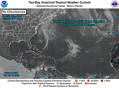
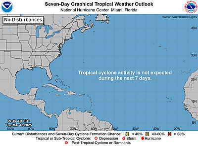
ZCZC MIATWOAT ALL
TTAA00 KNHC DDHHMM
Tropical Weather Outlook
NWS National Hurricane Center Miami
FL
100 PM EST Sun Nov 5 2023
For the North
Atlantic…Caribbean Sea and the Gulf of Mexico:
Tropical
cyclone formation is not expected during the next 7 days.
$$
Forecaster Roberts
NNNN
https://www.nhc.noaa.gov/gtwo.php?basin=atlc
date: 2023-11-05, from: NOAA tornado/severe thunderstorm watches, mesoscale discussions, convective outlooks, fire weather outlooks
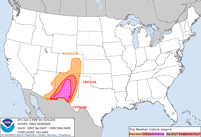
Day 2 Fire Weather Outlook
NWS Storm Prediction Center Norman OK
1116 AM CST Sun Nov 05 2023

Valid 061200Z - 071200Z

...NO CRITICAL AREAS...

The previous forecast (see below) remains on track. In addition, a
continuation of strong westerly/downslope flow across the central
Rockies will favor lee troughing over the adjacent High Plains. As a
result, locally dry/breezy conditions are expected over parts of
eastern NM into the TX South Plains and the I-25 corridor in
southern CO. While fine fuels will continue to dry out today, the
overall fire-weather risk appears too localized for Elevated
highlights at this time.

..Weinman.. 11/05/2023

.PREV DISCUSSION... /ISSUED 0157 AM CDT Sun Nov 05 2023/

...Synopsis...
As a strong mid-level jet continues to drift south through the day
on Monday, some dry and breezy conditions are expected to develop
across Nevada. Dry conditions are expected across much of the
Southwest. However, winds remain light in this region which should
alleviate most fire weather concerns. There may be some increase in
initial attack across Nevada, but due to currently moist fuels, no
large fires are anticipated.  Elsewhere, dry conditions are expected
from the Southeast into the Carolinas. However, the new large fire
threat should remain minimal due to light winds.

...Please see www.spc.noaa.gov/fire for graphic product...
https://www.spc.noaa.gov/products/fire_wx/fwdy2.html
date: 2023-11-05, from: Eastern Pacific Tropical Weather Outlook
000
ABPZ20 KNHC 051712
TWOEP
Tropical Weather Outlook
NWS National Hurricane Center Miami
FL
1000 AM PST Sun Nov 5 2023
For the eastern North
Pacific…east of 140 degrees west longitude:
Active
Systems:
The National Hurricane Center is issuing advisories on
Tropical
Storm Pilar, located several hundred miles
south-southwest of the
southern tip of the Baja California
peninsula.
Tropical cyclone formation is not expected
during the next 7 days.
$$
Forecaster
Roberts
https://www.nhc.noaa.gov/gtwo.php?basin=epac
date: 2023-11-05, from: NOAA tornado/severe thunderstorm watches, mesoscale discussions, convective outlooks, fire weather outlooks

Day 2 Convective Outlook
NWS Storm Prediction Center Norman OK
1106 AM CST Sun Nov 05 2023

Valid 061200Z - 071200Z

...NO SEVERE THUNDERSTORM AREAS FORECAST...

...SUMMARY...
Isolated thunderstorms are possible from the Pacific Northwest into
parts of the northern Rockies, as well as over Lower Michigan, on
Monday.

...Synopsis...

Fast, mostly zonal/low-amplitude flow will persist across parts of
the CONUS (stretching from CA through the central Rockies/Plains
into the Midwest) on Monday. The 500 mb jet max along the Pacific
coast will begin to shift southward over CA after 00z as a shortwave
upper trough begins digging along the coast. Strong deep-layer flow
will continue to transport moisture over parts of the Pacific
Northwest and northern Rockies. Cold temperatures aloft will foster
weak instability, and orographic influences will further aid in
isolated thunderstorm activity. However, severe potential is
expected to remain limited.

Further east, a surface low over the Upper Midwest early Monday will
develop east/northeast toward southern Quebec by Tuesday morning. A
cold front will shift east across the upper Great Lakes vicinity.
The front will stall across the central Plains and Mid-MS Valley as
persistent low-level warm advection/southerly flow maintains
northward moisture transport into the Ozark Plateau. Isolated
thunderstorms will be possible near the surface low/cold front
across parts of Lower MI where meager instability and cold
temperatures aloft may be sufficient for a few lightning flashes.
Further south, despite surface dewpoints in the upper 50s/low 60s F
and weak instability, warm midlevel temperatures will preclude
thunderstorm activity.

..Leitman.. 11/05/2023
https://www.spc.noaa.gov/products/outlook/day2otlk_1730.html
date: 2023-11-05, from: NOAA tornado/severe thunderstorm watches, mesoscale discussions, convective outlooks, fire weather outlooks

Day 1 Fire Weather Outlook
NWS Storm Prediction Center Norman OK
1043 AM CST Sun Nov 05 2023

Valid 051700Z - 061200Z

...NO CRITICAL AREAS...

The forecast remains on track. In addition to the fire-weather
concerns described below, dry/breezy conditions are expected across
parts of eastern NM into the western TX Panhandle, and gap-flow
areas along the I-25 corridor in southern CO. Strengthening
westerly/downslope flow and diurnal heating west of a lee
trough/dryline will yield 10-15 percent RH this afternoon. These dry
conditions, coupled with 15-20 mph sustained surface winds (locally
higher), could lead to localized fire-weather concerns. However,
marginally receptive fuels and the localized nature of the threat
preclude Elevated highlights.

Farther east, northerly surface winds and related continental
trajectories down the FL peninsula will aid in dry boundary-layer
conditions (25-30 percent RH) across northern/central FL this
afternoon. While sustained surface winds around 10 mph should
generally mitigate the fire-weather risk, locally elevated
conditions are possible.

..Weinman.. 11/05/2023

.PREV DISCUSSION... /ISSUED 0157 AM CDT Sun Nov 05 2023/

...Synopsis...
An elongated upper-level jet will extend from the eastern Pacific
into the central Rockies today. A weak mid-level shortwave is
expected to cross the Rockies today which will assist in
cyclogenesis across the Plains. The majority of strong winds will be
where fuels remain moist and relative humidity remains high. Some
dry and breezy conditions are expected across southeast Wyoming,
beneath the stronger mid-level jet, but fuels in this region are
moist and therefore, fire weather concerns should remain minimal.

An extended dry spell across the Southeast and into the Carolinas
continues to cure fuels in the region. Fuels are starting to reach
critically dry levels in spots, but winds should remain light for
the remainder of this weekend and into early next week. Therefore,
some increase in initial attack is likely, but winds should remain
too light for a greater threat.

...Please see www.spc.noaa.gov/fire for graphic product...
https://www.spc.noaa.gov/products/fire_wx/fwdy1.html
date: 2023-11-05, from: NOAA tornado/severe thunderstorm watches, mesoscale discussions, convective outlooks, fire weather outlooks

Day 1 Convective Outlook
NWS Storm Prediction Center Norman OK
1023 AM CST Sun Nov 05 2023

Valid 051630Z - 061200Z

...THERE IS A MARGINAL RISK OF SEVERE THUNDERSTORMS PARTS OF WESTERN
OR AND THE FAR NORTHERN CA COAST...

...SUMMARY...
A brief tornado or two, isolated damaging winds, and small hail will
be possible this afternoon into tonight over parts of western Oregon
and the far northern California coast.

...Western OR and far northern CA coast...
Minor expansion of the level 1 risk with this outlook as a
long-duration, low-probability tornado/wind threat remains apparent
beginning around midday. Observational imagery depicts a series of
embedded shortwave troughs moving generally eastward towards the
Pacific Northwest coast today into tonight, with relatively prolific
lightning production amid several convective clusters. A feed of
conditionally unstable low to mid-level lapse rates and meager
buoyancy (200-300 J/kg SBCAPE) will favor low-topped convection and
occasional lightning flashes over land this afternoon into tonight
as the waves progress inland. Low to mid-level wind profiles will
strengthen somewhat, yielding sufficient hodograph length and
low-level curvature for a few low-topped supercells. These cells
will be capable of producing a brief tornado or two, isolated strong
gusts, and small hail up to nickel size. The longest duration threat
should exist along the coast, mainly in OR with a gradual north to
south shift towards far northern CA tonight. The eastern extent of
the low-probability severe threat into parts of the Willamette
Valley should be confined from mid-afternoon to early evening.

..Grams/Wendt.. 11/05/2023
https://www.spc.noaa.gov/products/outlook/day1otlk_1630.html
date: 2023-11-05, from: Eastern Pacific Basin GIS Data
Shapefile last updated Sun, 05 Nov 2023 15:23:02 GMT
https://www.nhc.noaa.gov/gis/forecast/archive/wsp_120hrhalfDeg_latest.zip
date: 2023-11-05, from: Eastern Pacific Basin GIS Data
KMZ last updated Sun, 05 Nov 2023 14:38:53 GMT
https://www.nhc.noaa.gov/storm_graphics/api/EP192023_032adv_TRACK.kmz
date: 2023-11-05, from: Eastern Pacific Basin GIS Data
Initial and Forecast Surface Winds. Shapefile last updated Sun, 05 Nov 2023 14:38:44 GMT
https://www.nhc.noaa.gov/gis/forecast/archive/ep192023_fcst_032.zip
date: 2023-11-05, from: Eastern Pacific Basin GIS Data
KMZ last updated Sun, 05 Nov 2023 14:38:13 GMT
https://www.nhc.noaa.gov/storm_graphics/api/EP192023_032adv_CONE.kmz
date: 2023-11-05, from: Eastern Pacific Basin GIS Data
Forecast Track, Cone of Uncertainty, Watches/Warnings. Shapefile last updated Sun, 05 Nov 2023 14:37:58 GMT
https://www.nhc.noaa.gov/gis/forecast/archive/ep192023_5day_032.zip
date: 2023-11-05, from: Eastern Pacific Basin Tropical Cyclones

5-Day Uncertainty Track last
updated Sun, 05 Nov 2023 14:37:36 GMT

Wind Speed Probabilities last
updated Sun, 05 Nov 2023 15:22:33 GMT
https://www.nhc.noaa.gov/refresh/graphics_ep4+shtml/143736.shtml?cone
date: 2023-11-05, from: Eastern Pacific Basin Tropical Cyclones
000
WTPZ44 KNHC 051436
TCDEP4

Tropical Storm Pilar Discussion Number  32
NWS National Hurricane Center Miami FL       EP192023
800 AM MST Sun Nov 05 2023

Pilar's cloud pattern has degraded a bit this morning, and a recent
SSMIS microwave image shows that mid-level circulation and deep
convection have decoupled to the northeast of the low-level center.
Still, the initial intensity remains 45 kt, possibly generously,
based on the latest Dvorak CI numbers and objective satellite
estimates.  Although deep-layer shear is diagnosed in the SHIPS
model as being low, global model analyses suggest that stronger
mid-level southwesterly shear is occurring beneath the outflow
level.  Therefore, some gradual weakening is likely over the next
day or so.  After 24 hours, deeper-layer shear begins to increase to
the east of a trough, which should cause Pilar to weaken faster
through midweek.  The cyclone is forecast to lose organized
convection and degenerate into a remnant low in about 2 days, and
then dissipate into a trough by day 4.

Pilar has slowed down and turned west-northwestward with an initial
motion of 285/7 kt in response to a mid-level trough extending
southwest of the Baja California peninsula.  The storm is forecast
to turn toward the northwest in about 24 hours as it approaches the
trough, and continue on that heading until it dissipates in about 4
days.  The NHC track forecast is close to the previous prediction
and lies between the HCCA and TVCE consensus aids.


FORECAST POSITIONS AND MAX WINDS

INIT  05/1500Z 10.8N 112.8W   45 KT  50 MPH
 12H  06/0000Z 11.3N 113.7W   40 KT  45 MPH
 24H  06/1200Z 12.1N 114.7W   40 KT  45 MPH
 36H  07/0000Z 13.1N 115.7W   35 KT  40 MPH
 48H  07/1200Z 14.6N 116.9W   30 KT  35 MPH...POST-TROP/REMNT LOW
 60H  08/0000Z 16.0N 118.1W   25 KT  30 MPH...POST-TROP/REMNT LOW
 72H  08/1200Z 17.3N 119.3W   25 KT  30 MPH...POST-TROP/REMNT LOW
 96H  09/1200Z...DISSIPATED

$$
Forecaster Berg
https://www.nhc.noaa.gov/text/refresh/MIATCDEP4+shtml/051436.shtml
date: 2023-11-05, from: Eastern Pacific Basin Tropical Cyclones
000
FOPZ14 KNHC 051436
PWSEP4

TROPICAL STORM PILAR WIND SPEED PROBABILITIES NUMBER  32
NWS NATIONAL HURRICANE CENTER MIAMI FL       EP192023
1500 UTC SUN NOV 05 2023

AT 1500Z THE CENTER OF TROPICAL STORM PILAR WAS LOCATED NEAR
LATITUDE 10.8 NORTH...LONGITUDE 112.8 WEST WITH MAXIMUM SUSTAINED
WINDS NEAR 45 KTS...50 MPH...85 KM/H.

Z INDICATES COORDINATED UNIVERSAL TIME (GREENWICH)
   PACIFIC  STANDARD TIME (PST)...SUBTRACT 8 HOURS FROM Z TIME
   HAWAIIAN STANDARD TIME (HST)...SUBTRACT 10 HOURS FROM Z TIME

WIND SPEED PROBABILITY TABLE FOR SPECIFIC LOCATIONS

CHANCES OF SUSTAINED (1-MINUTE AVERAGE) WIND SPEEDS OF AT LEAST
   ...34 KT (39 MPH... 63 KM/H)...
   ...50 KT (58 MPH... 93 KM/H)...
   ...64 KT (74 MPH...119 KM/H)...
FOR LOCATIONS AND TIME PERIODS DURING THE NEXT 5 DAYS

PROBABILITIES FOR LOCATIONS ARE GIVEN AS OP(CP) WHERE
    OP  IS THE PROBABILITY OF THE EVENT BEGINNING DURING
        AN INDIVIDUAL TIME PERIOD (ONSET PROBABILITY)
   (CP) IS THE PROBABILITY OF THE EVENT OCCURRING BETWEEN
        12Z SUN AND THE FORECAST HOUR (CUMULATIVE PROBABILITY)

PROBABILITIES ARE GIVEN IN PERCENT
X INDICATES PROBABILITIES LESS THAN 1 PERCENT
PROBABILITIES FOR 34 KT AND 50 KT ARE SHOWN AT A GIVEN LOCATION WHEN
THE 5-DAY CUMULATIVE PROBABILITY IS AT LEAST 3 PERCENT.
PROBABILITIES FOR 34...50...64 KT SHOWN WHEN THE 5-DAY
64-KT CUMULATIVE PROBABILITY IS AT LEAST 1 PERCENT.


  - - - - WIND SPEED PROBABILITIES FOR SELECTED LOCATIONS - - - -

               FROM    FROM    FROM    FROM    FROM    FROM    FROM
  TIME       12Z SUN 00Z MON 12Z MON 00Z TUE 12Z TUE 12Z WED 12Z THU
PERIODS         TO      TO      TO      TO      TO      TO      TO
             00Z MON 12Z MON 00Z TUE 12Z TUE 12Z WED 12Z THU 12Z FRI

FORECAST HOUR    (12)   (24)    (36)    (48)    (72)    (96)   (120)
- - - - - - - - - - - - - - - - - - - - - - - - - - - - - - - - - -
LOCATION       KT

15N 115W       34  X   1( 1)   2( 3)   1( 4)   X( 4)   X( 4)   X( 4)

$$
FORECASTER BERG
https://www.nhc.noaa.gov/text/refresh/MIAPWSEP4+shtml/051436.shtml
date: 2023-11-05, from: Eastern Pacific Basin GIS Data
…PILAR TURNS WEST-NORTHWESTWARD… As of 8:00 AM MST Sun Nov 5 the center of Pilar was located near 10.8, -112.8 with movement WNW at 8 mph. The minimum central pressure was 1000 mb with maximum sustained winds of about 50 mph.
https://www.nhc.noaa.gov/text/refresh/MIATCPEP4+shtml/051436.shtml
date: 2023-11-05, from: Eastern Pacific Basin Tropical Cyclones
376
WTPZ24 KNHC 051436
TCMEP4

TROPICAL STORM PILAR FORECAST/ADVISORY NUMBER  32
NWS NATIONAL HURRICANE CENTER MIAMI FL       EP192023
1500 UTC SUN NOV 05 2023

NOTICE... LAND-BASED TROPICAL CYCLONE WATCHES AND WARNINGS ARE NO
LONGER INCLUDED IN THE TROPICAL CYCLONE FORECAST/ADVISORY...(TCM).
CURRENT LAND-BASED COASTAL WATCHES AND WARNINGS CAN BE FOUND IN THE
MOST RECENTLY ISSUED TROPICAL CYCLONE PUBLIC ADVISORY...(TCP).

TROPICAL STORM CENTER LOCATED NEAR 10.8N 112.8W AT 05/1500Z
POSITION ACCURATE WITHIN  30 NM

PRESENT MOVEMENT TOWARD THE WEST-NORTHWEST OR 285 DEGREES AT   7 KT

ESTIMATED MINIMUM CENTRAL PRESSURE 1000 MB
MAX SUSTAINED WINDS  45 KT WITH GUSTS TO  55 KT.
34 KT....... 50NE   0SE   0SW  50NW.
12 FT SEAS.. 60NE   0SE   0SW  75NW.
WINDS AND SEAS VARY GREATLY IN EACH QUADRANT.  RADII IN NAUTICAL
MILES ARE THE LARGEST RADII EXPECTED ANYWHERE IN THAT QUADRANT.

REPEAT...CENTER LOCATED NEAR 10.8N 112.8W AT 05/1500Z
AT 05/1200Z CENTER WAS LOCATED NEAR 10.7N 112.5W

FORECAST VALID 06/0000Z 11.3N 113.7W
MAX WIND  40 KT...GUSTS  50 KT.
34 KT... 50NE   0SE   0SW  40NW.

FORECAST VALID 06/1200Z 12.1N 114.7W
MAX WIND  40 KT...GUSTS  50 KT.
34 KT... 50NE   0SE   0SW  40NW.

FORECAST VALID 07/0000Z 13.1N 115.7W
MAX WIND  35 KT...GUSTS  45 KT.
34 KT... 50NE   0SE   0SW  40NW.

FORECAST VALID 07/1200Z 14.6N 116.9W...POST-TROP/REMNT LOW
MAX WIND  30 KT...GUSTS  40 KT.

FORECAST VALID 08/0000Z 16.0N 118.1W...POST-TROP/REMNT LOW
MAX WIND  25 KT...GUSTS  35 KT.

FORECAST VALID 08/1200Z 17.3N 119.3W...POST-TROP/REMNT LOW
MAX WIND  25 KT...GUSTS  35 KT.

EXTENDED OUTLOOK. NOTE...ERRORS FOR TRACK HAVE AVERAGED NEAR 100 NM
ON DAY 4 AND 125 NM ON DAY 5...AND FOR INTENSITY NEAR 15 KT EACH DAY

OUTLOOK VALID 09/1200Z...DISSIPATED

REQUEST FOR 3 HOURLY SHIP REPORTS WITHIN 300 MILES OF 10.8N 112.8W

NEXT ADVISORY AT 05/2100Z

$$
FORECASTER BERG
https://www.nhc.noaa.gov/text/refresh/MIATCMEP4+shtml/051436.shtml