(date: 2023-12-01 19:51:00)
date: 2023-12-01, from: NOAA Weather Forecasts
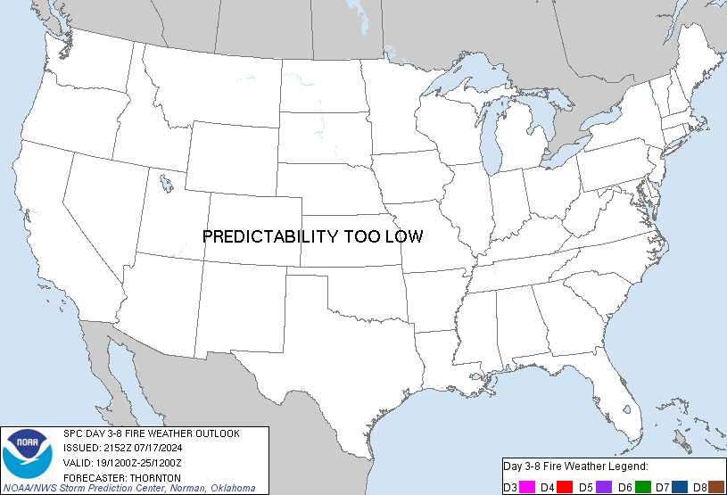
Day 3-8 Fire Weather Outlook
NWS Storm Prediction Center Norman OK
0322 PM CST Fri Dec 01 2023

Valid 031200Z - 091200Z

Dry and  breezy conditions are expected across portions of the
southern High Plains on Sunday as a mid-level trough moves southeast
through the central Rockies and overspreads strong mid-level winds
and the pressure gradient tightens across the region. Currently
fuels are not favorable for fire spread given recent rainfall in the
region. However, dry conditions and sunny skies today and Saturday
could lead to fine, dormant fuels becoming more receptive. However,
at this time, that seems unlikely.

Beyond Sunday, a mid-level ridge becomes well established across the
central CONUS. This will result in some dry and breezy conditions
across the eastern CONUS, but temperatures will be cold and fuels
will be moist. Therefore, there will be no fire weather concerns.
This pattern will bring several wet storm systems to the Pacific
Northwest and mostly dry conditions from southern California across
the Southwest and into the southern High Plains. This may lead to
drying of some fine fuels, especially in the southern High Plains,
but winds should be light. Therefore, fire weather concerns are
minimal.

..Bentley.. 12/01/2023

...Please see www.spc.noaa.gov/fire for graphic product...
https://www.spc.noaa.gov/products/exper/fire_wx/ Save to Pocket
date: 2023-12-01, from: Graphical Tropical Weather Outlooks
ZCZC HFOTWOCP ALL
TTAA00 PHFO DDHHMM
Tropical Weather Outlook
NWS Central Pacific Hurricane Center
Honolulu HI
800 PM HST Thu Nov 30 2023
For the
central North Pacific…between 140W and 180W:
No tropical
cyclones are expected during the next 7 days.
The central
North Pacific hurricane season officialy ends today,
November 30.
The is the last regularly scheduled Tropical Weather
Outlook of
the 2023 central North Pacific Hurricane Season. Routine
issuance
of the Tropical Weather Outlook will resume on June 1,
2024.
During the off-season, Special Tropical Weather outlooks will
be
issued as conditions warrant.
$$
Forecaster
Bohlin
NNNN
https://www.nhc.noaa.gov/gtwo.php?basin=cpac Save to Pocket
date: 2023-12-01, from: Central Pacific Basin Tropical Cyclones
No tropical cyclones as of Sat, 02 Dec 2023 02:31:10 GMT
https://www.nhc.noaa.gov/ Save to Pocket
date: 2023-12-01, from: Graphical Tropical Weather Outlooks
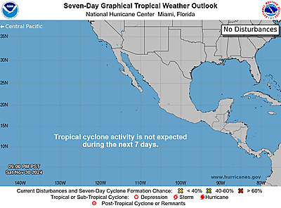
ZCZC MIATWOEP ALL
TTAA00 KNHC DDHHMM
Tropical Weather Outlook
NWS National Hurricane Center Miami
FL
1000 PM PST Thu Nov 30 2023
For the eastern North
Pacific…east of 140 degrees west longitude:
Tropical
cyclone formation is not expected during the next 7 days.
This is the last regularly scheduled Tropical Weather Outlook of the
2023 eastern North Pacific Hurricane Season. Routine issuance of
the Tropical Weather Outlook will resume on May 15, 2024. During
the off-season, Special Tropical Weather Outlooks will be issued
as
conditions warrant.
$$
Forecaster
Cangialosi
NNNN
https://www.nhc.noaa.gov/gtwo.php?basin=epac Save to Pocket
date: 2023-12-01, from: NOAA tornado/severe thunderstorm watches, mesoscale discussions, convective outlooks, fire weather outlooks

Mesoscale Discussion 2294
NWS Storm Prediction Center Norman OK
0652 PM CST Thu Nov 30 2023

Areas affected...Far southeast TX and southwest LA

Concerning...Severe potential...Watch unlikely

Valid 010052Z - 010245Z

Probability of Watch Issuance...20 percent

SUMMARY...A spatially limited threat for a tornado should persist
along a portion of the northwest Gulf Coast this evening.

DISCUSSION...A deep convective cluster has become confined to the
far southeast three counties of TX (Chambers, Jefferson, and
Orange). This convection has struggled to organize beyond sporadic
attempts at lower-end/transient mid-level rotation. The overall
thermodynamic environment, which has been the primary mitigating
factor to severe weather thus far, might become slightly more
conducive to generating a surface-based supercell as temperatures
have warmed into the upper 60s near/just south of this activity
along the immediate coast. This should gradually translate east
through the rest of the evening into southwest LA, improving upon
the nil instability sampled in the 00Z LCH sounding. While the
low-level wind profile has been in the process of strengthening over
the past few hours, resulting in increasingly enlarged hodographs,
confidence remains low that sustained supercell development will
occur as depicted in the 23Z RRFS compared to the negligible signal
in the 00Z WoFS.

..Grams/Smith.. 12/01/2023

...Please see www.spc.noaa.gov for graphic product...

ATTN...WFO...LCH...HGX...

LAT...LON   30249413 30369376 30349328 30249298 30089289 29909290
            29769299 29739308 29679349 29599407 29549447 29649457
            29699457 30249413
https://www.spc.noaa.gov/products/md/md2294.html Save to Pocket
date: 2023-11-30, from: Graphical Tropical Weather Outlooks
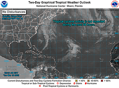
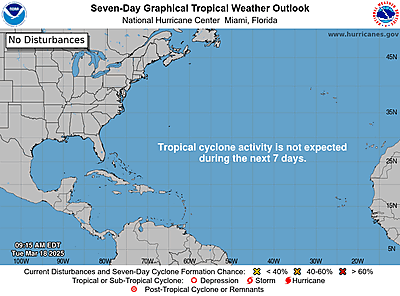
ZCZC MIATWOAT ALL
TTAA00 KNHC DDHHMM
Tropical Weather Outlook
NWS National Hurricane Center Miami
FL
700 PM EST Thu Nov 30 2023
For the North
Atlantic…Caribbean Sea and the Gulf of Mexico:
Tropical
cyclone formation is not expected during the next 7 days.
This is the last regularly scheduled Tropical Weather Outlook of the
2023 Atlantic Hurricane Season. Routine issuance of the Tropical
Weather Outlook will resume on May 15, 2024. During the
off-season,
Special Tropical Weather Outlooks will be issued as
conditions
warrant.
$$
Forecaster
Cangialosi
NNNN
https://www.nhc.noaa.gov/gtwo.php?basin=atlc Save to Pocket
date: 2023-11-30, from: NOAA tornado/severe thunderstorm watches, mesoscale discussions, convective outlooks, fire weather outlooks

Mesoscale Discussion 2291
NWS Storm Prediction Center Norman OK
1244 PM CST Thu Nov 30 2023

Areas affected...Northeast Texas into far southwestern Oklahoma

Concerning...Severe potential...Watch unlikely

Valid 301844Z - 302045Z

Probability of Watch Issuance...5 percent

SUMMARY...The potential for isolated severe hail, and perhaps
damaging wind gusts, should increase through the mid-afternoon hours
across northeast Texas and portions of far southwestern Oklahoma.
Watch issuance is not expected.

DISCUSSION...Over the past hour, the coverage and intensity of
convection has increased across central to northeast TX as lift
within a warm advection regime and ahead of an approaching upper
wave increases. While much of this convection is well displaced from
a narrow plume of surface-based buoyancy stretching from the TX Gulf
coast into central TX, MUCAPE across northeast TX has steadily
increased to around 1000 J/kg amid warming/moistening within the
925-850 mb layer. Observed storm motions and a lack of apparent
low-level mesocyclones further suggest that this convection is
rooted above the surface, but elongated hodographs above 2 km
(featuring effective bulk shear values near 40 knots), should
support storm organization with an attendant risk of isolated large
hail. Cooling cloud top temperatures and an uptick in lightning
counts over the past 15-30 minutes suggest convection is beginning
to realize this environment, so an increasing hail threat seems
probable (though clustered storm modes may inhibit the overall
threat). Recent hi-res guidance, including HRRR-based SCRAMM
solutions and WOFS ensemble output, appears to have picked up on
this trend and shows increasing potential for isolated hail across
northeast TX over the next several hours. While the signal for
severe winds is comparatively weaker, a few damaging gusts will be
possible. Regardless, the overall severe threat should remain too
limited to warrant watch issuance.

..Moore/Thompson.. 11/30/2023

...Please see www.spc.noaa.gov for graphic product...

ATTN...WFO...SHV...TSA...HGX...FWD...OUN...

LAT...LON   31409742 31779765 32809746 33529748 33949761 34369566
            34179495 33879449 33059425 32399443 31749489 31529539
            31409742
https://www.spc.noaa.gov/products/md/md2291.html Save to Pocket
date: 2023-11-30, from: NOAA tornado/severe thunderstorm watches, mesoscale discussions, convective outlooks, fire weather outlooks

Day 1 Convective Outlook
NWS Storm Prediction Center Norman OK
0154 PM CST Thu Nov 30 2023

Valid 302000Z - 011200Z

...THERE IS A SLIGHT RISK OF SEVERE THUNDERSTORMS ACROSS SOUTHEAST
TEXAS AND SOUTHWEST LOUISIANA...

...SUMMARY...
A few severe storms/tornadoes are possible through tonight from
southeast Texas into southern Louisiana. Farther north, isolated
hail and strong wind gusts will also be possible across parts of
East/North Texas and southern Oklahoma.

...20z Update...

The only changes with the 20z update were to trim the western edges
of the outlook area based on latest observation trends and location
of current convection. Widespread cloud cover and scattered
convection has limited heating, and combined with poor low-level
lapse rates, low-level inhibition is limited surface-based storm
development. Some stronger storms may still develop this evening
near the Sabine River as the surface cold front tracks southeast.
However, overall severe potential will likely remain somewhat
subdued due to poor thermodynamics despite favorable vertical shear.

..Leitman.. 11/30/2023

.PREV DISCUSSION... /ISSUED 1025 AM CST Thu Nov 30 2023/

...Northwest Gulf coast and southern Plains through tonight...
Thunderstorms are forming this morning over southeast TX from
Matagorda Bay northeastward through the Houston area to Toledo Bend
reservoir.  The convection appears to be driven by low-level warm
advection, as well as a subtle/lead speed max ejecting aloft, in
advance of the primary shortwave trough over NM.  Observed and
forecast hodographs (with substantial length and curvature) across
southeast TX look favorable for right-moving supercells with some
tornado potential.  However, with widespread cloud cover and warm
advection being the primary mode of storm initiation, the updrafts
may be rooted slightly above the ground.  Thus, the convection may
not take full advantage of the shear profiles, compared to a more
favorable scenario where fully surface-based storms formed in a
warmer environment upstream and moved into the environment expected
across southeast TX/upper TX coast this afternoon/evening.

Regardless, there will be some potential for supercells and a few
tornadoes given the strong low-level shear in a moistening/gradually
destabilizing environment, with the aforementioned caveats related
to poor low-level lapse rates.  This threat will slowly increase
across southeast TX/upper TX coast through the afternoon and
continue through tonight while spreading eastward into
southwest/south central LA.

Farther northwest, elevated thunderstorm development is expected
from central/north TX into southern OK, in the zone of ascent
preceding the primary shortwave trough that will begin to move
east-northeastward this afternoon from NM toward OK and north TX.
The strongest of these storms will pose some threat for marginally
severe hail based on some steepening of midlevel lapse rates and
relatively long hodographs aloft.  A narrow zone of buoyancy rooted
near the surface may develop later this afternoon from western north
TX into extreme southwest OK, near the primary surface cyclone.
However, the main forcing for ascent will be east/northeast of this
zone by late afternoon, and forecast hodographs reflect low-midlevel
wave passage with a pronounced veer-back signature relatively close
to the ground (as low as 1 km AGL).
https://www.spc.noaa.gov/products/outlook/day1otlk_2000.html Save to Pocket
date: 2023-11-30, from: NOAA tornado/severe thunderstorm watches, mesoscale discussions, convective outlooks, fire weather outlooks
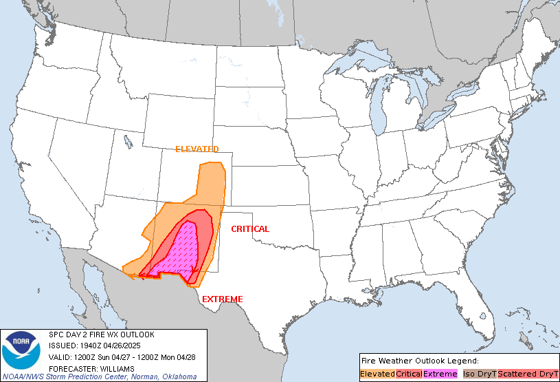
Day 2 Fire Weather Outlook
NWS Storm Prediction Center Norman OK
0155 PM CST Thu Nov 30 2023

Valid 011200Z - 021200Z

...NO CRITICAL AREAS...

The previous forecast (see below) remains on track, with no changes
or additions made.

..Squitieri.. 11/30/2023

.PREV DISCUSSION... /ISSUED 1254 AM CST Thu Nov 30 2023/

...Synopsis...
A belt of strong west-southwesterly flow aloft will persist across
the southern Rockies, favoring continued breezy downslope flow over
the southern High Plains. Similar to Day 1/Thursday, marginal RH
(25-30 percent) should mitigate most fire-weather concerns here.

Farther west, surface high pressure will build into the Great Basin,
yielding an offshore pressure gradient over southern CA. While
breezy/gusty north-northeasterly surface winds may support locally
elevated fire-weather conditions (primarily over parts of Santa
Barbara, Ventura, and Los Angeles Counties), fairly cool surface
temperatures will limit RH reductions and the overall fire-weather
risk.

...Please see www.spc.noaa.gov/fire for graphic product...
https://www.spc.noaa.gov/products/fire_wx/fwdy2.html Save to Pocket
date: 2023-11-30, from: NOAA tornado/severe thunderstorm watches, mesoscale discussions, convective outlooks, fire weather outlooks

Mesoscale Discussion 2290
NWS Storm Prediction Center Norman OK
1159 AM CST Thu Nov 30 2023

Areas affected...Southeast TX

Concerning...Severe potential...Watch possible

Valid 301759Z - 302000Z

Probability of Watch Issuance...40 percent

SUMMARY...The tornado threat may gradually increase with time
through the day. Eventual watch issuance is possible, though timing
is uncertain.

DISCUSSION...Convection is gradually increasing across parts of
southeast TX within a low-level warm-advection regime, with recent
satellite and radar trends indicating an increase in storm intensity
southwest of Galveston Bay. Mid/upper 60s F dewpoints are gradually
streaming northward across the region, though widespread cloudiness
and increasing precipitation will continue to limit heating and
destabilization through the afternoon.

The timing and extent of surface-based supercell development this
afternoon remain uncertain, and may continue to be limited by weak
low-level lapse rates and buoyancy. However, it remains possible
that consolidation of the stronger ongoing elevated convection may
result in transient supercell development, and there is also some
potential for a supercell or two to develop offshore and move inland
later this afternoon. Favorable low-level and deep-layer shear (as
noted on the TIAH/THOU VWPs) will support a conditional tornado risk
if any mature supercells can evolve with time. Tornado watch
issuance is possible sometime this afternoon, if observational
trends begin to support imminent supercell potential.

..Dean/Thompson.. 11/30/2023

...Please see www.spc.noaa.gov for graphic product...

ATTN...WFO...LCH...HGX...CRP...

LAT...LON   28639647 29129651 29409613 29869520 30139443 29829409
            29559411 29319446 29099484 28849533 28689568 28549599
            28439619 28369631 28639647
https://www.spc.noaa.gov/products/md/md2290.html Save to Pocket
date: 2023-11-30, from: NOAA tornado/severe thunderstorm watches, mesoscale discussions, convective outlooks, fire weather outlooks

Day 2 Convective Outlook
NWS Storm Prediction Center Norman OK
1127 AM CST Thu Nov 30 2023

Valid 011200Z - 021200Z

...THERE IS A MARGINAL RISK OF SEVERE THUNDERSTORMS ACROSS THE
CENTRAL GULF COAST VICINITY...

...SUMMARY...
Scattered storms, some severe, are possible over parts of the
central Gulf Coast states on Friday into Friday night.

...Synopsis...

A low-level warm advection regime will persist across the central
Gulf Coast/Southeast vicinity on Friday. This is in response to a
midlevel shortwave trough and surface low moving across the Midwest.
A trailing cold front extending from the low across eastern/southern
TX early in the period will shift slowly east toward the
Mid-South/Lower MS Valley vicinity. Mid/upper 60s F surface
dewpoints will develop northward across MS/AL through the day.
Showers and cloud cover will limit heating and the overall lapse
rate environment will remain poor. This will result in mainly weak
destabilization as far north as the I-20 corridor, though greater
instability (to around 1000 J/kg MLCAPE) will remain confined to the
coastal vicinity. Nevertheless, vertically veering wind profiles and
effective shear magnitudes greater than 35 kt will support at least
transient organized cells. Stronger forcing for ascent will remain
focused north of the region, with low-level confluence along the
effective surface front contributing to bands of
showers/thunderstorms shifting east through the period.

Given shear profiles conditionally supporting supercells, but a
rather modest thermodynamic environment, will maintain the Marginal
(level 1 of 5) risk with some southward adjustments based on latest
forecast guidance.

..Leitman.. 11/30/2023
https://www.spc.noaa.gov/products/outlook/day2otlk_1730.html Save to Pocket
date: 2023-11-30, from: NOAA tornado/severe thunderstorm watches, mesoscale discussions, convective outlooks, fire weather outlooks

Day 1 Convective Outlook
NWS Storm Prediction Center Norman OK
1025 AM CST Thu Nov 30 2023

Valid 301630Z - 011200Z

...THERE IS A SLIGHT RISK OF SEVERE THUNDERSTORMS THROUGH TONIGHT
FROM SOUTHEAST TX INTO SOUTHERN LA...

...SUMMARY...
A few severe storms/tornadoes are possible this afternoon through
tonight from southeast Texas into southern Louisiana. Farther north,
isolated hail and strong wind gusts will also be possible across
parts of East/North Texas and southern Oklahoma.

...Northwest Gulf coast and southern Plains through tonight...
Thunderstorms are forming this morning over southeast TX from
Matagorda Bay northeastward through the Houston area to Toledo Bend
reservoir.  The convection appears to be driven by low-level warm
advection, as well as a subtle/lead speed max ejecting aloft, in
advance of the primary shortwave trough over NM.  Observed and
forecast hodographs (with substantial length and curvature) across
southeast TX look favorable for right-moving supercells with some
tornado potential.  However, with widespread cloud cover and warm
advection being the primary mode of storm initiation, the updrafts
may be rooted slightly above the ground.  Thus, the convection may
not take full advantage of the shear profiles, compared to a more
favorable scenario where fully surface-based storms formed in a
warmer environment upstream and moved into the environment expected
across southeast TX/upper TX coast this afternoon/evening.

Regardless, there will be some potential for supercells and a few
tornadoes given the strong low-level shear in a moistening/gradually
destabilizing environment, with the aforementioned caveats related
to poor low-level lapse rates.  This threat will slowly increase
across southeast TX/upper TX coast through the afternoon and
continue through tonight while spreading eastward into
southwest/south central LA.

Farther northwest, elevated thunderstorm development is expected
from central/north TX into southern OK, in the zone of ascent
preceding the primary shortwave trough that will begin to move
east-northeastward this afternoon from NM toward OK and north TX.
The strongest of these storms will pose some threat for marginally
severe hail based on some steepening of midlevel lapse rates and
relatively long hodographs aloft.  A narrow zone of buoyancy rooted
near the surface may develop later this afternoon from western north
TX into extreme southwest OK, near the primary surface cyclone.
However, the main forcing for ascent will be east/northeast of this
zone by late afternoon, and forecast hodographs reflect low-midlevel
wave passage with a pronounced veer-back signature relatively close
to the ground (as low as 1 km AGL).

..Thompson/Moore.. 11/30/2023
https://www.spc.noaa.gov/products/outlook/day1otlk_1630.html Save to Pocket
date: 2023-11-30, from: NOAA tornado/severe thunderstorm watches, mesoscale discussions, convective outlooks, fire weather outlooks

Day 1 Fire Weather Outlook
NWS Storm Prediction Center Norman OK
1007 AM CST Thu Nov 30 2023

Valid 301700Z - 011200Z

...NO CRITICAL AREAS...

The previous forecast remains on track, with no changes or additions
made. Please see the previous forecast below for more details.

..Squitieri.. 11/30/2023

.PREV DISCUSSION... /ISSUED 1253 AM CST Thu Nov 30 2023/

...Synopsis...
A southern-stream midlevel trough accompanied by strong deep-layer
westerly flow will lift northeastward from the southern Rockies into
the Middle MS Valley. At the same time, an attendant surface low
will track east-northeastward from NM across north TX and OK. Along
the southern periphery of the surface low, a tight pressure gradient
and boundary-layer mixing into the strong flow aloft will yield 20+
mph sustained westerly surface winds (with higher gusts) over
portions of southeast NM, the TX Trans-Pecos, and TX South Plains.
While these winds could lead to locally elevated fire-weather
conditions, marginal RH (25-30 percent) and limited fuels should
generally mitigate the threat.

Farther east, breezy/gusty south-southwesterly surface winds are
expected from parts of the Mid-South into the Ohio Valley -- along
the western periphery of an expansive surface high off the Carolinas
coast. While 30-40 percent minimum RH should temper the fire-weather
threat, locally elevated conditions are possible owing to the breezy
winds over receptive fuels.

...Please see www.spc.noaa.gov/fire for graphic product...
https://www.spc.noaa.gov/products/fire_wx/fwdy1.html Save to Pocket
date: 2023-11-30, from: NOAA tornado/severe thunderstorm watches, mesoscale discussions, convective outlooks, fire weather outlooks

Day 1 Convective Outlook
NWS Storm Prediction Center Norman OK
0704 AM CST Thu Nov 30 2023

Valid 301300Z - 011200Z

...THERE IS AN ENHANCED RISK OF SEVERE THUNDERSTORMS ACROSS
SOUTHEAST TEXAS...

...SUMMARY...
Scattered severe thunderstorms are possible today especially over
southeast Texas. A few tornadoes will be possible, along with hail
and isolated damaging wind gusts. Farther north, hail along with a
few strong wind gusts will also be possible across parts of
East/North Texas and southern Oklahoma.

...Central/Eastern Texas and Louisiana...
A progressive southern-stream shortwave trough centered over
Arizona/New Mexico in the predawn hours will continue eastward
toward the southern High Plains, before ejecting more northeastward
toward the Ozarks/Lower Missouri Valley tonight, with surface
cyclogenesis in a similar southwest/northeast-oriented corridor
today.

As this occurs, an increasingly moisture-rich maritime warm sector
will spread inland along the middle/upper Texas coastal plain toward
east-central Texas, although source-region trajectories have been
somewhat deleteriously augmented, at least temporally, by overnight
convection that developed over the western Gulf of Mexico.

As additional low-level moistening (65-70F surface dewpoints)
occurs, confluence/convergence should increase within the broadening
warm sector across southeast/east-central Texas. Curved/relatively
elongated hodographs will exist today, such as noted in the 12z
observed sounding from Corpus Christi, TX, where 0-1 km SRH was
around 180 m2/s2, although a flow weakness and a residual capping
layer were both noted around 700 mb. Regardless, hodographs will
further lengthen as 1-3 km AGL (850mb/750mb) southwesterly winds
strengthen this afternoon.

This will support an increasing potential for supercells into
midday/afternoon across southeast/perhaps east-central Texas, with
associated potential for a few tornadoes aside from thunderstorm
wind damage and possibly some hail. The potential for severe storms
including a tornado risk should continue into the evening as a
convective cluster moves across southeast Texas into southwest
Louisiana.

...North Texas/Oklahoma...
Farther north, convection will tend to be elevated with a more
isolated severe risk in the form of hail and possibly locally
damaging winds. However, even with limited moisture, a few stronger
near-surface-based low-topped storms could materialize across
western north Texas/western Oklahoma in vicinity of the surface
low/triple point, where a very steep lapse rate environment will
exist.

..Guyer/Mosier.. 11/30/2023
https://www.spc.noaa.gov/products/outlook/day1otlk_1300.html Save to Pocket